Central Texas Regional Mobility Authority

Last updated
Central Texas Regional Mobility Authority
CTRMA CMYK logo vertical.jpg
Authority overview
Formed2002 (2002)
TypeRegional Mobility Authority
Jurisdiction Travis and Williamson Counties
Headquarters3300 N. IH 35, Austin, Tx 78705
Authority executives
  • Bobby Jenkins, Chairman
  • James Bass, Executive Director
Website www.mobilityauthority.com

The Central Texas Regional Mobility Authority (Mobility Authority) is an independent government agency created in 2002 to improve the transportation system in Travis and Williamson Counties in Texas. The Mobility Authority is headquartered at 3300 N. IH 35 in Austin.

Contents

Governance

The Mobility Authority is overseen by a seven-member Board of Directors. [1] The Governor appoints the Chairman, and the Travis and Williamson Counties Commissioners Courts each appoint three members to serve on the Board. Board members serve two-year terms and may be reappointed to subsequent terms. Board members are not compensated for their service. The Mobility Authority employs a professional staff of 32. The Mobility Authority uses private sector contractors with specialized expertise to provide staffing support for individual projects.

Enabling Legislation

The Mobility Authority was created and operates under the Texas Transportation Code Chapter 370 and is authorized under state law to implement a wide range of transportation systems including roadways, airports, seaports and transit services. The Mobility Authority is authorized to issue revenue bonds to fund projects and relies on toll collections to repay its bonds. It can receive grants from other government agencies to help finance projects, but does not have its own taxing authority. [2]

Existing Toll Roads

183A Toll Road

The Mobility Authority's first project was 183A, an 11.6 mile (18.7 km) toll road in southwest Williamson County. Construction of the US $238 million toll road began in March 2005 and was opened to traffic in March 2007. [3] The road serves the fast-growing suburban communities of Cedar Park, Leander and Liberty Hill. 183A features a state-of-the art electronic toll collection system and became the second toll road in the United States to convert to cashless all-electronic tolling on December 1, 2008. [4]

In 2010, the Mobility Authority began a project to extend the tolled lanes of 183A 5-miles (8.0 km) from FM 1431/Whitestone Boulevard to near San Gabriel Parkway in Leander. The US $105 million 183A Northern Extension (Phase 2) project was opened to traffic in April 2012. [5]

As of 2020, the Mobility Authority had completed an Environmental Assessment to extend the 183A an additional 6.6 miles (10.6 km) from just north of Hero Way to just north of SH 29 in Liberty Hill. The 183A Phase 3 project was estimated to cost US $260 million. Construction was projected to start in 2021 with completion slated for 2024. [6]

290 Toll Road

The Mobility Authority's second project was the 290 toll road, constructed in phases starting in 2010. Phase 1 of the project involved construction of four direct connect flyover ramps at the interchange between US 183 and US 290. The flyovers opened to traffic in December 2012. Phase 2 involved constructing three tolled lanes and three non-tolled frontage road lanes in each direction on a 6.2 mile (10.0 km) stretch of US 290 from US 183 to Manor just east of FM 734/Parmer Lane. The US $426 million project opened to traffic in May 2014. [7] The project was designed from the outset to be among the first all-electronic cashless toll roads in the United States with no traditional cash toll booths.

In 2019, the Mobility Authority began construction of three flyover ramps between SH 130 and the 290 toll road. The US $127 million project known as Phase 3, was developed in partnership with the Texas Department of Transportation, which funded the flyover ramp between the eastbound 290 toll road and southbound SH 130. The other two flyover ramps (southbound 130 to westbound 290 Toll and northbound SH 130 to westbound 290 Toll) were funded through the issuance of toll revenue bonds and are tolled. The Mobility Authority flyovers opened to traffic in phases between January and July 2020. The full project was completed in early 2021. [8]

During development of the original 290 Toll Road Phase 2 project, there were proposals to extend the toll road through Manor past FM 973. However, community opposition stalled those efforts. [9] As of 2019, a grassroots effort had begun to reconsider the project and the Mobility Authority authorized an initial feasibility study for a potential Phase 4 project. [10]

MoPac Express Lanes

In October 2013, the Mobility Authority began construction off the US $204 million MoPac Improvement Project, an 11-mile (17.7 km) express lane project with Congestion pricing between Cesar Chavez Street in downtown Austin and FM 734/Parmer Lane in North Austin. The project involved expanding State Loop 1/MoPac Boulevard by adding one tolled lane in each direction along the median of the highway. The first section of northbound toll lane between RM 2222/Northland Boulevard and FM 734/Parmer Lane opened in October 2016. The remaining lanes, in both directions, were opened in phases in October 2017. [11]

Other Roadways

Other Mobility Authority roadways open to traffic include the 4-mile 71 Toll Road adjacent to Austin-Bergstrom International Airport. [12] and the 3.5-mile 45 Southwest Toll Road in south Austin. [13] The Mobility Authority opened the 8-mile 183 South Toll Road in east Austin in phases between August 2019 and February 2021. [14]

Projects Under Development

183A Phase III

The 6.6-mile extension of 183A goes from near Hero Way in Leander to north of SH 29 in Liberty Hill. The project involves constructing two tolled lanes in each direction in the median of existing US 183 at a cost of $277 million. A shared-use path will be constructed for cyclists and pedestrians from Hero Way to the planned Seward Junction Loop. Construction began in 2021 and the extension is expected to open by 2025. [15]

183 North Mobility Project

The 9-mile project between Loop 1 (MoPac) and SH45/RM620 involves constructing two express toll lanes in each direction in the median of US 183 and adding one non-tolled lane in each direction along the outside shoulder of the existing limited-access roadway. Construction began in 2021 and the project is expected to open to traffic by 2026. The total project cost is $612 million. The toll lanes are expected to have demand-based variable tolls similar to the MoPac Express Lanes. [16]

MoPac South

The Mobility Authority has been working with stakeholders since 2013 to develop a plan to improve mobility on State Loop 1 (MoPac) between Cesar Chavez Street and Slaughter Lane. An Environmental Study is ongoing and the work to date has produced several concepts that include adding up to two express toll lanes in each direction with demand-based variable pricing similar to the existing MoPac Express Lanes. [17]

Authority Finances

According to the Mobility Authority's Fiscal Year 2020 Audited Financial Statements, the Authority collected toll revenue of US $116.9 million and had operating expenses (excluding depreciation and amortization) of US$37.9 million. The Authority had outstanding bonds and other debt of $1.8 billion and annual debt service payments of $65.8 million. [18]

In 2012, the Capital Area Metropolitan Planning Organization agreed to provide a grant of $130 million in available state and federal funds to the Mobility Authority, which used the money to help fund the US$204 million MoPac Project. The Mobility Authority is making annual payments to a Regional Infrastructure Fund that will eventually total US$230 million over 25 years. The funds will be available to CAMPO for local transportation projects, effectively leveraging the available funds to develop future funding through the construction of a partially tolled roadway. [19]

There has been some controversy in Texas over Public–private partnerships (P3), some of which have involved foreign toll road operators participating in the financing, construction, operation and maintenance of toll roads under long term concession agreements. To date, all of the Mobility Authority’s projects have been traditional government toll roads, financed by the Mobility Authority and completely under the control of the public, nonprofit governmental entity.

Related Research Articles

<span class="mw-page-title-main">Atlantic City Expressway</span> Highway in New Jersey

The Atlantic City Expressway is a 44.19-mile (71.12 km) long toll road in the U.S. state of New Jersey, managed and operated by the South Jersey Transportation Authority (SJTA). A controlled-access highway, it serves as an extension of the freeway part of Route 42 from Turnersville southeast to Atlantic City. The Atlantic City Expressway is signed east-west. It connects Philadelphia and the surrounding Delaware Valley with Atlantic City and other Jersey Shore resorts, and also serves other South Jersey communities, including Hammonton and Mays Landing. The expressway intersects many major roads, including Route 73 in Winslow Township, Route 54 in Hammonton, Route 50 in Hamilton Township, the Garden State Parkway in Egg Harbor Township, and U.S. Route 9 (US 9) in Pleasantville.

<span class="mw-page-title-main">U.S. Route 290</span> Highway in Texas

U.S. Route 290 is an east–west U.S. Highway located entirely within the state of Texas. Its western terminus is at Interstate 10 southeast of Segovia, and its eastern terminus is at Interstate 610 in northwest Houston. It is the main highway between Houston and Austin and is a cutoff for travelers wanting to bypass San Antonio on Interstate 10. Throughout its length west of Austin, US 290 cuts across mountainous hills comprising the Texas Hill Country and the Edwards Plateau; between Austin and Houston, the highway then travels through gradually hilly grasslands and pine forests comprising the Gulf Coastal Plains.

<span class="mw-page-title-main">Texas State Highway 360</span>

State Highway 360 is a 28-mile (45 km) north–south state highway in the Dallas–Fort Worth metroplex in the U.S. state of Texas. It runs north from an at-grade intersection with US 287 in Mansfield, near the Ellis-Johnson county line to a partial interchange with SH 121 in Grapevine, near Dallas/Fort Worth International Airport. The highway serves as a local north–south route running through the center of the metroplex, linking together the southern and northern suburbs to the core. Between US 287 and Camp Wisdom Road/Sublett Road, SH 360 follows a pair of frontage roads along a four-lane tollway known as the 360 Tollway, a tollway operated by the NTTA. Between Camp Wisdom Road/Sublett Road and SH 121, SH 360 follows a toll-free freeway maintained by TxDOT.

<span class="mw-page-title-main">Texas State Highway Loop 360</span> Highway in Texas

Loop 360 is a 13.99-mile (22.51 km) loop route in Austin in the U.S. state of Texas. Loop 360 is a scenic highway winding through the hills of West Austin. The road is described by the Texas Department of Transportation (TxDOT) as "a 4-lane depressed median arterial with at-grade signalized intersections." In 2021, the average daily traffic was 58,497 vehicles at the most traveled point, north of RM 2222.

<span class="mw-page-title-main">Texas State Highway Loop 1</span> Highway in Texas

Loop 1 is a freeway which provides access to the west side of Austin in the U.S. state of Texas. It is named Mopac Expressway after the Missouri Pacific Railroad. Local residents almost always use the name "MoPac" rather than calling the road by its number, which can cause much confusion, for few signs along the road use this name.

<span class="mw-page-title-main">Texas State Highway 99</span> State highway in Texas, United States

State Highway 99, also known as the Grand Parkway, is a ring road in the U.S. state of Texas. Its first section opened on August 31, 1994. When the route is completed, it will be the longest beltway in the U.S., the world's seventh-longest ring road, and the third (outer) loop of the Houston–The Woodlands–Sugar Land metropolitan area, with Interstate 610 being the first (inner) loop and Beltway 8 being the second (middle) loop. The proposed 170-mile (270 km) loop has been divided into 11 separate segments for construction and funding purposes. In May 2019, the Texas Department of Transportation gave the Grand Parkway a secondary designation as the Mayor Bob Lanier Memorial Parkway, honoring Bob Lanier, who served as the mayor of Houston from 1992 to 1998 and who had spearheaded the creation of the Grand Parkway.

<span class="mw-page-title-main">Texas State Highway Beltway 8</span> Highway in Texas

Beltway 8 (BW8), the Sam Houston Parkway, along with the Sam Houston Tollway, is an 88-mile (142 km) beltway around the city of Houston, Texas, United States, lying entirely within Harris County.

<span class="mw-page-title-main">Dallas North Tollway</span> Highway in Texas

The Dallas North Tollway is a 30.2-mile (49 km) controlled-access toll road operated by the North Texas Tollway Authority (NTTA), which runs from Interstate 35E near downtown Dallas, Texas (USA), to U.S. Highway 380, in Frisco, Texas.

<span class="mw-page-title-main">Texas State Highway 249</span> Highway in Texas

State Highway 249 (SH 249), also known depending on its location as West Mount Houston Road, the Tomball Parkway, Tomball Tollway, MCTRA 249 Tollway, or the Aggie Expressway, is a 49.443-mile (79.571 km) generally north–south highway in Southeast Texas. The southern terminus is in North Houston at Interstate 45 (I-45). The current northern terminus of the highway is east of Navasota at SH 105.

The Harris County Toll Road Authority maintains and operates a 103-mile (165.8 km) toll road system in the Greater Houston area. Its headquarters are located in Houston's Fairbanks/Northwest Crossing neighborhood.

<span class="mw-page-title-main">Texas State Highway 130</span> Pickle Parkway, highway in Texas

Texas State Highway 130 (SH 130), also known as the Pickle Parkway, is a highway from Interstate 35 (I-35) in San Antonio along I-410 and I-10 to east of Seguin, then north as tollway from there to I-35 north of Georgetown. SH 130 runs in a 91-mile (146 km) corridor east and south of Austin. The route parallels I-35 and is intended to relieve the Interstate's traffic volume through the San Antonio–Austin corridor by serving as an alternate route.

<span class="mw-page-title-main">Texas State Highway 45</span> State highway in Texas

State Highway 45 is a highway loop around Austin, Texas, that exists in two open segments. The official designation of SH 45 is such to form a complete loop around Austin, a distance of roughly 80 miles (130 km).

<span class="mw-page-title-main">U.S. Route 183 in Texas</span>

U.S. Route 183 (US 183) is a north-south U.S. highway that begins in Texas in Refugio at an intersection with US 77 concurrent with US 77 Alt. The highway runs through many small communities with Austin being the only major city along its route. The highway exits Texas concurrent with US 70, crossing into Oklahoma.

The 183A Toll Road or 183A is a toll road in the Austin metropolitan area of the U.S. state of Texas. The road includes sections in north Austin, Cedar Park, and Leander. It provides a bypass for U.S. Route 183. The road is owned and operated by the Central Texas Regional Mobility Authority. The 183A Toll road is electronic only and has no cash toll booths. Motorists driving without a toll tag will receive a bill in the mail payable within 30 days. The tolled portion of the highway runs from US 183 near SH-45 to FM 2243 in Leander.

<span class="mw-page-title-main">Interstate 35 in Texas</span> Section of Interstate Highway in Texas, United States

Interstate 35 (I-35) in Texas is a major north–south Interstate Highway running from Laredo near the Mexican border to the Red River north of Gainesville where it crosses into Oklahoma. Along its route, it passes through the cities of San Antonio, Austin, and Waco before it splits into two auxiliary routes just north of Hillsboro. I-35E heads northeast where it passes through Dallas. I-35W turns northwest to run through Fort Worth. The two branches meet up in Denton to again form I-35, where it continues to the Oklahoma border. The exit numbers for I-35E maintain the sequence of exit numbers from the southern segment of I-35, and the northern segment of I-35 follows on from the sequence of exit numbers from I-35E. I-35W maintains its own sequence of exit numbers.

<span class="mw-page-title-main">Farm to Market Road 1325</span>

Farm to Market Road 1325 is a 7.2-mile (11.6 km) roadway located in Travis and Williamson counties of Texas. Along much of its length it is referred to as Burnet Road.

There are approximately 25 current toll roads in the state of Texas. Toll roads are more common in Texas than in many other U.S. states, since the relatively low revenues from the state's gasoline tax limits highway planners' means to fund the construction and operation of highways.

The North Tarrant Express (NTE) project is a total highway reconstruction of the Interstate 820 (I-820) and State Highway 121/State Highway 183 corridor between I-35W and Industrial Boulevard in Northeast Tarrant County, Texas. The NTE and the Texas Department of Transportation (TxDOT) anticipate the new highway system will relieve traffic congestion, improve safety on its roadways and have integrated plans for the anticipated traffic growth in one of the country’s fastest developing regions. When the improvements are completed, the $2.5 billion North Tarrant Express will have upgraded main highway lanes, continuous frontage roads, and 13.3 miles (21.4 km) of newly added tolled managed lanes.

<span class="mw-page-title-main">Interstate 169 (Texas)</span> Auxiliary Interstate Highway in Texas

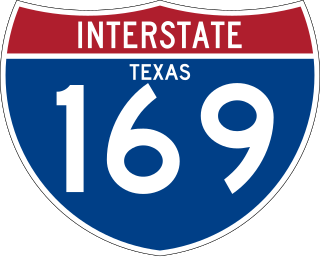
Interstate 169 (I-169) is an auxiliary route of I-69E in Texas that currently runs from I-69E in Brownsville southeast concurrently with State Highway 550 (SH 550), a toll road under construction that connects to the Port of Brownsville for 1.5 miles (2.4 km). When SH 550 is complete, it will be a limited-access toll route around the northern and eastern edges of Brownsville and signed as I-169, partly replacing and expanding Farm to Market Road 511 (FM 511). Its purpose is to provide a new entry point for truck traffic to the Port of Brownsville and forming a loop that allows traffic to bypass the northern sections of the urbanized extent of the Brownsville city limits. This may serve as a relief route for future traffic congestion and as a future business corridor.

References