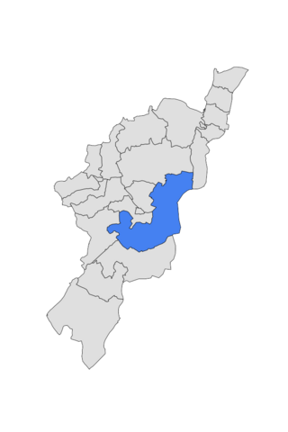
Kebbe is a Local Government Area in Sokoto State, Nigeria. Its headquarters are in the town of Kebbe. The LGA shares a border with Zamfara State in the east and Kebbi State in the south and west.
Kiyawa is a town and local government area in Jigawa State, Nigeria.
Guyuk is a town and Local Government Area in Adamawa State, Nigeria. Guyuk has many limestone deposits. Guyuk is located along the Numan–Biu road.
Gummi is a Local Government Area in Zamfara State, Nigeria. Its headquarters is in the town of Gummi at12°08′30″N5°07′30″E .

Fufore Local Government Area of Adamawa State, Nigeria.
Shelleng is a Local Government Area (LGA) of Adamawa State, North-east Nigeria.
Kirfi is a Local Government Area of Bauchi State, Nigeria, bordering Gombe State in the east. Its headquarters are in the town of Kirfi. The northeasterly line of equal latitude and longitude passes through the Local Government Area.
Gwiwa is a Local Government Area of Jigawa State, Nigeria. Its headquarters are in the town of Gwiwa which is a reminiscent of Kagara, a settlement that flourished around 1757c. According to oral tradition, Kagara was ransacked by an expedition sent by Bawa-jangwarzo as part of the wars that ensued between Katsina and Gobir. At that time the area was under the kingdom of Katsina until 1824 when Kazaure Emirate was curved out by the Sakkwato Caliphate. A number of legendary wells surround the old site of Kagara which is about 2 kilometers northwest of the present day Gwiwa town. The number of these wells suggest the size and influence of Kagara at that point in time. Other artefacts could also be found to illuminate on the historical significance of the area. There also exists a vast forest which served as fortress as well as pasture during intertribal wars before the advert of the Sakkwato Jihad in the 18th century. Gwiwa town was once a district headquarters at the inception of the indirect rule by the British. However, this was reverted and Gwiwa was reduced to a colonial out-post until in 1992 when it was made a Local Government headquarters. Generally, the area is arable and fertile. However the land is mainly of Katsina basic complex especially northward of Gwiwa. While some traces of sand dumes are found in the southern part of the local Government Area. It had an area of 450 km2 and a population of 124,517 at the 2006 census.
Zuru is a Local Government Area in Kebbi State, Nigeria. Its headquarters is in the town of Zuru. It is also the Headquarters of Zuru Emirate. The Emirate comprises four local government areas, namely: Wasagu/Danko, Fakai, Sakaba and Zuru.
Anka is a Local Government Area in Zamfara State, Nigeria. Its headquarters is in the town of Anka at 12°06′30″N5°56′00″E.
Maru is a Local Government Area in Zamfara State, Nigeria. Its headquarters are in the town of Maru at 12°20′00″N6°24′00″E in the far north of the Area.
Shinkafi is a Local Government Area in Zamfara State of Nigeria. Its headquarters is in the town of Shinkafi an area of about 674mk2 and population of 135,649. It shares boundaries with Isa Local Government Area and Niger Republic from the north, Zurmi Local Government Area to the South and South-East, Maradun Local Government Area and Raba Local Government Area by the west. Distance from the State Capital, Gusau is approximately 116 km.
Bungudu is a Local Government Area in Zamfara State, Nigeria. Its headquarters is in the town of Bungudu at12°16′00″N6°33′24″E.
Bukkuyum is a Local Government Area in Zamfara State, Nigeria. Its headquarters is in the town of Bukkuyum. In March 2017 more than 300 children died of Lead poisoning from illegal mining site at yar Galma village at12°08′00″N5°28′00″E in the north-west of the area.
Bakura is a Local Government Area in Zamfara State, Nigeria. Its headquarters are in the town of Bakura at12°42′37″N5°52′23″E in the north-east of the Local government area.Wind
Zurmi is a Local Government Area in Zamfara State, Nigeria. Its headquarters is in the town of Zurmi at 12°46′00″N6°47′10″E.
Birnin Magaji/Kiyaw is a Local Government Area in Zamfara State, Nigeria. Its headquarters are in the town of Birnin Magaji in the north of the LGA at12°33′00″N6°49′00″E. The LGA is also named from the town of Kiyaw to the south.
Yabo is a Local Government Area in Sokoto State, Nigeria. Its headquarters is in the town of Yabo, and Yabo local Government is one of the oldest local governments in Sokoto. Since Sokoto, Kebbi and Zamfara are known as Sokoto. by then Yabo, Tambuwal and Shagari are all known as Yabo local government.
Shagari is a Local Government Area in Sokoto State, Nigeria. Its headquarters are in the town of Shagari on the A1 highway. The local government area (LGA) shares a border with Zamfara State in the south.
Tureta is a Local Government Area in Sokoto State, Nigeria. Its headquarters is in the town of Tureta. It shares a border with Zamfara State in the south and east. They are mainly Hausa people predominantly Burmawa. Islam is there main religion. Fishing and farming are the major occupations. Currently Dr Muhammad Danrabi Tureta is their newly appointed king title as sarkin Burmin tureta.


