
Kushtia is a city in the Khulna Division of southwestern Bangladesh. Kushtia is the second largest municipality in Bangladesh and the eleventh largest city in the country. The second largest city in Khulna division, Kushtia is one of the commercial cities. It serves as the headquarters of Kushtia Sadar Upazila and Kushtia District.

Chandpur District (চাঁদপুর) is a district located in Chattogram Division of Bangladesh. It was part of the Comilla District until 15 February 1984.

Narayanganj is a city in central Bangladesh in the Greater Dhaka area. It is in the Narayanganj District, about 16 km (10 mi) southeast of the capital city of Dhaka. With a population of almost 1 million, it is the 6th largest city in Bangladesh. It is also a center of business and industry, especially the jute trade and processing plants, and the textile sector of the country. It is nicknamed the Dundee of Bangladesh, due to the presence of its many jute mills.
Shariatpur is a district in the Dhaka Division of central Bangladesh.
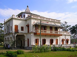
Kumarkhali is an upazila of Kushtia District in the Division of Khulna, Bangladesh. It is famous for the Shelaidaha area, where the poet Rabindranath Tagore spent a considerable time of his youth.

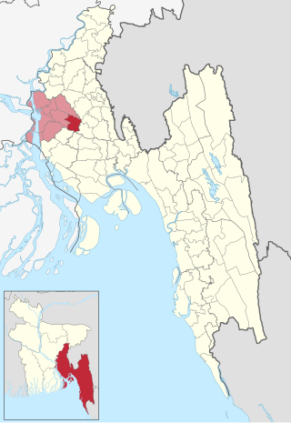
Chandpur Sadar is an upazila of the Chandpur District in the Division of Chittagong, Bangladesh.
Faridganj is an upazila of Chandpur District in Chittagong Division of Bangladesh. It is located between 23°03' and 23°14' north latitudes and in between 90°41' and 90°53' east longitudes.

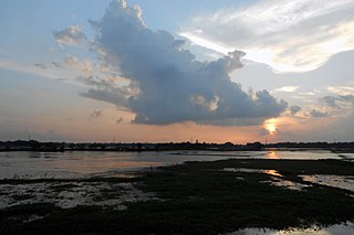
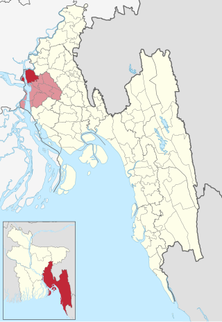
Haimchar is an upazila of Chandpur District in the Division of Chittagong, Bangladesh.
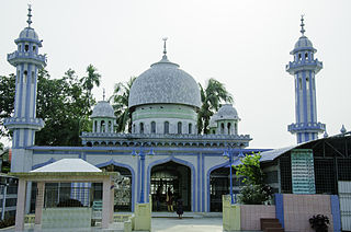
Haziganj or Hajiganj is an upazila of Chandpur District in the Division of Chittagong, Bangladesh.

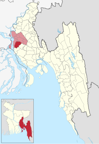
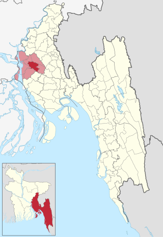
Matlab Dakshin is an upazila of Chandpur District in the division of Chittagong, Bangladesh. The former Matlab Upazila was bifurcated in 2000, creating Matlab Dakshin and Matlab Uttar upazilas.
Shahrasti is an upazila of Chandpur District in the Division of Chittagong, Bangladesh.

Raipur is an upazila in Lakshmipur District, Chittagong Division, Bangladesh. It is surrounded by the upazilas of Faridganj, Ramganj, Lakshmipur Sadar, Mehendiganj and Haimchar, and on the west by the Meghna River. Raipur has 40,618 households, and covers an area of 201.32 square kilometres (77.73 sq mi).
Raipura is an Upazila of Narsingdi District in the Narsingdi District belonging to Dhaka Division.

Gosairhat is an upazila of Shariatpur District in the Division of Dhaka, in south central Bangladesh.

Chauhali is an upazila, or sub-district of Sirajganj District, located in Rajshahi Division, Bangladesh.
Matlab Uttar is an upazila of Chandpur District in the division of Chittagong, Bangladesh. The former Matlab Upazila was bifurcated in 2000, creating Matlab Dakshin and Matlab Uttar upazilas.

Maijdee is a city and district headquarter of Noakhali District, located in south eastern Bangladesh. It is the administrative center and the main city of Noakhali District in Chattogram Division, Bangladesh. It is also known as Maijdee City. It consists of 9 wards and 36 mahallas. It has an area of 23.79 km2.
Chowmuhani is a town and municipal corporation in Noakhali District, located in Chattogram Division, Bangladesh. It is the administrative centre and capital of the Begumganj Upazila. Chowmuhani is an important businesses hub and trade centre in Noakhali District.
Feni is a city in the Chittagong Division of south-eastern Bangladesh. It is the headquarters of Feni Sadar Upazila and Feni District. The city has a population of about 265,000, making it the 18th largest city in Bangladesh. Feni is the oldest municipality in this region, established in 1958.
Monohorgonj is an upazila of Comilla District in the Division of Chittagong, Bangladesh.


