Burcott is a hamlet in the parish of Bierton with Broughton, Buckinghamshire, England.
Burcott is a hamlet in the parish of Wing(where at the 2011 Census the population was included ), Buckinghamshire, England. Burcott is a common place name in the English language. The place name is Old English and refers to a fortified cottage.
Botolph Claydon is a hamlet in the civil parish of East Claydon, in Buckinghamshire, England. It is situated about 9 miles (14 km) east of Bicester in Oxfordshire, and 7 miles (11 km) north west of Aylesbury.
Flowery Field is an area of Hyde, Greater Manchester, England.
Carlton is a village in the Metropolitan Borough of Barnsley in South Yorkshire, England. It is situated between the villages of Athersley and Royston. The village is split in two with one half in the Monk Bretton ward and the rest in the Royston ward of the Barnsley MBC. It was built up on coking and coal mining industries and now has one of the largest industrial estates within the surrounding area. In the industrial estate lies a glass recycling plant, called Rexam.

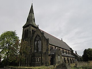
Gawber is an area of Barnsley in South Yorkshire, England. The area falls within the Darton West ward of the Barnsley MBC. There is a Primary School, Gawber Primary School, a Pre-School, Gawber Pre-School, and a church, St Thomas.

Hadfield is a village in the High Peak of Derbyshire, England. The population of the town's wards in the 2011 Census was 6,305. It lies on the south side of the River Etherow, the border between Derbyshire and Greater Manchester, at the western edge of the Peak District close to Glossop.
Aston Mullins is a hamlet in the parish of Dinton, in Buckinghamshire, England. At the 2011 Census the population of the hamlet was included in the civil parish of Dinton-with-Ford and Upton

Foulby is a village in the county of West Yorkshire, England. It is situated near Nostell, between Crofton and Ackworth Moor Top, on the A638 east-south east of the city of Wakefield. The village falls within the Ackworth, North Elmsall and Upton ward of Wakefield City Council.

Birdsedge is a small village in the borough of Kirklees in West Yorkshire, England, on the edge of Yorkshire's Pennine Hills, standing just below 1,000 feet (305 m) above sea level. It is approximately 6 miles (10 km) south-east from Huddersfield and about 4 miles (6 km) north-west from Penistone, between the villages of Shepley and Upper Cumberworth and is linked with the neighbouring hamlet of High Flatts, a former Quaker settlement.

Brough and Shatton is a civil parish in Hope Valley in the High Peak district of Derbyshire, England. It is named for the two hamlets of Brough-on-Noe and Shatton. Brough is about 2 km, or just over 1 mile, west (upstream) of Shatton; both are on the River Noe, a tributary of the upper River Derwent. They lie within the Peak District National Park, about 15 miles west of Sheffield and 30 miles east of Manchester. According to the 2011 census, Brough and Shatton had a combined population of 136. There is a friendly rivalry between the two hamlets, which contest numerous sports competitions throughout the year.
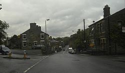
Haigh is a small village in South Yorkshire and West Yorkshire, England. Historically within the West Riding of Yorkshire, it lies half in the Wakefield district and half in the Barnsley district. It grew up as a pit village and had its own colliery until 1968. Thereafter, Woolley Colliery became the main source of employment until its closure in 1987. Haigh suffered from significant decline for several years afterwards. It is now a commuter village for the large towns and cities of Yorkshire.
Hall Bower is a small hamlet lying 2 miles (3.5 km) south of Huddersfield, West Yorkshire, England. It sits in the shadow of Castle Hill, just above the village of Newsome. Fields in the village next to Hall Bower CC were recently converted into rugby league pitches for use by Newsome Panthers ARLFC.
Chilton Moor is a village in Tyne and Wear, England. The village is located between Houghton le Spring and Fence Houses on the Tyne and Wear/County Durham county boundary.

Bamford Edge is an overhang of gritstone rock that sticks out north of the village of Bamford, Hope Valley, in the English county of Derbyshire. The first ascent of "Smoked Salmon", which is graded as E8 7b was made by British climber Johnny Dawes.

Arnfield is an area of Derbyshire, England. It is located on the north side of Tintwistle, adjacent to the Arnfield Reservoir.
Higher Dinting is a village in Glossopdale, Derbyshire, England. The village is near Glossop, Dinting, and Dinting Vale; the village falls within the Simmondley ward of the High Peak Council.
Dinting Vale is a village in Glossopdale, Derbyshire, England. The Vale falls within the Simmondley ward of the High Peak Council. Dinting Vale lies near to Higher Dinting, Dinting and Glossop.

Woolley Bridge is a village in Glossopdale, on the border of Greater Manchester and Derbyshire in England. It lies 10 miles from Manchester city centre. It is in the ward of Hadfield South. Nearby places include Hollingworth, Dinting Vale, Gamesley, Glossop and Mottram.