Chepstow Community Hospital

Last updated

Chepstow Community Hospital
Aneurin Bevan University Health Board
Chepstow Community Hospital - geograph.org.uk - 300923.jpg
Entrance to Chepstow Community Hospital
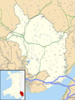
Monmouthshire UK location map.svg
Red pog.svg
Shown in Monmouthshire
Geography
Location Chepstow, Monmouthshire, Wales
Coordinates 51°38′23″N2°41′05″W / 51.63972°N 2.68472°W / 51.63972; -2.68472
Organisation
Care system NHS
Type Community hospital
History
Opened2000
Links
Website www.wales.nhs.uk/sitesplus/866/page/40469
Lists Hospitals in Wales

Chepstow Community Hospital (Welsh : Ysbyty Cymunedol Cas-gwent) is a community hospital located on the east side of St Lawrence Road in Chepstow, Monmouthshire, Wales. It is managed by the Aneurin Bevan University Health Board.

Contents

History

The site selected had previously been occupied by Mount Pleasant Hospital, a facility which had been built by the Admiralty for workers at the National Shipyard in Chepstow in 1917. It was used by ex-servicemen more generally from 1919, and later by the community as a whole. The new community hospital incorporates the old Admiralty portico moulding from the front façade of the old hospital. [1] St Lawrence Hospital, an old hospital specialising in burns, had been located on the western side of St Lawrence Road. [2] [3]

The new 87-bed hospital was procured under a Private Finance Initiative in 1997. It was built by Skanska at a cost of £10 million, accepted its first patients in February 2000 and was officially opened by Rt Hon Rhodri Morgan AM MP, the First Minister of Wales in October 2000. [4] [5]

The minor injuries unit closed in November 2011. [6] In March 2013 a local councillor raised concerns that the hospital was just becoming a "glorified health centre". [7]

Related Research Articles

<span class="mw-page-title-main">Monmouth</span> Town in Monmouthshire, Wales

Monmouth is a town and community in Wales. It is situated where the River Monnow joins the River Wye, two miles from the Wales–England border. Monmouth is 30 miles (50 km) northeast of Cardiff, and 113 miles (182 km) west of London. It is within the Monmouthshire local authority, and the parliamentary constituency of Monmouth. The population in the 2011 census was 10,508, rising from 8,877 in 2001. Monmouth is the historic county town of Monmouthshire although Abergavenny is now the county town.

<span class="mw-page-title-main">Chepstow</span> Human settlement in Wales

Chepstow is a town and community in Monmouthshire, Wales, adjoining the border with Gloucestershire, England. It is located on the tidal River Wye, about 2 miles (3 km) above its confluence with the River Severn, and adjoining the western end of the Severn Bridge. It is the easternmost settlement in Wales, situated 16 miles (26 km) east of Newport, 28 miles (45 km) east-northeast of Cardiff, 18 miles (29 km) northwest of Bristol and 110 miles (180 km) west of London.

<span class="mw-page-title-main">Caerwent</span> Human settlement in Monmouthshire, Wales

Caerwent is a village and community in Monmouthshire, Wales. It is located about five miles west of Chepstow and 11 miles east of Newport. It was founded by the Romans as the market town of Venta Silurum, an important settlement of the Brythonic Silures tribe. The modern village is built around the Roman ruins, which are some of the best-preserved in Europe. It remained prominent through the Roman era and Early Middle Ages as the site of a road crossing between several important civic centres. The community includes Llanvair Discoed. The village itself had a population of about 1,200.

<span class="mw-page-title-main">St Mellons</span> District of Cardiff, Wales

St Mellons is a district and suburb of eastern Cardiff, the capital city of Wales. Prior to 1996 St Mellons was the name given to the community largely north of Newport Road (B4487) which included the old St Mellons village. After 1996 the old community was divided and renamed as Old St Mellons and Pontprennau, with the newer, much larger area of modern housing and business parks to the south of Newport Road retaining the St Mellons name. Historically in Monmouthshire, St Mellons became part of South Glamorgan and Cardiff in 1974.

<span class="mw-page-title-main">Magor, Monmouthshire</span> Human settlement in Wales

Magor is a large village in Monmouthshire, south east Wales, about 9 miles (14 km) west of Chepstow and about 9 miles (14 km) east of Newport. It lies on the Caldicot Levels beside the Severn Estuary, and is in the community of Magor with Undy. Magor lies close to the M4 motorway.

<span class="mw-page-title-main">Raglan, Monmouthshire</span> Village in Monmouthshire, Wales

Raglan (; is a village and community in Monmouthshire, south east Wales, United Kingdom. It is located some 9 miles south-west of Monmouth, midway between Monmouth and Abergavenny on the A40 road very near to the junction with the A449 road. The fame of the village derives from Raglan Castle, built for William ap Thomas and now maintained by Cadw. The community includes the villages of Llandenny and Pen-y-clawdd. Raglan itself has a population of 1,183.

<span class="mw-page-title-main">Morriston Hospital</span> Hospital in Wales

Morriston Hospital is a 750-bed hospital located in Cwmrhydyceirw near Morriston in Swansea, Wales. It is managed by Swansea Bay University Health Board. Alongside its role as a district general hospital, Morriston is a teaching hospital for medical students of Swansea University Medical School.

<span class="mw-page-title-main">Royal Gwent Hospital</span> Hospital in Wales

The Royal Gwent Hospital is a local general hospital in the city of Newport. It is managed by the Aneurin Bevan University Health Board. Since 2020, the hospital no longer has a full Emergency Department, and redirects those with a serious illness or injury to call 999 or go to attend the Grange University Hospital in Cwmbran. The Royal Gwent hospital has a 24-hour Minor Injuries Unit.

<span class="mw-page-title-main">A466 road</span> Road in England and Wales

The A466, also known as the Wye Valley Road, is a road from Hereford, England to Chepstow, Wales via Monmouth, Tintern and the Wye Valley.

<span class="mw-page-title-main">Monnow Vale Integrated Health and Social Care Facility</span> Hospital in Monmouth, Wales

Monnow Vale Integrated Health and Social Care Facility is a hospital at Drybridge Park in Monmouth, Wales. It is managed by the Aneurin Bevan University Health Board.

<span class="mw-page-title-main">Devauden</span> Village in Wales

Devauden is a village and community in Monmouthshire, southeast Wales. It is located between Chepstow and Monmouth near the top of the Trellech ridge on the B4293 road. The community covers an area of 3,790 hectares (14.6 sq mi). The community includes the villages of Itton and Wolvesnewton, Llanfihangel-tor-y-mynydd and Newchurch.

<span class="mw-page-title-main">Chepstow Museum</span>

Chepstow Museum is a museum in Chepstow, Monmouthshire, south east Wales. It is operated by Monmouthshire Museums Service.

<span class="mw-page-title-main">Bulwark, Chepstow</span> Human settlement in Wales

Bulwark is a predominantly residential area of Chepstow, Monmouthshire, Wales, largely developed during the twentieth century. The area is so named because of its Iron Age fort, which is now maintained as a public open space. Substantial development in the area began during the First World War, with housing being provided for the military and civilian workforce brought to the area for the National Shipyard no.1 at Chepstow.

<span class="mw-page-title-main">Aneurin Bevan University Health Board</span> NHS local health board in South East Wales

Aneurin Bevan University Health Board (ABUHB) is the local health board of NHS Wales for Gwent, in the south-east of Wales. Headquartered in Caerleon, the local health board (LHB) was launched in October 2009 through the merger of Gwent Healthcare NHS Trust and Blaenau Gwent, Caerphilly, Newport, Torfaen, and Monmouthshire LHBs. It is named after Aneurin Bevan, a Member of Parliament who represented the area and who was the Minister of Health responsible for the foundation of the National Health Service. Aneurin Bevan University Health Board is the operational name of Aneurin Bevan Local Health Board.

<span class="mw-page-title-main">Old Wye Bridge, Chepstow</span> Bridge in Tutshill, Gloucestershire

The Old Wye Bridge or Town Bridge at Chepstow, also known historically as Chepstow Bridge, crosses the River Wye between Monmouthshire in Wales and Gloucestershire in England, close to Chepstow Castle. Although there had been earlier wooden bridges on the site since Norman times, the current road bridge was constructed of cast iron in 1816 during the Regency period, by John Rastrick of Bridgnorth, who greatly modified earlier plans by John Rennie.

<span class="mw-page-title-main">Llanfrechfa Grange Hospital</span> Hospital in Wales

Llanfrechfa Grange Hospital is a medical facility providing assessment and treatment services for people with learning disabilities. It is located to the east of Cwmbran on the B4236 road towards Caerleon to the south-east. It is managed by Aneurin Bevan University Health Board. The main building is a Grade II listed building.

<span class="mw-page-title-main">Maindiff Court Hospital</span> Hospital in Wales

Maindiff Court Hospital is a community hospital near Abergavenny, Monmouthshire. It is managed by the Aneurin Bevan University Health Board. Its most noted patient was Rudolf Hess, deputy to Adolf Hitler.

<i>Pontypool Free Press</i>

The Pontypool Free Press is an English language weekly regional newspaper that was originally published in Pontypool, as the Pontypool Free Press and Herald of the Hills, in 1859 and is circulated in Pontypool and the surrounding area of Torfaen, in south-east Wales.

St Lawrence Hospital was a specialist plastic surgery and burns hospital on the west side of St Lawrence Road in Chepstow, Wales.

<span class="mw-page-title-main">Gwent County Council</span>

Gwent County Council was the upper-tier local authority that governed the county of Gwent in South Wales from its creation in 1974 to its abolition in 1996. For most of its existence, the county council was based in Cwmbran.

References

  1. Ivor Waters, The Town of Chepstow, 1972
  2. "Proposed Housing Development at Bayfield, Chepstow, Gwent". The Clwyd-Powys Archaeological Trust. p. 18. Retrieved 23 February 2019.
  3. "Reserved Matters Application For Landscaping Scheme: St Lawrence Hospital, St Lawrence Road, Chepstow, Monmouthshire, NP16 5YX". Monmouthshire Council. Retrieved 23 February 2019.
  4. PFI Schemes Archived 27 September 2007 at the Wayback Machine
  5. "The Finances of NHS Wales 2002" (PDF). National Audit Office. Retrieved 23 February 2019.
  6. "Hospital unit closes". Chepstow Beacon. 1 December 2011. Retrieved 23 February 2019.[ permanent dead link ]
  7. "Concern that Wales' first PFI-funded hospital, at Chepstow, is being downgraded into a 'glorified health centre'". Wales Online. 21 March 2013. Retrieved 23 February 2019.