
Douglas County is a county located in the U.S. state of Colorado. As of the 2020 Census, the population was 357,978. The county is named in honor of U.S. Senator Stephen A. Douglas. The county seat is Castle Rock.

Petrified Forest National Park is an American national park in Navajo and Apache counties in northeastern Arizona. Named for its large deposits of petrified wood, the park covers about 346 square miles, encompassing semi-desert shrub steppe as well as highly eroded and colorful badlands. The park's headquarters is about 26 miles (42 km) east of Holbrook along Interstate 40 (I-40), which parallels the BNSF Railway's Southern Transcon, the Puerco River, and historic U.S. Route 66, all crossing the park roughly east–west. The site, the northern part of which extends into the Painted Desert, was declared a national monument in 1906 and a national park in 1962. The park received 644,922 recreational visitors in 2018.

Petrified wood, also known as petrified tree, is the name given to a special type of fossilized wood, the fossilized remains of terrestrial vegetation. Petrifaction is the result of a tree or tree-like plants having been replaced by stone via a mineralization process that often includes permineralization and replacement. The organic materials making up cell walls have been replicated with minerals. In some instances, the original structure of the stem tissue may be partially retained. Unlike other plant fossils, which are typically impressions or compressions, petrified wood is a three-dimensional representation of the original organic material.
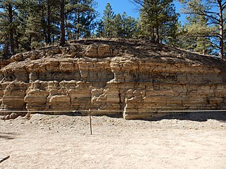
The Florissant Formation is a sedimentary geologic formation outcropping around Florissant, Teller County, Colorado. The formation is noted for the abundant and exceptionally preserved insect and plant fossils that are found in the mudstones and shales. Based on argon radiometric dating, the formation is Eocene in age and has been interpreted as a lake environment. The fossils have been preserved because of the interaction of the volcanic ash from the nearby Thirtynine Mile volcanic field with diatoms in the lake, causing a diatom bloom. As the diatoms fell to the bottom of the lake, any plants or animals that had recently died were preserved by the diatom falls. Fine layers of clays and muds interspersed with layers of ash form "paper shales" holding beautifully-preserved fossils. The Florissant Fossil Beds National Monument is a national monument established to preserve and study the geology and history of the area.
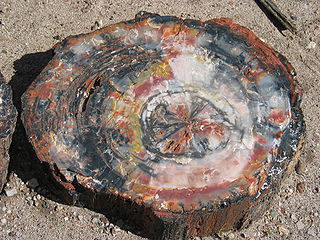
In geology, petrifaction or petrification is the process by which organic material becomes a fossil through the replacement of the original material and the filling of the original pore spaces with minerals. Petrified wood typifies this process, but all organisms, from bacteria to vertebrates, can become petrified. Petrifaction takes place through a combination of two similar processes: permineralization and replacement. These processes create replicas of the original specimen that are similar down to the microscopic level.

The Chinle Formation is an Upper Triassic continental geological formation of fluvial, lacustrine, and palustrine to eolian deposits spread across the U.S. states of Nevada, Utah, northern Arizona, western New Mexico, and western Colorado. In New Mexico, it is often raised to the status of a geological group, the Chinle Group. Some authors have controversially considered the Chinle to be synonymous to the Dockum Group of eastern Colorado and New Mexico, western Texas, the Oklahoma panhandle, and southwestern Kansas. The Chinle Formation is part of the Colorado Plateau, Basin and Range, and the southern section of the Interior Plains. A probable separate depositional basin within the Chinle is found in northwestern Colorado and northeastern Utah. The southern portion of the Chinle reaches a maximum thickness of a little over 520 meters (1,710 ft). Typically, the Chinle rests unconformably on the Moenkopi Formation.
The Lake Macquarie Petrified Forest is a petrified pine tree forest at Fennell Bay, Lake Macquarie, New South Wales, Australia. Geologically it is located in the Permo-Carboniferous strata. The nearest town is Swansea.
The Denver Formation is a geological formation that is present within the central part of the Denver Basin that underlies the Denver, Colorado, area. It ranges in age from latest Cretaceous (Maastrichtian) to early Paleocene, and includes sediments that were deposited before, during and after the Cretaceous-Paleogene boundary event.

The Rice Northwest Museum of Rocks and Minerals is a non-profit museum in Hillsboro, Oregon, United States. Located just north of the Sunset Highway on the northern edge of Hillsboro, the earth science museum is in the Portland metropolitan area. Opened in 1997, the museum's collections date to the 1930s with the museum housed in a home built to display the rock and mineral collections of the museum founders. The ranch-style home is listed on the National Register of Historic Places, the first of its kind listed in Oregon. In 2015 the museum became a Smithsonian Affiliate museum.
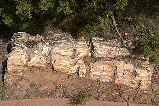
Escalante Petrified Forest State Park is a state park of Utah, USA, located a half-mile (0.8 km) north of the town of Escalante. A visitor center was built in 1991, and features displays of plant and marine fossils, petrified wood and fossilized dinosaur bones over 150 million years old. The Petrified Forest Trail is a one-mile (1.6 km) loop, winding up the side of a mesa to the top where most of the fossil wood occurs. Logs two feet or more in diameter are seen at several places along the trail where it is eroding from the conglomerate capping the mesa. This conglomerate lies near the top of the Brushy Basin Member of the Morrison Formation. The wood is multicolored and was prized by hobbyists before the Park was established. The logs are believed to be of conifers that were transported by a river before being buried and later fossilized as agate. A 50 foot (15m) log is displayed near the trail head and is one of the most complete fossil logs known from the Morrison Formation.


Franktown Cave is located 25 miles (40 km) south of Denver, Colorado on the north edge of the Palmer Divide. It is the largest rock shelter documented on the Palmer Divide, which contains artifacts from many prehistoric cultures. Prehistoric hunter-gatherers occupied Franktown Cave intermittently for 8,000 years beginning about 6400 BC The site held remarkable lithic and ceramic artifacts, but it is better known for its perishable artifacts, including animal hides, wood, fiber and corn. Material goods were produced for their comfort, task-simplification and religious celebration. There is evidence of the site being a campsite or dwelling as recently as AD 1725.

Paleontology in Mississippi refers to paleontological research occurring within or conducted by people from the U.S. state of Mississippi. The oldest rocks in Mississippi date back to the Late Devonian. At the time, the northeastern part of the state was covered in a sea where brachiopods, crinoids, and trilobites lived. Remains of contemporary local plants also ended up preserved in this environment. During the Late Carboniferous, Mississippi became part of a richly-vegetated coastal plain environment. There are no rocks dating to the Permian, Triassic, or Jurassic in the state. However, during the Cretaceous, evidence suggests that the state was covered by a sea home to cephalopods, mosasaurs and sharks. Local trees left behind petrified wood and amber. By the Cenozoic, only the southern half of the state was covered in seawater, where the early whale Basilosaurus lived. On land, trees that were home to some of the earliest known primates left behind petrified wood. For the remainder of the Cenozoic, the state's climate cooled. Many fossils have been serendipitously discovered in the state by people looking for fossil fuels. Significant fossil finds in Mississippi include some of the oldest known primate fossils. The Eocene whales Basilosaurus cetoides and Zygorhiza kochii are the Mississippi state fossils.
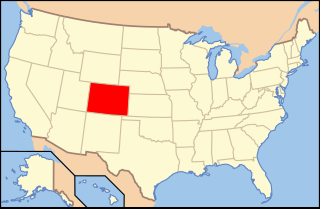
Paleontology in Colorado refers to paleontological research occurring within or conducted by people from the U.S. state of Colorado. The geologic column of Colorado spans about one third of Earth's history. Fossils can be found almost everywhere in the state but are not evenly distributed among all the ages of the state's rocks. During the early Paleozoic, Colorado was covered by a warm shallow sea that would come to be home to creatures like brachiopods, conodonts, ostracoderms, sharks and trilobites. This sea withdrew from the state between the Silurian and early Devonian leaving a gap in the local rock record. It returned during the Carboniferous. Areas of the state not submerged were richly vegetated and inhabited by amphibians that left behind footprints that would later fossilize. During the Permian, the sea withdrew and alluvial fans and sand dunes spread across the state. Many trace fossils are known from these deposits.
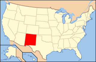
Paleontology in New Mexico refers to paleontological research occurring within or conducted by people from the U.S. state of New Mexico. The fossil record of New Mexico is exceptionally complete and spans almost the entire stratigraphic column. More than 3,300 different kinds of fossil organisms have been found in the state. Of these more than 700 of these were new to science and more than 100 of those were type species for new genera. During the early Paleozoic, southern and western New Mexico were submerged by a warm shallow sea that would come to be home to creatures including brachiopods, bryozoans, cartilaginous fishes, corals, graptolites, nautiloids, placoderms, and trilobites. During the Ordovician the state was home to algal reefs up to 300 feet high. During the Carboniferous, a richly vegetated island chain emerged from the local sea. Coral reefs formed in the state's seas while terrestrial regions of the state dried and were home to sand dunes. Local wildlife included Edaphosaurus, Ophiacodon, and Sphenacodon.
Amethyst Mountain, el. 9,609 feet (2,929 m) is the highest peak and central part of a northwest – southeast trending ridge that lies between the Lamar River to the northeast and Deep Creek to the southwest within Park County, Wyoming. From northwest to southeast, this ridge consists of Specimen Ridge, Amethyst Mountain, and the Mirror Plateau in Yellowstone National Park. The nearest town is Silver Gate, Montana, which is 19.2 miles away.
The Dawson Arkose is a geologic formation in the Denver Basin that underlies the Denver area in Colorado. It is characterized by alternating beds of arkosic sandstone and mudstone. The Dawson Arkose contains plant remains and other nonmarine fossils, and hosts aquifers that are important sources of water for the area.

Cherokee Ranch, in Douglas County, Colorado near Sedalia, has been a purebred cattle ranch since 1954, including raising Santa Gertrudis cattle. The ranch is private property but offers frequent public and private events and tours. The property overlaps with portions of the Cherokee Ranch petrified forest.

Daniels Park is a former working ranch in Douglas County, Colorado, United States. The park is one of the Denver Mountain Parks and was listed on the National Register of Historic Places in 1995. It is located along Douglas County Road 67 northeast of Sedalia and east of Castle Pines. The modern-day park may have been the site of Kit Carson's last campfire and includes a memorial to the frontiersman.
Mildred Montague Genevieve "Tweet" Kimball, was an American rancher, art collector, and heiress who owned and lived on the 3,400-acre Cherokee Ranch and its associated castle north of Sedalia in Douglas County, Colorado, from 1954 until her death. Born to a wealthy Tennessee family and raised in Chattanooga, Kimball moved to Colorado following her divorce from diplomat husband Merritt Ruddock.


