Chester Castle is in the city of Chester, Cheshire, England. It is sited at the southwest extremity of the area bounded by the city walls. The castle stands on an eminence overlooking the River Dee. In the castle complex are the remaining parts of the medieval castle together with the neoclassical buildings designed by Thomas Harrison which were built between 1788 and 1813. Parts of the neoclassical buildings are used today by the Crown Court and as a military museum. The museum and the medieval remains are a tourist attraction.

Chester-le-Street is a market town in the County Durham district, in the ceremonial county of Durham, England. It is located around 6 miles north of Durham and is also close to Newcastle upon Tyne and Sunderland. The town holds markets on Saturdays. In 2021, the town had a population of 23,555.

Hexham is a market town and civil parish in Northumberland, England, on the south bank of the River Tyne, formed by the confluence of the North Tyne and the South Tyne at Warden nearby, and close to Hadrian's Wall. Hexham was the administrative centre for the Tynedale district from 1974 to 2009. In 2011, it had a population of 13,097.

Durham Castle is a Norman castle in the city of Durham, England, which has been occupied since 1837 by University College, Durham after its previous role as the residence of the Bishops of Durham. Designated since 1986 as a cultural World Heritage Site in England, along with Durham Cathedral, the castle is open to the general public to visit, but only through guided tours, since it is in use as a working building and is home to over 100 students. The castle stands on top of a hill above the River Wear on Durham's peninsula, opposite Durham Cathedral.

Lambton Castle stands above Chester-le-Street, County Durham and is a stately home, the ancestral seat of the Lambton family, the Earls of Durham. It is listed in the mid-category of listed building, Grade II*.

Bellingham is a village and civil parish in Northumberland, to the north-west of Newcastle upon Tyne and is situated on the Hareshaw Burn at its confluence with the River North Tyne. In 2011 the parish had a population of 1334.
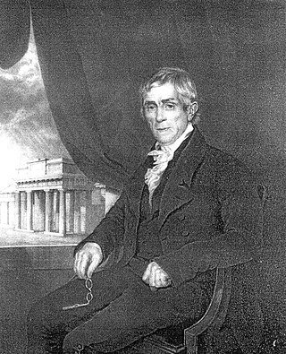
Thomas Harrison was an English architect and bridge engineer who trained in Rome, where he studied classical architecture. Returning to England, he won the competition in 1782 for the design of Skerton Bridge in Lancaster. After moving to Lancaster he worked on local buildings, received commissions for further bridges, and designed country houses in Scotland. In 1786 Harrison was asked to design new buildings within the grounds of Lancaster and Chester castles, projects that occupied him, together with other works, until 1815. On both sites he created accommodation for prisoners, law courts, and a shire hall, while working on various other public buildings, gentlemen's clubs, churches, houses, and monuments elsewhere. His final major commission was for the design of Grosvenor Bridge in Chester.

Hylton Castle is a stone castle in the North Hylton area of Sunderland, Tyne and Wear, England. Originally built from wood by the Hilton family shortly after the Norman Conquest in 1066, it was later rebuilt in stone in the late 14th to early 15th century. The castle underwent major changes to its interior and exterior in the 18th century and it remained the principal seat of the Hylton family until the death of the last Baron in 1746. It was then Gothicised but neglected until 1812, when it was revitalised by a new owner. Standing empty again until the 1840s, it was briefly used as a school until it was purchased again in 1862. The site passed to a local coal company in the early 20th century and was taken over by the state in 1950.

Victoria Viaduct, originally known as the Victoria Bridge, is a stone arch rail viaduct spanning the River Wear about 1 mile (1.6 km) south-east of Washington in the City of Sunderland North East England. It was built as part of the Durham Junction Railway under the supervision of Thomas Elliot Harrison.

The River Wear in Northern England rises in the Pennines and flows eastwards, mostly through County Durham, to the North Sea in the City of Sunderland. At 60 mi (97 km) long, it is one of the region's longest rivers. The Wear wends in a steep valley through the cathedral city of Durham and gives its name to Weardale in its upper reach and Wearside by its mouth.
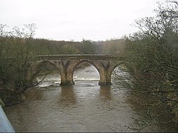
Corbridge Bridge is a 17th-century stone bridge across the River Tyne at Corbridge, Northumberland, England.

Runcorn is an industrial town in the borough of Halton, Cheshire, England. This list contains the 27 buildings that are recorded in the National Heritage List for England as designated listed buildings in the part of the borough lying to the south of the River Mersey outside the urban area of Runcorn. The area covered includes the villages of Clifton, Daresbury, Preston Brook, Preston on the Hill, and Moore. Three of the buildings in the area are classified as Grade II*, and the others are at Grade II; there are no buildings in Grade I. In the United Kingdom, the term listed building refers to a building or other structure officially designated as being of special architectural, historical, or cultural significance. These buildings are in three grades: Grade I consists of buildings of outstanding architectural or historical interest; Grade II* includes particularly significant buildings of more than local interest; Grade II consists of buildings of special architectural or historical interest. Buildings in England are listed by the Secretary of State for Culture, Media and Sport on recommendations provided by English Heritage, which also determines the grading.

Biddick Hall is a small privately owned 18th-century country mansion at Bournmoor, County Durham, near the City of Sunderland and Chester-le-Street. It is a Grade I listed building and the home of the Lambton family.

The English Presbyterian Church of Wales is in City Road, Chester, Cheshire, England. The church was built in 1864, and designed by Michael Gummow of Wrexham. It is constructed with a stuccoed front and brick sides, and has a slate roof. The architectural style is Neoclassical, Its entrance front is in five bays; it has a portico with four Ionic columns, and a three-bay pediment. The opposite end of the church is apsidal. The church is recorded in the National Heritage List for England as a designated Grade listed building.

Overleigh Cemetery is a large municipal burial ground adjacent to the approaches to Grosvenor Bridge on the south side of the River Dee in Chester, Cheshire, England. The cemetery was created in the mid-19th century by a private company but was taken into public ownership in the 1930s. The original part of the cemetery is listed at Grade II in the National Register of Historic Parks and Gardens. Since 2009, it has been owned and managed by the unitary authority Cheshire West and Chester.

St James the Great, or St James' Church, is a Grade II* listed church in Morpeth, Northumberland. The entrance screen which allows access to the churchyard from Newgate Street is also separately Grade II* listed. The church is still used for services and is currently part of the Anglican parish of Morpeth.

Mamhead House, Mamhead, Devon, is a country house dating from 1827. Its origins are older but the present building was constructed for Robert William Newman, an Exeter merchant, in 1827–1833 by Anthony Salvin. The house is Grade I listed as Dawlish College, its function at the time of listing. The parkland is listed at Grade II*.

Croft Bridge is a road bridge over the River Tees, straddling the border between North Yorkshire and County Durham, in the north of England. The road over the bridge is now the A167, previously a second branch of the Great North Road, meeting the old road in Darlington. The bridge dates back to Medieval times, and is the setting for the awarding of a sword to the incoming Bishop of Durham.