Chesterfield is a market town in the Borough of Chesterfield, Derbyshire, England. It is 24 miles (39 km) north of Derby and 11 miles (18 km) south of Sheffield at the confluence of the River Rother and River Hipper. In 2011, the built-up-area subdivision had a population of 88,483, making it the second-largest settlement in Derbyshire, after Derby. The wider borough had a population of 103,801 in 2011. In 2011, the town had a population of 76,753.
Meersbrook is a suburban district in the south-west of Sheffield, England bordered by Nether Edge to the west, Norton Lees to the south, Heeley to the north and the Meersbrook allotment site to the east. Until 1950 it was part of the Sheffield Ecclesall constituency and now forms part of the Sheffield Heeley constituency. The district falls within the Gleadless Valley ward of the city. The name comes from the stream, the Meers Brook, a tributary of the River Sheaf which means 'boundary brook' and in ancient times this, along with the River Sheaf formed the boundary between the Anglo-Saxon kingdoms of Northumbria and Mercia. It remained as the boundary between Yorkshire and Derbyshire into the 20th century. Meersbrook itself was once several small communities which have given many roads their names; Rush Dale, Carfield & Cliffe Field and in 1857 was known as Mears Brook.
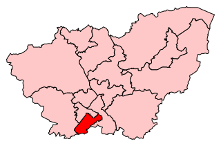
Sheffield Heeley is a constituency represented in the House of Commons of the UK Parliament since 2015 by Louise Haigh, a member of the Labour Party. It is located in the city of Sheffield, South Yorkshire.
Heeley is a former cluster of Derbyshire villages. Which all now form a suburb in the south of the City of Sheffield, England. The village has existed at least since 1343, its name deriving from Heah Leah, High Lea then Hely, meaning a high, woodland clearing. Originally Heeley was divided into three: Upper Heeley was around the intersection of Myrtle Road and Heeley Green, Middle Heeley was on the Gleadless Road at Well Road, and Lower Heeley was on the London Road around Artisan View. At the 2011 Census the village formed part of the Gleadless Valley ward of the City of Sheffield.
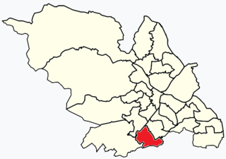
Woodseats is a district of Sheffield, South Yorkshire in the Graves Park ward. Historically, Norton Woodseats was a village that straddled Derbyshire Lane running from Four Lane Ends to Bolehill, originally in Derbyshire but since 1901, part of the City of Sheffield.
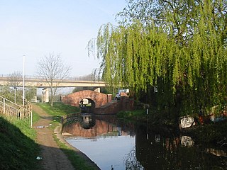
Rhodesia is a village and civil parish in the Bassetlaw district of Nottinghamshire, England. The village lies just west of the town of Worksop, and approximately 20 miles (32 km) east-southeast of Sheffield. At the 2011 Census, the population of the civil parish was 982.

The Meers Brook is a stream in Sheffield, England and one of the main tributaries of the River Sheaf. The Meers Brook originates in Gleadless and flows downhill through Gleadless Valley and Meersbrook then, culverted, continues underneath Heeley to pour into the River Sheaf near Saxon Road and Clyde Road in Lowfield.

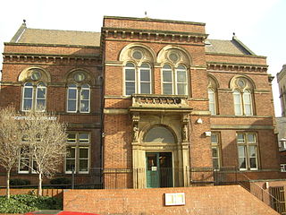
Heeley railway station was a railway station in Sheffield, England. The station served the communities of Heeley, Meersbrook and Lowfield and was situated on the Midland Main Line near London Road on Heeley Bridge, lying between Sheffield Midland station and Millhouses railway station.
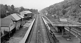
Beauchief railway station was in Sheffield, South Yorkshire, England.
Norton Lees is a residential suburb in the Graves Park ward of the City of Sheffield, England located to the east of Woodseats.

Sheffield Tramway was an extensive tramway network serving the English city of Sheffield and its suburbs.

Chesterfield Central was a railway station serving the town of Chesterfield, Derbyshire, England.
Eckington and Renishaw railway station is a former railway station between Eckington and Renishaw in Derbyshire, England.


