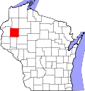
Chetek, Wisconsin

Last updated

Chetek, Wisconsin
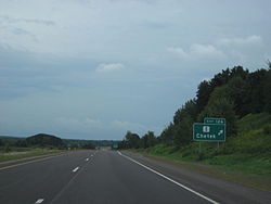
US Highway 53 at Chetek WI.jpg
U.S. Highway 53 at Chetek
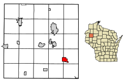
Barron County Wisconsin Incorporated and Unincorporated areas Chetek Highlighted.svg
Location of Chetek in Barron County, Wisconsin
Coordinates: 45°19′7″N91°39′16″W / 45.31861°N 91.65444°W / 45.31861; -91.65444
Country Flag of the United States.svg  United States
State Flag of Wisconsin.svg  Wisconsin
County Barron
Area
[1]
  Total3.11 sq mi (8.05 km2)
  Land2.40 sq mi (6.21 km2)
  Water0.71 sq mi (1.85 km2)
Elevation
[2]
1,050 ft (320 m)
Population
 (2010) [3]
  Total2,221
  Estimate 
(2019) [4]
2,095
  Density874.01/sq mi (337.46/km2)
Time zone UTC-6 (Central (CST))
  Summer (DST) UTC-5 (CDT)
Zip Code
54728
Area code(s) 715 & 534
FIPS code 55-14325 [5]
GNIS feature ID1562995 [2]
Website cityofchetek-wi.gov

Chetek is a city in Barron County, Wisconsin, United States. The population was 2,172 at the 2020 census, [6] down from 2,221 at the 2010 census. The city is located partially within the Town of Chetek.

Contents

History

The original inhabitants of the area were the Ojibwa Indians, who referred to the area as zhedeg, meaning "pelicans". This was translated into various spellings, such as "Sheetak", "Shetak", "Shetuk", and "Chetack", until the first post office was opened in 1872. The spelling was then standardized to "Chetek."

In 1872, the Omaha Railroad began service to Chetek, the Knapp-Stout logging camp was established, and the first log schoolhouse was built.

Other important dates:

Geography

Chetek is located at 45°19′7″N91°39′16″W / 45.31861°N 91.65444°W / 45.31861; -91.65444 (45.318656, -91.65447). [9]

According to the United States Census Bureau, the city has a total area of 3.13 square miles (8.11 km2), of which 2.42 square miles (6.27 km2) is land and 0.71 square miles (1.84 km2) is water. [10]

Chetek is located along U.S. Highway 53, as well as County Roads I and SS.

Demographics

Historical population
CensusPop.Note
1890 406
1900 53130.8%
1910 82956.1%
1920 1,15439.2%
1930 1,076−6.8%
1940 1,22714.0%
1950 1,58529.2%
1960 1,7299.1%
1970 1,630−5.7%
1980 1,93118.5%
1990 1,9531.1%
2000 2,18011.6%
2010 2,2211.9%
2019 (est.)2,095 [4] −5.7%
U.S. Decennial Census [11]

2010 census

As of the census [3] of 2010, there were 2,221 people, 951 households, and 564 families living in the city. The population density was 917.8 inhabitants per square mile (354.4/km2). There were 1,104 housing units at an average density of 456.2 per square mile (176.1/km2). The racial makeup of the city was 97.4% White, 0.2% African American, 0.4% Native American, 0.3% Asian, 0.7% from other races, and 0.9% from two or more races. Hispanic or Latino people of any race were 1.8% of the population.

There were 951 households, of which 26.9% had children under the age of 18 living with them, 43.2% were married couples living together, 11.3% had a female householder with no husband present, 4.8% had a male householder with no wife present, and 40.7% were non-families. 34.8% of all households were made up of individuals, and 18.4% had someone living alone who was 65 years of age or older. The average household size was 2.22 and the average family size was 2.82.

The median age in the city was 44.7 years. 21.1% of residents were under the age of 18; 6.8% were between the ages of 18 and 24; 22.6% were from 25 to 44; 24.7% were from 45 to 64; and 25% were 65 years of age or older. The gender makeup of the city was 45.9% male and 54.1% female.

2000 census

As of the census [5] of 2000, there were 2,180 people, 939 households, and 568 families living in the city. The population density was 925.7 people per square mile (358.2/km2). There were 1,052 housing units at an average density of 446.7 per square mile (172.8/km2). The racial makeup of the city was 98.62% White, 0.09% Black or African American, 0.32% Native American, 0.23% Asian, 0.05% Pacific Islander, 0.09% from other races, and 0.60% from two or more races. Hispanic or Latino people of any race were 0.96% of the population.

There were 939 households, out of which 25.0% had children under the age of 18 living with them, 47.9% were married couples living together, 8.7% had a female householder with no husband present, and 39.5% were non-families. 34.9% of all households were made up of individuals, and 20.4% had someone living alone who was 65 years of age or older. The average household size was 2.21 and the average family size was 2.81.

In the city, the population was spread out, with 22.2% under the age of 18, 7.2% from 18 to 24, 24.3% from 25 to 44, 20.8% from 45 to 64, and 25.6% who were 65 years of age or older. The median age was 43 years. For every 100 females, there were 92.9 males. For every 100 females age 18 and over, there were 88.6 males.

The median income for a household in the city was $31,270, and the median income for a family was $40,114. Males had a median income of $28,375 versus $18,906 for females. The per capita income for the city was $17,922. About 9.0% of families and 12.4% of the population were below the poverty line, including 15.0% of those under age 18 and 8.3% of those age 65 or over.
Transportation

Chetek Municipal–Southworth Airport (Y23) serves the city and surrounding communities.

Notable people

See also

Related Research Articles

<span class="mw-page-title-main">Pioneer, Iowa</span> Unincorporated community in Humboldt County, Iowa, United States

Pioneer is an unincorporated community in Humboldt County, Iowa, United States. The population was 4 at the time of the 2020 census, and elected to unincorporate as a municipality in 2020.

Valley Township is a civil township of Allegan County in the U.S. state of Michigan. The population was 2,221 at the 2020 census.

<span class="mw-page-title-main">Albertville, Minnesota</span> City in Minnesota, United States

Albertville is a city in Wright County, Minnesota, United States. The City is a Northwest suburb of the Minneapolis- St Paul “Twin Cities” metropolitan area. The population was 7,896 at the 2020 census.

<span class="mw-page-title-main">Youngsville, Pennsylvania</span> Borough in Pennsylvania, United States

Youngsville is a borough in Warren County, Pennsylvania, United States. The population was 1,731 at the 2020 census.

<span class="mw-page-title-main">Dovre, Wisconsin</span> Town in Wisconsin, United States

Dovre is a town in Barron County in the U.S. state of Wisconsin. The population was 849 at the 2010 census.

<span class="mw-page-title-main">Prairie Lake, Wisconsin</span> Town in Wisconsin, United States

Prairie Lake is a town in Barron County in the U.S. state of Wisconsin. The population was 1,532 at the 2010 census. The unincorporated community of Wickware is located partially in the town.

<span class="mw-page-title-main">Monona, Wisconsin</span> City in Wisconsin, United States

Monona is a city in Dane County, Wisconsin, United States. A suburb of the state capital, Madison, the city lies on the southeastern shore of Lake Monona, from which the city gets its name. The population was 8,624 at the 2020 census.

<span class="mw-page-title-main">Schofield, Wisconsin</span> City in Wisconsin, United States

Schofield is a city in Marathon County, Wisconsin, United States. It is part of the Wausau, Wisconsin Metropolitan Statistical Area. The population was 2,157 at the 2020 census. The city was named for William Scholfield, who came to the area in the 1851 to open a sawmill. The city has since dropped the "L" from its name.

<span class="mw-page-title-main">Cudahy, Wisconsin</span> City in Wisconsin, United States

Cudahy is a city in Milwaukee County, Wisconsin, United States. The population was 18,204 at the 2020 census.

<span class="mw-page-title-main">Amery, Wisconsin</span> City in Wisconsin, United States

Amery is a city in Polk County, Wisconsin, United States, along the Apple River. It is a part of Wisconsin's 7th congressional district. The population was 2,902 at the 2010 census. The city was named in honor of William Amery, a carpenter who held several local offices in the 1870s.

<span class="mw-page-title-main">Glenwood City, Wisconsin</span> City in Wisconsin, United States

Glenwood City is a city in St. Croix County, Wisconsin, United States. The population was 1,242 at the 2010 census. Glenwood City is the site of the yearly St. Croix County fair and is known as the "City of 57 Hills."

<span class="mw-page-title-main">Galesville, Wisconsin</span> City in Wisconsin, United States

Galesville is a city in Trempealeau County, Wisconsin, United States. The population was 1,662 at the 2020 census. A dam on Beaver Creek is located at Galesville, forming Lake Marinuka north of the city. The mayor is Vince Howe.

<span class="mw-page-title-main">Osseo, Wisconsin</span> City in Wisconsin, United States

Osseo is a city located in Trempealeau County, Wisconsin, at the confluence of the North and South Forks of the Buffalo River. The population was 1,701 at the 2010 census.

<span class="mw-page-title-main">Pittsville, Wisconsin</span> City in Wisconsin, United States

Pittsville is a city in Wood County, Wisconsin, United States. Located in a rural part of the county, Pittsville is surrounded by parks and public land, including; North Wood County Park and Campground, Powers Bluff, Dexter County Park and Campground, Sherwood County Park and Campground, Wood County Forest, Sandhill State Wildlife Area, and Black River State Forest. The population was 874 at the 2010 census and was 813 at the 2020 census.

<span class="mw-page-title-main">Dorchester, Wisconsin</span> Village in Wisconsin, United States

Dorchester is a village in Clark and Marathon counties in the U.S. state of Wisconsin, along the 45th parallel. It is part of the Wausau, Wisconsin Metropolitan Statistical Area. The population was 876 at the 2010 census. Of this, 871 were in Clark County, and only 5 were in Marathon County.

Chetek is a town in Barron County in the U.S. state of Wisconsin. The population was 1,644 at the 2010 census. The City of Chetek is located partially within the town.

<span class="mw-page-title-main">Unity, Wisconsin</span> Village in Wisconsin, United States

Unity is a village in Clark and Marathon counties in the U.S. state of Wisconsin. It is part of the Wausau, Wisconsin Metropolitan Statistical Area. The population was 343 at the 2010 census. Of this, 204 were in Marathon County, and 139 were in Clark County. The village is located in northeastern town of Unity in Clark County and northwestern town of Brighton in Marathon County.

<span class="mw-page-title-main">Mount Hope, Wisconsin</span> Village in Wisconsin, United States

Mount Hope is a village in Grant County, Wisconsin, United States. The population was 225 at the 2010 census. The village is located within the Town of Mount Hope.

<span class="mw-page-title-main">Rib Lake, Wisconsin</span> Village in Wisconsin, United States

Rib Lake is a village in Taylor County, Wisconsin, United States located at the junction of Wisconsin Highway 102 and Taylor County Highway D. The population was 910 at the 2010 census. The village is completely surrounded by the Town of Rib Lake.

<span class="mw-page-title-main">Hillsboro, Wisconsin</span> City in Wisconsin, United States

Hillsboro is a city in Vernon County, Wisconsin, United States. The population was 1,397 at the 2020 Census. The city is located within the Town of Hillsboro. Hillsboro is known as the Czech Capital of Wisconsin.

References

  1. "2019 U.S. Gazetteer Files". United States Census Bureau. Retrieved August 7, 2020.
  2. 1 2 U.S. Geological Survey Geographic Names Information System: Chetek, Wisconsin
  3. 1 2 "U.S. Census website". United States Census Bureau . Retrieved November 18, 2012.
  4. 1 2 "Population and Housing Unit Estimates". United States Census Bureau. May 24, 2020. Retrieved May 27, 2020.
  5. 1 2 "U.S. Census website". United States Census Bureau . Retrieved January 31, 2008.
  6. "Explore Census Data". data.census.gov. Retrieved May 23, 2024.
  7. Chetek, Wisconsin - Visitor Information Archived January 15, 2008, at the Wayback Machine
  8. "May 16th Wisconsin EF-3 Tornado". U. S. National Weather Service. Retrieved June 3, 2017.
  9. "US Gazetteer files: 2010, 2000, and 1990". United States Census Bureau. February 12, 2011. Retrieved April 23, 2011.
  10. "US Gazetteer files 2010". United States Census Bureau. Archived from the original on January 25, 2012. Retrieved November 18, 2012.
  11. "Census of Population and Housing". Census.gov. Retrieved June 4, 2015.