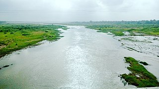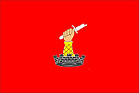
Jhabua is a town and a municipality in Jhabua district in the Indian state of Madhya Pradesh. It is the administrative headquarters of Jhabua District.

Sabarkantha district is one of the 33 districts of Gujarat state of India, it is located in the northeastern part of the state. The administrative headquarters of the district are located in Himatnagar.

Bhil or Bheel is an ethnic group in western India. They speak the Bhil languages, a subgroup of the Western Zone of the Indo-Aryan languages.

Narmada district is an administrative district in the state of Gujarat in India. The district headquarters are located at Rajpipla. The district is bounded by Vadodara and Chhota Udaipur districts in the north, by Nandurbar district of Maharashtra state in the east, by Surat and Tapi districts in the south and by Bharuch district in the west. The district occupies an area of 2,755 km² and has a population of 590,297. It was 10.44% urban as of 2011. As of 2011, it is the third least populous district of Gujarat, after Dang and Porbandar.

Dahod district is a district of Gujarat state in western India. This largely tribal district is mostly covered by forests and hills.

Jhabua is a district of Madhya Pradesh state in central India. The town of Jhabua is the administrative headquarters of the district.

Udaipur district is one of the 52 districts of Rajasthan state in western India. The historic city of Udaipur is the administrative headquarters of the district. The district is part of the Mewar region of Rajasthan.
Devgadh Baria is a municipality in Dahod district in the state of Gujarat, India. It is a small town nestled in the foothills on the eastern border of Gujarat State. It is 41 kilometers from Godhra in the west, 55 kilometers from Dahod in the east and 14 kilometers south of Ahmedabad-Indore highway. Devgadh Baria is located on the bank of Panam River and is part of Dahod district in the state of Gujarat. The name, Devgadh Baria of the place derived two words Devgadh and Baria. Devgadh is the name of the mountain that is surrounding the town and Baria is the name of local tribe.
Gogunda is a town and tehsil headquarters of Gogunda Tehsil in Udaipur district, located about 35 km (22 mi) in north-west from Udaipur city in the Indian state of Rajasthan. It is situated on a high mountain in Aravalli hills and is reached by crossing a difficult mountain pass.

A Bhilala is a tribe found in the Malwa and Nimar of the Central Provinces and in Central India. The total strength of the Bhilalas is about 150,000 persons, most of whom reside in the Bhopawar Agency, adjoining Nimar. Only 15,000 were returned from the Central Provinces in 1911. The Bhilalas are commonly considered, and the general belief may in their case be accepted as correct, to be a mixed caste sprung from the invading immigrant Rajputs with Bhils of the Central India hills. The original term was not improbably Bhilwala, and may have been applied to those Rajput chiefs, a numerous body, who conquered small estates in the Bhil country, or to those who took the daughters of Bhil chieftains to wife. The bhilalas in the central province are descendants of male Rajput with female Bhils and take the name of the Rajput clan to which they trace their origin. The Bhilalas are landholders and live like mukhis, darbar or thakur.

Bodeli is a town and taluka in Chhota Udaipur district in the eastern part of the state of Gujarat, India.
Kherwara Chhaoni is a census town in the Udaipur district in the Indian state of Rajasthan. It is part of the Vagad region, which includes the districts of Dungarpur, Banswara and parts of Udaipur district. It is in close proximity to two major highways, National Highway 8 and Rajasthan State Highway 76 and National Highway 927A passes through it. Its name derives from the large number of Kher (Khair) trees in the region in the past.
Rikhabdeo ( Rishabhadeo) is a town in Udaipur district in the state of Rajasthan, in north-west India.
The Dhanka are a tribe or caste of India who believe themselves to be aboriginal, although they are unable to assert from whence they came.found in Rajasthan, Haryana, Uttar Pradesh,Gujarat, Maharashtra, Chhattisgarh and Madhya Pradesh they are no relation with dhanuk kurmi. They are historically neither Hindu nor Muslim and their occupations have changed over time, as circumstances have dictated for survival. Although similar groups in India are often referred to as adivasi, the Dhanka generally reject this term.

The Rathva or Rathwa also spelled as Rathava and Rathawa is a Subcaste of the Koli caste found in the Indian state of Gujarat. Rathava Kolis were agriculturist by profession and turbulent by habits but now lives like Adivasis such as Bhil because of their neighborhood

Chhota Udaipur district is a district in the state of Gujarat in India. It was carved out of the Vadodara district on 26 January 2013 with its headquarters at Chhota Udaipur town and is the 28th district of Gujarat.
Simalwara is a census town in Dungarpur district in the Indian state of Rajasthan. It is the administrative headquarters for Simalwara Tehsil.

The Chhota Udaipur State or 'Princely State of Chhota Udaipur', was a princely state with its capital in Chhota Udaipur during the era of British India. The last ruler of Chhota Udaipur State signed the accession to join the Indian Union in 1948. Chhota Udaipur shares a history with Devgadh Baria and Rajpipla as one of the three princely states of eastern Gujarat.
Events in the year 1851 in India.

Kotra is a tehsil of Udaipur district in Rajasthan, India, consisting of 262 revenue villages and 31 panchayats. The tehsil is bordered to the north by Pali and Sirohi districts, to the east by Gogunda and Jhadol tehsils, and to the south by Gujarat state. The tehsil headquarter is located in the village of Kotra, southwest of the Udaipur at a distance of 57 km and 120 km by road.


