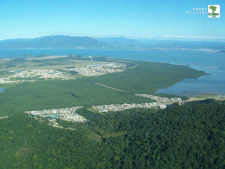
The reserve lies in the Acre River Depression and the Lower Amazon Plateau. Altitudes range from 200 to 300 metres (660 to 980ft) above sea level. The portion in the Acre River Depression is in the interfluvial between the Acre River and the Branco River, on the right bank of the Iaco River.[2] The highest points are less than 259 metres (850ft) in altitude. The Lower Amazon Plateau portion in the centre of the reserve is crossed by the Xapuri River, and has heights up to 300 metres (980ft).[2] The BR-317 highway is to the east and south of the reserve, running from Rio Branco to Assis Brasil. The Acre River forms part of south east boundary of the reserve. The Iaco River forms the north west boundary and the border with Peru forms part of the south west boundary.[4]
Average annual rainfall is 2,054 millimetres (80.9in). Temperatures range from 12 to 39°C (54 to 102°F) with an average of 28°C (82°F). The reserve is considered and centre of endemism for birds and amphibians and a haven for butterflies and birds. The traditional population hunt the collared peccary, white-lipped peccary, pampas deer, robust capuchin monkey and tapir, their main sources of protein.[2]
Conservation
The Chico Mendes Extractive Reserve was created by decree 99.144 of 12 March 1990, and is administered by the Chico Mendes Institute for Biodiversity Conservation.[1] The reserve is named after the assassinated rubber tapper and environmentalist Chico Mendes, and was meant to be maintained by families of traditional rubber tapper families who would harvest latex and nuts.[5] It is classed as IUCN protected area category VI (protected area with sustainable use of natural resources). An extractive reserve is an area used by traditional extractive populations whose livelihood is based on extraction, subsistence agriculture and small-scale animal raising. Its basic objectives are to protect the livelihoods and culture of these people and to ensure sustainable use of natural resources.[2] The reserve is supported by the Amazon Region Protected Areas Program.[6] The reserve would be included in the proposed Western Amazon Ecological Corridor.[7]
People and issues
Approximately 10,000 people live within the Chico Mendes Extractive Reserve , spread throughout 46 tree tracts. Many of the people living within the reserve participate in a community-based monitoring program that was implemented in 2013. This program was created by the Centre for Amazonian Workers (CTA), a local NGO in the reserve, and is coordinated by the Global Canopy Programme (GCP). This program was established with intent to help balance the monitoring needs of federal and state institutions with the needs of the reserve residents.[8] 40 community monitors living within the reserve were to be selected and trained to gather data and interview others living within the reserve. GCP would then feed back overall monitoring results to the monitors, who would in turn, share the information with their fellow residents.
There have been several hurdles in regards to gathering the data. The lack of social cohesion in the community and disputes over resources handicapped collection of data. The time taken to travel to meetings over large distances also discouraged consistent participation by monitors. However, the program has provided useful information on how the local population is involved in Acre's Reducing emissions from deforestation and forest degradation (REDD) program, and how it is affecting them, helping strengthen the management of the reserve.[9]
Tappers in the reserve collect latex that is sold to the Natex condom factory in the municipality of Xapuri, earning about R$800 per month. Almost all the residents today also raise cattle, which can be sold as needed and provide more income for less effort. Land is sometimes sold to people who are unaware that it is a reservation.[5] Under the utilisation plan each resident can use up to 15 hectares (37 acres) for pasture, but may be fined if they exceed this amount. The 2009 census showed that some families had indeed gone over this limit. A community leader said in 2013 that the son of a tapper born today wants to raise cattle.[5]
Ayres, José Márcio; Da Fonseca, Gustavo A. B.; Rylands, Anthony B.; Queiroz, Helder L.; Pinto, Luiz Paulo; Masterson, Donald; Cavalcanti, Roberto B. (2005), Os Corredores Ecológicos das Florestas Tropicais do Brasil(PDF) (in Portuguese), Sociedade Civil Mamirauá, archived from the original(PDF) on 2016-07-31, retrieved 2016-10-28
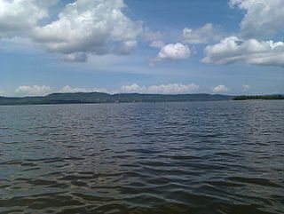
Pirajubaé Marine Extractive Reserve is an extractive reserve in the state of Santa Catarina, Brazil, created in 1993. The purpose was to support sustainable harvesting of shellfish from a shoal in the south bay of the Santa Caterina Island. In recent years, due to various natural and human causes including dredging and over-fishing, the catch has declined steeply. As of early 2016 just three families continued traditional extraction of the shellfish.
Corumbau Marine Extractive Reserve is a coastal marine extractive reserve in the state of Bahia, Brazil. The reserve was created in 2000 to help protect the traditional local fishing economy, which was suffering from predatory commercial fisheries. It includes an area of corals and rich marine biodiversity, and a breeding ground for humpback whales. Growth in tourism has caused a surge in real estate prices and introduced new social problems among the traditional residents.
The Verde para Sempre Extractive Reserve is an extractive reserve in the state of Pará, Brazil. The reserve supports sustainable use of Amazon rainforest resources by the local population. Both before and after creation of the reserve there have been violent conflicts between different groups seeking access to the resources.
The Acaú-Goiana Extractive Reserve is an extractive reserve in the states of Paraíba and Pernambuco, Brazil.
The Guariba-Roosevelt Extractive Reserve is an extractive reserve in the state of Mato Grosso, Brazil. A small traditional population live through fishing, hunting, small-scale agriculture and sale of forest products such as nuts. The reserve is under intense pressure from illegal logging and land grabbing.
The Médio Juruá Extractive Reserve is an extractive reserve in the state of Amazonas Brazil.
The Cazumbá-Iracema Extractive Reserve is an extractive reserve in the state of Acre, Brazil. The inhabitants extract rubber, Brazil nuts and other products from the forest for their own consumption or for sale, hunt, fish and engage in small-scale farming and animal husbandry. The reserve was created in 2002 as a sustainable use conservation area after a long campaign by the rubber tappers to prevent the government from evicting them and clearing the Amazon rainforest for cattle ranching. The reserve is rich in biodiversity, and helps form a buffer zone for the adjoining Chandless State Park. Due to decreases in rubber prices, some families want to clear the forest to raise cattle, which is seen as more profitable.
The Alto Juruá Extractive Reserve is an extractive reserve in the state of Acre, Brazil. The reserve is in the Amazon rainforest. As of 2011 it had about 5,000 residents. The objective is to support traditional occupations including extraction of rubber and other forest resources, farming, hunting and fishing, while preserving the environment.
The Cassurubá Extractive Reserve is an extractive reserve in the state of Bahia, Brazil.
The Terra Grande-Pracuúba Extractive Reserve is an extractive reserve in the state of Pará, Brazil.
The Mapuá Extractive Reserve is an extractive reserve in the state of Pará, Brazil.
The Baía do Iguape Marine Extractive Reserve is a marine extractive reserve in the state of Bahia, Brazil. As of 2002 the reserve supported about 5,000 people engaged in fishing and shellfish collection.
The Rio Ouro Preto Extractive Reserve is an extractive reserve in the state of Rondônia, Brazil. Created in 1990, it was one of the first such reserves in Brazil. The residents extract rubber, nuts and other products in the dry season and farm or work outside the reserve in the rainy season, when large areas are flooded. Houses are built on stilts to avoid flooding and discourage animals from entering.
The Alto Tarauacá Extractive Reserve is an extractive reserve in the state of Acre, Brazil.
The Maracanã Marine Extractive Reserve is a coastal marine extractive reserve in the state of Pará, Brazil. It protects an area of mangroves, and allows the local population to make sustainable use of the natural resources.
The Ituxi Extractive Reserve is an extractive reserve in the state of Amazonas, Brazil.
The Auatí-Paraná Extractive Reserve is an extractive reserve is Amazonas, Brazil.
The Rio Jutaí Extractive Reserve is an extractive reserve in the state of Amazonas, Brazil.
The Baixo Juruá Extractive Reserve is an extractive reserve in the state of Amazonas, Brazil. It contains an area of almost untouched Amazon rainforest inhabited by communities that rely on manioc farming, small-scale animal husbandry, fishing, hunting and gathering.
The Rio Cajari Extractive Reserve is an extractive reserve in the state of Amapá, Brazil. It protects a region of dense rainforest, cerrado fields and flooded riparian zones that is rich in biodiversity. Formerly it was used for rubber extraction, and later efforts were made to develop a pulp industry. Extraction of timber for sale is now prohibited. The residents, who are poorly educated and suffer poor health, engage in subsistence hunting, fishing and farming, and extract forest products such as Brazil nuts, açaí palm fruit and heart of palm.
This page is based on this Wikipedia article Text is available under the CC BY-SA 4.0 license; additional terms may apply. Images, videos and audio are available under their respective licenses.