Chief Garry Park, Spokane

Last updated

Chief Garry Park
The Gathering Place Monument.png
The Gathering Place monument to Spokane Garry in Chief Garry Park
Chief Garry Park cropped.png
Location of Chief Garry Park in Spokane
Coordinates: 47°41′24.3″N117°22′30.8″W / 47.690083°N 117.375222°W / 47.690083; -117.375222
CountryUnited States
StateWashington
County Spokane
CitySpokane
Population
 (2017 [1] )
  Total6,075
Demographics 2017
   White 74.8%
  Black5.9%
  Latinx7.1%
  Asian6.2%
  Native American3.8%
Time zone UTC-8 (PST)
  Summer (DST) UTC-7 (PDT)
ZIP Codes
99202
Area code 509

Chief Garry Park is a neighborhood in Spokane, Washington. [2] It is located immediately south of the Spokane River. It is named for Spokane Garry and a park that has taken his name. The neighborhood was first established in 1912 but it wasn't until 1932 that it was officially named for Chief Garry. [3]

Contents

Geography

Greene Street crossing the Spokane River from Chief Garry Park Greene Street Bridge.png
Greene Street crossing the Spokane River from Chief Garry Park

The neighborhood is bounded on the west and north by the Spokane River. The southern border runs along Trent Avenue to Havana Street, at which point it drops a few blocks to the south to follow railroad tracks east to Fancher Road. From Fancher, the boundary zig-zags to the northeast along the edge of Felts Field and delimits the municipal boundary of the City of Spokane where it meets the City of Spokane Valley. [1] [4]

It is an elongated neighborhood that extends more than four miles from the Trent Avenue Bridge in the neighborhood's far southwestern corner to the city limits in the northeast. The bulk of the residential area of the neighborhood centers on Chief Garry Park itself on the west side. The Spokane Community College campus is located at the intersection of Greene and Mission and stretches north to the river. The northeastern half of the neighborhood is dominated by Felts Field. [4]

An exclave of the neighborhood exists at Upriver Park to the north of and across the river from Felts Field. The park is part of the City of Spokane, but surrounded on the north side of the river by unincorporated Spokane County. [5]

Demographics

As of 2017 the population of Chief Garry Park was 6,075 people across 2,363 households, 32.2% of which were households with children. The median household income was $35,264, compared to $44,768 citywide. 13.8% of the population had a bachelor's degree or above and 30.3% had only a high school diploma. People aged 19 and under made up 28.4% of the population and people aged 65 and older made up 8.3% of the population. Persons of color made up 36.1% of the population, compared to 15.1% citywide. 55.7% of households were rentals, compared to 45.4% citywide. Unemployment was at 7.3%, compared to 6.5% citywide. 100% of children qualified for free or reduced school lunch, compared to 54.5% citywide. 82.4% of residents were born in the United States or its territories. Of those who weren't, 35.3% were from Vietnam, 15.5% from Mexico, 10.4% from Turkey and 8.4% from Russia. [6]

History

Chief Garry Park, the park itself, dates to 1912. In 1932 it was officially dedicated and named in honor of Spokane Garry. [3]

The neighborhood is one of Spokane's oldest. Lucias B. Nash, a U.S. District Court Judge, built a home for his family on Tilsey Place overlooking the Spokane River in 1886. The 24 room Queen Anne style home was designed by Nash's wife and was one of the first in Spokane with indoor plumbing. [5] Streetcar lines ran along Mission and Boone Avenues, connecting the neighborhood with Downtown Spokane to the west and the rest of the growing city. The Mission Avenue Bridge was built in 1909 and connected the neighborhood with the Logan Neighborhood and other areas on the north side of the river. [7]

Felts Field in 1935 Spokane Airport (Felts Field) 1934.jpg
Felts Field in 1935

Expansion into the Parkwater area on the east side of Chief Garry Park occurred between 1900 and 1930, first with the building of homes and then the development of an airport. Parkwater Aviation Field was established there in 1912 and designated as Spokane's official municipal airport in 1920. During the 1920s, Charles Lindbergh landed his famous Spirit of St. Louis at the airport. Since 1927 the airport has been known as Felts Field. [5] In the 1940s and 1950s, during the post-World War II housing boom in the United States, the area between Mission Avenue and the Spokane River was developed into a residential portion of the neighborhood. During those years the development was primarily single-family homes. Since 1970, however, denser multi-family housing has been built in the area, particularly on South Riverton Avenue, which runs along the river. Spokane Community College was established at the intersection of Mission Avenue and Greene Street in 1963 on the site of an existing technical and vocational school. [5]

In May 2020, construction began on the City Line, a bus rapid transit route that will pass through the neighborhood connecting Spokane Community college on the east with Browne's Addition on the west via Gonzaga University and Downtown Spokane. The line will follow Mission Avenue through the neighborhood with stops at Napa Street, the west side of Chief Garry Park, the east side of Chief Garry Park, and its terminus at Spokane Community College. [8] Service is expected to begin in July 2023. [9]

Education

Spokane Community College and its landmark clock tower SpokaneCommunityCollege.jpg
Spokane Community College and its landmark clock tower

The neighborhood is home to Spokane's first, and largest, community college, Spokane Community College. [10]

Stevens Elementary, located in the western area of Chief Garry Park, serves the neighborhood west of Freya and Greene Streets. Cooper Elementary, located in the adjacent Minnehaha neighborhood, serves the areas west of Greene, though those areas are not zoned for residential housing. [11] There is an area of residential zoning in the far east of the neighborhood, which is located within the city limits but not served by Spokane Public Schools like the rest of Chief Garry Park, but is instead served by Orchard Center Elementary in the West Valley School District, which feeds into Centennial Middle School and then West Valley High School. [12] Stevens Elementary feeds into Yasuhara Middle School in the adjacent Logan neighborhood and from there into North Central High School. [13]

Transportation

Aviation services are provided at Felts Field airport in the far eastern portion of the neighborhood.

Roads

State Route 290, a major highway connecting Spokane to Spokane Valley, follows Trent Avenue through Chief Garry Park.

A shared use path for pedestrians and cyclists runs along the southern bank of the Spokane River from Chief Garry Park's western limit to Felts Field. Pedestrian crossings of the Spokane River are available at Trent Avenue, Iron Bridge, Mission Avenue and Greene Street. The first three cross the river east-to-west into the Logan neighborhood, while the latter crosses south-to-north into the Minnehaha neighborhood. [14]

Connections to the rest of the city's street system are provided by three streets classified as "urban principle arterials." Mission Avenue, Trent Avenue and Greene Street/Freya Street are all classified as such. Napa Street south of Mission is classified as an "urban minor arterial." Trent Avenue carries Washington State Route 290. [15] The transportation situation in the neighborhood will change dramatically with the completion of the North Spokane Corridor. That corridor will carry U.S. Route 395 through and above the neighborhood in what is being called a "skyway." [16]

Public transit

The Spokane Transit Authority, the region's public transportation provider, serves Chief Garry Park with five fixed schedule bus lines. [17] The City Line's eastern terminus is located at Spokane Community College, from which travels through Chief Garry Park along Mission Avenue before crossing into Logan, East Central, Downtown, and finally to its western terminus at Browne's Addition. The City Line has a fleet of all-electric buses and provide service every 7.5 minutes during peak weekday hours. [18]

Related Research Articles

<span class="mw-page-title-main">Hillyard, Spokane</span> Neighborhood of Spokane in Spokane County, Washington, United States

Hillyard is a neighborhood in Spokane, Washington which existed as a separate town between 1892 and 1924.

<span class="mw-page-title-main">West Central, Spokane</span> Neighborhood in Spokane, Washington, U.S.

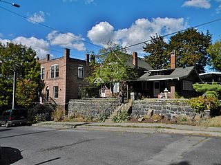
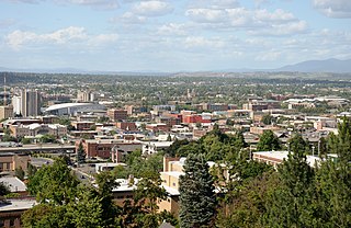
West Central is a neighborhood in Spokane, Washington. As the name suggests it is located centrally on the west side of the city. Downtown Spokane is immediately east of the neighborhood, and spreads into West Central along Monroe Street in the Kendall Yards area. The neighborhood is diverse, with single and multi-family residential zones dating back to the early days of Spokane, a new mixed use development on the site of a former rail yard, the Spokane County Courthouse campus and associated government buildings and a few commercial districts. The Spokane River gorge winds around the southern and western edge of the neighborhood. It is home to Nettleton's Addition Historic District, which was added to the National Register of Historic Places in March 2006, and is also the largest historic district on the Washington State Heritage Register.

<span class="mw-page-title-main">Bemiss, Spokane</span> Neighborhood in Spokane, Washington, United States

Bemiss is a neighborhood in Spokane, Washington. It is located within City Council District 1, which covers the northeastern section of the city. The neighborhood is bounded by Wellesley Avenue to the north, Market Street to the east, Illinois Avenue and the Spokane River to the south, and Perry Street and Napa Street to the west. It is located to the southeast of the Hillyard neighborhood and is often grouped into greater Hillyard.

<span class="mw-page-title-main">Logan, Spokane</span> Spokane Neighborhood in Washington, United States

Logan is a neighborhood in Spokane, Washington. It is located immediately northeast of Downtown Spokane and is home to Gonzaga University. The Spokane River runs along its eastern and southern edge. Due to its proximity to the city center, Logan is home to some of the oldest and densest areas in the city. It is known for its tree-lined streets, historic buildings and population of college students. In addition to numerous individual properties, there are two historic districts listed on the National Register of Historic Places located within Logan: the Desmet Avenue Warehouse Historic District and the Mission Avenue Historic District.

<span class="mw-page-title-main">East Central, Spokane</span> Spokane Neighborhood in Washington, United States

East Central is a neighborhood in Spokane, Washington. As the name suggests, it is on the east side of Spokane and centrally located. The official neighborhood is expansive and covers multiple areas considered by locals to be independent neighborhoods, such as the Sprague Union District on East Sprague Avenue, the South Perry District, the Underhill Park area and the University District on the eastern fringe of Downtown Spokane.

<span class="mw-page-title-main">Minnehaha, Spokane</span> Spokane Neighborhood in Washington, United States

Minnehaha is a neighborhood in Spokane, Washington, located in the northeastern portion of the city. The Spokane River flows along the southern edge of the neighborhood, from which the terrain rises along the slopes of Beacon Hill to the northeast. It is a primarily residential neighborhood, with its main commercial district on Euclid Street shared with the adjacent neighborhoods of Bemiss and Hillyard. Minnehaha Park is located here, though the nearby Minnehaha Rocks are just beyond the neighborhood's bounds.

<span class="mw-page-title-main">Browne's Addition, Spokane</span> Spokane Neighborhood in Washington, United States

Browne's Addition, often referred to shorthand as just Browne's, is a neighborhood in Spokane, Washington. It is located directly west of Downtown Spokane and is one of the oldest and densest neighborhoods in the city. The area is known for its numerous historic mansions, many of which have been converted into multi-family apartments. The terrain is flat in the neighborhood despite the degree of topographical relief in the immediate surrounding area. Latah Creek cuts a deep valley to the west, separating Browne's Addition from the Sunset Hill portion of the West Hills neighborhood and the Spokane River gorge drops off dramatically to the north into the Peaceful Valley neighborhood. The South Hill area of Spokane rises to the southwest.

<span class="mw-page-title-main">Peaceful Valley, Spokane</span> Spokane Neighborhood in Washington, United States

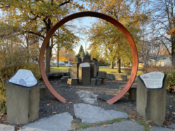
Peaceful Valley is a neighborhood in Spokane, Washington. It sits directly below Downtown Spokane on the Spokane River under its falls. The neighborhood snakes along the thin floodplain on the valley floor of the Spokane River Gorge. It is the smallest neighborhood in the city by both area and population, but due to its central location and unique character it is quite notable. The neighborhood has a working class and bohemian culture.

<span class="mw-page-title-main">Manito/Cannon Hill, Spokane</span> Neighborhood in Spokane, Washington, United States

Manito/Cannon Hill is a neighborhood on the South Hill of Spokane, Washington. It is named after the two public parks that dominate its setting: Manito Park and Cannon Hill Park. Manito/Cannon Hill is a predominantly residential neighborhood made up mostly by single-family homes and city park land.

<span class="mw-page-title-main">Emerson/Garfield, Spokane</span> Spokane Neighborhood in Washington, United States

Emerson/Garfield is a neighborhood in Spokane, Washington. It is located immediately north of Downtown Spokane's North Bank and extends out into the inner northwestern portion of the city. Emerson/Garfield is a diverse neighborhood with residential, commercial and civic zones all bordering one another, with density ranging from single-family homes to multi-use buildings. Due to its location in the central area of Spokane, Emerson/Garfield is criss-crossed by numerous arterials and thoroughfares. Along those main roads are numerous commercial and retail districts of importance to both the neighborhood and city as a whole.

<span class="mw-page-title-main">Lincoln Heights, Spokane</span> Spokane Neighborhood in Washington, United States

Lincoln Heights is a neighborhood in Spokane, Washington. It is located in the southeastern portion of the city in a broader area commonly known as the South Hill. As the name suggests, Lincoln Heights lies on the slopes and atop the crest of the South Hill area. Lincoln Heights is home to a mix of single-family residential, multi-family residential, and commercial areas and a significant amount of park land. The Lincoln Heights Shopping Center and surrounding area is one of the largest and most important commercial and retail districts on the entire south side of Spokane.

<span class="mw-page-title-main">Comstock, Spokane</span> Neighborhood in Washington, United States

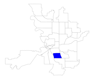
Comstock is a neighborhood in Spokane, Washington. It is located on the south side of the city in a broader area commonly known as the South Hill. The neighborhood is primarily single-family residential, and a mix of homes built during the streetcar era and then built during the post-World War II housing boom. The neighborhood is also home to a few commercial districts, including the regionally important Manito Shopping Center, two schools, the eponymous Comstock Park, sports fields and a golf course.

<span class="mw-page-title-main">Southgate, Spokane</span> Spokane Neighborhood in Washington, United States

Southgate is a neighborhood in Spokane, Washington. It is located in the southwestern corner of the City of Spokane and part of the broader area known locally as the South Hill. Southgate is one of the newer neighborhoods in the city, with development first taking hold in the post-World War II housing boom and continuing into the present day. It is a mix of single-family residential, multi-family residential and commercial districts. The neighborhood has grown as Spokane has expanded southward, with multiple annexations expanding Southgate and the city since 2000 and as recently as 2016.

<span class="mw-page-title-main">North Hill, Spokane</span> Spokane Neighborhood in Washington, United States

North Hill is a neighborhood in Spokane, Washington. As the name suggests, it is atop a hill on the north side of Spokane, within which it is centrally located and crossed by numerous major thoroughfares. It is home to parks, commercial districts and single family residential areas. The historic Garland Theater is located in North Hill, and the city's main north–south arterial, Division Street, is home to a major commercial district along the eastern edge of the neighborhood.

<span class="mw-page-title-main">North Indian Trail, Spokane</span> Spokane neighborhood in Washington, United States

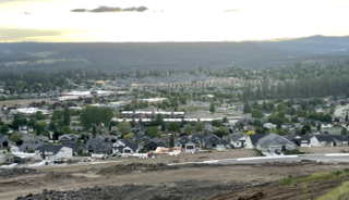
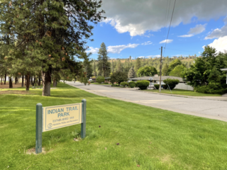
North Indian Trail is a neighborhood in the northwesternmost corner of Spokane, Washington. It extends to the northwest of the rest of Spokane along a tableland east of the Spokane River, west of the Five Mile Prairie. Its terrain isolates the neighborhood somewhat, and it was only extensively developed starting in the second half of the 20th century.
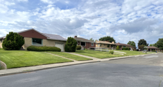
<span class="mw-page-title-main">Audubon/Downriver, Spokane</span> Spokane Neighborhood in Washington, United States

Audubon/Downriver is a neighborhood in Spokane, Washington, located on the northwest side of the city. There is a diversity of land use in the neighborhood, with single-family residential areas dating from the early 20th century through the Post–World War II economic expansion era, regionally important commercial districts, smaller neighborhood retail areas, numerous schools, large parks, a golf course, conservation areas and part of Riverside State Park along the Spokane River. The neighborhood is the site of the corporate offices for Rosauers Supermarkets, a regional grocery store chain with stores located across the Northwestern United States.

<span class="mw-page-title-main">Nevada Heights, Spokane</span> Spokane Neighborhood in Washington, United States

Nevada Heights is a neighborhood in Spokane, Washington, located on the north side of the city. Its southern border is atop a bluff that runs east–west across the north side of the city, which gives the neighborhood its name. Nevada Street, a major north–south arterial, runs through the neighborhood. The neighborhood is largely residential, but also home to large retail districts, medical facilities, schools and parks. Being surrounded by the city of Spokane on all sides, the neighborhood is well integrated into urban area.

<span class="mw-page-title-main">Shiloh Hills, Spokane</span> Spokane Neighborhood in Washington, United States

Shiloh Hills is a neighborhood in Spokane, Washington, located on the far northeastern side of the city. It is one of the newer areas of the city, initially annexed in the late 1960s with growth continuing into the 21st century. The neighborhood is home to residential, commercial and industrial districts as well as multiple regionally important transportation corridors such as the Division Street "Y".

<span class="mw-page-title-main">Northwest, Spokane</span> Spokane Neighborhood in Washington, United States

Northwest is a neighborhood in Spokane, Washington, located in the northwestern portion of the city. Largely single-family residential, Northwest is also home to Spokane's VA Medical Center, the Dwight Merkel Sports complex, a large public sports facility, and portions of Riverside State Park along the Spokane River. The neighborhood contains developments that span from the post-World War II housing boom in the east to more contemporary, suburban-style developments in the west. It was also home to Joe Albi Stadium from 1950 until 2022, which served as the Spokane region's main high school sports stadium over its seven decades of use.

<span class="mw-page-title-main">Whitman, Spokane</span> Spokane Neighborhood in Washington, United States

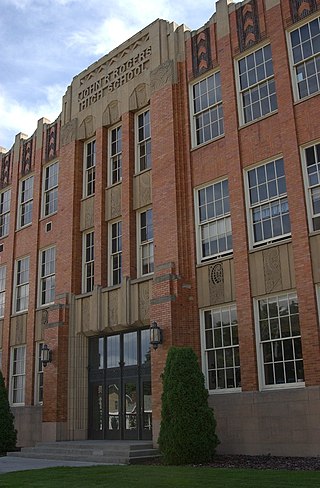
Whitman is a neighborhood located on the northeast side of Spokane, Washington. It is named for pioneer missionaries Marcus and Narcissa Whitman.

References

  1. 1 2 "Chief Garry Neighborhood Snapshot" (PDF). spokanecity.org. City of Spokane. Retrieved October 28, 2021.
  2. "Chief Garry Park Neighborhood Council". spokanecity.org. City of Spokane.
  3. 1 2 Rebstock, Tracy L. "Chief Garry Park" . Retrieved October 28, 2021.
  4. 1 2 "Chief Garry Park Map" (PDF). spokanecity.org. City of Spokane. Retrieved October 28, 2021.
  5. 1 2 3 4 "Chief Garry Park Neighborhood Profile" (PDF). spokanecity.org. City of Spokane. Retrieved October 28, 2021.
  6. "Chief Garry Park Neighborhood Snapshot" (PDF). spokanecity.org. City of Spokane. Retrieved June 17, 2022.
  7. "Spokane River". bridgehunter.com. Bridgehunter.com: Historic Bridges of the United States. Retrieved October 28, 2021.
  8. "City Line Spokane". citylinespokane.com. Spokane Transit Authority. Retrieved October 28, 2021.
  9. Brown, Sydney (October 8, 2021). "Spokane's city transit line will have to wait another year, slated to open July 2023". The Spokesman-Review. Retrieved October 28, 2021.
  10. "Quick Facts". scc.spokane.edu. Community Colleges of Spokane. Retrieved June 23, 2022.
  11. "Elementary School Boundary Map" (PDF). spokaneschools.org. Spokane Public Schools. Retrieved June 14, 2022.
  12. "District boundary map". wvsd.org. West Valley School District. Retrieved June 23, 2022.
  13. "High School Boundary Map" (PDF). spokaneschools.org. Spokane Public Schools. Retrieved June 14, 2022.
  14. "Spokane Regional Bike Map". srtc.maps.arcgis.org. Spokane Regional Transportation Council. Retrieved May 7, 2022.
  15. "Official Arterial Street Map" (PDF). spokanecity.org. City of Spokane. Retrieved May 7, 2022.
  16. Deshais, Nicholas (February 19, 2018). "Getting There: Look to the sky, because the North Spokane Corridor is happening". The Spokesman Review. Retrieved May 7, 2022.
  17. "STA System Map" (PDF). spokanetransit.com. Spokane Transit Authority. Retrieved June 17, 2022.
  18. "City Line Spokane". Spokane Transit Authority. Retrieved May 7, 2022.