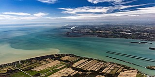
The Detroit River flows west and south for 24 nautical miles from Lake St. Clair to Lake Erie as a strait in the Great Lakes system. The river divides the metropolitan areas of Detroit, Michigan, and Windsor, Ontario—an area collectively referred to as Detroit–Windsor—and forms part of the border between Canada and the United States. The Ambassador Bridge, the Detroit–Windsor Tunnel, and the Michigan Central Railway Tunnel connect the cities.

Windsor is a city in southwestern Ontario, Canada, on the south bank of the Detroit River directly across from Detroit, Michigan, United States. Geographically located within but administratively independent of Essex County, it is the southernmost city in Canada and marks the southwestern end of the Quebec City–Windsor Corridor. The city's population was 229,660 at the 2021 census, making it the third-most populated city in Southwestern Ontario, after London and Kitchener. The Detroit–Windsor urban area is North America's most populous trans-border conurbation. Linking the Great Lakes Megalopolis, the Ambassador Bridge border crossing is the busiest commercial crossing on the Canada–United States border.

Toronto Chinatowns are ethnic enclaves in Toronto, Ontario, Canada, with a high concentration of ethnic Chinese residents and businesses. These neighbourhoods are major cultural, social and economic hubs for the Chinese-Canadian communities of the region. In addition to Toronto, several areas in the Greater Toronto Area also hold a high concentration of Chinese residents and businesses.

Lakeshore is a municipality on Lake St. Clair, in Essex County, Ontario, Canada. It was incorporated in 1999 by amalgamating the Town of Belle River with the townships of Maidstone, Rochester, Tilbury North, and Tilbury West. It is the largest and the most populous municipality within Essex County. However, it is part of the Windsor census metropolitan area.
Jefferson Avenue is a 63.71-mile-long (102.53 km) scenic road along the eastern part of the Detroit metropolitan area in the southeastern part of the U.S. state of Michigan. It travels alongside Lake Erie, the Detroit River, and Lake St. Clair. This road also provides access to many recreational facilities in the area. West Jefferson Avenue is primarily commercial, while East Jefferson Avenue contains a historic residential district.

Downriver is the unofficial name for a collection of 19 cities and townships in Wayne County, Michigan, south of Detroit, along the western shore of the Detroit River.

Chinatown in Montreal is located in the area of De la Gauchetière Street in Montreal. The neighbourhood contains many Asian restaurants, food markets, and convenience stores as well being home to many of Montreal's East Asian community centres, such as the Montreal Chinese Hospital and the Montreal Chinese Community and Cultural Centre.

The Michigan Central Railway Tunnel is a railroad tunnel under the Detroit River connecting Detroit, Michigan, in the United States with Windsor, Ontario, in Canada. The U.S. entrance is south of Porter and Vermont streets near Rosa Parks Boulevard. The Canadian entrance is south of Wyandotte Street West between Cameron and Wellington Avenues. It was built by the Detroit River Tunnel Company for the Canada Southern Railway, leased by the Michigan Central Railroad and owned by the New York Central Railroad. The tunnel opened in 1910 and is still in use today by the Canadian Pacific Railway.

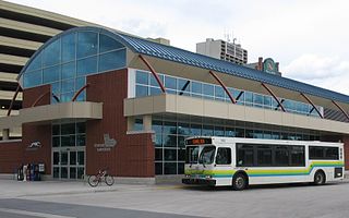
Transit Windsor provides public transportation in the city of Windsor, Ontario, Canada as well as LaSalle, Essex, Kingsville, Amherstburg and Leamington and serves more than 6 million passengers each year, covering an area of 310 km2 (120 sq mi) and a population of 235,000. They operate a cross border service between the downtown areas of Windsor and Detroit, Michigan via the Tunnel Bus, and service to events at Detroit's Comerica Park, Little Caesars Arena, Huntington Place, and Ford Field. The Windsor International Transit Terminal neighbours with the Windsor International Aquatic and Training Centre.
Windsor's Department of Parks and Recreation maintains 3,000 acres (12 km2) of green space, 180 parks, 40 miles (64 km) of trails, 22 miles (35 km) of sidewalk, 60 parking lots, vacant lands, natural areas and forest cover within the City of Windsor, as well as the Bike Trails, Bike Lanes, and Bike-Friendly Streets.

The Roy A. Battagello River Walk Bike Trail is the current backbone of the "Windsor Loop" bike trail network in Windsor, Ontario. The bike trail travels from the foot of the Ambassador Bridge, to traffic lights at Riverside Drive and Lincoln Avenue. This makes the trail the second-longest trail in the City of Windsor, at 8.0 km.
The Little River Extension is one of the newest and busiest recreational trails in Windsor, Ontario, having been built in 1996. The trail is used mainly as a link between the large subdivision of Forest Glade, to Ganatchio Trail, Sandpoint Beach, Stop 26 Beach, and Lakeview Park And Marina. The trail has a posted speed limit of 20 kilometres per hour (12 mph).
Windsor, Ontario, has a very diverse population, and this diversity is shown in its many neighbourhoods. Windsor has twenty in all, ranging from rural farmland to densely built-up areas.

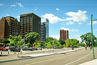
Ouellette Avenue is one of the main North-South Roads in Windsor, Ontario, and acts as its Main Street. The road diverges from Dougall Avenue south of Downtown Windsor, travelling northward over the Essex Terminal Railway/CP Rail tracks, before terminating at a turnaround and parking lot at Dieppe Gardens in Windsor's core.

Ottawa's Chinatown is located along Somerset Street west of downtown Ottawa. It runs from Bay Street in the east to Preston Street in the west. Signs for Chinatown continue along Somerset until Preston Street, and Chinese/Asian restaurants can be found even farther west.

Grange Park is a neighbourhood in downtown Toronto, Ontario, Canada. It is bounded on the west by Spadina Avenue, on the north by College Street, on the east by University Avenue and on the south by Queen Street West. It is within the 'Kensington-Chinatown' planning neighbourhood of the City of Toronto. Its name is derived from the Grange Park public park. The commercial businesses of Chinatown extend within this neighbourhood.
Chinatowns in Canada generally exist in the large cities of Vancouver, Ottawa, Calgary, Edmonton, Toronto, and Montreal, and existed in some smaller towns throughout the history of Canada. Prior to 1900, almost all Chinese were located in British Columbia, but have spread throughout Canada thereafter. From 1923 to 1967, immigration from China was suspended due to exclusion laws. In 1997, the handover of Hong Kong to China caused many from there to flee to Canada due to uncertainties. Canada had about 25 Chinatowns across the country between the 1930s to 1940s, some of which have ceased to exist.
As of 2002, ethnic Chinese and Chinese American people comprise the second-largest Asian-origin ethnic group in the Wayne–Macomb–Oakland tri-county area in Metro Detroit. As of that year there were 16,829 ethnic Chinese, concentrated mainly in Troy, Rochester Hills, and Canton Township. As of 2012, Madison Heights also hosts a significant Chinese community.

Chinatown, Toronto is a Chinese ethnic enclave located in the city's downtown core of Toronto, Ontario, Canada. It is centred at the intersections of Spadina Avenue and Dundas Street, West.


