Chollerton

Last updated
Chollerton
Chollerton Farm (2) (geograph 3403939).jpg
Chollerton Farm
Northumberland UK location map.svg
Red pog.svg
Chollerton
Chollerton shown within Northumberland
Population 818 (2011) [1]
OS grid reference NY935725
Unitary authority
Ceremonial county
Region
Country England
Sovereign state United Kingdom
Post town HEXHAM
Postcode district NE46
Dialling code 01434
Police Northumbria
Fire Northumberland
Ambulance North East
EU Parliament North East England
UK Parliament
List of places
UK
England
Northumberland
55°02′46″N2°06′11″W / 55.046°N 2.103°W / 55.046; -2.103 Coordinates: 55°02′46″N2°06′11″W / 55.046°N 2.103°W / 55.046; -2.103

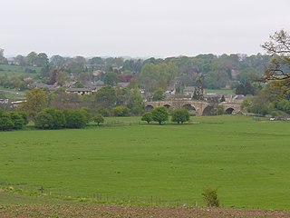
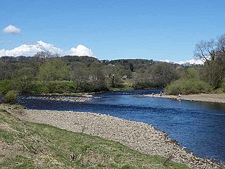
Chollerton is a village in Northumberland, England, on the A6079 road about six miles (10 km) to the north of Hexham, on the River North Tyne. Nearby villages include Low Brunton and Humshaugh. The village has a fine example of a mounting block standing at the churchyard gate. [2]

Northumberland County of England

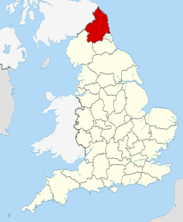
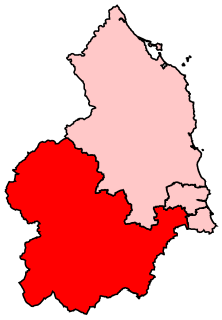
Northumberland is a county in North East England. The northernmost county of England, it borders Cumbria to the west, County Durham and Tyne and Wear to the south and the Scottish Borders to the north. To the east is the North Sea coastline with a 64 miles (103 km) path. The county town is Alnwick, although the County council is based in Morpeth.

The A6079 is a road in Northumberland, northern England, that runs eight miles (13 km) from Hexham to the A68 road. The road begins off the A69 road to the north of Hexham, before passing the villages of Acomb and Wall before meeting the B6318 road just to the south of Chollerford - unusually, traffic on the A6079 must give way to the traffic on the B6318, despite the fact that "A"-roads are more important than "B"-roads. The A6079 continues through the village of Chollerton, and terminates at its junction with the A68 road to Edinburgh, nine miles (14 km) north-west of Corbridge.

Hexham market town and civil parish in Northumberland, England

Hexham is a market town and civil parish in Northumberland, England, south of the River Tyne, and was the administrative centre for the Tynedale district from 1974 to 2009. In 2011, it had a population of 11,829.

Contents

The church, built around the 12th Century from local stone quarried from nearby. dedicated to Saint Giles, is noteworthy for the four large Roman columns built into its south aisle. These are believed to have been brought from the Roman fort of Chesters a couple of miles downstream.

Saint Giles Christian hermit

Saint Giles, also known as Giles the Hermit, was a Greek, Christian, hermit saint from Athens, whose legend is centered in Provence and Septimania. Giles founded the abbey in Saint-Gilles-du-Gard whose tomb became a place of pilgrimage. It was a stop on the road that led from Arles to Santiago de Compostela, the pilgrim Way of St. James. Giles is one of the Fourteen Holy Helpers.

Cilurnum human settlement in United Kingdom

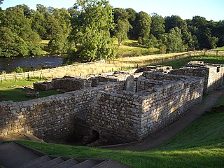
Cilurnum or Cilurvum was a fort on Hadrian's Wall mentioned in the Notitia Dignitatum. It is now identified with the fort found at Chesters near the village of Walwick, Northumberland, England. It was built in 123 AD, just after the wall's completion.

Chollerton is also a registration sub-district in Northumberland; its population in 1851 was 5024 people. [3]

The etymology of the name Chollerton is uncertain; possibly it is from the Old English "Ceolferth's tun" but more likely it meant "tun by Ceolan ford or Ceolford", if so "Ceolford" meant "Ceola's ford" (i.e. modern Chollerford). [4] [5]

Governance

Chollerton is in the parliamentary constituency of Hexham.

House of Commons of the United Kingdom lower house in the Parliament of the United Kingdom

The House of Commons is the lower house of the Parliament of the United Kingdom. Like the upper house, the House of Lords, it meets in the Palace of Westminster. Officially, the full name of the house is the Honourable the Commons of the United Kingdom of Great Britain and Northern Ireland in Parliament assembled. Owing to shortage of space, its office accommodation extends into Portcullis House.

Hexham (UK Parliament constituency) Parliamentary constituency in the United Kingdom

Hexham is a constituency in Northumberland represented in the House of Commons of the UK Parliament since 2010 by Guy Opperman, a Conservative.

Transport

Chollerton was served by Chollerton railway station on the Border Counties Railway which linked the Newcastle and Carlisle Railway, near Hexham, with the Border Union Railway at Riccarton Junction in Scotland. The first section of the route was opened between Hexham and Chollerford in 1858, the remainder opening in 1862. The line was closed to passengers by British Railways in 1956.

The Border Counties Railway was a railway line connecting Hexham in Northumberland, with Riccarton Junction on the Waverley Route in Roxburghshire.

Newcastle & Carlisle Railway

The Newcastle & Carlisle Railway (N&CR) was an English railway company formed in 1825 that built a line from Newcastle upon Tyne on Britain's east coast, to Carlisle, on the west coast. The railway began operating mineral trains in 1834 between Blaydon and Hexham, and passengers were carried for the first time the following year. The rest of the line opened in stages, completing a through route between Carlisle and Gateshead, south of the River Tyne in 1837. The directors repeatedly changed their intentions for the route at the eastern end of the line, but finally a line was opened from Scotswood to a Newcastle terminal in 1839. That line was extended twice, reaching Newcastle Central station in 1851.

The Border Union Railway was a railway line which connected places in the south of Scotland and Cumberland in England. It was authorised on 21 July 1859 and advertised as the Waverley Route by the promoters - the North British Railway. It connected the Edinburgh and Hawick Railway at Hawick with Carlisle.

The station still stands and is now in use as a private house. Also still standing is a small viaduct over the road into the village.

Landmarks

A mile to the south-east, Cocklaw Tower is a ruined late 14th or early 15th-century tower house. [6]

See also

Related Research Articles

Corbridge village in the United Kingdom

Corbridge is a village in Northumberland, England, 16 miles (26 km) west of Newcastle and 4 miles (6 km) east of Hexham. Villages nearby include Halton, Acomb, Aydon and Sandhoe.

Haltwhistle town in Northumberland, England

Haltwhistle is a small town and civil parish in Northumberland, England, 10 miles (16 km) east of Brampton, near Hadrian's Wall. It had a population of 3,811 at the 2011 Census.

Barrasford village in United Kingdom

Barrasford is a village in Northumberland, England. It is situated to the north of Hexham, on the North Tyne. Barrasford is an ancient village that lies within the shadow of Haughton Castle. The village is notable for being the location of a Bronze Age burial site where the Reaverhill Dagger was excavated in 1964. Today Barrasford is noted for its quarry.

Charlton, Northumberland village in United Kingdom

Charlton is a village in Northumberland, England. It is about 1.5 miles (2.4 km) to the northwest of Bellingham, on the River North Tyne.

Chollerford village in United Kingdom

Chollerford is a village in Northumberland, England. It is situated approximately four miles to the north of Hexham on the B6318 road, not far from Hadrian's Wall. There is a roundabout in the village where the B6318 and B6320 roads meet, and the traffic light-controlled Chollerford Bridge crosses the River North Tyne. Beside the river is The George Hotel

Wark on Tyne village in United Kingdom

Wark on Tyne is a small village and civil parish usually called Wark in Northumberland, England about 12 miles (19 km) north of Hexham. The name is derived from the Viking word for Earthworks, and refers to the mound at the south of the village, where a meeting hall once stood. The hotel name 'battlesteads' is taken from the stables that once stood there, as the meeting hall was used as the main meeting place for the Clan Chieftains. Wark was also once the capital town of Tynedale, and still retains a Town Hall, rather than a Village Hall. A Bronze-age stone circle known as The Goatstones is located near Ravensheugh crags in Wark parish.

Falstone village in the United Kingdom

Falstone is a small village in Northumberland, England, just south of Kielder Water. The village is 8 miles (13 km) from the Anglo–Scottish border. The name Falstone means "speckled stone".

Greenhead, Northumberland village in United Kingdom

Greenhead is a village in Northumberland, England. The village is on the Military Road (B6318), about 17 miles (27 km) from Chollerford, 3 miles (5 km) from Haltwhistle and 9 miles (14 km) from Brampton, Cumbria along the A69 road. The A69 road bypasses the village, but until the 1980s all vehicular traffic passed through the village. The village lies just outside the Northumberland National Park, close to Hadrian's Wall. Just to the north of the village is the 12th-century Thirlwall Castle, recently restored and opened to the public. Nearby villages include Upper Denton and Haltwhistle.

Tarset village in Northumberland, England

Tarset is a civil parish in Northumberland, England, created in 1955 from parts of Bellingham, Tarset West and Thorneyburn parishes. It is 4 miles (6 km) west-north-west of Bellingham. Today it shares a parish council with the adjacent parish of Greystead. It is partly located within the Northumberland National Park, and also mostly within the international dark skies park.

Wall, Northumberland village and civil parish in Northumberland, England

Wall is a village in Northumberland, England situated to the north of Hexham close by the River North Tyne and Hadrian's Wall. The Battle of Heavenfield was fought nearby. The village has one pub and a garage.

Low Brunton village in the United Kingdom

Low Brunton is a small village in Northumberland, England. Nearby settlements include Humshaugh, Chollerford and Walwick.

Walwick village in United Kingdom

Walwick is a village in Northumberland, England near Hadrian's Wall. Nearby villages include Humshaugh, Chollerford and Low Brunton.

Warden, Northumberland village in Northumberland

Warden is a village in Northumberland, England about 2 miles (3 km) west of Hexham.

Plashetts village in Northumberland, in England

Plashetts is a small settlement in Northumberland, in England south east of Kielder, Northumberland. It is about 22 miles (35 km) north west of Hexham. Part of the settlement is now beneath the surface of Kielder Water.

Plashetts railway station is a closed stone built railway station that served the mining hamlet of Plashetts, in Northumberland, England, which is now beneath the surface of Kielder Water.

Falstone railway station

Falstone railway station is a former railway station that served the hamlet of Falstone, in Northumberland, England.

Lewiefield Halt was a wooden-built halt that served the hamlet of Lewie, and a Ministry of Labour training camp, in Northumberland, England.

Kielder railway station is a closed railway station that served the village hamlet of Kielder, Northumberland.

Chollerford railway station

Chollerford railway station served the village of Chollerford, Northumberland, England from 1858 to 1958 on the Border Counties Railway.

References

  1. "Parish population 2011" . Retrieved 29 June 2015.
  2. Book of the British Countryside. London: Drive Publications, (1973). p. 302.
  3. A vision of Britain Through Time
  4. Ekwall, E. (1940) The Concise Dictionary of English Place-names; 2nd ed. Oxford: Clarendon Press; p. 101
  5. "Chollerton" is also an older form of Chorlton, Manchester.
  6. "Cocklaw Tower". Pastscape. Retrieved 14 June 2011.

Further reading

Awdry, Christopher (1990). Encyclopaedia of British Railway Companies. Sparkford: Patrick Stephens Ltd. ISBN   1-8526-0049-7. OCLC   19514063. CN 8983.