
The River Mersey is a major river in North West England. Its name derives from Old English and means "boundary river", possibly referring to its having been a border between the ancient kingdoms of Mercia and Northumbria. For centuries it has formed part of the boundary between the historic counties of Lancashire and Cheshire.
Chorlton-cum-Hardy is a suburban area of Manchester, England, three miles (4.8 km) southwest of the city centre. Chorlton ward had a population of 14,138 at the 2011 census, and Chorlton Park 15,147.

Withington is a suburb of Manchester, Greater Manchester, England. Historically part of Lancashire, it lies 4 miles (6.4 km) from Manchester city centre, about 0.4 miles (0.6 km) south of Fallowfield, 0.5 miles (0.8 km) north-east of Didsbury and also 1 mile (1.6 km) east of Chorlton-cum-Hardy. Withington has a population of just over 14,000 people, reducing at the 2011 census to 13,422.

Fallowfield is a bustling area of Manchester with a population of 14,869 at the 2021 census. Historically in Lancashire, it lies 3 miles (5 km) south of Manchester city centre and is bisected east–west by Wilbraham Road and north–south by Wilmslow Road. The former Fallowfield Loop railway line, now a shared use path, follows a route nearly parallel with the east–west main road.

The River Irwell is a tributary of the River Mersey in north-west England. It rises at Irwell Springs on Deerplay Moor, approximately 1+1⁄2 miles north of Bacup and flows southwards for 39 mi (63 km) to meet the Mersey near Irlam. The Irwell marks the boundary between Manchester and Salford, and its lower reaches have been canalised and now form part of the Manchester Ship Canal.
Didsbury is a suburb of Manchester, England, on the north bank of the River Mersey, 5 miles south of Manchester city centre. The population at the 2011 census was 26,788.
Burnage is an area of Manchester, England, 4 miles (6.4 km) south of the city centre and bisected by Kingsway. The population at the 2011 census was 15,227. It lies within the Greater Manchester Metropolitan area, in the historic county of Lancashire, between Withington to the west, Levenshulme to the north, Heaton Chapel to the east and Didsbury and Heaton Mersey to the south.

Whalley Range is an area of Manchester, England; it is located about 2 miles (3.2 km) south-west of the city centre. The population at the 2011 census was 15,430. Historically in Lancashire, it was one of the earliest of the city's suburbs, built by local businessman Samuel Brooks.

Manchester Withington is a constituency represented in the House of Commons of the UK Parliament since 2015 by Jeff Smith of Labour. Of the 30 seats with the highest percentage of winning majority in 2017, the seat ranks 25th with a 55.7% margin, and is the only one of the twenty nine of these seats won by the Labour Party in which the second-placed candidate was a Liberal Democrat, rather than Conservative. This is despite being a Conservative seat right up to 1987, then becoming relatively safely Labour, then Liberal Democrat from 2005 to 2015 before they lost on a large swing in 2015, after which Smith substantially increased his majority.

Heaton Mersey is a suburb of Stockport, Greater Manchester, England. It is situated on the north-western border of Stockport, adjacent to Didsbury and Burnage which are in the City of Manchester.

Sale Water Park is a 152-acre (62 ha) area of parkland including a 52-acre (21 ha) artificial lake in the Metropolitan Borough of Trafford in Greater Manchester, England. Opened in 1979 and owned by Trafford Council, the water park lies in an area of the green belt running through the Mersey river valley between Sale and Stretford, located between the river and the M60 motorway. The lake was formed in the 1970s by the flooding of a gravel pit excavated to provide material for the construction of an embankment raising the motorway 34 feet (10 m) above the Mersey's floodplain. The pit was excavated to a depth of around 115 feet (35 m), making the lake about 90 feet (27 m) deep in places.
Ees is an archaic English term for a piece of land liable to flood, or water meadow. It is derived from the Anglo-Saxon ¯eg meaning "'island', also used of a piece of firm land in a fen and of land situated on a stream or between streams". It is still used locally in Greater Manchester to indicate former water meadows and flood basins adjoining the River Mersey: Chorlton Ees, Sale Ees and Stretford Ees. In the Lake District there are Ees and Strickland Ees on Esthwaite Water. The term is also modified to "eye" and "eea" in the name of Park Eye.

Withington is a tram stop on the South Manchester Line (SML) of Greater Manchester's light-rail Metrolink system. It is located on the west side of Princess Road on the fringe of Withington in south Manchester, England.

Burton Road is a stop on the South Manchester Line of Greater Manchester's light rail Metrolink system. It is located on Burton Road, on the border of the suburbs of Withington and West Didsbury in Manchester, England.

Barlow Moor is an area of Manchester, England. It was originally an area of moorland between Didsbury and Chorlton-cum-Hardy and was named after the Barlow family of Barlow Hall. Barlow Moor Road runs through the area and connects to Wilmslow Road at the southern end and Manchester Road at the northern end. Southern Cemetery and Chorlton Park are landmarks on the route. Immediately adjacent to the northwest corner of the cemetery, also on Barlow Moor Road, is the Manchester Crematorium which opened in 1892, the second in the United Kingdom. The architects were Steinthal and Solomons who chose to revive the Lombard-Romanesque style. Another notable building is the Chorlton Park Apartments, 2002.

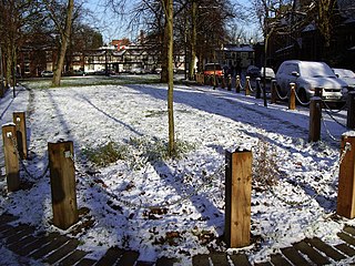
Parks, water parks and other open spaces in Chorlton-cum-Hardy, Manchester, include the following.
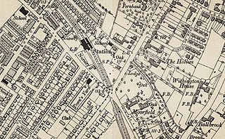
Withington and West Didsbury railway station is a former station in West Didsbury, in the southern suburbs of Manchester, England, United Kingdom. The station was located on Lapwing Lane, close to the junction with Palatine Road and opposite Withington Town Hall. Nothing now remains of the old station buildings, which have been demolished. West Didsbury is now served by West Didsbury tram stop which is approximately 85 metres (279 ft) further down the line from the original railway station.

The South Manchester Line (SML) is a tram line of the Manchester Metrolink in Manchester, England, running from Manchester city centre to Didsbury. The line opened as far as St. Werburgh's Road in 2011 and then to East Didsbury in 2013 as part of phase three of the system's expansion, along a former railway trackbed.

