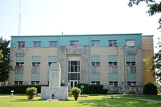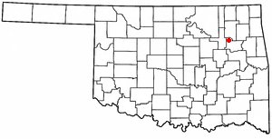
Wagoner County is a county located in the U.S. state of Oklahoma. As of the 2020 census, the population was 80,981. Its county seat is Wagoner.

Hulbert is a town in Cherokee County, Oklahoma, United States, named after Ben H. Hulbert, a prominent Cherokee man. The population was 483 at the 2020 census, previously it was 590 in 2010. Our Lady of the Annunciation of Clear Creek Monastery is a Benedictine monastery located in Hulbert. The Clear Creek Monastery, recently elevated to the status of an abbey, is a foundation abbey of France's Notre Dame de Fontgombault, which is itself a foundation abbey of Saint Pierre de Solesmes, also in France.

Stigler is a city in and county seat of Haskell County, Oklahoma. The population was 2,685 at the time of the 2010 census, down from 2,731 recorded in 2000.

New Tulsa was a town in Wagoner County, Oklahoma, United States. The population was 568 at the 2000 census. The town was dissolved in 2001 by a vote of the residents and is now part of the city of Broken Arrow.

Porter is a town in Wagoner County, Oklahoma, United States. It promotes itself as "The Peach Capital of Oklahoma." The population was 566 at the 2010 census, a loss of 1.4 percent, compared to 574 at the 2000 census.

Redbird is a town in Wagoner County, Oklahoma, United States. The population was 137 at the 2010 census, a 10.5 percent decline from the figure of 153 in 2000. Founded at the turn of the 20th century, it was one of more than fifty all-black towns in Oklahoma Territory and Indian Territory and is one of thirteen surviving black communities in Oklahoma.

Tullahassee is a town in Wagoner County, Oklahoma, United States. The population was 106 in both the 2010 and the 2000 censuses. It was the location of Tullahassee Mission, an Indian boarding school that burned in 1880. Because their population in the community had declined, the Muscogee Creek gave the school to Creek Freedmen, paying to replace the main building, and relocated with their families to the area of Wealaka Mission.

Wagoner is a city in Wagoner County, Oklahoma, United States. The population was 8,323 at the 2010 census, compared to the figure of 7,669 recorded in 2000. It is the county seat of Wagoner County. Wagoner became the first city incorporated in Indian Territory on January 4, 1896.
The NW 39th Street Enclave, also known as "The Strip," "The Gayborhood," "May-Penn," "39th & Penn" or simply "39th Street" is a prominent lesbian, gay, bisexual and transgender (LGBT) district in Oklahoma City, Oklahoma. The area is located along NW 39th Street in the city's northwest quadrant, one block west of Pennsylvania Avenue.

Area codes 918 and 539 are telephone area codes serving Tulsa and northeast Oklahoma. Besides Tulsa, these area codes cover cities such as Bartlesville, Broken Arrow, Claremore, Gore, Jenks, McAlester, Muskogee, Okmulgee, Pryor, Sapulpa, Tahlequah, and northeastern Oklahoma.

State Highway 104, abbreviated SH-104 or OK-104, is a short state highway in the U.S. state of Oklahoma. It travels for 2.08 miles (3.35 km) in Muskogee County and 4.94 miles (7.95 km) in Wagoner County, for a total length of 7.02 miles (11.30 km). It has no lettered spur routes.
Wagoner High School is a high school in Wagoner, Oklahoma.
Taylor Ferry is an unincorporated community in Wagoner County, Oklahoma, United States, situated on Fort Gibson Lake. The community was the site of a ferry crossing across the Grand River when Oklahoma was the Indian Territory during the 19th century.
Nolia is a former community in eastern Pushmataha County, Oklahoma, United States, five miles east of Nashoba. Nolia is located at 34°28′35″N95°09′06″W.

Rodney is a former community in Pushmataha County, Oklahoma, United States, five miles north of Antlers.

Clarksville is an unincorporated community in Wagoner County, Oklahoma, United States. It is located three miles south of Porter on N. 4210 Road.
Gibson is an unincorporated community in Wagoner County, Oklahoma, United States. It is located on Oklahoma State Highway 16, approximately six miles south of Wagoner and 2+1⁄2 miles northwest of Okay. The Gibson Station was the first passenger and freight station built in Indian Territory, now Oklahoma, constructed in 1872 by the Missouri–Kansas–Texas Railroad.
Mallard Bay is an unincorporated community in Wagoner County, Oklahoma, United States. The elevation is 607 feet.
Dighton is a populated place in Okmulgee County, Oklahoma. It is about 7 miles east-northeast of Henryetta, Oklahoma, and is located south of US Route 266 on Bartlett Road.
Gulftown is a unincorporated community in Okmulgee County, Oklahoma, at an elevation of 610 feet. It is located about two miles east of Dewar, Oklahoma. It is centered around the corner of Hackberry Road and Arbeka Road, being both south and east of US Route 266.


