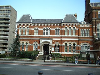
The Metropolitan Borough of Southwark was a metropolitan borough in the County of London from 1900 to 1965. It was created to cover the western section of the ancient borough of Southwark and the parish of Newington. In common with the rest of inner London, the borough experienced a steady decline in population throughout its existence. The borough council made an unsuccessful attempt to gain city status in 1955. Its former area is now the northwestern part of the current London Borough of Southwark.

The Metropolitan Borough of St Marylebone was a metropolitan borough of the County of London from 1900 to 1965. It was based directly on the previously existing civil parish of St Marylebone, Middlesex, which was incorporated into the Metropolitan Board of Works area in 1855, retaining a parish vestry, and then became part of the County of London in 1889.

Minories is the name of a small former administrative unit, and also of a street in the Aldgate area of the City of London. Both the street and the former administrative area take their name from the Abbey of the Minoresses of St. Clare without Aldgate.

125 Old Broad Street, formerly known as the Stock Exchange Tower and still often referred to as such, is a high-rise office building in London, located on Old Broad Street in the City of London financial district.
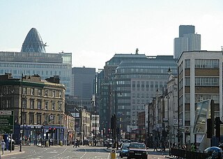
The EC postcode area, also known as the London EC postal area, is a group of postcode districts in central London, England. It includes almost all of the City of London and parts of the London boroughs of Islington, Camden, Hackney, Tower Hamlets and Westminster. The area covered is of very high density development. Deliveries for the EC postcode area are made from Mount Pleasant Mail Centre.

Houndsditch is a street running through parts of the Portsoken and Bishopsgate Without wards of the City of London; areas which are also a part of the East End of London. The road follows the line of the outside edge of the ditch which once ran outside the London Wall. The road took its name from the section of ditch between Bishopsgate and Aldgate. The name may derive from the widespread dumping of rubbish in this stretch of ditch; relating to the dumping of dead dogs, or the scavenging of the waste by feral dogs.
Norton Folgate is a short length of street in London, connecting Bishopsgate with Shoreditch High Street, on the northern edge of the City of London.

Southwark Bridge Road is a road in Southwark, London, England, between Newington Causeway near Elephant and Castle and Southwark Bridge across the River Thames, leading to the City of London, in a meandering route.

Hackney Road is a London arterial route running from Shoreditch Church in London Borough of Hackney to Cambridge Heath in the London Borough of Tower Hamlets. The route runs along the northern edge of Bethnal Green and southern edge of Haggerston. It lies close to the border between the boroughs of London Boroughs of Hackney and Tower Hamlets.

The Queen's Lawn is a green lawned area situated at the centre of Imperial College London's South Kensington campus, next to the Queen's Tower and immediately to the north of Imperial College Road. It provides an open space of 1,600 sq metres, and is surrounded by the Abdus Salam Library, and the Sherfield administration, Chemistry, and Skempton buildings. It is often the site of college events, including student bands, fairs, and balls, as well as student activism.

The Landmark London is a five-star hotel on Marylebone Road on the northern side of central London, England, in the City of Westminster. It was originally opened by the Great Central Railway, as the Hotel Great Central. As one of London's railway hotels it declined after the advent of the motor car, and served as a military convalescent home during the Second World War, and later the headquarters of the British Railways Board. It reopened as a hotel in 1993.
Saffron Square is a town square and high-rise building in Croydon, United Kingdom. The purple and red Saffron Tower is currently the second-tallest building in Croydon.

No. 1 Croydon is a tall building at 12–16 Addiscombe Road, Croydon, Greater London, next to East Croydon station. It was designed by Richard Seifert & Partners and completed in 1970. It has 24 storeys and is 269 feet (82 m) high. 'NLA' stood for 'Noble Lowndes Annuities'. It was one of many new buildings constructed in the growing town of Croydon in the 1960s. The development of tall buildings was later encouraged in the 2004 London Plan, which led to the erection of new skyscrapers as Greater London went through a high-rise boom.

Maine Tower is a 41-storey residential building located between Lighterman's Road and Dockyard Lane on the Isle of Dogs forming part of the Harbour Central development at Canary Wharf, London.

Sky Gardens Nine Elms is a residential and retail tower in Nine Elms, within the borough of Lambeth, London. The scheme has been designed by architects Careyjones Chapmantolcher (CJCT) and developed by Fraser Property Development UK. Its construction was part of a wider regeneration of the Nine Elms area of London. The building is 120 metres (390 ft) in height.
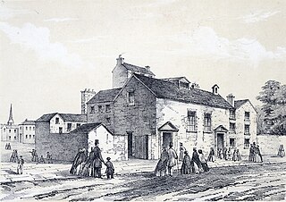
The Foundery, in Moorfields, was the first London foundry for casting brass cannon for the British Board of Ordnance. The building subsequently served as the first Wesleyan Methodist house of worship, and an important meeting place for the early Methodist community. In 1778, the Methodist congregation was moved to the nearby purpose-built Wesley's Chapel on City Road.

250 City Road is a residential-led scheme under construction in the borough of Islington, London, designed by Foster + Partners and developed by Berkeley. It was given planning permission in 2014 by the then London Mayor Boris Johnson after being rejected by Islington Council.

The Montcalm East is an 18-storey hotel in the Shoreditch area of Hackney, London. Opened in 2015, the 269-room hotel is part of The Montcalm group.

Novotel London Canary Wharf also known as 40 Marsh Wall is a 127 m (419 ft), 39-storey hotel in the Isle of Dogs, London, just south of the financial district of Canary Wharf. It has been designed by BUJ Architects for AccorHotels as one of the company's Novotel hotels and has 313 rooms. It is the tallest all-hotel building in the United Kingdom and the tallest Novotel in the world.

Highpoint is a 142-metre, 46-storey, 458-apartment residential tower in Elephant and Castle in the London Borough of Southwark in London on the site of the London Park Hotel.


