Related Research Articles

Chattanooga is a city in and the county seat of Hamilton County, Tennessee, along the Tennessee River bordering Georgia. With an estimated population of 182,799 in 2019, it is Tennessee's fourth-largest city and one of the two principal cities of East Tennessee, along with Knoxville. The city anchors the Chattanooga metropolitan area, Tennessee's fourth-largest metropolitan statistical area, as well as a larger three-state area that includes Southeast Tennessee, Northwest Georgia, and Northeast Alabama. Served by multiple railroads and Interstate highways, Chattanooga is a transit hub. It is 118 miles (190 km) northwest of Atlanta, Georgia, 112 miles (180 km) southwest of Knoxville, Tennessee, 134 miles (216 km) southeast of Nashville, Tennessee, 102 miles (164 km) east-northeast of Huntsville, Alabama, and 147 miles (237 km) northeast of Birmingham, Alabama.

The Little Tennessee River is a 135-mile (217 km) tributary of the Tennessee River that flows through the Blue Ridge Mountains from Georgia, into North Carolina, and then into Tennessee, in the southeastern United States. It drains portions of three national forests— Chattahoochee, Nantahala, and Cherokee— and provides the southwestern boundary of the Great Smoky Mountains National Park.

Etowah Indian Mounds (9BR1) are a 54-acre (220,000 m2) archaeological site in Bartow County, Georgia south of Cartersville, in the United States. Built and occupied in three phases, from 1000–1550 AD, the prehistoric site is located on the north shore of the Etowah River.

Chota is a historic Overhill Cherokee town site in Monroe County, Tennessee, in the southeastern United States. Developing after nearby Tanasi, Chota was the most important of the Overhill towns from the late 1740s until 1788. It replaced Tanasi as the de facto capital, or 'mother town' of the Cherokee people.

Moundville Archaeological Site, also known as the Moundville Archaeological Park, is a Mississippian culture archaeological site on the Black Warrior River in Hale County, near the modern city of Tuscaloosa, Alabama. Extensive archaeological investigation has shown that the site was the political and ceremonial center of a regionally organized Mississippian culture chiefdom polity between the 11th and 16th centuries. The archaeological park portion of the site is administered by the University of Alabama Museums and encompasses 185 acres (75 ha), consisting of 29 platform mounds around a rectangular plaza.

Tennessee is one of the 50 states of the United States. What is now Tennessee was initially part of North Carolina, and later part of the Southwest Territory. It was admitted to the Union on June 1, 1796, as the 16th state. Tennessee would earn the nickname "The Volunteer State" during the War of 1812, when many Tennesseans would step in to help with the war effort. Especially during the Americans victory at the Battle of New Orleans. The nickname would become even more applicable during the Mexican–American War in 1846, after the Secretary of War asked the state for 2,800 soldiers, and Tennessee sent over 30,000.

The Kincaid Mounds Historic Site c. 1050–1400 CE, is a Mississippian culture archaeological site located at the southern tip of present-day U.S. state of Illinois, along the Ohio River. Kincaid Mounds has been notable for both its significant role in native North American prehistory and for the central role the site has played in the development of modern archaeological techniques. The site had at least 11 substructure platform mounds, and 8 other monuments.

Toqua was a prehistoric and historic Native American site in Monroe County, Tennessee, located in the Southeastern Woodlands. Toqua was the site of a substantial ancestral town that thrived during the Mississippian period (1000-1600CE). Toqua had a large earthwork 25-foot (7.6 m) platform mound built by the town's Mississippian-era inhabitants, in addition to a second, smaller mound. The site's Mississippian occupation may have been recorded by the Spanish as the village of Tali, which was documented in 1540 by the Hernando de Soto expedition. It was later known as the Overhill Cherokee town Toqua, and this name was applied to the archeological site.

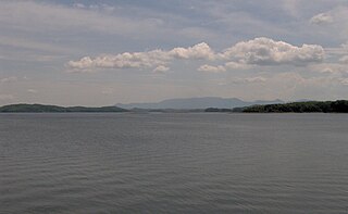
Citico is a prehistoric and historic Native American site in Monroe County, Tennessee, in the southeastern United States. The site's namesake Cherokee village was the largest of the Overhill towns, housing an estimated Indian population of 1,000 by the mid-18th century. The Mississippian village that preceded the site's Cherokee occupation is believed to have been the village of "Satapo" visited by the Juan Pardo expedition in 1567.
Citico can refer to:
Chiaha was a Native American chiefdom located in the lower French Broad River valley in modern East Tennessee, in the southeastern United States. They lived in raised structures within boundaries of several stable villages. These overlooked the fields of maize, beans, squash, and tobacco, among other plants which they cultivated. Chiaha was the northern extreme of the paramount Coosa chiefdom's sphere of influence in the 16th century when the Spanish expeditions of Hernando de Soto and Juan Pardo passed through the area. The Chiaha chiefdom included parts of modern Jefferson and Sevier counties, and may have extended westward into Knox, Blount and Monroe counties.
The Jere Shine Site (1MT6) is an archaeological site on the Tallapoosa River near its confluence with the Coosa River in modern Montgomery County, Alabama. Based on comparison of archaeological remains and pottery styles, scholars believe that it was most likely occupied from 1400–1550 CE by people of the South Appalachian Mississippian culture.

Old Town is an archaeological site in Williamson County, Tennessee near Franklin. The site includes the remnants of a Native American village and mound complex of the Mississippian culture, and is listed on the National Register of Historic Places (NRHP) as Old Town Archaeological Site (40WM2).
The Dallas Phase is an archaeological phase, within the Mississippian III period, in the South Appalachian Geologic province in North America.

The Little Egypt site was an archaeological site located in Murray County, Georgia, near the junction of the Coosawattee River and Talking Rock Creek. The site originally had three platform mounds surrounding a plaza and a large village area. It was destroyed during the construction of the Dam of Carters Lake in 1972. It was situated between the Ridge and Valley and Piedmont sections of the state in a flood plain. Using Mississippian culture pottery found at the site archaeologists dated the site to the Middle and Late South Appalachian culture habitation from 1300 to 1600 CE during the Dallas, Lamar, and Mouse Creek phases.

The McMahan Mound Site (40SV1), also known as McMahan Indian Mound, is an archaeological site located in Sevierville, Tennessee just above the confluence of the West Fork and the Little Pigeon rivers in Sevier County.
The Ware Mounds and Village Site (11U31), also known as the Running Lake Site, located west of Ware, Illinois, is an archaeological site comprising three platform mounds and a 160-acre (65 ha) village site. The site was inhabited by the Late Woodland and Mississippian cultures from c. 800 to c. 1300. The village is one of the only Mississippian villages known to have existed in the Mississippi River valley in Southern Illinois. As the village was located near two major sources of chert, which Mississippian cultures used to make agricultural tools, it was likely a trading center for the mineral.
The Mouse Creek Phase is an archaeological culture of the Eastern Tennessee region of Mississippian chiefdoms, first defined by T. M. N. Lewis and Madeline Kneberg in their examinations of the Chickamauga Basin. This area exhibits artifacts, burials, and architecture distinct from other settlements in the area. The region was occupied from around 1400–1600.

The Taskigi Mound or Mound at Fort Toulouse – Fort Jackson Park (1EE1) is an archaeological site from the South Appalachian Mississippian Big Eddy phase. It is located on a 40 feet (12 m) bluff at the confluence of the Coosa and Tallapoosa rivers where they meet to form the Alabama River, near the town of Wetumpka in Elmore County, Alabama.
References
- Evans, E. Raymond & Smith, Gerald, Test Excavations at Citico (40HA65) Hamilton County, Tennessee 1988
- Moore, Clarence B., The Tennessee, Green, and Lower Ohio River Expeditions of Clarence Bloomfield Moore. Richard Polhemus, ed., University of Alabama Press 2002
- Hatch, James W., "The Citico Site (40HA65): A Synthesis", 'Tennessee Anthropologist', journal of the Tennessee Anthropological Association, 1:2 Fall 1976
- Honerkamp, Nicholas, Beth Fowler, Tracy Little, Robby Mantooth, "An archaeological Survey of the Citico Site (40HA65), Chattanooga, Tennessee"; Research Contributions 2, Jeffrey L. Brown Institute of Archaeology, University of Tennessee at Chattanooga, December 1989