Related Research Articles

South Cambridgeshire is a local government district of Cambridgeshire, England, with a population of 162,119 at the 2021 census. It was formed on 1 April 1974 by the merger of Chesterton Rural District and South Cambridgeshire Rural District. It completely surrounds the city of Cambridge, which is administered separately from the district by Cambridge City Council.

East Cambridgeshire is a local government district in Cambridgeshire, England. Its council is based in the city of Ely. The district also contains the towns of Littleport and Soham and surrounding rural areas, including parts of the Fens.

Fenland is a local government district in Cambridgeshire, England. It was historically part of the Isle of Ely. The district covers around 500 square kilometres (190 sq mi) of mostly agricultural land in the extremely flat Fens. The council is based in March. Other towns include Chatteris, Whittlesey and Wisbech.

Braintree District is a local government district in Essex, England. The district is named after the town of Braintree, where the council is based. The district also includes the towns of Halstead and Witham and surrounding rural areas.

A civil parish is a country subdivision, forming the lowest unit of local government in England. There are 264 civil parishes in the ceremonial county of Cambridgeshire, most of the county being parished; Cambridge is completely unparished; Fenland, East Cambridgeshire, South Cambridgeshire and Huntingdonshire are entirely parished. At the 2001 census, there were 497,820 people living in the parishes, accounting for 70.2 per cent of the county's population.
Alwalton is a village and civil parish in Cambridgeshire, England. Alwalton lies approximately 5 miles (8 km) west of Peterborough city centre. Alwalton is situated within Huntingdonshire which is a non-metropolitan district of Cambridgeshire as well as being a historic county of England. The village runs onto the Peterborough suburb of Orton Northgate, with which the administrative boundary runs along the A605 road, the northern side of the road being in Alwalton and the southern side in Orton Northgate. Alwalton overlooks the southern bank of the River Nene and is close to the line of Ermine Street or the A1 road, west of which lies the neighbouring village of Chesterton.

Pidley is a small village in Cambridgeshire, England. Pidley lies approximately 7 miles (11 km) north-east of Huntingdon. Together with the neighbouring village of Fenton, Pidley forms the civil parish of Pidley cum Fenton. Pidley is situated within Huntingdonshire which is a non-metropolitan district of Cambridgeshire as well as being a historic county of England.

Tetworth is a village and former civil parish, now in the parish of Waresley-cum-Tetworth, in Cambridgeshire, England. Tetworth lies approximately 12 miles (19 km)south of Huntingdon, near Waresley south of St Neots. Tetworth is situated within Huntingdonshire which is a non-metropolitan district of Cambridgeshire as well as being a historic county of United Kingdom. In 2001 the parish had a population of 45.

Waresley is a village and former civil parish, now in the parish of Waresley-cum-Tetworth, in Cambridgeshire, England. Waresley lies approximately 11 miles (18 km) south of Huntingdon and 5 miles (8 km) south-east of the town of St Neots. Waresley is situated within Huntingdonshire which is a non-metropolitan district of Cambridgeshire as well as being a historic county of England.

Tilbrook is a village and civil parish in the Huntingdonshire district of Cambridgeshire, England, approximately 10 miles (16 km) west of Huntingdon and 24 miles (39 km) north-west of Cambridge. Though administered as part of Cambridgeshire, the village historically belonged to Bedfordshire, being situated 12 miles (19 km) north of Bedford. The parish had a population of 256 in 2021.

Farcet is a village and civil parish in Cambridgeshire, England. Farcet lies approximately 2 miles (3 km) south of Peterborough city centre, between Yaxley and the Peterborough suburb of Old Fletton. Farcet is situated within Huntingdonshire which is a non-metropolitan district of Cambridgeshire as well as being a historic county of England.

Peterborough City Council is the local authority for Peterborough in the East of England. It is a unitary authority, having the powers of a non-metropolitan county and district council combined. The City was incorporated as a municipal borough in 1874; from 1888, it fell within the jurisdiction of the Soke of Peterborough county council and from 1965, Huntingdon and Peterborough county council. In 1974, it was replaced by a wholly new non-metropolitan district, broadly corresponding to the Soke, in the new enlarged Cambridgeshire. In 1998, Peterborough became independent of Cambridgeshire as a unitary authority, but the city continues to form part of that county for ceremonial purposes as defined by the Lieutenancies Act 1997.
Cambridge City Council is the local authority for the city of Cambridge, a non-metropolitan district with city status in Cambridgeshire, England.

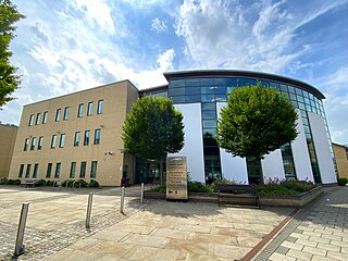
Cambridgeshire County Council is the county council of Cambridgeshire, England. The council consists of 61 councillors, representing 59 electoral divisions. The council is based at New Shire Hall in Alconbury Weald, near Huntingdon. It is part of the East of England Local Government Association and a constituent member of the Cambridgeshire and Peterborough Combined Authority.
Earith is a village and civil parish in Cambridgeshire, England. Lying approximately 10 miles (16 km) east of Huntingdon, Earith is situated within Huntingdonshire which is a non-metropolitan district of Cambridgeshire as well as being a historic county of England. At Earith, two artificial diversion channels of the River Great Ouse, the Old Bedford River and the New Bedford River, leave the river on a course to Denver Sluice near Downham Market, where they rejoin the Great Ouse in its tidal part. At the 2001 census, the parish had a population of 1,677, reducing to 1,606 at the 2011 Census.

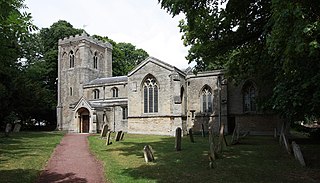
Old Hurst is a village and civil parish in Cambridgeshire, England, approximately 5 miles (8 km) north-east of Huntingdon. It is situated within Huntingdonshire which is a non-metropolitan district of Cambridgeshire as well as being a historic county of England.The small Parish Church of St Peter's dates from the 13th century and is a Grade II* listed building.
Huntingdonshire District Council is the local authority for the district of Huntingdonshire in Cambridgeshire, England. The council is based in the town of Huntingdon. The district also includes the towns of Godmanchester, Ramsey, St Ives and St Neots and surrounding rural areas. The district covers almost the same area as the historic county of Huntingdonshire, which had been abolished for administrative purposes in 1965, with some differences to the northern boundary with Peterborough.

Brington is a village and former civil parish, now in the parish of Brington and Molesworth, in Cambridgeshire, England. Brington lies approximately 9 miles (14 km) north-west of Huntingdon. Brington is situated within Huntingdonshire which is a non-metropolitan district of Cambridgeshire as well as being a historic county of England. In 1931 the parish had a population of 75.

The inaugural Cambridgeshire and Peterborough mayoral election was held on 4 May 2017 to elect the Mayor of Cambridgeshire and Peterborough. The supplementary vote system was used to elect the mayor for a four-year term of office. Subsequent elections will be held in May 2021 and every four years after.
West Suffolk District is a local government district in Suffolk, England. It was established in 2019 as a merger of the previous Forest Heath District with the Borough of St Edmundsbury. The council is based in Bury St Edmunds, the district's largest town. The district also contains the towns of Brandon, Clare, Haverhill, Mildenhall and Newmarket, along with numerous villages and surrounding rural areas. In 2021 it had a population of 180,820.
References
- ↑ "Councillors". Archived from the original on 2 April 2015. Retrieved 22 March 2015.