
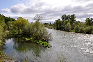
Detroit Lake is a reservoir impounded by the Detroit Dam on the North Santiam River 46 miles (74 km) southeast of Salem, Oregon, United States. The lake is adjacent to Oregon Route 22 near the city of Detroit. This mesotrophic lake stores water for use by the city of Salem and other nearby communities.

Casey State Recreation Site is a day-use only state park located 29 miles northeast of Medford, Oregon off Oregon Route 62. The parks offers picnic and boating facilities, as well as access to the Rogue River. It is located on the Crater Lake Highway and is a popular salmon fishing area.
The Albany Parks & Recreation is a city agency in AlbanyAlbany, Oregon, United States responsible for maintaining the local city parks as well as organizing cultural events. Its headquarters are at City Hall, 333 Broadalbin Street SW. One goal of the City of Albany is to have all residents live within 2 miles (3 km) of a park.

The Multnomah Channel is a 21.5-mile (34.6 km) distributary of the Willamette River. It diverges from the main stem a few miles upstream of the main stem's confluence with the Columbia River in Multnomah County in the U.S. state of Oregon. The channel flows northwest then north around Sauvie Island to meet the Columbia River near the city of St. Helens, in Columbia County.

Foster Reservoir is a reservoir created by Foster Dam on the South Santiam River in the city of Foster, Oregon, United States. The reservoir is approximately 5.6 km (3.5 mi) long and covers approximately 494 ha when full. Primary use of the reservoir is recreation in the summer and flood control in the winter and spring.
TouVelle State Recreation Site is a state park, administered by Oregon Parks and Recreation Department, and located in Jackson County, Oregon, United States, 9 miles (14 km) north of Medford, where Table Rock Road crosses the Rogue River. This 51-acre (210,000 m2) park is used for fishing, birding, hiking, picnicking and swimming. There is also a boat ramp, which lies at the lower end of an easily navigated stretch of the Rogue. A daily user-fee or annual permit is required.

Lewis and Clark State Recreation Site is a state park in eastern Multnomah County, Oregon, near Troutdale and Corbett, and is administered by the Oregon Parks and Recreation Department. It is located on the Sandy River, near its confluence with the Columbia River. Broughton's Bluff marks the westernmost extent of the Columbia River Gorge at the site.

Diamond Lake is a natural body of water in the southern part of the U.S. state of Oregon. It lies near the junction of Oregon Route 138 and Oregon Route 230 in the Umpqua National Forest in Douglas County. It is located between Mount Bailey to the west and Mount Thielsen to the east; it is just north of Crater Lake National Park.

The Prineville Reservoir is in the high desert hills of Central Oregon, Oregon, United States. The reservoir is on the Crooked River 14 miles (22.5 km) southeast of Prineville, and 29 miles (46.7 km) east of Bend. This reservoir is a popular retreat for most of Central Oregon. It is near the geographic center of Oregon. Prineville Reservoir State Park is managed by the Oregon Parks and Recreation Department.

Wallowa Lake State Park is a state park located in northeast Oregon in the United States. It is at the southern shore of Wallowa Lake, near the city of Joseph in Wallowa County. The town of Wallowa Lake is situated next to the park.
Fall Creek State Recreation Site is a state park in the U.S. state of Oregon, administered by the Oregon Parks and Recreation Department. The park includes 47 campsites that do not include many luxuries. Each site includes a picnic table and a fire ring. There is also a designated swimming area in the lake that Fall Creek flows into. A dock and boat ramp are on the lake as well.

Minam State Recreation Area is a state park in the U.S. state of Oregon. Administered by the Oregon Parks and Recreation Department, it covers about 600 acres (240 ha) along the Wallowa River north of La Grande in Wallowa County. The park is off Oregon Route 82 about 15 miles (24 km) northeast of Elgin.

Unity Lake State Recreation Site is a state park in the U.S. state of Oregon, administered by the Oregon Parks and Recreation Department.
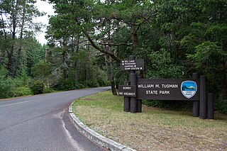
William M. Tugman State Park is a state park in the U.S. state of Oregon. Administered by the Oregon Parks and Recreation Department (OPRD), the park borders Eel Lake, about 8 miles (13 km) south of Reedsport near U.S. Route 101.

Willamette Park is a city park of about 26 acres (11 ha) in south Portland, in the U.S. state of Oregon. Located at Southwest Macadam Avenue and Nebraska Street, the park includes a boat dock and ramp, paved and unpaved paths, picnic areas, restrooms, a dog off-leash area, playground, soccer field, and tennis courts.

Indian Mary Park is part of the Josephine County Parks system in the U.S. state of Oregon. Bordering the Rogue River, the 61-acre (25 ha) park is along Merlin–Galice Road, about 16 miles (26 km) northwest of the city of Grants Pass. The heavily used park is the county's most popular in summer.

Green Peter Reservoir is a reservoir created by Green Peter Dam on the Middle Santiam River 11 miles (18 km) northeast of Sweet Home, Oregon, United States. The reservoir is approximately 10 miles (16 km) long and has a surface area of approximately 3,720 acres (1,510 ha) when full. The reservoir is used for hydropower, recreation, flood risk management, water quality, irrigation, and as a fish and wildlife habitat.

Milwaukie Riverfront Park is an 8.5-acre (3.4 ha) park adjacent to downtown Milwaukie, Oregon, United States.

Moore Park is a municipal park in Klamath Falls, Oregon, United States. It is located along a section of the south end of the Upper Klamath Lake. Because almost all the fishing on the Klamath Lake requires a boat, with the exception of a few springtime bank fisheries, paved boat ramps at Moore Park are popular access points to the Lake for fishing.

Cathedral Park is a park and the name for the eponymous neighborhood in the northernmost section of Portland, Oregon on the east shore of the Willamette River. The park is situated under the St. Johns Bridge, and was given its name due to the Gothic arches that support the bridge, which resemble a cathedral arch.

