Canals or artificial waterways are waterways or engineered channels built for drainage management or for conveyancing water transport vehicles. They carry free, calm surface flow under atmospheric pressure, and can be thought of as artificial rivers.

A towpath is a road or trail on the bank of a river, canal, or other inland waterway. The purpose of a towpath is to allow a land vehicle, beasts of burden, or a team of human pullers to tow a boat, often a barge. This mode of transport was common where sailing was impractical because of tunnels and bridges, unfavorable winds, or the narrowness of the channel.
The Thames and Medway Canal is a disused canal in Kent, south east England, also known as the Gravesend and Rochester Canal. It was originally some 11 km (6.8 mi) long and cut across the neck of the Hoo peninsula, linking the River Thames at Gravesend with the River Medway at Strood. The canal was first mooted in 1778 as a shortcut for military craft from Deptford and Woolwich Dockyards on the Thames to Chatham Dockyard on the Medway, avoiding the 74 km (46 mi) journey round the peninsula and through the Thames estuary. The canal was also intended to take commercial traffic between the two rivers.

The Chesterfield Canal is a narrow canal in the East Midlands of England and it is known locally as 'Cuckoo Dyke'. It was one of the last of the canals designed by James Brindley, who died while it was being constructed. It was opened in 1777 and ran for 46 miles (74 km) from the River Trent at West Stockwith, Nottinghamshire to Chesterfield, Derbyshire, passing through the Norwood Tunnel at Kiveton Park, at the time one of the longest tunnels on the British canal system. The canal was built to export coal, limestone, and lead from Derbyshire, iron from Chesterfield, and corn, deals, timber, groceries and general merchandise into Derbyshire. The stone for the Palace of Westminster was quarried in North Anston, Rotherham, and transported via the canal.

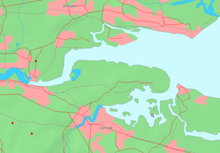
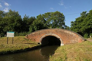
The Foss Dyke, or Fossdyke, connects the River Trent at Torksey to Lincoln, the county town of Lincolnshire, and may be the oldest canal in England that is still in use. It is usually thought to have been built around AD 120 by the Romans, but there is no consensus among authors. It was refurbished in 1121, during the reign of King Henry I, and responsibility for its maintenance was transferred to the city of Lincoln by King James I. Improvements made in 1671 included a navigable sluice or lock at Torksey, and warehousing and wharves were built at Brayford Pool in the centre of Lincoln.

The canal network of the United Kingdom played a vital role in the Industrial Revolution. The UK was the first country to develop a nationwide canal network which, at its peak, expanded to nearly 4,000 miles in length. The canals allowed raw materials to be transported to a place of manufacture, and finished goods to be transported to consumers, more quickly and cheaply than by a land based route. The canal network was extensive and included feats of civil engineering such as the Anderton Boat Lift, the Manchester Ship Canal, the Worsley Navigable Levels and the Pontcysyllte Aqueduct.

The Trent is the third longest river in the United Kingdom. Its source is in Staffordshire, on the southern edge of Biddulph Moor. It flows through and drains the North Midlands into the Humber Estuary. The river is known for dramatic flooding after storms and spring snowmelt, which in the past often caused the river to change course.

The River Weaver is a river, navigable in its lower reaches, running in a curving route anti-clockwise across west Cheshire, northern England. Improvements to the river to make it navigable were authorised in 1720 and the work, which included eleven locks, was completed in 1732. An unusual clause in the enabling Act of Parliament stipulated that profits should be given to the County of Cheshire for the improvement of roads and bridges, but the navigation was not initially profitable, and it was 1775 before the first payments were made. Trade continued to rise, and by 1845, over £500,000 had been given to the county.

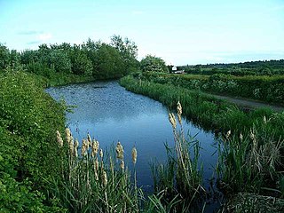
The Grantham Canal ran 33 miles (53 km) from Grantham through 18 locks to West Bridgford, where it joined the River Trent. It was built primarily for the transportation of coal to Grantham. It opened in 1797 and its profitability steadily increased until 1841. It was then sold to a railway company, declined, and was finally closed in 1936. It was used as a water supply for agriculture, and so most of it remained in water after closure, although bridges were lowered. Since the 1970s, the Grantham Canal Society have been working to restore parts of it. Two stretches are now navigable to small vessels. A new route will be required where the canal joins the Trent, as road building has severed the original one.

The Derby Canal ran 14 miles (23 km) from the Trent and Mersey Canal at Swarkestone to Derby and Little Eaton, and to the Erewash Canal at Sandiacre, in Derbyshire, England. The canal was authorised by an act of Parliament, the Derby Canal Act 1793 and was fully completed in 1796. It featured a level crossing of the River Derwent in the centre of Derby. An early tramroad, known as the Little Eaton Gangway, linked Little Eaton to coal mines at Denby. The canal's main cargo was coal, and it was relatively successful until the arrival of the railways in 1840. It gradually declined, with the gangway closing in 1908 and the Little Eaton Branch in 1935. Early attempts at restoration were thwarted by the closure of the whole canal in 1964. Since 1994, there has been an active campaign for restoration spearheaded by the Derby and Sandiacre Canal Trust and Society. Loss of the Derwent crossing due to development has resulted in an innovative engineering solution called the Derby Arm being proposed, as a way of transferring boats across the river.

The Erewash Canal is a broad canal in Derbyshire, England. It runs just under 12 miles (19 km) and has 14 locks. The first lock at Langley Bridge is part of the Cromford Canal.
The Nottingham Canal is a canal in the English counties of Nottinghamshire and Derbyshire. As built, it comprised a 14.7-mile (23.7 km) long main line between the River Trent just downstream of Trent Bridge in Nottingham and Langley Mill in Derbyshire. At the same time as the main line of the canal was built by its proprietors, the separate Trent Navigation Company built the Beeston Cut, from the main line at Lenton in Nottingham to rejoin the River Trent upstream of Nottingham, thus bypassing the difficult section of navigation through Trent Bridge. The section of the main line between Trent Bridge and Lenton, together with the Beeston Cut, is still in use, forming part of the navigation of the River Trent and sometimes referred to as the Nottingham & Beeston Canal. The remainder of the main line of the canal beyond Lenton has been abandoned and partially filled.

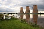
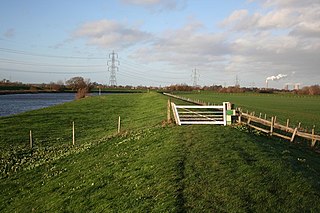
Torksey is a small village in the West Lindsey district of Lincolnshire, England. The population of the civil parish at the 2011 census was 875. It is situated on the A156 road, 7 miles (11 km) south of Gainsborough and 9 miles (14 km) north-west of Lincoln, and on the eastern bank of the tidal River Trent, which here forms the boundary with Nottinghamshire.
The Shrewsbury Canal was a canal in Shropshire, England. Authorised in 1793, the main line from Trench to Shrewsbury was fully open by 1797, but it remained isolated from the rest of the canal network until 1835, when the Birmingham and Liverpool Junction Canal built the Newport Branch from Norbury Junction to a new junction with the Shrewsbury Canal at Wappenshall. After ownership passed to a series of railway companies, the canal was officially abandoned in 1944; many sections have disappeared, though some bridges and other structures can still be found. There is an active campaign to preserve the remnants of the canal and to restore the Norbury to Shrewsbury line to navigation.

The Stainforth and Keadby Canal is a navigable canal in South Yorkshire and Lincolnshire, England. It connects the River Don Navigation at Bramwith to the River Trent at Keadby, by way of Stainforth, Thorne and Ealand, near Crowle. It opened in 1802, passed into the control of the River Don Navigation in 1849, and within a year was controlled by the first of several railway companies. It became part of the Sheffield and South Yorkshire Navigation, an attempt to remove several canals from railway control, in 1895. There were plans to upgrade it to take larger barges and to improve the port facilities at Keadby, but the completion of the New Junction Canal in 1905 made this unnecessary, as Goole could easily be reached and was already a thriving port.

The River Wey Navigation and Godalming Navigation together provide a 20-mile (32 km) continuous navigable route from the River Thames near Weybridge via Guildford to Godalming. Both waterways are in Surrey and are owned by the National Trust. The River Wey Navigation connects to the Basingstoke Canal at West Byfleet, and the Godalming Navigation to the Wey and Arun Canal near Shalford. The navigations consist of both man-made canal cuts and adapted parts of the River Wey.
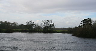
Derwent Mouth is a location on the River Trent, which at that point forms the border between the English counties of Derbyshire and Leicestershire. It is both the confluence of the River Derwent with the River Trent, and the point at which the Trent and Mersey Canal joins the natural River Trent.
Duke's Cut is a short waterway in Oxfordshire, England, which connects the Oxford Canal with the River Thames via the Wolvercote Mill Stream. It is named after George Spencer, 4th Duke of Marlborough, across whose land the waterway was cut. It is seen as a branch of the Oxford Canal.

Thorne and Hatfield Moors Peat Canals were a series of canals in South Yorkshire and Lincolnshire, England, which were used to carry cut peat from Thorne and Hatfield Moors to points where it could be processed or exported. There were two phases to the canals, the first of which lasted from the 1630s until the 1830s when coal imported on the Stainforth and Keadby Canal reduced the demand for peat as a fuel. The second started in the 1890s when peat found a new use as bedding for working horses and lasted until 1922 when Moorends Mill which processed the peat was destroyed by fire.
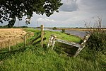
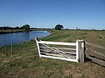
The Trent Valley Way is a waymarked long-distance footpath in England following the River Trent and its valley in the counties of Nottinghamshire and Lincolnshire.