
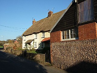
Belstone is a small village and civil parish in the West Devon District of Devon, England. Lying on the northern side of Dartmoor, the western boundary of the parish is mostly formed by the East Okement River and the eastern by the River Taw; its highest point is Belstone Tor in the south, at 1,508 feet. The parish is surrounded, clockwise from the north, by the parishes of Sticklepath, South Tawton, Dartmoor Forest and Okehampton Hamlets. In 2001 its population was 257, relatively unchanged from the 1901 figure of 236.

Cookbury is a village and civil parish in the local government district of Torridge, Devon, England. The parish, which lies about five miles east of the town of Holsworthy, is surrounded clockwise from the north by the parishes of Thornbury, Bradford, Ashwater, Hollacombe, and Holsworthy Hamlets. In 2001 its population was 158, little changed from the 146 residents it had in 1901.
Woodbury is a village and civil parish in East Devon in the English county of Devon, 7 miles (11 km) south east of the city of Exeter. At the 2011 Census the village had a population of 1,605, and the parish had a population of 3,466. It lies on the east bank of the Exe Estuary, has borders – clockwise from the estuary – with the district of Exeter and then the parishes of Clyst St George, Clyst St Mary, Farringdon, Colaton Raleigh, Bicton and Lympstone. Woodbury is part of the electoral ward of Woodbury and Lympstone whose population at the 2011 Census was 5,260.

Beaford is a village and civil parish in the Torridge district of Devon, England. The village is about five miles south-east of Great Torrington, on the A3124 road towards Exeter. According to the 2001 census the parish had a population of 393, compared to 428 in 1901. The western boundary of the parish is formed by the River Torridge and it is surrounded, clockwise from the north, by the parishes of St Giles in the Wood, Roborough, Ashreigney, Dolton, Merton and Little Torrington.

Bigbury is a village and civil parish in the South Hams district of Devon, England. According to the 2001 census the parish had a population of 582, compared to 260 in 1901, and decreasing to 500 in 2011. The southern side of the parish lies on the coast, and it is surrounded clockwise from the west by the parishes of Ringmore, Modbury, Aveton Gifford, and on the opposite bank of the estuary of the River Avon, Thurlestone. Road access to the parish is via the A379 and the B3392. The parish council meets on the second Wednesday of every month at 7.30pm in Bigbury Memorial Hall.

Broadclyst is a village and civil parish in the East Devon local government district. It lies approximately 5 miles northeast of the city of Exeter, Devon, England, on the B3181. In 2001 its population was 2,830, reducing at the 2011 Census to 1,467. An electoral ward with the same name exists whose population at the above census was 4,842.
Sowton is a village and civil parish east of Exeter in East Devon, England. It has a population of 639.
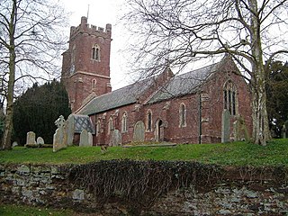
St Giles in the Wood is a village and civil parish in the Torridge district of Devon, England. The village lies about 2.5 miles east of the town of Great Torrington, and the parish, which had a population of 566 in 2001 compared with 623 in 1901, is surrounded clockwise from the north by the parishes of Huntshaw, Yarnscombe, High Bickington, Roborough, Beaford, Little Torrington and Great Torrington. Most of the Victorian terraced cottages in the village, on the east side of the church, were built by the Rolle Estate.

The A379 is a road in the English county of Devon. It links points on the edges of that county's two principal cities, Exeter and Plymouth, by an indirect and largely coastal route. The A38 provides a faster and more direct inland route between Exeter and Plymouth, whilst the A380 provides a similarly faster route between Exeter and the Torbay area. However the A379 serves many small coastal communities and ports along the coast. The indented nature of the South Devon coast means that the road is usually out of sight of the sea, but the many rivers and estuaries are crossed by bridges and, in one case, a cable ferry.
Clyst St Mary is a small village and civil parish 3 miles (4.8 km) east of Exeter on the main roads to Exmouth and Sidmouth in East Devon. The name comes from the Celtic word clyst meaning 'clear stream'. The village is a major part of the electoral ward of Clyst Valley. At the 2011 Census this ward population was 2,326.
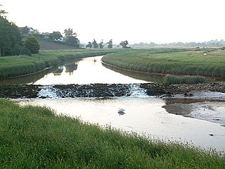
The River Clyst is a river of Devon, England. The name derives from Old English, and translates as Clean-stream. The river lends its name to several settlements on its route, Clyst Honiton, Clyst St Lawrence, Clyst St George, and Broadclyst. The William part of Clyst William derives from the Old English of aewelm, which means river source.
Farringdon is a village, civil parish and former manor in the district of East Devon in the county of Devon, England. The parish is surrounded clockwise from the north by the parishes of Clyst Honiton, Aylesbeare, a small part of Colaton Raleigh, Woodbury, Clyst St Mary and a small part of Sowton.
Bishop's Clyst was an ancient manor in Devonshire and is also the modern name adopted by the council representing two civil parishes that form part of the East Devon district in the English county of Devon.
Stokenham is a village and civil parish in the English county of Devon. The population of the parish at the 2011 census was 1,895.
Rockbeare is a village and civil parish in the East Devon district of the county of Devon, England, located near Exeter Airport and the city of Exeter. "Whilst the name has nothing to do with either 'rocks' nor 'bears', it simply means 'rooks in the grove '." "The parish comprises the hamlets of Marsh Green, Pithead, Allercombe, and Little Silver". The village, which is of small extent, is situated on the high road from Honiton to Exeter, and is an agricultural town. The land is nearly evenly divided between arable and pasture, with about 200 acres of common. According to the 2011 Census there were 431 males and 483 females living in the parish. "Rockbeare is written within the Broadclyst ward and electoral division, which is in the constituency of East Devon County Council".

Clyst Honiton is an English village and civil parish five miles from Exeter in the East Devon district, in the county of Devon. The church is St Michael and All Angels. Exeter International Airport which opened in 1938 is located on the outskirts of the village. The village was originally on the main A30 road from Exeter to Honiton but was bypassed in the 1990s. Another bypass to the east of the village linking the A30 to the new developments around Cranbrook opened in October 2013.

Clyst Hydon is a village and civil parish in the county of Devon, England. It was in the Cliston Hundred and has a church dedicated to St Andrew. The parish is surrounded, clockwise from the north, by the parishes of Cullompton, Plymtree, Payhembury, Talaton, Whimple, Clyst St Lawrence and Broad Clyst.

Clyst St George is a village in East Devon, England, adjoining the River Clyst some 4 miles (6.4 km) south east of Exeter and 5 miles (8.0 km) north of Exmouth.

Chittlehamholt is a village and civil parish in North Devon district, Devon, England. In the 2011 census it was recorded as having a population of 169.

George Nympton or Nymet St George is a small village and civil parish in North Devon district, Devon, England. In the 2011 census it was recorded as having a population of 175.
