Related Research Articles

Upshur County is a county in the U.S. state of West Virginia. As of the 2020 census, the population was 23,816. Its county seat is Buckhannon. The county was formed in 1851 from Randolph, Barbour, and Lewis counties and named for Abel Parker Upshur, a distinguished statesman and jurist of Virginia. Upshur served as United States Secretary of State and Secretary of the Navy under President John Tyler.

Raleigh County is a county in the U.S. state of West Virginia. As of the 2020 census, the population was 74,591. Its county seat is Beckley. The county was founded in 1850 and is named for Sir Walter Raleigh. Raleigh County is included in the Beckley, West Virginia Metropolitan Statistical Area.

Trumbull County is a county in the far northeast portion of the U.S. state of Ohio. As of the 2020 census, the population was 201,977. Its county seat and largest city is Warren, which developed industry along the Mahoning River. Trumbull County is part of the Youngstown–Warren, OH Metropolitan Statistical Area.

Meigs County is a county located in the U.S. state of Ohio. As of the 2020 census, the population was 22,210. Its county seat is Pomeroy. The county is named for Return J. Meigs Jr., the fourth Governor of Ohio.

Foster Township is a township in Luzerne County, Pennsylvania. The population was 3,413 at the 2020 census.

John McBride was an American labor union leader. He served as a member of the Ohio House of Representatives, representing Stark County from 1884 to 1888. He was the second president of the American Federation of Labor, serving from 1894 to 1895.

Liberty Township is one of the twenty-four townships of Trumbull County, Ohio, United States. The 2020 census found 21,514 people within the geographical area of the township.

The Youngstown–Warren, OH Metropolitan Statistical Area, typically known as the Mahoning Valley, is a metropolitan area in Northeast Ohio with Youngstown, Ohio, at its center. According to the U.S. Census Bureau, the metropolitan statistical area (MSA) includes Mahoning and Trumbull counties. As of the 2020 census, the region had a population of 430,591, making it the 125th-largest metro area in the country.

Brookfield Township is one of the twenty-four townships of Trumbull County, Ohio, United States. The 2020 census found 8,447 people in the township.

Vienna Township is one of the twenty-four townships of Trumbull County, Ohio, United States. The 2020 census enumerated 3,978 people in the township.

Maynard is an unincorporated community located in western Colerain Township, Belmont County, Ohio, United States, along Wheeling Creek. It has a post office with the ZIP code 43937.

Fowler is an unincorporated community in central Fowler Township, Trumbull County, Ohio, United States. It has a post office with the ZIP code 44418. It lies at the intersection of State Routes 193 and 305.

Burghill is an unincorporated community in southern Vernon Township, Trumbull County, Ohio, United States. It is unincorporated although it had a post office, with the ZIP code of 44404 until 2011. It lies along State Route 7 north of Hubbard. The community is part of the Youngstown–Warren–Boardman, OH-PA Metropolitan Statistical Area.
Wellington, formerly a separate district and town, is a neighbourhood of north Nanaimo, on the east coast of southern Vancouver Island, British Columbia.
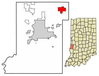
Fontanet is an unincorporated census-designated place in central Nevins Township, Vigo County, in the U.S. state of Indiana. It lies along Baldwin St., northeast of the city of Terre Haute, the county seat of Vigo County. Its elevation is 614 feet (187 m), and it is located at 39°34′34″N87°14′37″W. Although Fontanet is unincorporated, it has a post office, with the ZIP Code of 47851.

The Hocking Valley Railway was a railroad in the U.S. state of Ohio, with a main line from Toledo to Athens and Pomeroy via Columbus. It also had several branches to the coal mines of the Hocking Valley near Athens. The company became part of the Chesapeake and Ohio Railway system in 1910, and the line between Toledo and Columbus continues to see trains as CSX Transportation's Columbus Subdivision. Portions of the main line south of Columbus are now operated by the Indiana and Ohio Railway and Hocking Valley Scenic Railway.
Royce Gaylord Surdam was an American businessman, real estate agent and developer. He did a lot to build up Ventura County, California, and was the founder of the towns of Nordhoff, which was later renamed Ojai, and Bardsdale. Surdam never married, was a Royal Arch Mason and a staunch Republican.
Coalburg is an unincorporated community in Jefferson County, Alabama, United States.
The Coal miners' strike of 1873, was a strike against wage cuts in the Mahoning, Shenango, and TuscarawasValleys of northeastern Ohio and northwestern Pennsylvania. In the Tuscarawas Valley, the labor action lasted six months, and in the Mahoning Valley four and a half months, but the walkouts failed. The introduction of imported strikebreakers and manufacturers finding substitutes for the area's special block-coal, forced the organized miners back to work at prevailing wages.
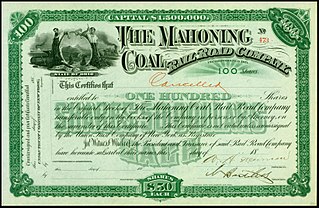
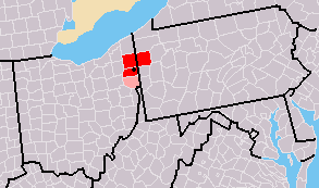
The Mahoning Coal Railroad (MCR) was a railroad line in the U.S. states of Ohio and Pennsylvania. Incorporated in 1871, it largely linked Youngstown, Ohio, with Andover, Ohio. It had a major branch into Sharon, Pennsylvania, and several small branches and spurs to coal mines and iron works along the Ohio-Pennsylvania border. The railroad leased itself to the Lake Shore and Michigan Southern Railway in 1873. The lease was assumed by the New York Central Railroad in 1914, when that company consolidated with the Lake Shore & Michigan Southern. The New York Central merged with the Pennsylvania Railroad in 1968 to create the Penn Central. Despite abandonment of much track, bankruptcy of the Penn Central in 1970 eventually caused the MCR's dissolution on January 7, 1982.
References
- ↑ "GNIS Detail - Coalburg".
- ↑ "United States Official Postal Guide". U.S. Government Printing Office. January 1, 1912. p. 31 – via Google Books.
- ↑ LLC., Historic Map Works. "Hubbard Township, Coalburg, Atlas: Trumbull County 194x, Ohio Historical Map".
- ↑ Department of the Interior. 11th Decennial Census Office. 3rd Division - Geography. ca. 1889-ca. 1894 (Predecessor); Department of the Interior. 7th Decennial Census Office. ca. 1850-ca. 1855 (Predecessor); Department of the Interior. 8th Decennial Census Office. ca. 1859-ca. 1870 (Predecessor); Department of the Interior. 9th Decennial Census Office. ca. 1870-ca. 1877 (Predecessor); Department of the Interior. 10th Decennial Census Office. ca. 1877-ca. 1885 (Predecessor); Department of Commerce. Bureau of the Census. Office of the Assistant Director for Operations. Geography Division. (March 13, 1947 - 1968). "1940 Census Enumeration District Descriptions - Ohio - Trumbull County - ED 78-58, ED 78-59, ED 78-60, ED 78-61, ED 78-62" – via US National Archives Research Catalog.
{{cite web}}: CS1 maint: numeric names: authors list (link) - ↑ "Archived copy" (PDF). Archived from the original (PDF) on November 25, 2016. Retrieved January 2, 2017.
{{cite web}}: CS1 maint: archived copy as title (link) - ↑ "Western Reserve chronicle. (Warren, Ohio) 1855-1921, February 05, 1873, Image 2". February 5, 1873 – via chroniclingamerica.loc.gov.
41°11′35″N80°35′17″W / 41.19306°N 80.58806°W
| | This Trumbull County, Ohio state location article is a stub. You can help Wikipedia by expanding it. |