Coastal Barrier Resources Act

Last updated
Coastal Barrier Resources Act
Great Seal of the United States (obverse).svg
Long titleAn Act to protect and conserve fish and wildlife resources, and for other purposes.
Acronyms (colloquial)CBRA
NicknamesCoastal Barrier Resources Act of 1982
Enacted bythe 97th United States Congress
EffectiveOctober 18, 1982
Citations
Public law Pub. L. Tooltip Public Law (United States)  97–348
Statutes at Large 96  Stat.   1653
Codification
Titles amended 16 U.S.C.: Conservation
U.S.C. sections created 16 U.S.C. ch. 55 § 3501 et seq.
Legislative history
Major amendments

The Coastal Barrier Resources Act (CBRA, Public Law 97-348) of the United States was enacted into law by the 40th President of the United States Ronald Reagan on October 18, 1982. [1] The United States Congress passed this Act in order to address the many problems associated with coastal barrier development. CBRA designated various undeveloped coastal barriers, which were illustrated by a set of maps adopted by law, to be included in the John H. Chafee Coastal Barrier Resources System (CBRS). [2] These designated areas were made ineligible for both direct and indirect federal expenditures and financial assistance, which are believed to encourage development of fragile, high-risk, and ecologically sensitive coastal barriers.

Contents

CBRA was originally authored by U.S. Representative Thomas B. Evans, Jr. and Senator John Chafee, who kept three objectives in mind: 1) to minimize the loss of human life by discouraging development in high risk areas vulnerable to storm surges and hurricane winds; 2) to reduce wasteful expenditure of federal resources; and 3) to protect the natural resources associated with undeveloped coastal barriers.

Undeveloped coastal barriers

Coastal barriers are landscape features that protect the mainland, lagoons, wetlands and salt marshes from the full force of wind, wave and tidal energy. “Undeveloped coastal barriers” are defined by the CBRA to include barrier islands, bars, spits, and tombolos, along with associated aquatic habitats, such as adjacent estuaries and wetlands. Composed of sand and other loose sediments, these elongated, narrow landforms are dynamic ecosystems and are vulnerable to hurricane damage and shoreline recession. Coastal barriers also provide important habitat for a variety of wildlife, and are an important recreational resource.

The Coastal Barrier Resources Reauthorization Act of 2000 (Public Law 106-514) provided specifications for determining if an area was undeveloped at the time it was included within the CBRS, and ordered the development of a Digital Mapping Pilot Project for between 50 and 75 CBRS areas for the purpose of information precision and accessibility. If some portion of a barrier landform is developed, the remaining undeveloped portion may be included in the CBRS.

U.S. Fish and Wildlife Service Role

The United States Department of the Interior, through the United States Fish and Wildlife Service (Service), was named the primary authority in the implementation of this Act, and may approve the use of subsidies for such uses as emergency assistance, national security, navigability, fish and wildlife research, and energy exploration.

Other Service responsibilities for administrating the CBRA include:

• Maintaining the official maps of the CBRS and providing copies for public viewing at USFWS headquarters, regional, and field office locations;

• Maintaining the administrative record for each CBRS unit;

• Consulting with federal agencies to determine whether federal funds may be spent within designated CBRS areas;

• Determining whether properties lay within CBRS boundaries;

• Reviewing and modifying the CBRS every five years to reflect geomorphic changes such as erosion and accretion; and

• Working with Congress, landowners, and other interested parties when questions concerning the correct application of CBRS boundaries

Designated and Protected Areas

Initially, CBRA consisted of 186 units totaling 666 miles (1,072 km) of shoreline and 452,834 acres (1,833 km2) of undeveloped, unprotected coastal barriers on the Atlantic Ocean and Gulf of Mexico coasts. Shortly following its enactment, Congress passed the Great Lakes Coastal Barrier Act (Public Law 100-707), which required the Secretary of the Interior to identify additional System units along the Great Lakes. The Secretary identified and recommended for inclusion in the System 112 Great Lakes units totaling 30,150 acres (122 km2).

The Act was amended in 1990 by the Coastal Barrier Improvement Act (CBIA, Public Law 101-591) to include the designation of otherwise protected areas (OPAs), which applies to the national, state and local areas that include coastal barriers held for conservation or recreation. Examples of OPAs include National Wildlife Refuges, national parks and seashores, state parks, and lands owned by private organizations for conservation purposes.

The CBIA expanded existing CBRS units, and created new units and OPAs along the Great Lakes, Puerto Rico, the Florida Keys, the U.S. Virgin Islands, and secondary barriers within large embayments. Additionally, CBIA required the Secretary to prepare a report on Pacific Coast coastal barriers. This report has never been submitted to the Congress, and no Pacific coast barrier units have been included in the System.

The CBRS currently includes 585 System units, which add up to approximately 1,300,000 acres (5,300 km2) of land and associated aquatic habitat. Additionally, there are 271 OPAs, which comprise nearly 1,800,000 acres (7,300 km2) of land and associated aquatic habitat, which are protected by CBRA. CBRS areas now extend along the coasts of the Atlantic Ocean and the Gulf of Mexico, as well as Puerto Rico, the U.S. Virgin Islands, and the Great Lakes.

Modification of boundaries

According to the Act, only Congress has the power to modify boundaries of the CBRS through legislation. The one exception to this rule is a five-year review of the CBRS conducted by the Service that modifies boundaries only to reflect changes due to natural processes such as accretion and erosion. Since the establishment of the CBRS in 1982, several pieces of legislation have removed land from the CBRS, making it available to federal subsidies for development.

Congress determined the initial CBRS units in 1982, and modified and expanded the CBRS in 1990. Subsequent modifications to the CBRS have since been made via Congressional action. If a technical mapping error warranting a change in any single part of the CBRS map is found by the Service, all adjacent areas must be reviewed to ensure the map’s accuracy. This is a comprehensive approach to map revisions that treats all landowners who may be affected equitably, and ensures that Congress will not have to remap the same area in the future. While this may be an extensive process, it allows the Service to uphold the integrity of the entire CBRS by looking at boundary revisions in a holistic manner instead of pursuing incremental fixes for individual areas on a single map.

Map modernization

On April 7, 2009, the U.S. Fish and Wildlife Service (Service) released to the public its Report to Congress: John H. Chafee Coastal Barrier Resources System Digital Mapping Pilot Project and announced the start of a 90-day public comment period. The report, which was directed by the Coastal Barrier Resources Reauthorization Act of 2000 (P.L. 106-514), highlights the benefits of updating Coastal Barrier Resources System (CBRS) maps with more accurate and precise digital maps to better protect people, coastal areas and natural resources. The report includes draft revised maps for 70 units, or approximately 10 percent of the entire CBRS, and a framework for modernizing the remainder of the maps. The 70 pilot project units are located in Delaware, North Carolina, South Carolina, Florida and Louisiana. On June 29, 2009, the Service announced a 30-day extension of the public comment period. The public comment period closed on August 5, 2009. [3]

Accomplishments

Since limiting federally subsidized development on designated coastal barriers, CBRA has managed to save federal dollars, protect humans by keeping them out of the path of deadly storm surges, and conserve valuable coastal habitat for fish and other wildlife. [ citation needed ]

Since its enactment, CBRA has been promoted as a fiscally conservative, free-market approach to encourage coastal conservation. In no way does the Act regulate how individuals develop their land on and around areas of coastal barrier. Instead, it directs that federal dollars not be spent for development purposes on designated coastal barriers. Therefore, the full cost of development and rebuilding is transferred from American taxpayers to the individuals who choose to live and build in such hazard-prone areas.

An economic study conducted by the USFWS in 2002 estimated that by 2010, CBRA will have saved American taxpayers nearly $1.3 billion by restricting federal spending for roads, wastewater systems, potable water supply, and disaster relief. [4]

Sources

Related Research Articles

<span class="mw-page-title-main">United States Fish and Wildlife Service</span> United States federal government agency

The United States Fish and Wildlife Service is a U.S. federal government agency within the U.S. Department of the Interior which oversees the management of fish, wildlife, and natural habitats in the United States. The mission of the agency is "working with others to conserve, protect, and enhance fish, wildlife, plants and their habitats for the continuing benefit of the American people."

<span class="mw-page-title-main">National Wildlife Refuge</span> United States protected area designation

National Wildlife RefugeSystem (NWRS) is a system of protected areas of the United States managed by the United States Fish and Wildlife Service (FWS), an agency within the Department of the Interior. The National Wildlife Refuge System is the system of public lands and waters set aside to conserve America's fish, wildlife, and plants. Since President Theodore Roosevelt designated Florida's Pelican Island National Wildlife Refuge as the first wildlife refuge in 1903, the system has grown to over 568 national wildlife refuges and 38 wetland management districts encompassing about 856,000,000 acres (3,464,109 km2).

<span class="mw-page-title-main">National Wild and Scenic Rivers System</span> Conservation effort of certain rivers in the United States and its territories

The National Wild and Scenic Rivers System was created by the Wild and Scenic Rivers Actof 1968, enacted by the U.S. Congress to preserve certain rivers with outstanding natural, cultural, and recreational values in a free-flowing condition for the enjoyment of present and future generations.

In all modern states, a portion of land is held by central or local governments. This is called public land, state land, or Crown land. The system of tenure of public land, and the terminology used, varies between countries. The following examples illustrate some of the range.

<span class="mw-page-title-main">Coastal Zone Management Act</span>

The Coastal Zone Management Act of 1972 is an Act of Congress passed in 1972 to encourage coastal states to develop and implement coastal zone management plans (CZMPs). This act was established as a United States National policy to preserve, protect, develop, and where possible, restore or enhance, the resources of the Nation's coastal zone for this and succeeding generations.

<span class="mw-page-title-main">John Chafee</span> American politician (1922–1999)

John Lester Hubbard Chafee was an American politician and officer in the United States Marine Corps. A member of the Republican Party, he served as the 66th Governor of Rhode Island, as the Secretary of the Navy, and as a United States Senator.

<span class="mw-page-title-main">Edwin B. Forsythe National Wildlife Refuge</span> More than 40,000 acres of southern New Jersey Coastal Habitats and tidal wetlands

The Edwin B. Forsythe National Wildlife Refuge is a U.S. National Wildlife Refuge located in southern and south-central New Jersey, along the Atlantic coast, north of Atlantic City, in Atlantic and Ocean counties. The refuge was created in 1984 out of two existing refuge parcels created to protect tidal wetland and shallow bay habitat for migratory water birds. The Barnegat Division is located in Ocean County on the inland side of Barnegat Bay. The Brigantine Division is located approximately 10 miles (16 km) north of Atlantic City along the south bank of the mouth of the Mullica River. The two divisions are separated by approximately 20 miles (32 km). The refuge is located along most active flight paths of the Atlantic Flyway, making it an important link in the network of national wildlife refuges administered nationwide by the U.S. Fish and Wildlife Service. Forsythe Refuge is a part of the Hudson River/New York Bight Ecosystem and The New Jersey Coastal Heritage Trail Route. The refuge is named for Edwin B. Forsythe, conservationist Congressman from New Jersey.

<span class="mw-page-title-main">Assateague Island National Seashore</span> Barrier island operated by the National Park Service of the United States

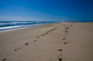
Assateague Island National Seashore is a unit of the National Park Service system of the U.S. Department of the Interior. Located on the East Coast along the Atlantic Ocean in Maryland and Virginia, Assateague Island is the largest natural barrier island ecosystem in the Middle Atlantic states region that remains predominantly unaffected by human development. Located within a three-hour drive to the east and south of Richmond, Washington, Baltimore, Wilmington, Philadelphia major metropolitan areas plus north of the several clustered smaller cities around Hampton Roads harbor of Virginia with Newport News, Hampton, Norfolk, Portsmouth, Chesapeake and Virginia Beach. The National Seashore offers a setting in which to experience a dynamic barrier island and to pursue a multitude of recreational opportunities. The stated mission of the park is to preserve and protect “unique coastal resources and the natural ecosystem conditions and processes upon which they depend, provide high-quality resource-based recreational opportunities compatible with resource protection and educate the public as to the values and significance of the area”.

<span class="mw-page-title-main">National Wilderness Preservation System</span> Protection of wilderness areas in the U.S.

The National Wilderness Preservation System (NWPS) of the United States protects federally managed wilderness areas designated for preservation in their natural condition. Activity on formally designated wilderness areas is coordinated by the National Wilderness Preservation System. Wilderness areas are managed by four federal land management agencies: the National Park Service, the U.S. Forest Service, the U.S. Fish and Wildlife Service, and the Bureau of Land Management.

<span class="mw-page-title-main">Cape May National Wildlife Refuge</span> Wildlife habitat in New Jersey, USA

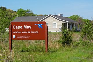
The Cape May National Wildlife Refuge is a protected area on the Cape May Peninsula in Cape May County, New Jersey. It is part of the National Wildlife Refuge System and managed by the United States Fish and Wildlife Service. Established in January 1989 with 90 acres (0.36 km2) acquired from the Nature Conservancy, it has since grown to more than 11,000 acres (45 km2) in size, and plans call for its further expansion to more than 21,200 acres (86 km2). It comprises three distinct and non-contiguous units: the Delaware Bay Division, the Great Cedar Swamp Division and the Two Mile Beach Unit. Located in the Middle Atlantic coastal forests ecoregion, the cape provides habitat for large numbers of migratory birds.

The National Flood Insurance Act of 1968 is a federal law in the United States that was enacted as Title XIII of the Housing and Urban Development Act of 1968 and signed into law by President Lyndon B. Johnson that led to the creation of the National Flood Insurance Program (NFIP).

The Stewart B. McKinney National Wildlife Refuge is a 950-acre (384.5 ha) National Wildlife Refuge in ten units across the U.S. state of Connecticut. Located in the Atlantic Flyway, the refuge spans 70 miles (110 km) of Connecticut coastline and provides important resting, feeding, and nesting habitat for many species of wading birds, shorebirds, songbirds and terns, including the endangered roseate tern. Adjacent waters serve as wintering habitat for brant, scoters, American black duck, and other waterfowl. Overall, the refuge encompasses over 900 acres (364.2 ha) of barrier beach, intertidal wetland and fragile island habitats.

<span class="mw-page-title-main">History of the National Wildlife Refuge System</span>

The National Wildlife Refuge System in the United States has a long and distinguished history.

The Fish and Wildlife Coordination Act (FWCA) of the United States was enacted March 10, 1934 to protect fish and wildlife when federal actions result in the control or modification of a natural stream or body of water. The Act provides the basic authority for the involvement of the United States Fish and Wildlife Service (Service) in evaluating impacts to fish and wildlife from proposed water resource development projects.

The Alaska Department of Fish and Game (ADF&G) is a department within the government of Alaska. ADF&G's mission is to protect, maintain, and improve the fish, game, and aquatic plant resources of the state, and manage their use and development in the best interest of the economy and the well-being of the people of the state, consistent with the sustained yield principle. ADF&G manages approximately 750 active fisheries, 26 game management units, and 32 special areas. From resource policy to public education, the department considers public involvement essential to its mission and goals. The department is committed to working with tribes in Alaska and with a diverse group of State and Federal agencies. The department works cooperatively with various universities and nongovernmental organizations in formal and informal partnership arrangements, and assists local research or baseline environmental monitoring through citizen science programs.

<span class="mw-page-title-main">Coastal Wetlands Planning, Protection and Restoration Act</span>

The Coastal Wetlands Planning, Protection and Restoration Act (CWPPRA) was passed by Congress in 1990 to fund wetland enhancement. In cooperation with multiple government agencies, CWPPRA is moving forward to restore the lost wetlands of the Gulf Coast, as well as protecting the wetlands from future deterioration. The scope of the mission is not simply for the restoration of Louisiana's Wetlands, but also the research and implementation of preventative measures for wetlands preservation.

<span class="mw-page-title-main">New York State Wildlife Management Areas</span> Protected area in New York, US

New York State Wildlife Management Areas (WMAs) are conservation areas managed by the New York State Department of Environmental Conservation (NYSDEC) primarily for the benefit of wildlife, and used extensively by the public for hunting, fishing, and trapping. As of 2016, the NYSDEC owns and maintains 113 WMAs, with a total area of approximately 197,000 acres. The Wildlife Management Areas program is administered by the Division of Fish, Wildlife and Marine Resources of the NYSDEC.

The National Wetlands Inventory (NWI) was established by the United States Fish and Wildlife Service (FWS) to conduct a nationwide inventory of U.S. wetlands to provide biologists and others with information on the distribution and type of wetlands to aid in conservation efforts. To do this, the NWI developed a wetland classification system that is now the official FWS wetland classification system and the Federal standard for wetland classification. The NWI also developed techniques for mapping and recording the inventory findings. The NWI relies on trained image analysts to identify and classify wetlands and deepwater habitats from aerial imagery. NWI started mapping wetlands at a small scale. Eventually, large-scale maps became the standard product delivered by NWI. As computerized mapping and geospatial technology evolved, NWI discontinued production of paper maps in favor of distributing data via online "mapping tools" where information can be viewed and downloaded. Today, FWS serves its data via an on-line data discovery "Wetlands Mapper". GIS users can access wetlands data through an online wetland mapping service or download data for various applications. The techniques used by NWI have recently been adopted by the Federal Geographic Data Committee as the federal wetland mapping standard. This standard applies to all federal grants involving wetland mapping to insure the data can be added to the Wetlands Layer of the National Spatial Data Infrastructure. NWI also produces national wetlands status and trends reports required by the United States Congress.

The John H. Chafee National Wildlife Refuge is a national wildlife refuge of the United States, located along the Narrow River on the southern coast of Rhode Island.

<span class="mw-page-title-main">Ellicott Slough National Wildlife Refuge</span> United States National Wildlife Refuge

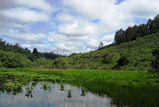
The Ellicott Slough National Wildlife Refuge is a United States National Wildlife Refuge located in the northern part of the Monterey Bay area of California.

References

  1. Reagan, Ronald W. (October 18, 1982). "Statement on Signing the Coastal Barrier Resources Act - October 18, 1982". Internet Archive. Washington, D.C.: National Archives and Records Service. pp. 1336–1337.
  2. "John H. Chafee Coastal Barrier Resources System (CBRS)". U.S. Fish & Wildlife Service. U.S. Department of the Interior.
  3. "Federal Register" (PDF). Vol. 74, no. 123. June 29, 2009. Archived from the original (PDF) on 2017-02-25.
  4. "The Coastal Barrier Resources Act: Harnessing the Power of Market Forces to Conserve America's Coasts and Save Taxpayers' Money" (PDF). U.S. Fish & Wildlife Service.