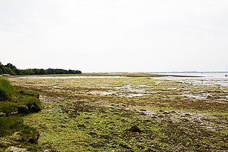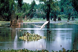
A swamp is a forested wetland. Swamps are considered to be transition zones because both land and water play a role in creating this environment. Swamps vary in size and are located all around the world. The water of a swamp may be fresh water, brackish water, or seawater. Freshwater swamps form along large rivers or lakes where they are critically dependent upon rainwater and seasonal flooding to maintain natural water level fluctuations. Saltwater swamps are found along tropical and subtropical coastlines. Some swamps have hammocks, or dry-land protrusions, covered by aquatic vegetation, or vegetation that tolerates periodic inundation or soil saturation. The two main types of swamp are "true" or swamp forests and "transitional" or shrub swamps. In the boreal regions of Canada, the word swamp is colloquially used for what is more formally termed a bog, fen, or muskeg. Some of the world's largest swamps are found along major rivers such as the Amazon, the Mississippi, and the Congo.

Wetlands, or simply a wetland, is a distinct ecosystem that is flooded or saturated by water, either permanently or seasonally. Flooding results in oxygen-free (anoxic) processes prevailing, especially in the soils. The primary factor that distinguishes wetlands from terrestrial land forms or water bodies is the characteristic vegetation of aquatic plants, adapted to the unique anoxic hydric soils. Wetlands are considered among the most biologically diverse of all ecosystems, serving as home to a wide range of plant and animal species. Methods for assessing wetland functions, wetland ecological health, and general wetland condition have been developed for many regions of the world. These methods have contributed to wetland conservation partly by raising public awareness of the functions some wetlands provide.

Grand Isle is a town in Jefferson Parish in the U.S. state of Louisiana, located on a barrier island of the same name in the Gulf of Mexico. The island is at the mouth of Barataria Bay where it meets the gulf. The town of Grand Isle is statistically part of the New Orleans−Metairie−Kenner metropolitan statistical area, though it is not connected to New Orleans' continuous urbanized area.
The Mississippi River–Gulf Outlet Canal is a 76 mi (122 km) channel constructed by the United States Army Corps of Engineers at the direction of Congress in the mid-20th century that provided a shorter route between the Gulf of Mexico and New Orleans' inner harbor Industrial Canal via the Intracoastal Waterway. In 2005, the MRGO channeled Hurricane Katrina's storm surge into the heart of Greater New Orleans, contributing significantly to the subsequent multiple engineering failures experienced by the region's hurricane protection network. In the aftermath the channel was closed. A permanent storm surge barrier was constructed in the MRGO in 2009, and the channel has been closed to maritime shipping.

A tidal marsh is a marsh found along rivers, coasts and estuaries which floods and drains by the tidal movement of the adjacent estuary, sea or ocean. Tidal marshes experience many overlapping persistent cycles, including diurnal and semi-diurnal tides, day-night temperature fluctuations, spring-neap tides, seasonal vegetation growth and decay, upland runoff, decadal climate variations, and centennial to millennial trends in sea level and climate.

Lake Borgne is a lagoon of the Gulf of Mexico in southeastern Louisiana. Although early maps show it as a lake surrounded by land, coastal erosion has made it an arm of the Gulf of Mexico. Its name comes from the French word borgne, which means "one-eyed."

The Mississippi River Delta is the confluence of the Mississippi River with the Gulf of Mexico in Louisiana, southeastern United States. The river delta is a three-million-acre area of land that stretches from Vermilion Bay on the west, to the Chandeleur Islands in the east, on Louisiana's southeastern coast. It is part of the Gulf of Mexico and the Louisiana coastal plain, one of the largest areas of coastal wetlands in the United States. The Mississippi River Delta is the 7th largest river delta on Earth (USGS) and is an important coastal region for the United States, containing more than 2.7 million acres of coastal wetlands and 37% of the estuarine marsh in the conterminous U.S. The coastal area is the nation's largest drainage basin and drains about 41% of the contiguous United States into the Gulf of Mexico at an average rate of 470,000 cubic feet per second.

The wetlands of Louisiana are water-saturated coastal and swamp regions of southern Louisiana, often called 'Bayou'.

The Atchafalaya Basin, or Atchafalaya Swamp, is the largest wetland and swamp in the United States. Located in south central Louisiana, it is a combination of wetlands and river delta area where the Atchafalaya River and the Gulf of Mexico converge. The river stretches from near Simmesport in the north through parts of eight parishes to the Morgan City southern area.
The Louisiana Coastal Protection and Restoration Authority (CPRA) is a governmental authority created by the Louisiana Legislature in the aftermath of Hurricanes Katrina and Rita. The organization takes advantage of both federal and state funding of around $1 billion annually. Since its founding, the organization has dredged over 60 miles of sediment into islands and artificial land, as well as 36,000 acres of marshland. CPRA predicts that over the next 50 years, over 1,450 square miles of land in Louisiana could be lost along coastal areas.
Caernarvon is an unincorporated community in St. Bernard Parish, Louisiana, United States. The name of the community is from a plantation originally located here. The plantation's name is widely believed to be from a similarly named town and castle in Wales. Names of antebellum plantations in the American South were often reflective of European roots and aspirations of grandeur; two upriver Mississippi River plantations, Nottoway near White Castle, Louisiana, and Sans Souci near Osceola, Arkansas, are two examples of this tradition.
America's WETLAND Foundation (AWF) was a nonprofit, tax exempt 501(c)(3) organization with the stated mission to save and conserve coastal wetlands in the U.S. state of Louisiana. The organization aimed to achieve this mission through a public awareness campaign on the impact Louisiana's wetland loss has on the state, region, nation and world.
The Water Resources Development Act of 2000, Pub. L. 106–541 (text)(PDF), was enacted by Congress of the United States on December 11, 2000. Most of the provisions of WRDA 2000 are administered by the United States Army Corps of Engineers.

High marsh is a tidal marsh zone located above the Mean Highwater Mark (MHW) which, in contrast to the low marsh zone, is inundated infrequently during periods of extreme high tide and storm surge associated with coastal storms. This zone is impacted by spring tides, which is a bi-monthly lunar occurrence where the high marsh experiences higher inundation levels. The high marsh is the intermittent zone between the low marsh and the uplands, an entirely terrestrial area rarely flooded during events of extreme tidal action caused by severe coastal storms. The high marsh is distinguished from the low marsh by its sandy soil and higher elevation. The elevation of the high marsh allows this zone to be covered by the high tide for no more than an hour a day. With the soil exposed to air for long periods of time, evaporation occurs, leading to high salinity levels, up to four times that of sea water. Areas of extremely high salinity prohibit plant growth altogether. These barren sandy areas are known as "salt pans". Some cordgrass plants do survive here, but are stunted and do not reach their full size.
Pass a Loutre Wildlife Management Area (WMA) is a 66,000-acre (270 km2) protected wetland in Plaquemines Parish, Louisiana, United States. The WMA is located due south and bordering the 48,000 acre Delta National Wildlife Refuge, accessible only by air or boat, contains the Pass A L'Outre Lighthouse, and Port Eads is within the boundary.
Fritchie Marsh is an area encompassing 6,291 acres of intermediate and brackish marsh located approximately three miles to the southeast of Slidell, Louisiana, USA. This wetland was originally documented as a freshwater marsh but has since been converted to a mixed intermediate and brackish marsh, and it threatens to become open salt water. Through the combined efforts of conservation groups and sponsors, the Fritchie Marsh Restoration Project was created and designed to restore the area to its original state. In the early years, this project showed a positive impact but soon suffered a devastating impact during Hurricane Katrina.

The effects of Hurricane Isaac in Louisiana were more severe than anywhere in the storm's path, and included $611.8615 million in damages and five total deaths. Forming from a tropical wave in the central Atlantic, Isaac traversed across many of the Lesser and Greater Antilles, before reaching peak intensity with winds of 80 mph (130 km/h) on August 28, 2012 while in the Gulf of Mexico. Nearing the coast of Louisiana, the Category 1 hurricane slowly moved towards the west, making two landfalls in the state with little change of intensity prior to moving inland for a final time. The hurricane weakened and later dissipated on September 1 while over Missouri. Before landfall, Governor Bobby Jindal declared a state of emergency to the state, as well as ordering the mandatory evacuation of 60,000 residents in low-lying areas of Louisiana along the Tangipahoa River in Tangipahoa Parish.

Coastal Erosion in Louisiana is the process of steady depletion of wetlands along the state's coastline in marshes, swamps, and barrier islands, particularly affecting the alluvial basin surrounding the mouth of the Mississippi River at the foot of the Gulf of Mexico on the Eastern half of the state's coast. In the last century, Southeast Louisiana has lost a large portion of its wetlands and is expected to lose more in the coming years, with some estimates claiming wetland losses equivalent to up to 1 football field per hour. One consequence of coastal erosion is an increased vulnerability to hurricane storm surges, which affects the New Orleans metropolitan area and other communities in the region. The state has outlined a comprehensive master plan for coastal restoration and has begun to implement various restoration projects such as fresh water diversions, but certain zones will have to be prioritized and targeted for restoration efforts, as it is unlikely that all depleted wetlands can be rehabilitated.

Climate change in Louisiana encompasses the effects of climate change, attributed to man-made increases in atmospheric carbon dioxide, in the U.S. state of Louisiana.
Terrebonne Basin is an abandoned delta complex, in Terrebonne Parish, Louisiana. The area is identified by thick sections of unconsolidated sediments that are undergoing dewatering and compaction which contributes to high subsidence. There is a network of old distributary ridges, associated with past distributaries of the Mississippi River, extending south from Houma, Louisiana into the Gulf of Mexico.


