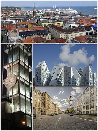
Aarhus is the second-largest city in Denmark and the seat of Aarhus Municipality. It is located on the eastern shore of Jutland in the Kattegat sea and approximately 187 kilometres (116 mi) northwest of Copenhagen.
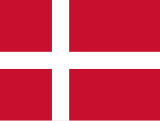
The national flag of Denmark is red with a white Nordic cross, which means that the cross extends to the edges of the flag and the vertical part of the cross is shifted to the hoist side.

Tunø is a Danish island in the Kattegat, approximately 4 km west of the neighbouring island of Samsø. The island covers an area of 3.52 square kilometres, has a circumference of 9.5 km (5.9 mi) and has total of 66 inhabitants as of November 2022. It comes under the administration of Odder municipality. Tunø By is the only village on the island, with the hamlet of Løkkegårde as the second most populated area.
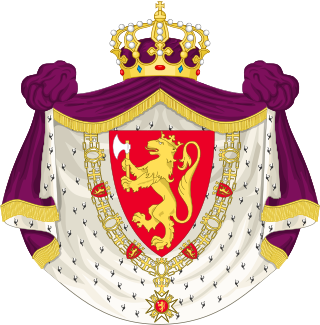
The coat of arms of Norway is the arms of dominion of king Harald V of Norway, and as such represents both the monarch and the kingdom. It depicts a standing golden lion on a red background, bearing a golden crown and axe with silver blade.
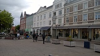
Odder Municipality is a municipality in the Central Denmark Region on the east coast of the Jutland peninsula in Central Denmark south of Aarhus. It is a part of the greater Aarhus area. The municipality covers an area of 225.04 km², including the islands of Alrø and Tunø. It borders Aarhus Municipality to the north, Skanderborg Municipality to the north-west and Horsens Municipality to the west. It also connects to Hedensted Municipality across Horsens Fjord to the south, and connects to Samsø Municipality through a ferry route.

Hedalen Stave Church is a parish church of the Church of Norway in Sør-Aurdal Municipality in Innlandet county, Norway. The stave church is located in the Hedalen valley. It is the church for the Hedalen parish which is part of the Valdres prosti (deanery) in the Diocese of Hamar. The brown, wooden stave church was built in a cruciform design around the year 1160 using plans drawn up by an unknown architect. The church seats about 210 people.

The coat of arms of Denmark has a lesser and a greater version.

Gabsheim is an Ortsgemeinde – a municipality belonging to a Verbandsgemeinde, a kind of collective municipality – in the Alzey-Worms district in Rhineland-Palatinate, Germany. It belongs to the Verbandsgemeinde of Wörrstadt, whose seat is in the like-named municipality.

The coat of arms of Copenhagen was granted on 24 June 1661 by king Frederick III of Denmark in appraisal of Copenhagen's citizen's efforts in repelling the Swedish siege and attack in 1658–1659. An accompanying royal letter of privilege granted the citizens of Copenhagen the same rights to own fixed property as applied to the Danish nobility.
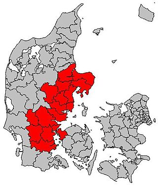
East Jutland metropolitan area is a potential metropolitan area in Jutland and Funen, Denmark. Aarhus is the most populated city in the region.

Langenæs is a small neighborhood in the city of Aarhus, Denmark with about 6,500 residents, as of 2014. The neighborhood is part of the district Midtbyen and borders the neighborhoods of Frederiksbjerg and Marselisborg to the East and the district of Viby to the South. Langenæs is delimited by the streets Søndre Ringgade, Skanderborgvej, Marselis Boulevard and the valley of Brabrand Ådal.

A house mark was originally a mark of property, later also used as a family or clan emblem, incised on the facade of a building, on animals, in signet and similar in the farmer and burgher culture of Germany and Scandinavia.

Brabrand Lake is a lake in the district of Brabrand (Gellerup), west of Aarhus city, Denmark. The Aarhus River passes through Brabrand Lake and it is possible to canoe all the way to the inner city from here. The lake is oblong-shaped.

The flag and coat of arms of the Sovereign Military Order of Malta, or the Jerusalem flag, display a white cross on a red field, ultimately derived from the design worn by the Knights Hospitaller during the Crusades.
The following is a timeline of the history of the city of Aarhus, a city in central Denmark.

The architecture of Aarhus comprises numerous architectural styles and works from the Middle Ages to present-day. Aarhus has a well-preserved medieval city center with the oldest dwellings dating back to the mid-1500s and some ecclesiastical structures such as St. Clemen's Cathedral and numerous smaller churches that can be traced back to the 1100s. The industrialization of the 19th and 20th centuries left distinctive industrial structures, important National romantic works and some of the best examples of Functionalist architecture in the country. The history of the city as a Viking fort is evidenced in the street layout of the Latin Quarter, the wider Indre By neighborhood testifies to its later role as a Market town and center of commerce while the Frederiksbjerg, Trøjborg and Marselisborg districts showcase the first cohesive urban planning efforts of the early 20th century.
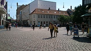
Lille Torv is a cobbled public square located in the Indre By neighborhood in Aarhus, Denmark. It is situated between the squares of Store Torv and Immervad in the historic Latin Quarter neighborhood and it is one of the oldest public squares in Aarhus. The streets of Vestergade, Guldsmedgade, Immervad and Badstuegade radiates from Lille Torv. It is today a venue for public events and gatherings in the city. The square is home to some notable buildings such as the storied Meulengracht's House and the listed Business- and Agricultural Bank of Jutland.

Frederiksgade is a street in the Indre By district in Aarhus, Denmark which runs north to south from Åboulevarden to Frederiks Allé. Frederiksgade is a major thoroughfare for pedestrians and cyclists and it connects Immervad to ARoS Aarhus Art Museum and the City Hall and Concert Hall parks. The street is fairly narrow and the architecture is primarily late 19th century to early 20th century.

Østbirk Church is a parish church in Horsens Municipality. It is overseen by the Diocese of Aarhus in the Church of Denmark.


