Related Research Articles

Cumberland County is a coastal county located on the Delaware Bay in the Southern Shore Region of the U.S. state of New Jersey. As of the 2020 census, the county was the state's 16th-most-populous county, with a population of 154,152, a decrease of 2,746 (−1.8%) from the 2010 census count of 156,898. Its county seat is Bridgeton. Cumberland County is named for Prince William, Duke of Cumberland. The county was formally created from portions of Salem County on January 19, 1748.

Route 49 is a state highway in the southern part of the U.S. state of New Jersey. It runs 53.80 mi (86.58 km) from an interchange with the New Jersey Turnpike, Interstate 295 (I-295), and U.S. Route 40 (US 40) in Deepwater, Salem County, southeast to Route 50 and County Route 557 in Tuckahoe, Cape May County. The route serves Salem, Cumberland, Atlantic, and Cape May counties, passing through rural areas and the communities of Salem, Bridgeton, and Millville along the way. It is a two-lane, undivided road for most of its length.
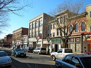
Bridgeton is a city in Cumberland County, within the U.S. state of New Jersey. It is the county seat of Cumberland County and is located on the Cohansey River near Delaware Bay in the South Jersey region of the state.

Deerfield Township is a township in Cumberland County, in the U.S. state of New Jersey. It is part of the Vineland--Bridgeton metropolitan statistical area, which encompasses those cities and all of Cumberland County for statistical purposes and which constitutes a part of the Delaware Valley. As of the 2020 United States census, the township's population was 3,136, an increase of 17 (+0.5%) from the 2010 census count of 3,119, which in turn reflected an increase of 192 (+6.6%) from the 2,927 counted in the 2000 census.
Downe Township is a township in Cumberland County, in the U.S. state of New Jersey. It is part of the Vineland-Bridgeton metropolitan statistical area for statistical purposes. As of the 2020 United States census, the township's population was 1,399, a decrease of 186 (−11.7%) from the 2010 census count of 1,585, which in turn reflected decline of 46 (−2.8%) from the 1,631 counted in the 2000 census.

Fairfield Township is a township in Cumberland County, in the U.S. state of New Jersey. It is part of the Vineland-Bridgeton metropolitan statistical area, which encompasses all of Cumberland County for statistical purposes and which constitutes a part of the Delaware Valley. As of the 2020 United States census, the township's population was 5,546, a decrease of 749 (−11.9%) from the 2010 census count of 6,295, which in turn reflected an increase of 12 (+0.2%) from the 6,283 counted in the 2000 census.

Greenwich Township is the westernmost township in Cumberland County, in the U.S. state of New Jersey. As of the 2020 United States census, the township's population was 771, a decrease of 33 (−4.1%) from the 2010 census count of 804, which in turn reflected a decline of 43 (−5.1%) from the 847 counted in the 2000 census. It is part of the Vineland-Bridgeton metropolitan statistical area, which encompasses those cities and all of Cumberland County for statistical purposes and which constitutes a part of the Delaware Valley.

Hopewell Township is a township in Cumberland County, in the U.S. state of New Jersey. It is part of the Vineland-Bridgeton metropolitan statistical area, which encompasses those cities and all of Cumberland County for statistical purposes and which constitutes a part of the Delaware Valley. As of the 2020 United States census, the township's population was 4,391, a decrease of 180 (−3.9%) from the 2010 census count of 4,571, which in turn reflected an increase of 137 (+3.1%) from the 4,434 counted in the 2000 census.

Shiloh is a borough in Cumberland County, in the U.S. state of New Jersey. It is part of the Vineland–Bridgeton metropolitan statistical area for statistical purposes. As of the 2020 United States census, the borough's population was 444, a decrease of 72 (−14.0%) from the 2010 census count of 516, which in turn reflected a decline of 18 (−3.4%) from the 534 counted in the 2000 census.

Stow Creek Township is a township in Cumberland County, in the U.S. state of New Jersey. It is part of the Vineland-Bridgeton metropolitan statistical area for statistical purposes. As of the 2020 United States census, the township's population was 1,312, a decrease of 119 (−8.3%) from the 2010 census count of 1,431, which in turn reflected an increase of two people (+0.1%) from the 1,429 counted in the 2000 census.

The Cohansey River, also called Cohansey Creek, is a 30.6-mile-long (49.2 km) river in southern New Jersey of the United States. It drains approximately 108 square miles (280 km2) of rural agricultural and forested lowlands on the north shore of Delaware Bay.
Newton Township was a township in New Jersey that existed initially within Gloucester County from its creation in 1695, and became part of Camden County when that county was formed in 1844, where it existed until its dissolution in 1871.
Columbia Township was a rather short-lived township that existed in Cumberland County, New Jersey, United States, from 1844 to 1845.
The Lawrence Township School District is a community public school district that serves students in pre-kindergarten through eighth grade from Lawrence Township, in Cumberland County, New Jersey, United States.
South Woods State Prison is a state prison for male offenders located in Bridgeton, Cumberland County, New Jersey, United States. It is operated by the New Jersey Department of Corrections.
Mary Elmer Lake is a reservoir on the Cohansey River in Cumberland County, New Jersey, used for water-supply and recreation purposes.
The Flood of 1934 was a natural disaster that hit the town of Bridgeton, New Jersey on August 2 and 3, 1934. Over the course of three days, storms brought 7 inches (180 mm) of rain to the region, swelling Sunset Lake and other local interconnected waterways. At the time, there were two earthen dams holding the water back at Sunset Lake and Mary Elmer Lake. Eventually the pressure was too much and the dams gave way sending a torrent of water down the Cohansey River as well as tributaries connected to the Lakes. The wall of water surged down through the banks of the Cohansey, emptying the lakes and the Raceway and flowing into and through downtown Bridgeton, which straddles the river. All the bridges that connected the east and west sides of the town were destroyed. Also damaged was Tumbling Dam Park, where the dam that held the water of Sunset Lake was located. An estimated $1 million in damage was caused by the flooding.
Seeley is a census-designated place (CDP) in Cumberland County, in the U.S. state of New Jersey. It is in the northern part of the county, on the west side of Upper Deerfield Township. The western border of the CDP is the Cohansey River, which forms the border with Hopewell Township to the west. Seeley is 5 miles (8 km) north of Bridgeton, the county seat, and 13 miles (21 km) west of Vineland.
Sheppards Mill is an unincorporated community and census-designated place (CDP) in Cumberland County, in the U.S. state of New Jersey. It is located in the western part of the county in northeastern Greenwich Township and southwestern Hopewell Township. The community is centered on Mill Creek, which is dammed to form Sheppards Millpond in the northwestern part of the CDP. Mill Creek is a southwest-flowing tributary of Wheaton Run, part of the Cohansey River watershed leading to Delaware Bay.
Silver Lake is a census-designated place (CDP) in Cumberland County, in the U.S. state of New Jersey. It is in the northern part of the county, in the southwest part of Upper Deerfield Township. It is bordered to the west by the Cohansey River, which forms the boundary with Hopewell Township, to the north by Seeley, and to the south by Sunset Lake. Bridgeton, the Cumberland county seat, is 3 miles (5 km) to the south.