
Copmanthorpe is a village and civil parish in the City of York in the English county of North Yorkshire, 4 miles (6.4 km) south-west of York, west of Bishopthorpe and close to Acaster Malbis, Askham Bryan and Askham Richard. According to the 2001 census the parish had a population of 4,262, reducing to 4,173 at the 2011 Census.

Tadcaster is a market town and civil parish in North Yorkshire, England, 12 miles (19 km) north-east of Leeds and 10 miles (16 km) south-west of York. Its historical importance from Roman times onward was largely as the lowest road crossing-point on the River Wharfe until the construction of the A64 Tadcaster by-pass some 660 yards (600 m) to the south, in 1978. There are two rail crossings downstream of the town before the Wharfe joins the River Ouse near Cawood.
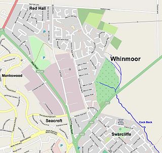
Whinmoor is a residential area of east Leeds, West Yorkshire, England.

Garforth is a town in the metropolitan borough of the City of Leeds, West Yorkshire, England.

The A64 is a major road in North and West Yorkshire, England, which links Leeds, York and Scarborough. The A64 starts as the A64(M) ring road motorway in Leeds, then towards York it becomes a high-quality dual carriageway until it is east of the city, where it becomes a single carriageway for most of its route to Scarborough.
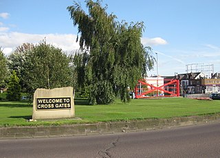
Cross Gates is a suburb in east Leeds, West Yorkshire, England.

Dringhouses is a suburb of York, in the ceremonial county of North Yorkshire, England. Historically part of the West Riding of Yorkshire, it is bounded by the Knavesmire, an open area of land on which York Racecourse is situated, to the east, Askham Bog and the A64 to the south, Woodthorpe and Foxwood to the west, and Acomb and Holgate to the north. It is part of the City of York ward is called Dringhouses and Woodthorpe which covers an area of 4.3 km2 (1.7 sq mi) and had a population of 11,084 at the 2011 Census. It is located approximately two and quarter miles from York City Centre.

Collingham is a village and civil parish in Nottinghamshire, England. The population at the 2011 Census was 2,738.

Appleton Roebuck is a village and civil parish in the former Selby District of North Yorkshire, England. It had a population of 692 according to the 2001 census, increasing to 871 in the 2021 census and including Acaster Selby. The village is about 9 miles (14 km) south-west of York. It covers an area of around 2,900 acres (1,200 ha).

Bolton Percy is a village and civil parish in the Selby District of North Yorkshire, England. According to the 2001 census it had a population of 305 in 115 households, reducing marginally to 304 at the 2011 census. The village is about 4 miles (6.4 km) east of Tadcaster.
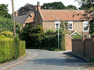
Bubwith is a village and civil parish in the East Riding of Yorkshire, England. The village is situated about 6 miles (10 km) north-east of Selby, and 12 miles (19 km) south-east of York. It is situated on the east bank of the River Derwent, west of which is the Selby District of North Yorkshire. It lies between Selby and Market Weighton on the A163 road.

Holme is a village and civil parish in the South Lakeland district of Cumbria, England, about 2 miles (3.2 km) north of Burton-in-Kendal and 3 miles (4.8 km) south east of Milnthorpe. The parish had a population of 1,167 at the 2001 census, increasing to 1,486 at the 2011 Census.

Little Snoring is a village and a civil parish in Norfolk, England.

Stutton is a small village in the Selby District of North Yorkshire, England, a mile south-west of Tadcaster.
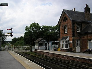
Cattal is a village and civil parish in the Borough of Harrogate district of North Yorkshire, England, about 6 miles (9.7 km) east of Knaresborough, and is located 12 miles (19 km) west of the city of York. Cattal is located on the River Nidd. Despite being a small village it is served by Cattal railway station on the Harrogate line ; the railway station generally provides an hourly service to the nearby cities of York and Leeds.
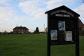
Sproston is a village and civil parish in the unitary authority of Cheshire West and Chester and the ceremonial county of Cheshire, in the north-west of England, approximately 2 miles east of Middlewich. The population of the civil parish taken at the 2011 census was 218.

Ryther cum Ossendyke is a civil parish 6 miles (9.7 km) from Tadcaster and 6 miles (9.7 km) from Selby, North Yorkshire, England. It includes the village of Ryther. The civil parish population at the 2011 census was 241.

Church Fenton is a village and civil parish in the North Yorkshire district of North Yorkshire, England. It is about 16 miles (26 km) east of Leeds, about 6 miles (10 km) south-east from Tadcaster and 3 miles (5 km) north from Sherburn in Elmet. Neighbouring villages include Barkston Ash, Cawood and Ulleskelf. The former RAF Church Fenton is located immediately north-east, which is now known as Leeds East Airport.

Healaugh is a village and civil parish in the Selby District of North Yorkshire, England. According to the 2001 census it had a population of 161 in 63 households. The population had increased to 249 at the 2011 census. The village is about three miles north north-east of Tadcaster.

Copmanthorpe railway station served the village of Copmanthorpe, North Yorkshire, England from 1839 to 1959 on the York to Normanton line. The line also became part of the East Coast Main Line at various periods. The station was moved and substantially rebuilt halfway through its working life.


