Related Research Articles

The Nez Perce are an Indigenous people of the Plateau who still live on a fraction of the lands on the southeastern Columbia River Plateau in the Pacific Northwest. This region has been occupied for at least 11,500 years.

The Yakama are a Native American tribe with nearly 10,851 members, based primarily in eastern Washington state.

Walla Walla, Walawalałáma, sometimes Walúulapam, are a Sahaptin indigenous people of the Northwest Plateau. The duplication in their name expresses the diminutive form. The name Walla Walla is translated several ways but most often as "many waters".

The Cayuse are a Native American tribe in what is now the state of Oregon in the United States. The Cayuse tribe shares a reservation and government in northeastern Oregon with the Umatilla and the Walla Walla tribes as part of the Confederated Tribes of the Umatilla Indian Reservation. The reservation is located near Pendleton, Oregon, at the base of the Blue Mountains.
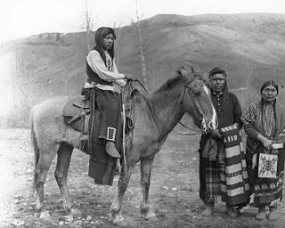
The Palouse are a Sahaptin tribe recognized in the Treaty of 1855 with the United States along with the Yakama. It was negotiated at the 1855 Walla Walla Council. A variant spelling is Palus. Today they are enrolled in the federally recognized Confederated Tribes and Bands of the Yakama Nation and some are also represented by the Colville Confederated Tribes, the Confederated Tribes of the Umatilla Indian Reservation and Nez Perce Tribe.
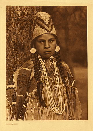
The Umatilla are a Sahaptin-speaking Native American tribe who traditionally inhabited the Columbia Plateau region of the northwestern United States, along the Umatilla and Columbia rivers.

The Confederated Tribes of the Umatilla Indian Reservation are the federally recognized confederations of three Sahaptin-speaking Native American tribes who traditionally inhabited the Columbia River Plateau region: the Cayuse, Umatilla, and Walla Walla.

Celilo Falls was a tribal fishing area on the Columbia River, just east of the Cascade Mountains, on what is today the border between the U.S. states of Oregon and Washington. The name refers to a series of cascades and waterfalls on the river, as well as to the native settlements and trading villages that existed there in various configurations for 15,000 years. Celilo was the oldest continuously inhabited community on the North American continent until 1957, when the falls and nearby settlements were submerged by the construction of The Dalles Dam. In 2019, there were calls by tribal leaders to restore the falls.

Celilo Village, Oregon is an unincorporated Native American community on the Columbia River in northeastern Wasco County in the U.S. state of Oregon. It is near Lake Celilo, the former site of Celilo Falls; it is just south of the community of Wishram, Washington, across the Columbia River.
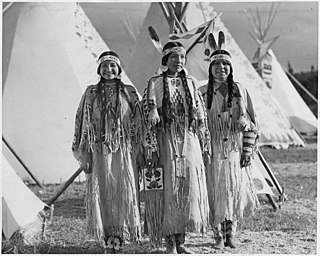
The Sahaptin are a number of Native American tribes who speak dialects of the Sahaptin language. The Sahaptin tribes inhabited territory along the Columbia River and its tributaries in the Pacific Northwest region of the United States. Sahaptin-speaking peoples included the Klickitat, Kittitas, Yakama, Wanapum, Palus, Lower Snake, Skinpah, Walla Walla, Umatilla, Tenino, and Nez Perce.
Sahaptin or Shahaptin, endonym Ichishkin, is one of the two-language Sahaptian branch of the Plateau Penutian family spoken in a section of the northwestern plateau along the Columbia River and its tributaries in southern Washington, northern Oregon, and southwestern Idaho, in the United States; the other language is Nez Perce or Niimi'ipuutímt.
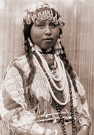
Wasco-Wishram are two closely related Chinook Indian tribes from the Columbia River in Oregon. Today the tribes are part of the Confederated Tribes of Warm Springs living in the Warm Springs Indian Reservation in Oregon and Confederated Tribes and Bands of the Yakama Nation living in the Yakama Indian Reservation in Washington.
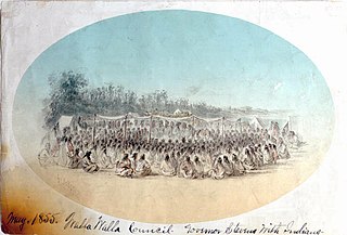
The Walla Walla Council (1855) was a meeting in the Pacific Northwest between the United States and sovereign tribal nations of the Cayuse, Nez Perce, Umatilla, Walla Walla, and Yakama. The council occurred on May 29 – June 11; the treaties signed at this council on June 9 were ratified by the U.S. Senate four years later in 1859.

Sohappy v. Smith, 302 F. Supp. 899, was a federal case heard by the United States District Court for the District of Oregon, decided in 1969 and amended in 1975. It began with fourteen members of the Yakama who sued the U.S. state of Oregon over its fishing regulations. The federal court combined the case with another case, United States v. Oregon, in which the U.S. federal government sued the state along with the Yakama, Warm Springs, Umatilla, and Nez Perce tribes.

Oxbow Regional Park is a 1,000-acre (4.0 km2) natural area park located ten miles (16 km) southeast of Troutdale along the Sandy River in the U.S. state of Oregon. Owned and operated by Metro regional government, it hosts a yearly festival celebrating salmon.
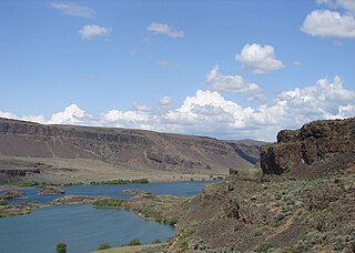
The Columbia Plateau ecoregion is a Level III ecoregion designated by the United States Environmental Protection Agency (EPA) encompassing approximately 32,100 square miles (83,139 km2) of land within the U.S. states of Washington, Oregon, and Idaho. The ecoregion extends across a wide swath of the Columbia River Basin from The Dalles, Oregon to Lewiston, Idaho to Okanogan, Washington near the Canada–U.S. border. It includes nearly 500 miles (800 km) of the Columbia River, as well as the lower reaches of major tributaries such as the Snake and Yakima rivers and the associated drainage basins. It is named for the Columbia Plateau, a flood basalt plateau formed by the Columbia River Basalt Group during the late Miocene and early Pliocene. The arid sagebrush steppe and grasslands of the region are flanked by moister, predominantly forested, mountainous ecoregions on all sides. The underlying basalt is up to 2 miles (3 km) thick and partially covered by thick loess deposits. Where precipitation amounts are sufficient, the deep loess soils have been extensively cultivated for wheat. Water from the Columbia River is subject to resource allocation debates involving fisheries, navigation, hydropower, recreation, and irrigation, and the Columbia Basin Project has dramatically converted much of the region to agricultural use.
United States v. Winans, 198 U.S. 371 (1905), was a U.S. Supreme Court case that held that the Treaty with the Yakima of 1855, negotiated and signed at the Walla Walla Council of 1855, as well as treaties similar to it, protected the Indians' rights to fishing, hunting and other privileges.
The Harvard Project on American Indian Economic Development, also known as the Harvard Project, was founded in 1987 at Harvard Kennedy School at Harvard University. It administers tribal awards programs as well as provides support for students and conducting research. The Harvard Project aims to understand and foster the conditions under which sustained, self-determined social and economic development is achieved among American Indian nations through applied research and service.

Sherar's Falls, is a small waterfall along the Deschutes River shortly before emptying into the Columbia River. It is a place considered a sacred fishing ground by local native tribes. It is located just north of the city of Maupin on Oregon Route 216 at Sherar's Bridge in Wasco County, in the U.S. state of Oregon. It totals 15 feet fall in a single drop and is the last waterfall along the Deschutes River before the Columbia River. The waterfall is rated as a class 6 whitewater and has an administrative closure to boaters because of the danger. It was named after Joseph Sherar, a 19th-century wagon road builder.
Celilo Fish Committee is a committee formed by the representatives from Yakama Nation.
References
- 1 2 3 4 The first Oregonians. Laura Berg, Oregon Council for the Humanities (2nd ed.). Portland, Or.: Oregon Council for the Humanities. 2007. ISBN 978-1-880377-02-4. OCLC 123767094.
{{cite book}}: CS1 maint: others (link) - 1 2 3 4 5 "Columbia River Inter-Tribal Fish Commission". www.nwcouncil.org. Retrieved 2021-03-16.
- 1 2 3 4 5 6 7 "CRITFC Impact | Treaty fishing rights, salmon restoration". CRITFC. Retrieved 2021-03-16.
- ↑ "Spilyay tymoo. (Warm Springs, Or.) 1976-current, October 14, 1994, Image 1 « Historic Oregon Newspapers". oregonnews.uoregon.edu. Retrieved 2021-03-16.
- Berg, L. (2007). The first Oregonians. Portland, OR: Oregon Council for the Humanities.
- University of Oregon, K. (n.d.). Spilyay tymoo. (Warm Springs, OR.) 1976-current, October 14, 1994, image 1. Retrieved March 14, 2021
This article needs additional or more specific categories .(January 2024) |