 |
|---|
The districts of Lesotho are further divided into constituencies, which are in turn divided into community councils. [1] [2]
 |
|---|
The districts of Lesotho are further divided into constituencies, which are in turn divided into community councils. [1] [2]
Functions of a community council: [3]
|
|
|

Lesotho, formally the Kingdom of Lesotho, is a landlocked country in Southern Africa. As an enclave of South Africa, with which it shares a 1,106 km border, it is the only sovereign enclave in the world outside of the Italian Peninsula. It is situated in the Maloti Mountains and contains the highest peak in Southern Africa. It has an area of over 30,000 km2 (11,600 sq mi) and has a population of about 2 million. Its capital and largest city is Maseru.

The history of people living in the area now known as Lesotho goes back as many as 400 years. Present Lesotho emerged as a single polity under King Moshoeshoe I in 1822. Under Moshoeshoe I, Basotho joined other clans in their struggle against the Lifaqane associated with famine and the reign of Shaka Zulu from 1818 to 1828.
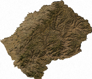
Lesotho is a mountainous, landlocked country located in Southern Africa. It is an enclave, surrounded by South Africa. The total length of the country's borders is 909 kilometres (565 mi). Lesotho covers an area of around 30,355 square kilometres (11,720 sq mi), of which a negligible percentage is covered with water.

The National University of Lesotho, the main and oldest university in Lesotho, is located in Roma, 34 km (21 mi) southeast of Maseru, the capital of Lesotho. The Roma valley is broad and is surrounded by a barrier of rugged mountains which provides magnificent scenery. The university enjoys a temperate climate with four distinct seasons. The governing body of the university is the council and academic policy is in the hands of Senate, both Council and Senate being established by the Act.

The Kingdom of Lesotho is divided into ten districts, each headed by a district administrator. Each district has a capital known as a camptown. The districts are further subdivided into 80 constituencies, which consist of 129 local community councils. Most of the districts are named after their capitals. Hlotse, the capital of Leribe District is also known as Leribe. Conversely, the Berea District is sometimes called Teyateyaneng, based on its capital.
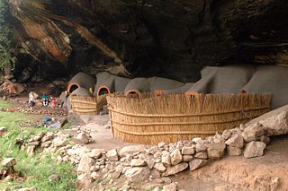
Berea is a district of Lesotho. In the west, Berea borders on the Free State Province of South Africa. Domestically, it borders on the following districts: Leribe District in the north, Thaba-Tseka District in southeast and Maseru District in the south. Teyateyaneng is the capital of the district. It is also home to the Kome Cave Dwellings. It is also the only district in Lesotho which is not named after its capital.

Butha-Buthe is a district of Lesotho. Butha-Buthe is the capital or camptown, and only town in the district. In the north, Butha-Buthe borders on the Free State Province of South Africa. Domestically, it borders on Mokhotlong District in southeast and Leribe District on the south.
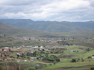
Thaba-Tseka is a district of Lesotho. Thaba-Tseka is also the name of the district's capital or camptown, which is the only town in the district. In the east, Thaba-Tseka borders on the KwaZulu-Natal Province of South Africa. Domestically, it borders on Mokhotlong District in northeast, Leribe District in north, Berea District in northwest, Maseru District in west, Mohale's Hoek District in southwest and Qacha's Nek District in the southern direction. The district is one of the major tourist attractions in Lesotho because of the second largest arch dam in Africa Katse Dam.

Mokhotlong district is a district of Lesotho. It includes the highest terrain in the Maloti Mountains and the source of the Senqu River, Lesotho's primary watershed. Mokhotlong is the capital or camptown, and only town in the district. Mokhotlong borders on the KwaZulu-Natal Province of South Africa, with its north point bordering the Free State Province. Domestically, it borders on Butha-Buthe District in northwest, Leribe District in west, and Thaba-Tseka District in the south.
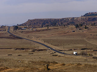
Leribè is a district of Lesotho. It has an area of 2,828 km2 and a population in 2016 of approximately 337,500. Hlotse is the capital or camptown of the district. The district has one additional town, namely Maputsoe. In the west, Leribe borders on the Free State Province of South Africa. Domestically, it borders Butha-Buthe District in the north, Mokhotlong District in the east, Thaba-Tseka District in southeast and Berea District in southwest.

Mafeteng is a district of Lesotho. It has an area of 2,119 km2 and a population in 2016 of 178,222. Mafeteng is the capital or camptown, and only town in the district. In the west, Mafeteng borders on the Free State Province of South Africa. Domestically, it borders on the following districts Maseru District in the northeast and Mohale's Hoek District in the southeast.

Maseru is a district of Lesotho. Maseru is also the name of the district's capital, and is the only city in the district and also the capital of the country. It is the largest urban area in the country, and therefore the only city. The city of Maseru is located on Lesotho's western border with the Free State Province of South Africa, the frontier being the Caledon River. Maseru borders on Berea District in north, Thaba-Tseka District in the east, Mohale's Hoek District in south, and Mafeteng District in southwest.
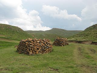
Mohale's Hoek is a district of Lesotho. Mohale's Hoek is the capital city or camptown, and only town in the district. In the southwest, Mohale's Hoek borders on South Africa, while domestically, it borders on Mafeteng District in northwest, Maseru District in north, Thaba-Tseka District in northeast, Qacha's Nek District in east, and Quthing District in southeast.

Qacha's Nek is a district of Lesotho. Qacha's Nek is the capital or camptown, and only town in the district. In the south, Qacha's Nek borders on the Eastern Cape Province of South Africa, and it has a short border with KwaZulu-Natal Province in the far east. Domestically, it borders on Quthing District in southwest, Mohale's Hoek District in west and Thaba-Tseka District in the northern direction.
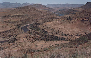
Quthing is a district of Lesotho. Moyeni, is the camp town or capital of the district. There are two of the most important sets of dinosaur footprints in the region. There is a large panel of Bushman paintings at Qomoqomong. Quthing district is home to the Masitise Cave House, a satellite location of the Morija Museum & Archives. In the southwest, south and east, Quthing borders on the Eastern Cape Province of South Africa. Domestically, it borders Mohale's Hoek District in the north and Qacha's Nek District in the northeast.

The University of Botswana (UB) was established in 1982 as the first institution of higher education in Botswana. The university has three campuses: one in the capital city Gaborone, one in Francistown, and another in Maun. The university is divided into six faculties: Business, Education, Engineering, Humanities, Health Sciences, Science and Social Sciences and the Sir Ketumile Masire Teaching Hospital.

The Lesotho Defence Force (LDF) is the military of the Southern African Kingdom of Lesotho, which consists of about 2,000 personnel and is tasked with maintaining internal security, territorial integrity, and defending the constitution of Lesotho. Since the mountainous kingdom is completely landlocked by South Africa, in practice the country's external defence is guaranteed by its larger neighbour, so the armed forces are mainly used for internal security. The LDF is an army with a small air wing.

Christianity is the dominant religion in Lesotho, with Protestantism and Catholicism being its main denominations.

Administratively, Lesotho is divided into ten districts, each headed by a district administrator. Each district has a capital known as a camptown.
Mabote is a community council in the Maseru Municipality located in the Berea District of Lesotho. The population in 2006 was 38,047.