Comparison of free off-line satellite navigation software

Last updated

This article contains a list with gratis (but not necessarily open source) satellite navigation (or "GPS") software for a range of devices (PC, laptop, tablet PC, mobile phone, handheld PC (Pocket PC, Palm)). Some of the free software mentioned here does not have detailed maps (or maps at all) or the ability to follow streets or type in street names (no geocoding). However, in many cases, it is also that which makes the program free (and sometimes open source [1] ), avoid the need of an Internet connection, [2] [3] [4] and make it very lightweight (allowing use on small portable devices, including smartphones). Very basic programs like this may not be suitable for road navigation in cars, but serve their purpose for navigation while walking or trekking, and for use at sea. To determine the GPS coordinates of a destination, one can use sites such as GPScoordinates.eu and GPS visualizer.

Contents

Some software presented here is free, but maps may need to be paid for. In this instance, and in the instance that some maps (of specific countries) are not standardly available, Mobile Atlas Creator (MOBAC) can be used (e.g. on OruxMaps, Maverick, Sports Tracker, Maplorer).

Some of the software mentioned can also be run on different devices than what they are intended for. A particular case-in-point is the Android software which can often be run on laptops or PCs (running Linux, Windows or Mac OS X) as well. This can be done using emulators.

Some of the software mentioned here may run only on devices that are no longer commercially sold (such as the PalmPilot and PocketPC devices). However, these devices are often still obtainable via second-hand websites.

Free maps

Navigation software with free maps often uses maps from the OpenStreetMap project.

NameCompany or developerType of device [5] Operating system 3rd-party GPS-able? [6] Software with maps? Follows streets?Open source?Remarks
Aqua Map [7] GECsmartphone, tabletAndroid, iOS ?Yes, yesNo
Google Maps Googlesmartphone, tablet, laptop (online), PC (online)Android, iOS ?Yes, yesNoMaps can be downloaded, but they expire after 30 days, [8] [9] ads
Here WeGo [10] HERE Global B.V., Netherlandssmartphone, tablet, laptop (online), PC (online), Android, iOS ?yes (color maps), ?Nointended for marine navigation
Magic EarthGeneral Magic B.V.Smartphone, tablet Android, iOS ?Yes (OpenStreetMap data), yesNoFree OSM maps intended for car navigation, hiking and biking
MapFactor [11] MapFactor, s.r.o., Czech Republicsmartphone, tablet, laptop (online), tablet PC, car navigation Android, iOS, Windows, WinCE, Windows Phone 8.1, Windows 10 Mobile ?Yes (OpenStreetMap data), yesNoFree OSM maps, optional non-free TomTom maps, ads
MAPS.ME [12] MapsWithMe GmbHsmartphone Android, BlackBerry, iOS ?Yes (OpenStreetMap data), [13] yes [14] (Apache License 2.0) [13] ?
Mapy.cz Seznam.czsmartphone, tablet, laptop (online), PC (online), car navigation Android, iOS, Windows 10 Mobile ?Yes, yesNocar, hiking, cycling, skiing and boating navigation with unlimited offline maps
Navmii (formerly NavFree) [15] [16] Navmiismartphone, tablet, PC Android, BlackBerry, iOS ?Yes (OpenStreetMap data), yes??
NaviComputer [17] ? Windows Phone Windows Mobile ?yes (?), no?For hiking and biking
Navit [18] [19] nonesmartphone, tablet, laptop (online), PC (online) Android, Linux, OpenMoko, Windows for PC?Yes (OpenStreetMap and others), yes(GPLv2)Intended for road navigation
OpenCPN [20] ?laptop, PC IntelMac, Linux (Fedora, Ubuntu, CentOS),Windows XP SP3, Vista, 7, 8?yes (various charts and OpenStreetMap data), N/AGPLIntended for maritime navigation
OsmAnd [21] OsmAND bvsmartphone, tablet Android, iOS ?Yes (OpenStreetMap data), yes(GPLv3+)Limited to 7 maps for the free Google Play version, [22] unlimited on F-Droid
Maps can be added manually via PC in program order on smartphone
OSM Scout for Sailfish OS [23] Karas Lukáš [24] smartphone Sailfish OS ?Yes (OpenStreetMap data), yes(LGPL)Unlimited offline maps loaded from within the app.
Organic Maps [25] Organic Maps [25] smartphone, tablet Android, iOS ?Yes (OpenStreetMap data), yes(Apache License 2.0) [13] Privacy-focused navigation - no location tracking and no data collection. For hiking, cycling and driving. Developed by the community as a free and open-source project.
Pure Maps [26] + OSM Scout Server [27] rinigus [28] smartphone Linux, Sailfish OS, UBports ?Yes (OpenStreetMap data), yes(GPLv3)Pure Maps acts as frontend and OSM Scout Server as backend. Unlimited offline maps loaded from within OSM Scout Server.


Non-free maps

NameCompanyType of device [5] Operating system 3rd-party GPS-able? [6] Software with maps? Follows streets?Open-source?Remarks
Aqua Map [7] GECSmartphone, tablet Android, iOS ?Yes, yesNo
i-Boating [29] i-BoatingTablet, PC, Smartphone Android, Embedded Linux & BlackBerry, iOS, Mac OS, Windows YesYesNoMarine Navigation Software, free program, but maps need to be paid for
HandMap [30] [31] ?handheld PC (Palm) Palm OS ?yes (color maps, basic), ??May be a free program, but maps need to be paid for (hence called "shareware" at Tucows) ?
Navionics Boating App [32] Navionics smartphone, tablet Android, iOS ?yes (OpenStreetMap data), ??Intended for marine navigation, free program, but maps need to be paid for
SailPalm [33] ?handheld PC (Palm) Palm OS ?yes (black and white maps), ??Free program, but maps need to be paid for (hence called "shareware" at Tucows), intended for marine navigation (sailing)

Other satellite navigation software

NameCompanyType of device [5] Operating system 3rd-party GPS-able? [6] Software with maps? Follows streets?Open-source?Remarks
FieldNote [34] Mobile Computing handheld PC (pocket PC) Windows CE ?no, ??mainly intended to mark specific points without a map, not intended for actual navigation
GPSLogger [35] Open Project

Basic Air Data

Tablet, PC, Smartphone

and any android enabled device

Android Yes, no specific hardwareNoGPLv3 [36] Free and no ads. Exports in common formats and via email [37]
osmdroid [38] osmdroid.orgTablet, PC, Smartphone

and any android enabled device

Android Yes, no specific hardwareyes (?), noApache [39] may not allow actual navigation from point-to-point, only showing the current position on a map

Miscellaneous / unsorted software

NameCompanyType of device [5] Operating system 3rd-party GPS-able? [6] Software with maps? Follows streets?Open-source?Remarks
Maverick [40] [41]  ?Tablet PC Android  ?yes (OpenStreetMap data), ?No ?
gvSIG Mini [42] [43] ProdevelopTablet PC Android  ?yes (OpenStreetMap data), ?GPL ?
OpenSatNav [44] Kieran Fleming et al.Tablet PC Android, OpenMoko  ?yes (OpenStreetMap data), ? ? ?
Minimap [45]  ?Tablet PC Android  ?yes (OpenStreetMap data), ? ? ?
MapDroyd [46] CloudMade Deutschland GmbHTablet PC Android  ?yes (OpenStreetMap data), ? ? ?
OruxMaps [47]  ?Tablet PC Android  ?yes (OpenStreetMap data), ?No ?
AlpineQuest Off-Road Explorer [48] PsyberiaTablet, PC, Smartphone

and any android enabled device

Android  ?yes (?), ?NoSince 2010.
AndNav 2 [49]  ?Tablet PC, Android  ?yes (?), ? ? ?
Big Planet Tracks [50]  ?Tablet PC, Android  ?yes (?), ? ? ?
Sports Tracker [51] Sports Tracking TechnologiesTablet PC Android, ?yes (?), noNoDoes not allow navigation to specific points, only tracking
RMaps [52] [53]  ?tablet PC Android  ?yes (?), ? ?may not provide actual navigation, only marking of GPS points, and the current position
AFTrack [54]  ?Tablet PC, handheld PC (Symbian) Android, Symbian OS series 60  ?yes (?), ? ? ?
CacheBox [55]  ?Tablet PC, PC, handheld PC (pocket PC) Android, Windows Mobile, Windows for PC ?yes (?), ? ?initially intended for geocaching
Mapopolis [56]  ?Handheld PC (Palm) Palm OS  ?yes (black and white maps), ? ?only has maps for USA
Magellan Nav Companion [57]  ?handheld PC (Palm) Palm OS  ?yes (OpenStreetMap data), ? ? ?
TZGPS [58]  ?handheld PC (Palm) Palm OS  ?yes (OpenStreetMap data), ? ? ?
Trax [59] [60] Luke Klein-Berndthandheld PC (Palm) Palm OS  ? ? (?), ? ? ?
SoaringPilot [61]  ?handheld PC (Palm, some PocketPC/WinCE devices) Palm OS  ?yes (OpenStreetMap data), ? ?Originally intended for use in sailplanes
CotoGPS [62]  ?handheld PC (Palm) Palm OS  ? ? (?), ? ?Originally intended for geocaching
GpsPilot [63]  ?handheld PC (Symbian One) Symbian  ?no (?), ? ? ?
Maplorer [64]  ?handheld PC (pocket PC) Windows CE, Mobile ?yes (?), ? ? ?
OSMtracker [65]  ?handheld PC (pocket PC), smartphone Android, Windows Mobile  ?yes (?), ?GPLv3 ?
gpsVP [66]  ?handheld PC, certain smartphones Windows Mobile 5,6, 2003 ?yes (OpenStreetMap data), ? ? ?
CacheWolf [67]  ?Laptop, PC Windows, Mac OS X, Linux  ?yes (?), ? ? ?
Glopus [68]  ?Laptop, PC, handheld PC (Pocket PC) Windows, ? ?yes (?), ? ? ?
TrekBuddy [69] [70]  ?PC, laptop, handheld PC (Palm, Symbian, BlackBerry), Windows Phone Android,Symbian, Palm OS, SE proprietary OS, Windows Mobile, Windows XP, Vista, ?yes (?), ? ?Runs on Java, hence cross-platform
gvSIG 2.0 [71]  ?PC, laptop,Windows XP, Vista, Linux, OS X ?yes (?), ? ?cross-platform; originally intended as a GIS; however can be fitted with GPS receiver and has support for it [72] and also allows to easily download maps from any location from an online database as OpenStreetMap, and many others [73] [74]
LuckyGPS [75]  ?Laptop, PC, smartphone Windows, Linux, OpenMoko  ?yes (?), ? ? ?
Mumpot [76]  ?Laptop, PC, smartphone Linux, OpenMoko, GPE  ?yes (?), ? ? ?
Pyroute [77] OjwLaptop, PC, smartphone Windows XP, Linux, OpenMoko  ?yes (?), ? ? ?
TangoGPS [78] Marcus BauerLaptop, PC, smartphone Linux, OpenMoko  ?yes (?), ? ? ?
FoxtrotGPS [79]  ?Laptop, PC Linux, OpenMoko  ?yes (?), ? ?based on TangoGPS, actively being developed, especially adapted for use with touch screens
Rana [80] Ojwsmartphone OpenMoko, Neo Freerunner ?yes (?), ? ?runs on Python, so possibly cross-platform
BikeAtor [81] [82]  ?smartphone (OpenMoko, Symbian), tablet PC Android, OpenMoko, Symbian  ?yes (?), ? ? ?
Osmarender [83]  ?laptop, PC, Linux, OS X, Windows  ?yes (OpenStreetMap data), ? ?Not intuitive
Mobile Trail Explorer [84]  ?smartphone, ? Symbian, multiple OSs ?yes (?), ? ?Runs on Java, so a cross-platform GPS navigation software
Open Citymap [85]  ?smartphone (Qt) Windows CE, OpenMoko  ?yes (?), ? ? ?
Mappero  ?Nokia N810 Maemo [86]  ?yes (OpenStreetMap data), ? ? ?
NaviPOWM [87]  ?handheld PC, Laptop, PC Windows for PC, Windows Mobile 5/6/2003 SE, Linux  ?yes (OpenStreetMap data), ? ? ?
GPSSRobin LovelockLaptop or Pocket PC Windows for PC, Windows Mobile ?yes (can import)NoSince 1995. www.gpss.co.uk
NaVisu  ?Laptop, PC Linux, OS X, Windows  ?yes (OpenStreetMap data), ? ?Developed for marine applications, not intuitive, built around NASA WorldWind
Cetus GPS [88] Cetus softwareembedded system (Garmin) OS 5  ?yes (?), ? ? ?
GPS interpreter [89] Marcel Durieux, Christian Tavernier [90] [89] Embedded system (purpose-build PCB) [91]  ? ?yes, ? ? ?
Andrew Holme's GPS softwareAndrew Holme [92] Embedded system (several custom PCB's + Raspberry Pi) [93] Raspbian Linux  ? ?, ? ? ?
AdvRider WD [94] Adi BardaAndroid Android  ?yes (can import)NoSince 2013.
TheGOAT [95]  ?Tablet PC Android  ?yes (OpenStreetMap data), ?No ?

See also

Related Research Articles

Wayfinder was a wholly owned subsidiary of Vodafone specializing in creating mobile navigation systems for a number of platforms such as Symbian 2nd and 3rd edition, UIQ, Windows Mobile and some other smartphones. An external Bluetooth GPS receiver is required for non GPS enabled phones. On March 12, 2010, it was announced that Vodafone was closing the company and all employees would be let go.

Google Developers is Google's site for software development tools and platforms, application programming interfaces (APIs), and technical resources. The site contains documentation on using Google developer tools and APIs—including discussion groups and blogs for developers using Google's developer products.

diagrams.net Graph drawing software

diagrams.net is a cross-platform graph drawing software developed in HTML5 and JavaScript. Its interface can be used to create diagrams such as flowcharts, wireframes, UML diagrams, organizational charts, and network diagrams. Parts of its source code are provided under the Apache 2 open-source license.

<span class="mw-page-title-main">Navit</span>

Navit is a free and open-source, modular, touch screen friendly, car navigation system with GPS tracking, realtime routing engine and support for various vector map formats. It features both a 2D and 3D view of map data.
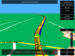
<span class="mw-page-title-main">Turn-by-turn navigation</span> Feature of GPS navigation devices

Turn-by-turn navigation is a feature of some satellite navigation devices where directions for a selected route are continually presented to the user in the form of spoken or visual instructions. The system keeps the user up-to-date about the best route to the destination, and is often updated according to changing factors such as traffic and road conditions. Turn-by-turn systems typically use an electronic voice to inform the user whether to turn left or right, the street name, and the distance to the next turn.

This is a list of notable commercial satellite navigation software for various devices, with a specific focus on mobile phones, tablets, tablet PCs,.

<span class="mw-page-title-main">Kiwix</span> Open-source offline browser for public domain projects

Kiwix is a free and open-source offline web browser created by Emmanuel Engelhart and Renaud Gaudin in 2007. It was first launched to allow offline access to Wikipedia, but has since expanded to include other projects from the Wikimedia Foundation, public domain texts from Project Gutenberg, many of the Stack Exchange sites, and many other resources. Available in more than 100 languages, Kiwix has been included in several high-profile projects, from smuggling operations in North Korea and encyclopedic access in Cuba to Google Impact Challenge's recipient Bibliothèques Sans Frontières.

<span class="mw-page-title-main">Google Authenticator</span> Two-step verification app

Google Authenticator is a software-based authenticator by Google. It implements multi-factor authentication services using the time-based one-time password and HMAC-based one-time password, for authenticating users of software applications.

<span class="mw-page-title-main">OsmAnd</span> Offline maps & navigation Android and iOS app

OsmAnd is a map and navigation app for Android and iOS. It uses the OpenStreetMap (OSM) map database for its primary displays, but is an independent app not endorsed by the OpenStreetMap Foundation. It is available in both free and paid versions; the latter unlocks the download limit for offline maps and provides access to Wikipedia points of interest (POIs) and their descriptions from within the app. Map data can be stored on the device for offline use. Using the device's GPS capabilities, OsmAnd offers routing, with visual and voice guidance, for car, bike, and pedestrian. All of the main functionalities work both online and offline.

Avare is a free open source "moving map" aviation GPS, A/FD and EFB app for phones or tablets using the Android Operating System. The app uses any internal Android or compatible external GPS receiver to determine location, allowing real-time display of location, heading, speed, distance, time, and altitude on free U.S. FAA IFR or VFR aviation charts; or on select topographic charts. Included are 3D, ADSB-In and other advanced options. The user can access all relevant static current FAA official data and some non-FAA maps and data in flight without data connection, once data has been downloaded to the device. With an aircraft ADSB-Out transmitter and inexpensive ADSB-In receiver Avare can also display any available FAA live ADSB data in flight. Some advanced users also interface Avare with an auto-pilot or flight simulator.

Bibledit is series of related open source software projects for editing and translating the Bible. Bibledit is a free software.
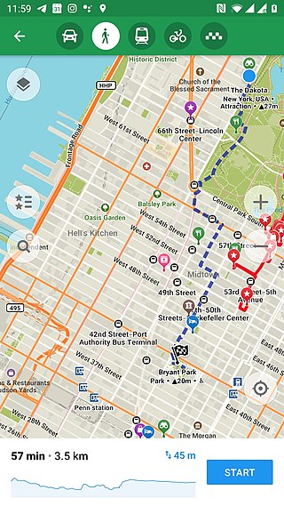
<span class="mw-page-title-main">Maps.me</span> Commercial satellite navigation software using OpenStreetMap data

Maps.me is a mobile app for Android, iOS and BlackBerry that provides offline maps using OpenStreetMap data. It was formerly known as MapsWithMe. In November 2014, it was acquired by Mail.Ru Group and became part of its My.com brand. In September 2015, the app was open sourced and a free and open-source software version was additionally made available on F-droid until the application was sold to the payment processor Daegu Limited, part of Parity.com, which changed the application user interface and content, which led Alexander Borsuk and Viktor Govako to release an open source ad-and tracker-free fork called 'Organic Maps' in response.

<span class="mw-page-title-main">Here WeGo</span> Web mapping and navigation service since 2012

Here WeGo is a web mapping and satellite navigation software, operated by HERE Technologies and available on the Web and mobile platforms. It is based on HERE's location data platform, providing its in-house data, which includes satellite views, traffic data, and other location services. Maps are updated every two or three months.

<span class="mw-page-title-main">KDE Gear</span> Set of applications and supporting libraries

The KDE Gear is a set of applications and supporting libraries that are developed by the KDE community, primarily used on Linux-based operating systems but mostly multiplatform, and released on a common release schedule.

<span class="mw-page-title-main">Locus Map</span>

Locus Map is a multi-functional Android navigation app. Primarily it is designed and used for leisure time outdoor activities like hiking, biking, or geocaching. The app is also used by professionals e.g. by S&R teams or for collecting geospatial data.

Karta GPS is a mobile application developed by Karta Software Technologies Lda., a daughter company of NDrive, for the Android, iOS and iPadOS operating systems. It is distributed for free and pairs open-source map data from OpenStreetMap alongside curated content from Yelp and Foursquare.

KartaView, formerly called OpenStreetView and OpenStreetCam, is a project to collect crowdsourced street-level photographs for improving OpenStreetMap operated by Grab Holdings. Collected imagery is published under a CC BY-SA license and while some of the project's code is released as open source, much of it still require proprietary software to function. This is one of the few alternative platforms that offer street view like Google.

<span class="mw-page-title-main">Foliate (software)</span> E-book reading application for Linux

Foliate is a free e-book reading application for desktop Linux systems. The name refers to leaves, meaning "(getting) leafy" or "…-leaved".

<span class="mw-page-title-main">Conversations (software)</span> Free software instant messaging client for the XMPP protocol

Conversations is a free software, instant messaging client application software for Android. It is largely based on recognized open standards such as the Extensible Messaging and Presence Protocol (XMPP) and Transport Layer Security (TLS).

References

  1. Having open-source GPS programs available for different devices also allows people to expand on this software for certain projects, like automated or semi-automated steering systems for vehicles
  2. Programs like Google maps require an internet connection as the maps are not available offline, in part because this would also make the program very large in filesize
  3. "offline - How to use GPS/Maps without an Internet connection? - Android Enthusiasts Stack Exchange". Android.stackexchange.com. Retrieved 2017-05-03.
  4. Joe Levi (2013-07-22). "Here's how to take your Google Maps offline after the v7 update". Pocketnow.com. Archived from the original on 2017-06-24. Retrieved 2017-05-03.
  5. 1 2 3 4 Tablet PCs have touchscreens, laptops do not
  6. 1 2 3 4 support of add-on GPS receiver, rather than say the embedded GPS receiver of the device the software was initially designed for
  7. 1 2 "Aqua Map - App functions".
  8. "How to use your Google Maps offline". Android Authority. 2017-08-21. Retrieved 2017-09-11.
  9. "Google Groups". groups.google.com. Retrieved 2017-09-11.
  10. "HERE WeGo App". Here.com. Retrieved 2017-05-10.
  11. "MapFactor GPS Navigation Maps - Android Apps on Google Play". Play.google.com. Retrieved 2017-05-03.
  12. "MAPS.ME". maps.me. Retrieved 2017-09-11.
  13. 1 2 3 MAPS.ME — Offline OpenStreetMap maps for iOS and Android, MAPS.ME, 2017-09-11, retrieved 2017-09-11
  14. Happy, Map (2015-06-03). "The Best Free Offline Maps for Traveling". Huffington Post. Retrieved 2017-09-11.
  15. "Archived copy". Archived from the original on 2014-04-14. Retrieved 2014-04-13.{{cite web}}: CS1 maint: archived copy as title (link)
  16. "Navmii GPS World (Navfree) - Android Apps on Google Play". Play.google.com. Retrieved 2017-05-03.
  17. "Home". NaviComputer. Retrieved 2017-05-03.
  18. "Navit". OpenStreetMap Wiki. Retrieved 2017-05-03.
  19. "Navit - Car navigation system". Navit-project.org. Retrieved 2017-05-03.
  20. Team, OpenCPN. "About OpenCPN". opencpn.org. Retrieved 2017-09-11.
  21. "Offline Mobile Maps and Navigation". OsmAnd. Retrieved 2017-05-03.
  22. maps installation in program
  23. "OSM Scout for Sailfish OS". GitHub . 28 February 2022.
  24. "karry.cz". karry.cz. Retrieved 2020-10-13.
  25. 1 2 "Offline Mobile Maps and Navigation".
  26. "Pure Maps". GitHub . 17 April 2022.
  27. "OSM Scout Server".
  28. "rinigus Github". GitHub . Retrieved 2020-10-13.
  29. "i-Boating" . Retrieved December 28, 2016.
  30. "HandMap : Free Download & Streaming : Internet Archive". Archive.org. 27 November 2002. Retrieved 2017-05-03.
  31. "GPS Plugin : Free Download & Streaming : Internet Archive". Archive.org. January 2002. Retrieved 2017-05-03.
  32. "Navionics Boating". Navionics.com. Retrieved 2017-05-03.
  33. "SailPalm : Free Download & Streaming : Internet Archive". Archive.org. 12 April 2002. Retrieved 2017-05-03.
  34. "Mobile Computing in a Fieldwork Environment". Archived from the original on 2013-01-13. Retrieved 2014-04-13.
  35. "Free GPSLogger for Android". www.basicairdata.eu. BasicAirData. Retrieved 2016-12-06.
  36. "Source code on GitHub". GitHub. Retrieved 2016-12-06.
  37. BasicAirData. "GPSLogger/apk at master · BasicAirData/GPSLogger · GitHub". Github.com. Retrieved 2017-05-03.
  38. "Source code on GitHub". GitHub. Retrieved 2018-05-03.
  39. "Osmdroid". GitHub . 28 January 2022.
  40. "Products". Code Sector. Retrieved 2017-05-03.
  41. "Maverick: GPS Navigation - Android Apps on Google Play". Play.google.com. Retrieved 2017-05-03.
  42. "gvSIG Mini Maps - Android Apps on Google Play". Play.google.com. Retrieved 2017-05-03.
  43. Miguel Montesinos (2012-03-28). "Home - gvSIG Mini - Confluence". Confluence.prodevelop.es. Archived from the original on 2017-06-25. Retrieved 2017-05-03.
  44. "OpenSatNav". OpenStreetMap Wiki. Retrieved 2017-05-03.
  45. "Archived copy". Archived from the original on 2014-04-15. Retrieved 2014-04-13.{{cite web}}: CS1 maint: archived copy as title (link)
  46. "Archived copy". Archived from the original on 2014-04-14. Retrieved 2014-04-13.{{cite web}}: CS1 maint: archived copy as title (link)
  47. "Oruxmaps Homepage". Oruxmaps.com. Retrieved 2017-05-03.
  48. "Presentation". AlpineQuest. Retrieved 2017-05-03.
  49. "Android Navigation System". AndNav.org. Retrieved 2017-05-03.
  50. "Google Code Archive - Long-term storage for Google Code Project Hosting". Code.google.com. Retrieved 2017-05-03.
  51. "Sports Tracker". Sports Tracker. Retrieved 2017-05-03.
  52. "My Android Applications". Robertdeveloper.blogspot.be. Retrieved 2017-05-03.
  53. "RMaps free app download". Android Freeware. 2010-05-28. Retrieved 2017-05-03.
  54. "AFTrack - GPS Tracking". Afischer-online.de. Retrieved 2017-05-03.
  55. "Downloads". Team-cachebox.de. 2013-10-16. Archived from the original on 2017-05-14. Retrieved 2017-05-03.
  56. "Mapopolis : Free Download & Streaming : Internet Archive". Archive.org. 17 February 2002. Retrieved 2017-05-03.
  57. Dale DePriest. "Navigation with Palm OS". Gpsinformation.org. Retrieved 2017-05-03.
  58. "TZGPS - a GPS Applet for PalmOS". Linas.org. Retrieved 2017-05-03.
  59. "Trax Download | ZDNet". Archived from the original on 2014-04-14. Retrieved 2014-04-13.
  60. "Trax : : Free Download & Streaming : Internet Archive". Archive.org. 25 June 2001. Retrieved 2017-05-03.
  61. "SoarPilot - Soaring Flight Computer". Soaringpilot.org. Retrieved 2017-05-03.
  62. "Cotogps". Archived from the original on 2014-04-13. Retrieved 2014-04-13.
  63. "ブライトニングフォーミュラの効果はどう?【@コスメ1位の秘密とは!】". Gpspilot.biz. Retrieved 2017-05-03.
  64. "Free hiking maps on your Windows CE / Windows mobile based GPS". Maplorer. Retrieved 2017-05-03.
  65. "OSMtracker". Wiki.openstreetmap.org. OpenStreetMap Wiki. 2016-07-23. Retrieved 2017-05-03.
  66. "Google Code Archive - Long-term storage for Google Code Project Hosting". Code.google.com. Retrieved 2017-05-03.
  67. "Home Page - Cachewolf". Cachewolf.aldos.de. 2015-08-02. Retrieved 2017-05-03.
  68. "Glopus - Home". Glopus.de. 2014-03-15. Retrieved 2017-05-03.
  69. "Outdoor companion". Trekbuddy.net. Retrieved 2017-05-03.
  70. "Installation - TrekBuddy Wiki". Trekbuddy.net. Retrieved 2017-05-03.
  71. "Portal gvSIG — gvSIG". Archived from the original on 2014-05-27. Retrieved 2014-05-13.
  72. "GPS extension for gvSIG". Joinup.ec.europa.eu. Archived from the original on 2014-12-19. Retrieved 2017-05-03.
  73. "gvSIG 2.0: OpenStreetMap, adding new servers | gvSIG blog". Blog.gvsig.org. 5 June 2013. Retrieved 2017-05-03.
  74. "OSM gvSIGv2". YouTube. 2013-05-16. Retrieved 2017-05-03.
  75. "LuckyGPS". OpenStreetMap Wiki. Retrieved 2017-05-03.
  76. "Mumpot". OpenStreetMap Wiki. Retrieved 2017-05-03.
  77. "Pyroute". OpenStreetMap Wiki. Retrieved 2017-05-03.
  78. "TangoGPS". OpenStreetMap Wiki. Retrieved 2017-05-03.
  79. "FoxtrotGPS". OpenStreetMap Wiki. Retrieved 2017-05-03.
  80. "Rana". Wiki.openstreetmap.org. OpenStreetMap Wiki. 2010-12-21. Retrieved 2017-05-03.
  81. "BikeAtor". OpenStreetMap Wiki. Retrieved 2017-05-03.
  82. "BikeAtor for Android". Bikeator.de. Retrieved 2017-05-03.
  83. "Osmarender". wiki.openstreetmap.org. OpenStreetMap Wiki. 2016-10-26. Retrieved 2017-05-03.
  84. "Google Code Archive - Long-term storage for Google Code Project Hosting". Code.google.com. Retrieved 2017-05-03.
  85. "Google Code Archive - Long-term storage for Google Code Project Hosting". Code.google.com. Retrieved 2017-05-03.
  86. "Intro: The Home of the Maemo Community". Maemo.org. Archived from the original on 2017-05-25. Retrieved 2017-05-03.
  87. "NaviPOWM download". SourceForge.net. 2009-11-22. Retrieved 2017-05-03.
  88. "Cetus GPS (Palm) for Mobile - Free download and software reviews - CNET Download.com". Download.cnet.com. 2007-05-15. Retrieved 2017-05-03.
  89. 1 2 "Multi-purpose GPS Receiver" . Elektor Magazine. October 2008.
  90. "MikroElektronika Forum • View topic - GPS interpreter". Mikroe.com. Retrieved 2017-05-03.
  91. "Elektor Multi-purpose GPS Receiver PCB Elektor". Archived from the original on 2014-04-13. Retrieved 2014-04-13.
  92. "Homemade GPS Receiver". Aholme.co.uk. Retrieved 2017-05-03.
  93. "Homemade GPS receiver". Raspberry Pi. 2013-05-13. Archived from the original on 2015-03-17. Retrieved 2017-05-03.
  94. "AdvRider WD - Android Apps on Google Play". Play.google.com. Retrieved 2017-05-03.
  95. "TheGOAT". benpl.net. Archived from the original on 2018-06-12. Retrieved 2018-06-08.