Aquileia is an ancient Roman city in Italy, at the head of the Adriatic at the edge of the lagoons, about 10 kilometres (6 mi) from the sea, on the river Natiso, the course of which has changed somewhat since Roman times. Today, the city is small, but it was large and prominent in classical antiquity as one of the world's largest cities with a population of 100,000 in the 2nd century AD. and is one of the main archaeological sites of northern Italy. In late antiquity the city was the first city in the Italian Peninsula to be sacked by Attila the Hun.

Cividale del Friuli is a town and comune in the Province of Udine, part of the North-Italian Friuli-Venezia Giulia regione. The town lies 135 metres (443 ft) above sea-level in the foothills of the eastern Alps, 15 kilometres (9 mi) by rail from the city of Udine and close to the Slovenian border. It is situated on the river Natisone, which forms a picturesque ravine here. Formerly an important regional power, it is today a quiet, small town that attracts tourists thanks to its medieval center.
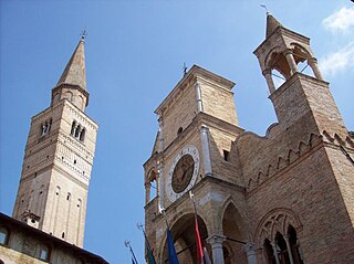
Pordenone is the main comune of Pordenone province of northeast Italy in the Friuli-Venezia Giulia region.
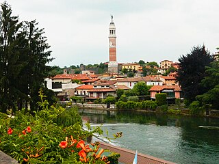
Palazzolo sull'Oglio is a city and comune in the Province of Brescia, in the region of Lombardy in northern Italy. It is located south of Lake Iseo, bordering the Province of Bergamo, and has a population of 20,208. It is the fifth largest city in the Province, after Brescia, Desenzano del Garda, Montichiari and Lumezzane.

Aviano is a town and comune in the province of Pordenone at the foot of the Dolomites mountain range in Friuli-Venezia Giulia, northern Italy.

Grado is a town and comune of 8 064 residents in the north-eastern Italian region of Friuli-Venezia Giulia, located on an island and adjacent peninsula of the Adriatic Sea between Venice and Trieste. The territory of the municipality of Grado extends between the mouth of the Isonzo and the Adriatic Sea and the lagoon of the same name which covers an area of about 90 square kilometers and goes from Porto Buso to Fossalon. Characteristic of the lagoon is the presence of the casoni, which are simple houses with thatched roof used in the past by the fishermen of Grado, who remained in the lagoon for a long time, returning to the island of Grado only during the colder period of the year.

Carsoli is a town and comune in the province of L'Aquila, Abruzzo. The ancient Roman city lies 4 kilometres (2.5 mi) southwest of the modern town.
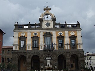
Nepi is a town and comune in the province of Viterbo, Lazio, central Italy. The town lies 30 kilometres (19 mi) southeast of the city of Viterbo and about 13 kilometres (8 mi) southwest from Civita Castellana.
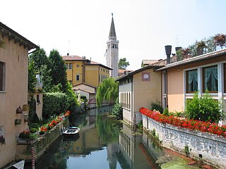
Sacile is a town and comune in the province of Pordenone, in the Friuli-Venezia Giulia region of northeastern Italy. It is known as the "Garden of the Serenissima" after the many palaces that were constructed along the river Livenza for the nobility of the Most Serene Republic of Venice.

Spilimbergo is a town with a population of 11,635 located northeast of Venice in the province of Pordenone in Friuli-Venezia Giulia, northern Italy. The town is notable as the home of the Mosaic School of Friuli, which was founded in 1922 and has students from all over the world.

Portogruaro is a town and comune in the Metropolitan City of Venice, Veneto, northern Italy. The city is the centre of a district, made up of 11 comuni, which form the Venezia Orientale with the San Donà di Piave district.

Tolmezzo is a town and comune in the province of Udine, part of the autonomous Friuli-Venezia Giulia region of north-eastern Italy.
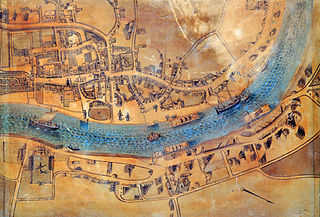
Latisana is a town and comune in the province of Udine, in the Friuli-Venezia Giulia region of north-eastern Italy, on the Tagliamento river.

Cervignano del Friuli is a comune in the province of Udine, Italy. It is the most important town of Bassa Friulana. It lies at about 12 kilometres (7 mi) from the Laguna di Grado and at about 18 kilometres (11 mi) from the Adriatic Sea; from the point of view of viability, its position is peculiar since it lies at the junction of the SS14, linking Venice to Trieste, and the SS352, linking Udine to Grado. Nevertheless, it is in Cervignano that the railroad from Austria, passing through Tarvisio and Udine, ends, and is linked to the one from Venice to Trieste.

Codroipo is a comune (municipality) in the Italian region Friuli-Venezia Giulia, located about 70 kilometres (43 mi) northwest of Trieste and about 20 kilometres (12 mi) southwest of Udine.
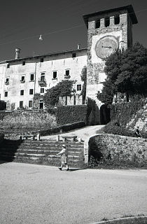
Colloredo di Monte Albano is a comune (municipality) in the Italian region Friuli-Venezia Giulia, located about 80 kilometres (50 mi) northwest of Trieste and about 14 kilometres (9 mi) northwest of Udine.
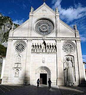
Gemona del Friuli is a comune (municipality) in the Province of Udine in the Italian region Friuli-Venezia Giulia, located about 90 kilometres (56 mi) northwest of Trieste and about 25 kilometres (16 mi) northwest of Udine.

Moggio Udinese is a comune (municipality) in the Province of Udine in the Italian region Friuli-Venezia Giulia.

Venzone is a comune (municipality) in the Province of Udine in the Italian region of Friuli-Venezia Giulia.
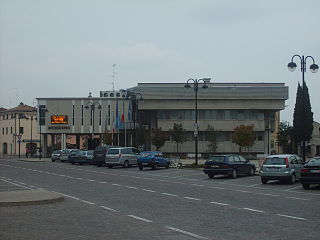
Cordenons is a comune (municipality) in the Province of Pordenone in the Italian region Friuli-Venezia Giulia, located about 90 kilometres (56 mi) northwest of Trieste and about 4 kilometres (2.5 mi) northeast of Pordenone. As of 31 December 2004, it had a population of 17,738 and an area of 56.8 square kilometres (21.9 sq mi).

