Taylors is a census-designated place (CDP) in Greenville County, South Carolina, United States. The population was 23,222 at the 2020 census. It is part of the Greenville–Mauldin–Easley Metropolitan Statistical Area.
Floyd Dale, shown on federal maps as Floydale, is an unincorporated community and census-designated place (CDP) in Dillon County, South Carolina, United States. It was first listed as a CDP in the 2020 census with a population of 421.
Pauline is an unincorporated community and census-designated place (CDP) in Spartanburg County, South Carolina, United States. It was first listed as a CDP in the 2020 census with a population of 209.
Glenn Springs is an unincorporated community and census-designated place (CDP) in Spartanburg County, South Carolina, United States located at a spring. It was first listed as a CDP in the 2020 census with a population of 263.
Grandy is an unincorporated community and census-designated place (CDP) in Currituck County, North Carolina, USA. It was first listed as a CDP in the 2020 census with a population of 2,776. It is located along US 158 between the Currituck Sound and the North River.
Beech Island is an unincorporated community and census-designated place (CDP) in Aiken County, South Carolina, United States. It was first listed as a CDP in the 2020 census with a population of 1,421.

Linville is an unincorporated community and census-designated place (CDP) in Avery County, North Carolina, United States. It was first listed as a CDP in the 2020 census with a population of 283. Centered just south of US 221 and NC 105, the community is known as a summer mountain resort and host of the Grandfather Mountain Highland Games, the largest modern Highland games events in North Carolina.
Long Creek is an unincorporated community and census-designated place (CDP) in western Oconee County, South Carolina, United States. It was first listed as a CDP in the 2020 census with a population of 96.

Green Sea is an unincorporated community and census-designated place (CDP) in Horry County, South Carolina, United States, near the city of Loris. It was first listed as a CDP in the 2020 census with a population of 105.

Hamer is an unincorporated community and census-designated place (CDP) in Dillon County, South Carolina, United States. It was first listed as a CDP in the 2020 census with a population of 820.
De Soto is a census-designated place and unincorporated community in Clarke County, Mississippi, United States.
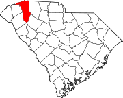
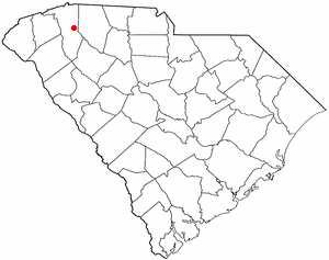
Caesars Head is an unincorporated community and census-designated place (CDP) on top of Caesars Head, a mountain in Greenville County, South Carolina, United States. It was first listed as a CDP in the 2020 census with a population of 84.
Dacusville is a small unincorporated community and census-designated place (CDP) in Pickens County, South Carolina, United States. It is best known for its tractor show once a year in the month of September. The community also has an elementary school and a middle school. It was first listed as a CDP in the 2020 census with a population of 399.
Little Rock is an unincorporated community and census-designated place (CDP) in Dillon County, South Carolina, United States. Per the 2020 census, the population was 658.

Seabrook is an unincorporated community and census-designated place (CDP) located in Beaufort County, South Carolina, United States. It was first listed as a CDP in the 2020 census with a population of 1,255.
Good Pine is an unincorporated community and census-designated place (CDP) in La Salle Parish, Louisiana, United States. It was first listed as a CDP in the 2020 census with a population of 259.
Ashwood is an unincorporated community and census-designated place (CDP) in Lee County, South Carolina, United States. It was first listed as a CDP prior to the 2020 census which showed a population of 116.
Olympia is an urban unincorporated area and census-designated place (CDP) in Richland County, South Carolina, United States. It was first listed as a CDP prior to the 2020 census with a population of 1,087.
The Cliffs Valley is a resort community and census-designated place (CDP) in Greenville County, South Carolina, United States. It was first listed as a CDP prior to the 2020 census with a population of 736.