Waterloo is a city in the Canadian province of Ontario. It is one of three cities in the Regional Municipality of Waterloo. Waterloo is situated about 94 km (58 mi) southwest of Toronto. Due to the close proximity of the city of Kitchener to Waterloo, the two together are often referred to as "Kitchener–Waterloo" or the "Twin Cities".

Cambridge is a city in the Regional Municipality of Waterloo, Ontario, Canada, located at the confluence of the Grand and Speed rivers. The city had a population of 138,479 as of the 2021 census. Along with Kitchener and Waterloo, Cambridge is one of the three core cities of Canada's tenth-largest metropolitan area.

Elmira is the largest community in the township of Woolwich, Ontario, Canada. It is 15 kilometres (9 mi) north of the city of Waterloo near the Regional Municipality of Waterloo's northern border with Wellington County. The community was listed in the 2016 Canadian census as having a population of 10,161.

The Township of Woolwich is a rural township in Southwestern Ontario, Canada, considered as a municipality. The Township is located in the northeast part of Waterloo Region and is made up of 10 small communities, with Elmira, Ontario the largest and St. Jacobs, Ontario the second largest. The population at the time of the 2016 Census was 25,006, up slightly from the 2011 population of 23,145. Waterloo Region is still home to the largest population of Old Order Mennonites in Canada, particularly in the areas around St Jacobs and Elmira. They are often seen on the local roads using their traditional horse and buggy transportation; many also use horses to pull the implements in their farm fields.
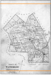
Waterloo County, created in 1853 and dissolved in 1973, was the forerunner of the Regional Municipality of Waterloo in Ontario, Canada. Situated on a subset of land within the Haldimand Tract, the traditional territory of the Attawandaron, Anishinaabe and Haudenosaunee peoples, Waterloo County consisted of five townships: Woolwich, Wellesley, Wilmot, Waterloo, and North Dumfries. The major population centres were Waterloo, Kitchener, Preston, Hespeler, Blair, and Doon in Waterloo township; Galt in North Dumfries; Elmira in Woolwich; and New Hamburg in Wilmot. All are now part of the Regional Municipality.

The Township of Wellesley is the rural, north-western township of the Regional Municipality of Waterloo in Ontario, Canada. It encompasses 277.79 km2 (107.26 sq mi) and had a population of 11,260 in the Canada 2016 Census.

West Montrose is an unincorporated rural community in Woolwich Township in the Regional Municipality of Waterloo, Ontario, Canada. As of the 2016 census, the population of the community was 257.

St. Jacobs is a community and former village located in the township of Woolwich in Waterloo Region, Ontario, just north of the city of Waterloo. It is a popular location for tourism, due to its quaint village appearance, retail focus and Mennonite heritage. Waterloo Region is still home to the largest population of Old Order Mennonites in Canada, particularly in the areas around St Jacobs and Elmira. They are often seen on the local roads using their traditional horse and buggy transportation; many also use horses to pull the implements in their farm fields.
Conestoga originally referred to the Conestoga people, an English name for the Susquehannock people of Pennsylvania.

New Hamburg is a community of approximately 11,953 in the township of Wilmot, Ontario, Canada. It is in the far western part of the Regional Municipality of Waterloo, near the regional border with Perth County. It is adjacent to the community of Baden, which sits to its east and is also a part of the township of Wilmot. The nearest cities are Kitchener, Waterloo, and Stratford.

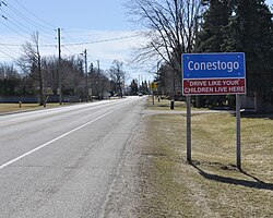
The Conestogo River is a river in Waterloo Region and Wellington County in Southwestern Ontario, Canada. The river was named by Mennonite settlers after the Conestoga River in Pennsylvania. In the 1800s there were several different spellings of the name of the river and of the nearby settlement of Conestogo, Ontario but the name ending in "o" became official.

Preston is a community in Cambridge, Ontario, Canada in the Regional Municipality of Waterloo, Ontario. Prior to 1973 it was an independent town, incorporated in 1915, but amalgamation with the town of Hespeler, Ontario, the city of Galt, Ontario and the village of Blair formed the new municipality of Cambridge. Parts of the surrounding townships were also included. No population data is available for the former Preston since the Census reports cover only the full area of Cambridge, though the combined population of the census tracts covering the majority of Preston reported a population of 20,008 as of the 2016 Canada Census. The first mayor of Cambridge was Claudette Millar.
New Dundee is a small community of 1,119 people at the time of the 2016 Census, in the township of Wilmot, Ontario, Canada. It is located southwest of Kitchener.

The village of Hawkesville in Ontario, Canada is a small community in the township of Wellesley in the Regional Municipality of Waterloo. Several Mennonite families are located nearby. Hawkesville is noted for its custom-built furniture industry.

The community of Ayr, Ontario, Canada is located within the Township of North Dumfries in the Regional Municipality of Waterloo in Southwestern Ontario. Ayr is located south of Kitchener and west of Cambridge.
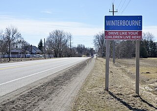
Winterbourne is a village located to the east of the Grand River in the township of Woolwich, Ontario in the Regional Municipality of Waterloo. It is located just northeast of the city of Waterloo. The fine stonework of the Scottish stonemasons can be seen in many of the older buildings throughout the settlement.

Breslau is a community located within the township of Woolwich, part of the Waterloo Regional Municipality in Ontario Canada. Separated from the city of Kitchener by the Grand River, Breslau is named after the former German city of Breslau, now Wrocław, capital of Poland's Lower Silesia.

Floradale is an unincorporated rural community in Southwestern Ontario, Canada. It is part of the township of Woolwich in the Regional Municipality of Waterloo. The community is located 5 kilometres to the north of the town of Elmira, Ontario and 20 kilometres to the north of the city of Waterloo, Ontario. The Canagagigue Creek, a tributary of the Grand River, flows through the village. The community is located in an area where there is an historically large settlement of Old Order Mennonites noted for their traditional customs, dress, and use of horse and buggies.

Hespeler is a neighbourhood and former town within Cambridge, Ontario, located along the Speed River in the Regional Municipality of Waterloo, Ontario, Canada. In 1973, Hespeler, Preston, Galt, and the hamlet of Blair were amalgamated in 1973 to form the City of Cambridge. The first mayor of Cambridge was Claudette Millar.

Doon is a suburban community and former village which is now a part of the city of Kitchener, Ontario, Canada. Doon was settled around 1800 by German Mennonites from Pennsylvania, and after 1830 by Scottish immigrants. The area is located at the confluence of Schneider Creek and the Grand River. The post office was opened in 1845. A large flour mill, oatmeal mill, distillery and sawmill were built on the Doon River over the following years. The Perine brothers established extensive linen works and flax mills near the settlement. By 1870, there was a single church, Presbyterian, a variety of tradesmen and a population of 200.