Gamlingay is a village and civil parish in the South Cambridgeshire district of Cambridgeshire, England about 14 miles (23 km) west southwest of the county town of Cambridge.

Eynesbury is an urban area forming part of St Neots, in the civil parish of St Neots, in the Huntingdonshire district, in the county of Cambridgeshire, England. It mainly consists of housing, although there is an area of light industry, and a large supermarket. Eynesbury is home to Ernulf Academy and a fitness centre called One Leisure. In addition there is a large area of open grassland and a caravan park. In earlier times Eynesbury was a distinct area, but nowadays it is considered to be a subdivision of St Neots.

Haddenham is a village and civil parish in west Buckinghamshire, England. It is about 5 miles (8 km) south-west of Aylesbury and 4 miles (6 km) north-east of Thame in neighbouring Oxfordshire. At the 2011 Census, the population of the civil parish was 4,502.

Thornborough is a village and civil parish in north Buckinghamshire, England, around 2 miles (3.2 km) east of Buckingham.

Hemingford Grey is a village and civil parish in Cambridgeshire, England. Hemingford Grey lies approximately 4 miles (6 km) east of Huntingdon. Hemingford Grey is situated within Huntingdonshire which is a non-metropolitan district of Cambridgeshire as well as being a historic county of England.
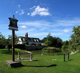
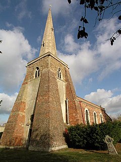
Comberton is a village and civil parish in South Cambridgeshire, England, just east of the Prime Meridian.

Boxworth is a village in South Cambridgeshire, situated about eight miles to the north-west of Cambridge. It falls under the Papworth Everard and Caxton ward and lies within the diocese of Ely. The village covers an area of 1,053 ha. Boxworth is a relatively small village, with around 100 houses.
Balsham is a rural village and civil parish in the county of Cambridgeshire, England, which has much expanded since the 1960s and is now one of several dormitory settlements of Cambridge. The village is south east of the centre of Cambridge beyond the A11 road and near Newmarket and Haverhill where many residents work and shop.
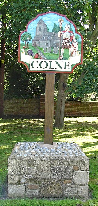
Colne is a village and civil parish in Cambridgeshire, England. Colne lies about 9 miles (14 km) east of Huntingdon; the villages of Bluntisham, Woodhurst, and Somersham are close by. Colne is situated within Huntingdonshire which is a non-metropolitan district of Cambridgeshire as well as being a historic county of England.
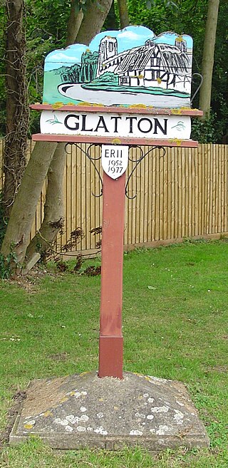
Glatton is a village and civil parish in Cambridgeshire, England, some 8 miles (13 km) south-west of Peterborough, near the villages of Conington, Yaxley and Stilton. It lies in the non-metropolitan district of Huntingdonshire, which is part of Cambridgeshire as well as being a historic county. A World War II airfield built nearby is now known as Peterborough's Conington Airport.
Ashley is a village and civil parish in the East Cambridgeshire district of Cambridgeshire, England, about 4 miles (6.4 km) east of Newmarket. The modern village consists of the two ancient parishes of Ashley and Silverley. Ashley covers 2,250 acres (910 ha) and in the 2011 census had a population of 749. Ashley is in the electoral area of Cheveley ward.

Barton Bendish is a civil parish and small ancient village in the English county of Norfolk located 10 miles (16 km) south of King's Lynn and 90 miles (140 km) North East of London. It has two medieval parish churches, and once had three. The parish includes the old hamlet of Eastmoor, and covers 3,936 acres (1,593 ha). The village has been settled since Neolithic times and was expanded during the Saxon period. Today the village has a population of 210 as recorded at the 2010 census and contains eight listed buildings, with the two medieval parishes churches being Grade I.

Conington is an English village and civil parish in the Cambridgeshire district of Huntingdonshire. Conington lies about 10 km south of Peterborough and 3 km north of Sawtry. It is within earshot of the A1(M), part of the Great North Road, which follows the course of the Roman Ermine Street. Conington lies within Huntingdonshire, which is a non-metropolitan district of Cambridgeshire and one of the historic counties of England.

Croxton is a village and civil parish about 13 miles (21 km) west of Cambridge in South Cambridgeshire, England. In 2001, the resident population was 163 people, falling slightly to 160 at the 2011 Census. Croxton Park is to the south of the current village and contains a large house and parkland.
Old Malden is a ward of the Royal Borough of Kingston upon Thames in south London, 10 miles (16 km) south west of Charing Cross.
Frensham is a village in Surrey, England, next to the A287 road, 13 miles (20.9 km) WSW of Guildford, the county town. Frensham lies on the right bank of the River Wey, only navigable to canoes, shortly before its convergence with the north branch. Farnham is the nearest town, 3.5 miles (5.6 km) to the north.
Elm is a village and civil parish in the Fenland District of Cambridgeshire, England. In Domesday, it is called Helle.
Bourn is a small village and civil parish in South Cambridgeshire, England. Surrounding villages include Caxton, Eltisley and Cambourne. It is 8 miles (12 km) from the county town of Cambridge. The population of the parish was 1,015 at the time of the 2011 census.
Papworth St Agnes is a village and civil parish in South Cambridgeshire, England. The population of the village is included in the civil parish of Graveley It has also been known as Papworth Magna, to distinguish it from the adjoining Papworth Everard and Papworth Parva. The name of the village does not come from any church of St Agnes, but from a certain Agnes de Papewurda, c1160.
Pondersbridge is a village in Whittlesey civil parish, part of the Fenland district of Cambridgeshire, England. Pondersbridge is essentially a settlement which has built up around the river crossing, situated on an artificial drainage cutting called Bevill's Leam. The banks of Bevill's Leam form a strong visual boundary. The older settlement has been extended on the Main Road, north-wards by the local authority housing. The settlement has very limited services and a sporadic development pattern. The main part of Pondersbridge is contained within a triangle of roads - the B1040, the B1095 and The Drove.