
U.S. Route 202 (US 202) is a spur route of US 2. It follows a northeasterly and southwesterly direction stretching from Delaware in the south to Maine in the north and traveling through the states of Pennsylvania, New Jersey, New York, Connecticut, Massachusetts, and New Hampshire. The highway has borne the number 202 since at least 1936. Before this, sections of the highway were designated U.S. Route 122, as it intersected US 22 in New Jersey. It intersects its parent route, US 2, in Bangor, Maine.

Route 15 is a state highway in the U.S. state of Connecticut that runs 83.53 miles (134.43 km) from a connection with New York's Hutchinson River Parkway in Greenwich, Connecticut, to its northern terminus intersecting with Interstate 84 (I-84) in East Hartford, Connecticut. Route 15 consists of four distinct sections: the Merritt Parkway, the Wilbur Cross Parkway, most of the Berlin Turnpike, and part of the Wilbur Cross Highway. The unified designation was applied to these separate highways in 1948 to provide a continuous through route from New York to Massachusetts. The parkway section of Route 15 is often referred to locally as "The Merritt".
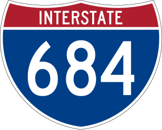
Interstate 684 (I-684) is a 28.53-mile (45.91 km) auxiliary Interstate Highway in the state of New York in the United States. There is also a short portion in Connecticut with no junctions. The highway connects I-84 with I-287 and the Hutchinson River Parkway, primarily serving commuter traffic to and from the northern suburbs of the New York metropolitan area. Most of the route is in northern Westchester County. The route of the highway was originally designated as part of I-87 from 1968 to 1970. The first section of the roadway opened to traffic in October 1968, and the final segment was completed in December 1974.
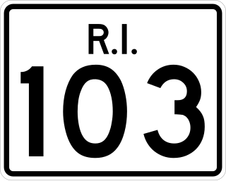
Route 103 is a numbered state highway running 11.8 miles (19.0 km) in Rhode Island, United States. It runs from Interstate 195 (I-195) in East Providence to the Massachusetts state line in the town of Warren, where the road continues as Massachusetts Route 103. Route 103 is a major commercial corridor in East Providence.

New Hampshire Route 119 is a state highway in the U.S. state of New Hampshire. The highway begins in Hinsdale at the Connecticut River, across which the highway continues into Brattleboro, Vermont, as Vermont Route 119 for 0.080 miles (0.129 km) to its terminus at VT 142. NH 119 heads east 39.908 miles (64.226 km) to the Massachusetts state line in New Ipswich, where the highway continues as Massachusetts Route 119. The state highway is the main east–west highway of southern Cheshire County, where it connects the towns of Hinsdale, Winchester, Richmond, Fitzwilliam, and Rindge.

Route 4 is an east–west primary state highway connecting rural Litchfield County to the Greater Hartford area of the U.S. state of Connecticut. It runs 46.72 miles (75.19 km) from the town of Sharon to the town of West Hartford.

New York State Route 35 (NY 35) is the principal east–west highway in the northern part of Westchester County, New York, carrying average daily volumes of around 16,500 vehicles. Its western terminus is at US 9 in Peekskill, while its eastern terminus is at the Connecticut state line in Lewisboro, where it becomes that state's Route 35.

New York State Route 343 (NY 343) is a state highway located entirely within central Dutchess County, in the Hudson Valley region of the U.S. state of New York. It runs east–west from the intersection of NY 82 in the village of Millbrook to the town of Amenia, where it crosses the Connecticut state line and continues eastward as Route 343, a Connecticut state highway located entirely within the town of Sharon. Along the way, it has a 7.3-mile (11.7 km) concurrency with NY 22 from vicinity of the hamlet of Dover Plains to the hamlet of Amenia.

Massachusetts Route 32 is a state highway in the U.S. state of Massachusetts. The highway runs 60.66 miles (97.62 km) from the Connecticut state line north to the New Hampshire state line, where it continues as NH 32. Route 32 connects several towns on the eastern edge of Western Massachusetts. The highway serves Palmer in eastern Hampden County, Ware in eastern Hampshire County, and Barre and Athol in northwestern Worcester County. Route 32 intersects major east–west routes including U.S. Route 20 and the Massachusetts Turnpike in Palmer, Route 9 in Ware, and US 202 and Route 2 in Athol. The highway has an alternate route, Route 32A, through Hardwick and Petersham.

New York State Route 116 (NY 116) is an east–west state highway in Westchester County, New York, in the United States. It extends for 8.12 miles (13.07 km) from an intersection with U.S. Route 202 (US 202) in the town of Somers to the Connecticut state line, where it becomes that state's Route 116. As it heads east, NY 116 connects to Interstate 684 (I-684) and has an overlap with NY 121. NY 116 originally extended as far west as Peekskill when it was assigned as part of the 1930 renumbering of state highways in New York. It was cut back to its current length in the late 1930s.

New York State Route 120A (NY 120A) is a state highway in southern Westchester County, New York, in the United States. It serves as an alternate route to the southern half of NY 120 running along the New York–Connecticut state line. The southern terminus of the route is at NY 120 in Harrison. Its northern terminus is at NY 120 in North Castle. Most of the 8.55-mile (13.76 km) route straddles the New York–Connecticut state line, and part of the route is physically located in Connecticut. However, this part of the highway is not recognized by Connecticut as "Route 120A", and is considered to be part of NY 120A by the New York State Department of Transportation (NYSDOT).

Connecticut Route 10 is a state highway that runs from Interstate 95 (I-95) in New Haven Massachusetts state line, where it continues as Massachusetts Route 10, which in turn continues directly to New Hampshire Route 10.

Route 45 is a Connecticut state highway from US 202 in Washington to US 7 in Cornwall, in the rural northwest of the state. It is 10.29 miles (16.56 km) long and runs north–south.

Route 47 is a Connecticut state highway from US 6 in Woodbury to US 202 in Washington, in the western south-central part of the state. It is 12.27 miles (19.75 km) long and runs roughly northwest-southeast, signed north–south.

U.S. Route 202 (US 202) is a part of the U.S. Highway System that runs from New Castle, Delaware, to Bangor, Maine. In the U.S. state of New York, US 202 extends 55.57 miles (89.43 km) from the New Jersey state line near Suffern to the Connecticut state line east of Brewster. While most of US 202 is signed north–south, the portion within New York is signed east–west. It drifts north slowly as it crosses southern New York. US 202 is the only road to cross New York between New Jersey and Connecticut and not pass through New York City on the way.
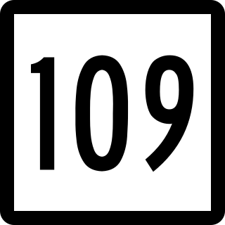
Route 109 is a state highway in western Connecticut, running from New Milford to Thomaston.
In Connecticut, U.S. Route 202 is usually signed as an east–west route. It enters from the New York state line in Danbury overlapped with U.S. Route 6 and ends at the Massachusetts state line in Granby overlapped with Route 10. Although the route serves no major city centers for most of its run, with the largest city being Danbury, it does pass through Hartford County, serving the northern fringe of Greater Hartford. US 202 is overlapped with other routes for most of its length.

Route 185 is a Connecticut state highway in the western Hartford suburbs, running from Simsbury to West Hartford.

Route 372 is a 14.95-mile (24.06 km) state highway in Hartford and Middlesex counties in central Connecticut, United States, running from Plainville to Cromwell, and serving to communicate between the numerous freeways in the area. The section of Route 372 from Route 10 in Plainville to the Plainville-New Britain town line is designated the Joseph E. Tinty Memorial Highway. The section of Route 372 from the interchange with Route 72 in New Britain to the intersection with Route 71A and SR 571 in Berlin is designated the Polish Legion of American Veterans Memorial Highway.

U.S. Route 44 (US 44) is an east–west United States Numbered Highway that runs for 237 miles (381 km) through four states in the Northeastern United States. The western terminus is at US 209 and New York State Route 55 (NY 55) in Kerhonkson, New York, a hamlet in the Hudson Valley region. The eastern terminus is at Route 3A in Plymouth, Massachusetts.


