
The European Centre for Medium-Range Weather Forecasts (ECMWF) is an independent intergovernmental organisation supported by most of the nations of Europe. It is based at three sites: Shinfield Park, Reading, United Kingdom; Bologna, Italy; and Bonn, Germany. It operates one of the largest supercomputer complexes in Europe and the world's largest archive of numerical weather prediction data.

The National Oceanic and Atmospheric Administration is a Washington, D.C.–based scientific and regulatory agency within the United States Department of Commerce, a United States federal government department. The agency is charged with forecasting weather, monitoring oceanic and atmospheric conditions, charting the seas, conducting deep sea exploration, and managing fishing and protection of marine mammals and endangered species in the U.S. exclusive economic zone.

A weather satellite or meteorological satellite is a type of Earth observation satellite that is primarily used to monitor the weather and climate of the Earth. Satellites can be polar orbiting, or geostationary.

The Meteorological Office, abbreviated as the Met Office, is the United Kingdom's national weather service. It is an executive agency and trading fund of the Department for Science, Innovation and Technology and is led by CEO Penelope Endersby, who took on the role as Chief Executive in December 2018 and is the first woman to do so. The Met Office makes meteorological predictions across all timescales from weather forecasts to climate change.
The Earth Observing System (EOS) is a program of NASA comprising a series of artificial satellite missions and scientific instruments in Earth orbit designed for long-term global observations of the land surface, biosphere, atmosphere, and oceans. Since the early 1970s, NASA has been developing its Earth Observing System, launching a series of Landsat satellites in the decade. Some of the first included passive microwave imaging in 1972 through the Nimbus 5 satellite. Following the launch of various satellite missions, the conception of the program began in the late 1980s and expanded rapidly through the 1990s. Since the inception of the program, it has continued to develop, including; land, sea, radiation and atmosphere. Collected in a system known as EOSDIS, NASA uses this data in order to study the progression and changes in the biosphere of Earth. The main focus of this data collection surrounds climatic science. The program is the centrepiece of NASA's Earth Science Enterprise.

The European Organisation for the Exploitation of Meteorological Satellites (EUMETSAT) is an intergovernmental organisation created through an international convention agreed by a current total of 30 European Member States.
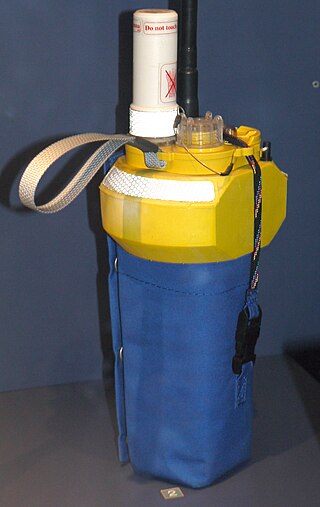
Argos is a global satellite-based system that collects, processes, and disseminates environmental data from fixed and mobile platforms around the world. The worldwide tracking and environmental monitoring system is the results from Franco-American cooperation. In addition to satellite data collection, the main feature of the Argos system is its to ability to geographically locate the data source from any location on Earth using the Doppler effect; which refers to the apparent change in the wavelength due to relative motion between its source and observer. Argos is operated by CLS/Argos, based in Toulouse, France, and its United States subsidiary, CLS America.
The Global Earth Observation System of Systems (GEOSS) was built by the Group on Earth Observations (GEO) on the basis of a 10-Year Implementation Plan running from 2005 to 2015. GEOSS seeks to connect the producers of environmental data and decision-support tools with the end users of these products, with the aim of enhancing the relevance of Earth observations to global issues. GEOSS aims to produce a global public infrastructure that generates comprehensive, near-real-time environmental data, information and analyses for a wide range of users. The Secretariat Director of Geoss is Barbara Ryan.

The India Meteorological Department (IMD) is an agency of the Ministry of Earth Sciences of the Government of India. It is the principal agency responsible for meteorological observations, weather forecasting and seismology. IMD is headquartered in Delhi and operates hundreds of observation stations across India and Antarctica. Regional offices are at Chennai, Mumbai, Kolkata, Nagpur, Guwahati and New Delhi.

The National Polar-orbiting Operational Environmental Satellite System (NPOESS) was to be the United States' next-generation satellite system that would monitor the Earth's weather, atmosphere, oceans, land, and near-space environment. NPOESS satellites were to host proven technologies and operational versions of sensors that were under operational-prototyping by NASA, at that time. The estimated launch date for the first NPOESS satellite, "C1" or "Charlie 1" was around 2013. Issues with sensor developments were the primary cited reason for delays and cost-overruns.
The Global Climate Observing System (GCOS) was established in 1992 as an outcome of the Second World Climate Conference, to ensure that the observations and information needed to address climate-related issues are obtained and made available to all potential users. The GCOS is co-sponsored by the World Meteorological Organization (WMO), the Intergovernmental Oceanographic Commission (IOC) of UNESCO, the United Nations Environment Programme (UNEP), and the International Council for Science (ICSU). In order to assess and monitor the adequacy of in-situ observation networks as well as satellite-based observing systems, GCOS regularly reports on the adequacy of the current climate observing system to the United Nations Framework Convention on Climate Change (UNFCCC), and thereby identifies the needs of the current climate observing system.

Copernicus is the Earth observation component of the European Union Space Programme, managed by the European Commission and implemented in partnership with the EU Member States, the European Space Agency (ESA), the European Organisation for the Exploitation of Meteorological Satellites (EUMETSAT), the European Centre for Medium-Range Weather Forecasts (ECMWF), the Joint Research Centre (JRC), the European Environment Agency (EEA), the European Maritime Safety Agency (EMSA), Frontex, SatCen and Mercator Océan.

Metop is a series of three polar-orbiting meteorological satellites developed by the European Space Agency (ESA) and operated by the European Organisation for the Exploitation of Meteorological Satellites (EUMETSAT). The satellites form the space segment component of the overall EUMETSAT Polar System (EPS), which in turn is the European half of the EUMETSAT / NOAA Initial Joint Polar System (IJPS). The satellites carry a payload comprising 11 scientific instruments and two which support Cospas-Sarsat Search and Rescue services. In order to provide data continuity between Metop and NOAA Polar Operational Environmental Satellites (POES), several instruments are carried on both fleets of satellites.
The European Union Space Programme is an EU funding programme established in 2021 along with its managing agency, the European Union Agency for the Space Programme, in order to implement the pre-existing European Space Policy established on 22 May 2007 when a joint and concomitant meeting at the ministerial level of the Council of the European Union and the Council of the European Space Agency, known collectively as the European Space Council, adopted a Resolution on the European Space Policy. The policy had been jointly drafted by the European Commission and the Director General of the European Space Agency. This was the first common political framework for space activities established by the European Union (EU).
The Himawari geostationary satellites, operated by the Japan Meteorological Agency (JMA), support weather forecasting, tropical cyclone tracking, and meteorology research. Most meteorological agencies in East Asia, Southeast Asia, Australia and New Zealand use the satellites for their own weather monitoring and forecasting operations.

The Croatian Meteorological and Hydrological Service is a public entity for meteorology, hydrology and air quality in Croatia.

The Joint Polar Satellite System (JPSS) is the latest generation of U.S. polar-orbiting, non-geosynchronous, environmental satellites. JPSS will provide the global environmental data used in numerical weather prediction models for forecasts, and scientific data used for climate monitoring. JPSS will aid in fulfilling the mission of the U.S. National Oceanic and Atmospheric Administration (NOAA), an agency of the Department of Commerce. Data and imagery obtained from the JPSS will increase timeliness and accuracy of public warnings and forecasts of climate and weather events, thus reducing the potential loss of human life and property and advancing the national economy. The JPSS is developed by the National Aeronautics and Space Administration (NASA) for the National Oceanic and Atmospheric Administration (NOAA), who is responsible for operation of JPSS. Three to five satellites are planned for the JPSS constellation of satellites. JPSS satellites will be flown, and the scientific data from JPSS will be processed, by the JPSS – Common Ground System (JPSS-CGS).
ScatSat-1 was a satellite providing weather forecasting, cyclone prediction, and tracking services to India. It has been developed by ISRO Satellite Centre, Bangalore whereas its payload was developed by Space Applications Centre, Ahmedabad. The satellite carries a Ku-band scatterometer similar to the Oceansat-2 which became dysfunctional after its life span of four-and-a-half years. India was dependent on NASA's ISS-RapidScat for prediction of cyclone forecasting and weather prediction. The data generated by this mini-satellite are used by National Aeronautics and Space Administration (NASA), European Organisation for the Exploitation of Meteorological Satellites (EUMETSAT) and National Oceanic and Atmospheric Administration (NOAA).
The domain of international space politics gained significant traction during the Cold War. This was largely fuelled by the ongoing space race between the USA and the USSR. At this time in history, space exploration was an endeavour largely restricted to the global superpowers and seemed out of reach for many smaller, developing, nations to actively participate in. Subsequently, public concerns for the cost of research and development into novel space technologies did not receive sufficient policy and academic attention in Africa. As the Cold War reached its conclusion, political power began to diffuse across the world, and this led to many smaller nation states developing national and regional space capabilities. In the context of Africa, Nigeria, Algeria, Egypt and South Africa were the front-runners in terms of investments into space-related research and development.

The Space for Climate Observatory, or SCO, is an international initiative launched in 2019 to combat and adapt to the impacts of climate change using satellite data.
