
Suriname, officially the Republic of Suriname, is a country in northern South America, sometimes considered part of the Caribbean and the West Indies. Situated slightly north of the equator, over 90% of its territory is covered by rainforests, the highest proportion of forest cover in the world. Suriname is bordered by the Atlantic Ocean to the north, French Guiana to the east, Guyana to the west, and Brazil to the south. It is the smallest country in South America by both population and territory, with around 612,985 inhabitants in an area of approximately 163,820 square kilometers. The capital and largest city is Paramaribo, which is home to roughly half the population.
Commewijne is a district of Suriname, located on the right bank of the Suriname River. Commewijne's capital city is Nieuw Amsterdam. Tamanredjo is another major town, while Meerzorg is the most populated.

Saramacca is a district of Suriname, in the north. Saramacca's capital city is Groningen, with other towns and cities including Batavia, Kampong Baroe, Uitkijk, Maho and Boskamp. Saramacca has a population of 17,480 and an area of 3,636 km2.
The Kwinti are a Maroon people, descendants of runaway African slaves, living in the forested interior of Suriname on the bank of the Coppename River, and the eponymous term for their language, which has fewer than 300 speakers. Their language is an English-based creole with Dutch, Portuguese and other influences. It is similar to the languages spoken by the Aluku and Paramaccan Maroons, and split from Sranan Tongo in the middle 18th century. The Kwinti had a population of about 300 in 2014 and adhere to the Moravian Church.
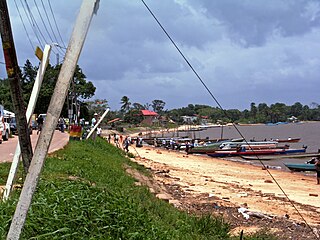
Albina is a town in eastern Suriname, and is capital of the Marowijne District. The town lies on the west bank of the Marowijne river, which forms the border with French Guiana, directly opposite the French Guianan town of Saint-Laurent-du-Maroni, to which it is connected by a frequent ferry service. Albina can be reached by bus via the East-West Link. The distance between Paramaribo and Albina is about 150 kilometres (95 mi).
Corneliskondre is a village in Suriname, located in the Boven Coppename resort of Sipaliwini District. It has a population of 70 as of 2020, and is inhabited by indigenous people of the Kalina tribe.
Jenny is a town on the East-West Link in Suriname, located in the Welgelegen resort of Coronie district. It lies on the mouth of the Coppename River opposite the town of Boskamp, to which it is linked by the Coppename bridge.

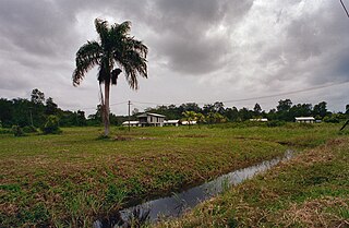
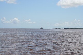
Nieuw Amsterdam is the capital of the Commewijne District in Suriname. It is a small coastal town situated at the confluence of the Suriname River and Commewijne River, just across from Paramaribo, the country's capital. Its population at the 2012 census was 5,650, with around 1,200 people living in the main town, most of whom are of Javanese and East Indian origin. It is the location of the historical Fort Nieuw-Amsterdam, today an open-air museum. The town of Mariënburg with former sugarcane factory is located 3 km from Nieuw Amsterdam and part of the resort.

Batavia on the Coppename River in Suriname is a former cocoa plantation, military post and state leper colony of the Dutch colonists. Batavia functioned as a leper colony from 1824 to 1897, after which the location was completely abandoned. Since 2001 it has been redeveloped as a place of pilgrimage and tourism.
Witagron is a Kwinti village in Suriname on the Coppename River at the crossing of the Southern East-West Link from Paramaribo to Apoera in West-Suriname.
Nieuw Jacobkondre is a town in the Sipaliwini District of Suriname. It is situated on the Saramacca River. The village is inhabited by Matawai people.

Boskamp is a town on the East-West Link in Suriname, in the central north of the country, in the Calcutta resort of the Saramacca District. It lies opposite to Jenny, to which it is connected via the Coppename bridge. Boskamp is mainly a fishing village.

Welgelegen is a resort in Suriname, located in the Coronie District. Its population at the 2012 census was 593. Welgelegen started as a cotton plantation in 1824. The church of Welgelegen was consecrated on 1 November 1883, but wasn't built at the spot. It was first erected on Cardross Park, and later moved to its current location. The church is no longer in service.

Kabalebo is a resort in Suriname, located in the Sipaliwini District. Its population at the 2012 census was 2,291.
Boven Saramacca is a resort in Suriname, located in the Sipaliwini District. Its population at the 2012 census was 1,427. The dominant geographical feature of this resort is the Saramacca River. The resort is mainly inhabited by Maroons of the Matawai tribe.

Boven Coppename is a resort in Suriname, located in the Sipaliwini District. Its population at the 2012 census was 539. The resort is mainly inhabited by indigenous people of the Tiriyó, and Maroons of the Kwinti tribe. The main village is Bitagron. Other villages include Corneliskondre and Donderskamp.

The Jules Wijdenbosch Bridge, also called Suriname bridge and known locally as Bosje Brug, is a bridge over the Suriname River between the capital city Paramaribo and Meerzorg in the Commewijne District. The bridge is part of the East-West Link, and is named after former president Jules Wijdenbosch. Constructed by Dutch constructor Ballast-Nedam, the bridge has two lanes, is 1504 metres long, and was opened on 20 May 2000.
The (northern) East-West Link is a road in Suriname between Albina in the eastern part of the country to Nieuw Nickerie in the western part, via the capital city of Paramaribo. The southern East-West Link connects Paramaribo with Apoera via Bitagron. Construction of the road link started in the 1960s.

South Drain, also Zuiddrain, is a town in western Suriname. Since the pavement of 32 kilometres (20 mi) road section to Nieuw Nickerie, it is the final destination of the northern East-West Link. The European Union funded the reconstruction, which started in 2007, with 13.2 million euro. The section was opened on 30 April 2010. There is a jeep trail between South Drain and Apoera, connecting the Northern East-West Link with the Southern East-West Link. Contrary to earlier plans, the pavement of this road is not imminent.
The Berbice Bridge is a pontoon bridge over the Berbice River near New Amsterdam in Guyana. The bridge is tolled and was opened on 23 December 2008.

