Tournafulla, or Toornafulla, is a village in the southwest of County Limerick, Ireland. Tournafulla is a long single-street village. It has a Catholic church, a primary school, three pubs, a community hall and a GAA pitch. As of the 2016 census, the village had a population of 144 people.

Cill Charthaigh is a Gaeltacht village on the R263 regional road in the south west of County Donegal in Ireland. It is also a townland of 233 acres and a civil parish in the historic barony of Banagh.

Slieverue, officially Slieveroe, is a village in South County Kilkenny, Republic of Ireland. It is located in the historical barony of Ida. Despite the name, the land is relatively low-lying and fertile. Slieverue's population, as of the 2016 census, was 476.
Bayside is a small modern residential suburb on the Northside of Dublin, Ireland, commenced in 1967.

Carrickmore is a village in County Tyrone, Northern Ireland. It is situated in the historic barony of Omagh East, the civil parish of Termonmaguirk and the Roman Catholic Parish of Termonmaguirc between Cookstown, Dungannon and Omagh. It had a population of 612 in the 2001 Census. In the 2011 Census 2,330 people lived in the Termon Ward, which covers the Carrickmore and Creggan areas.

Ballymoyer or Ballymyre is a civil parish in the historic barony of Fews Upper, County Armagh, Northern Ireland, 3 miles north-east of Newtownhamilton.

Tydavnet, officially Tedavnet , is a village in northern County Monaghan, Ireland, and also the name of the townland and civil parish in which the village sits. Both the Church of Ireland and Catholic church have Tydavnet named as a parish and in both cases, the geographical area is almost identical. The village is located on the R186 regional road.
Séamus Turlough McElwaine was a volunteer in the South Fermanagh Brigade of the Provisional Irish Republican Army (IRA) during The Troubles who was shot dead by the British Army.
Sheskin, traditionally divided into Sheskinmor and Sheskinbeg, is a townland in the north of County Monaghan in Ireland. It is in the foothills of Sliabh Beagh. Sheskin is part of the civil parish of Tydavnet, situated about 3 miles from the village of Scotstown and about 8 miles from Monaghan town. Sheskin is straddled in the east by the River Blackwater and in the south by one of its tributaries, which converge at the south eastern corner of the townland.

Scotstown is a village in the townland of Bough in north County Monaghan, Ireland. Scotstown is located in the parish of Tydavnet, along the Monaghan Blackwater, Scotstown being the village closest to the river's source. Scotstown is centred in the townland of Bough, but extends into Carrowhatta, Teraverty, Drumdesco and Stracrunnion townlands.

Naul, is a village, townland, and civil parish at the northern edge of Fingal and the traditional County Dublin in Ireland. The Delvin River to the north of the village marks the county boundary with County Meath. Naul civil parish is in the historic barony of Balrothery West.
Knockatallon or Knockatallan is a hamlet and townland in the north of County Monaghan in Ireland, being located in the parish of Tydavnet. The Roman Catholic parish church is located in the village of Tydavnet itself. Knockatallan is located to the west of Sheskin. The Knockatallan name is also used by locals to refer to a larger area including several other townlands such as Knockacullion and Corlat.

Kilmovee is a village and civil parish in County Mayo, Ireland. It is a mainly rural parish on the R325 road, midway between Kilkelly and Ballaghaderreen.
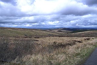
Slieve Beagh is a mountainous area straddling the border between County Monaghan in the Republic of Ireland and County Fermanagh and County Tyrone in Northern Ireland. A point just east of its summit is the highest point in Monaghan; however the true summit is on the Fermanagh-Tyrone border. The point where the three counties meet, is referred to as the "Three County Hollow".

The Parish of Drumholm is a parish in the Roman Catholic Diocese of Raphoe. It is also a civil parish, with the variant spelling of Drumhome, in the barony of Tirhugh, County Donegal in Ireland. The parish contains all the land between the large towns of Ballyshannon and Donegal Town, including the small villages of Laghey, Ballintra and Rossnowlagh and the hamlet of Bridgetown. The parish has two Catholic primary schools: St Ernan's National School in Ballintra and St Eunan's National School in Laghey. The current parish priest is Fr Seamus Dagens, who succeeded Fr Daniel McBrearty in 2007. Drumholm is also a parish for the Church of Ireland and a civil parish.
Currow is a rural village in County Kerry in south west Ireland, located approximately 12 km from Killarney and 18 km from Tralee. Currow is situated on the Brown Flesk River, a tributary of the River Maine.
Templeglantine, officially Templeglentan, is a village in west County Limerick, Ireland between Newcastle West and Abbeyfeale on the N21 national primary route – the main road from Limerick to Tralee. The village is approximately 55 kilometres southwest Limerick City and roughly 45 kilometres east of Tralee. Templeglantine is often simply referred to as 'Glantine' by natives and other west Limerick locals.
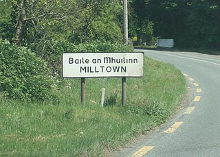
Milltown is a village in County Kildare, Ireland. The village is in the townland of the same name in the civil parish of Feighcullen It is 7km from the town of Newbridge. It is on the R415 regional road between Allenwood and Crookstown.
Maghera is a parish in County Londonderry, Northern Ireland. It is bordered by the parishes of Ballynascreen, Ballyscullion, Desertmartin, Dungiven, Kilcronaghan, Killelagh, Magherafelt, Tamlaght O'Crilly, and Termoneeny. As a civil parish it lies within the former barony of Loughinsholin and as an ecclesiastical parish it lies within the Church of Ireland Diocese of Derry and Raphoe.

Scotstown GAA is a Gaelic football and ladies' football club in Scotstown, County Monaghan, Ireland which represents the parish of Tydavnet.


