Related Research Articles

Liathach is a mountain in the Torridon Hills, in the Northwest Highlands of Scotland. It stands between Loch Torridon and the neighbouring mountain Beinn Eighe. The mountain is a ridge running east–west, with several peaks, and its upper half is made up of many steep rocky terraces. The highest peak is the Munro of Spidean a' Choire Lèith at 1,055 metres (3,461 ft) high. The other Munro peak is Mullach an Rathain at 1,024 metres (3,360 ft) high.

An Teallach is a mountain group in Wester Ross, in the Northwest Highlands of Scotland. It lies west of Dundonnell Forest, north of Loch na Sealga, and south of Little Loch Broom. Its highest peaks are the Munros of Bidean a' Ghlas Thuill at 1062 m, and Sgùrr Fiona at 1058 m.

Sgùrr Mòr is the highest of the nine Munros in the mountain range known as the Fannichs in northern Scotland. This range is located between Loch Fannich and the A835 Ullapool road — a remote area with few habitations, but these Munros, which are usually climbed in groups or occasionally in a single hike, are mostly gentle sloped and fairly accessible from either of these locations. If approached from Loch Fannich, a bicycle or permission to drive on the private road would be helpful.
In mathematics, variational perturbation theory (VPT) is a mathematical method to convert divergent power series in a small expansion parameter, say
Arqiva is a British telecommunications company which provides infrastructure, broadcast transmission and smart meter facilities in the United Kingdom. The company is headquartered at the former Independent Broadcasting Authority headquarters at Crawley Court in the village of Crawley, Hampshire, just outside Winchester. Its main customers are broadcasters and utility companies, and its main asset is a network of circa. 1,500 radio and television transmission sites. It is owned by a consortium of investors led by Digital 9 Infrastructure and the Australian investment house Macquarie Bank. Arqiva is a patron of the Radio Academy.

Cairn Toul is the fourth-highest mountain in Scotland and all of the British Isles, after Ben Nevis, Ben Macdui and Braeriach. The summit is 1,291 metres above sea level. It is in the western massif of the Cairngorms, linked by a bealach at about 1125 m to Braeriach. The mountain towers above the Lairig Ghru pass.
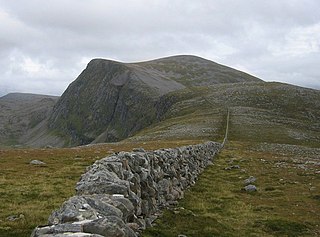
Beinn Dearg is a mountain in the Inverlael area of the Highlands of Scotland. It is most frequently climbed by following the River Lael up Gleann na Sguaib. Starting from near the head of Loch Broom, a path follows the glen to a bealach, which is about 1 kilometre (0.62 mi) north of the summit. From this bealach, the neighbouring peaks of Cona' Mheall and Meall na Ceapraichean may also be climbed. Eididh nan Clach Geala, which lies about 3 kilometres (1.9 mi) north of Beinn Dearg, is also added in to complete a round of four Munros.

New Aberdour is a small planned village in the Aberdour parish of Aberdeenshire, Scotland, situated south of Aberdour Bay on the Moray Firth. It lies 7 miles (11 km) west of Fraserburgh. One of the earliest churches in Scotland is said to have been founded here in 580 AD by Saint Drostan and Saint Columba.

The Quiraing is a landslip on the eastern face of Meall na Suiramach, the northernmost summit of the Trotternish on the Isle of Skye, Scotland. The whole of the Trotternish Ridge escarpment was formed by a great series of landslips; the Quiraing is the only part of the slip still moving – the road at its base, near Flodigarry, requires repairs each year.

The A415 is a British A road which runs from the A4074 at Berinsfield, Oxfordshire (51.6591°N 1.1762°W), to Witney (51.7852°N 1.4965°W), passing through Abingdon, Marcham and Kingston Bagpuize. It crosses the River Thames twice, at Abingdon Bridge and Newbridge.

Sgurr a' Choire Ghlais is a mountain in the North-west Highlands of Scotland. It lies between Glen Strathfarrar and Glen Orrin and it is an excellent viewpoint, being the highest mountain in its group - a group which includes the Munros of Sgurr na Ruaidhe, Sgurr Fhuar-thuill and Carn nan Gobhar. Northwards there is no higher ground apart from the Fannichs.

Scolty Hill is a small hill south of the Deeside town, Banchory. Its best known feature is the 20m tall tower monument, built in 1840 as a memorial to General William Burnett who fought alongside Wellington. The tower was restored in 1992 and a viewing platform added by the Rotary Club of Banchory-Ternan. It enjoys splendid views over Banchory, the Dee Valley and the Grampian Mountains, which surround the hill. This encourages thousands of visitors each year. It is popular for tourists, locals and mountain bikers.
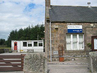
Netherley, Scotland is a village in Aberdeenshire, situated approximately five miles northwest of Stonehaven. Netherley is located in the Mounth area of the Grampian Highlands. At the eastern edge of Netherley is a significant wetland bog known as Red Moss. To the southwest of Netherley lie Meikle Carewe Hill and Curlethney Hill. At the south edge of Netherley is the peak of Craggie Cat.

Dubford is a small village in northern coastal Aberdeenshire, Scotland. Dubford is situated along the B9031 road approximately 6 kilometres (3.7 mi) east of Macduff, south of Gardenstown. There is evidence of prehistoric man in the vicinity of Dubford, notably from the nearby Longman Hill and Cairn Lee ancient monuments.

Beinn Bhrotain or Ben Vrottan is a Scottish mountain in the Cairngorms range, 18 kilometres west of Braemar in the county of Aberdeenshire.

The Alberta–British Columbia foothills forests are a temperate coniferous forests ecoregion of Western Canada, as defined by the World Wildlife Fund (WWF) categorization system. This ecoregion borders Canada's taiga and contains a mix of subarctic forest and temperate forest species as a result. This makes the region an ecotone region, or a region that acts as a buffer between two other biomes.

Monadh Mòr is a mountain in the Cairngorms region of the Highlands of Scotland. A pass connects it with Beinn Bhrotain.

Chicabal is a 2,720 metres (8,920 ft) inactive volcano in the Quetzaltenango department of Guatemala. Its edifice has a volume of 12 km3 (2.9 cu mi). The volcano has a crater lake, Chicabal Lake, and is constructed within a collapse scar that may have been the consequence of a failure of a previous edifice. It is associated with Santa Maria volcano.
Chorley Rural District was a rural district in the administrative county of Lancashire, England from 1894 to 1974.
Ralaniten is an N-terminal domain antiandrogen which was never marketed. It is a derivative of bisphenol A and one of the four stereoisomers of EPI-001. A prodrug of ralaniten, ralaniten acetate (EPI-506), was under development for the treatment of prostate cancer.
References
- ↑ United Kingdom Ordnance Survey Map, Landranger, 1:50,000 (2004)
57°02′15″N2°39′33″W / 57.0375°N 2.6591°W
| | This Aberdeenshire location article is a stub. You can help Wikipedia by expanding it. |