Cottesmore, Rutland

Last updated

Cottesmore
Cottesmore St Nicholas.JPG
St Nicholas' Church, Cottesmore
Rutland UK location map.svg
Red pog.svg
Cottesmore
Location within Rutland
Area3.91 sq mi (10.1 km2)  [1]
Population2,062 Including Barrow, Rutland. 2011 Census [2]
  Density 596/sq mi (230/km2)
OS grid reference SK904136
  London 87 miles (140 km) SSE
Unitary authority
Shire county
Ceremonial county
Region
Country England
Sovereign state United Kingdom
Post town OAKHAM
Postcode district LE15
Dialling code 01572
Police Leicestershire
Fire Leicestershire
Ambulance East Midlands
UK Parliament
List of places
UK
England
Rutland
52°43′N0°40′W / 52.71°N 0.66°W / 52.71; -0.66 Coordinates: 52°43′N0°40′W / 52.71°N 0.66°W / 52.71; -0.66
Village sign in Cottesmore UK Cottesmore (Rutland).jpg
Village sign in Cottesmore

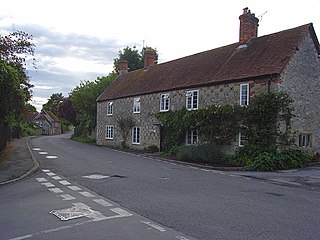
Cottesmore (often pronounced Cotts'more) is a village and civil parish in the north of the county of Rutland in the East Midlands of England. In terms of population it is the largest village in Rutland, and the third-largest settlement after Oakham and Uppingham. This is due in part to the presence of Kendrew Barracks (formerly RAF Cottesmore).

Contents

The village's name means 'moor of Cott'. [3]

At the time of Edward the Confessor (mid 11th century), "Manors Cottesmore" was held, together with Greetham, by Saxon called Goda. Goda held 12 carucates of land, three of which were held in tax to the Danegeld. The King held three carucates in demesne and three socmen with 40 villeins and six bordarii held 20 carucates. Of the land held by the manor, one Goisfridus held half a carucate; he had one plough and eight villeins. Cottesmore also had 40 acres (160,000 m2) of meadow and a wood measuring a mile in length by seven furlongs in breadth.

St Nicholas' Church, Cottesmore is a Grade II* listed building. [4] The north aisle forms a RAF chapel, dedicated in 1949 to those who gave their lives while serving at RAF Cottesmore. A stained glass window was erected to the memory of Major General George Williams Knox CB (1838 - 1894). The colours of the 1st Battalion Scots Guards were gifted to the church by his widow and hang in the nave. [5] [6] The Cottesmore Benefice is part of the North Rutland Churches group. [7]

There are two primary schools in the parish: St Nicholas C of E (Aided) Primary School is in the village and Cottesmore Academy is on the military base.

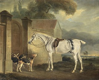
The Cottesmore Hunt takes its name from the village (although the kennels are not now in the parish). Sir William Lowther, 1st Earl of Lonsdale brought the foxhounds he had bought from Thomas Noel to Cottesmore in 1740.

Three ships of the Royal Navy have been named HMS Cottesmore after the Cottesmore hunt. Prince Andrew, Duke of York commanded the minesweeper HMS Cottesmore (M32) from April 1993 until November 1994 and visited the village with members of his crew.

See also

Related Research Articles

Hadlow Human settlement in England

Hadlow is a village in the borough of Tonbridge and Malling in Kent, England. It is situated in the Medway valley, north-east of Tonbridge and south-west of Maidstone.

Biddestone Human settlement in England

Biddestone is a village and civil parish in northwest Wiltshire, England, about 3 miles (5 km) west of Chippenham and 2 miles (3.2 km) north of Corsham. The parish includes the smaller settlement of Slaughterford.

Cottesmore may refer to:

Ketton Human settlement in England

Ketton is a village and civil parish in Rutland in the East Midlands of England. It is about 8 miles (13 km) east of Oakham and 3 miles (5 km) west of Stamford, Lincolnshire. The 2011 Census recorded a parish population of 1,926, making it the fourth largest settlement in Rutland, after Oakham, Uppingham and Cottesmore.

Market Overton Human settlement in England

Market Overton is a village on the northern edge of the county of Rutland in the East Midlands of England. The population of the civil parish was 494 at the 2001 census, increasing to 584 at the 2011 census.

Barnardiston Human settlement in England

Barnardiston is a village and civil parish in the West Suffolk district of Suffolk, England. The village is located about four miles north-east of Haverhill off the A143.

Worthington, Leicestershire Village in Leicestershire, England

Worthington is a village and civil parish in North West Leicestershire, England, about 4 miles (6.4 km) north of the town of Coalville and a similar distance north-east of the market town of Ashby-de-la-Zouch. The population of the civil parish at the 2011 census was 1,461. The village is about 5 miles (8 km) from East Midlands Airport and junction 23a of the M1 motorway where it meets the A42 road. The parish also includes the hamlet of Newbold.

Lubenham

Lubenham is a small rural village and civil parish 2 miles (3.2 km) west of the market town of Market Harborough, in the Harborough district, in the south of Leicestershire, England. The first National Hunt Chase Challenge Cup was held in Lubenham, on the grounds of what is now Thorpe Lubenham Hall. Lubenham Parish extends to Gartree in the north and Bramfield Park in the west. The village appears in four entries in the Domesday Book.

Frinsted Human settlement in England

Frinsted or Frinstead is a small village and civil parish in the ecclesiastical parish of Wormshill and in the Maidstone District of Kent, England. and has been a recorded settlement as far back as the Domesday Book and indeed was the only settlement in the surrounding area to be described at the time to have a church. The village exists in the Hundred of Eyhorne.

West Peckham Human settlement in England

West Peckham is a village and civil parish in the borough of Tonbridge and Malling in Kent, England. The River Bourne flows through the extreme west of the parish, and formerly powered a paper mill and corn mill. The Wateringbury Stream rises in the parish. Oxon Hoath is the former manor house of West Peckham.

Shenington Human settlement in England

Shenington is a village about 5 miles (8 km) west of Banbury in the United Kingdom. It was an exclave of Gloucestershire until the Counties Act 1844 transferred it to Oxfordshire. Shenington is on Oxfordshire's boundary with Warwickshire. Shenington was an ancient parish of 1,628 acres (659 ha). It is now part of the civil parish of Shenington with Alkerton.

Wingfield, Wiltshire Human settlement in England

Wingfield is a small village and civil parish in the county of Wiltshire, England, about 2.5 miles (4.0 km) south of Bradford-on-Avon and 2.2 miles (3.5 km) west of Trowbridge.

Skipwith Village and civil parish in North Yorkshire, England

Skipwith is a village and civil parish about 4 miles (6.4 km) north-east of Selby and 10 miles (16 km) south-east of York in the Selby District of North Yorkshire, England. Until the 1974 local government reorganisation Skipwith was part of the East Riding of Yorkshire.

Hinton Waldrist Human settlement in England

Hinton Waldrist is a village and civil parish in the Vale of White Horse, England. It was part of Berkshire until the 1974 boundary changes transferred it to Oxfordshire. The village is between Oxford and Faringdon, 9 miles (14 km) southwest of Oxford. The parish includes the hamlet of Duxford. The 2011 Census recorded the parish's population as 328.

Cottesmore Hunt Foxhound pack in Cottesmore, Britain

The Cottesmore Hunt, which hunts mostly in Rutland, is one of the oldest foxhound packs in Britain. Its name comes from the village of Cottesmore where the hounds were kennelled.

Fifield Bavant Human settlement in England

Fifield Bavant is a small village and former civil parish in Wiltshire, England, about 6 miles (10 km) southwest of Wilton, midway between Ebbesbourne Wake and Broad Chalke on the north bank of the River Ebble.

Steeple Langford Human settlement in England

Steeple Langford is a village and civil parish in the English county of Wiltshire, 6 miles (10 km) northwest of Wilton. It has also been called Great Langford or Langford Magna. The village lies on the north bank of the River Wylye, and is bypassed to the north by the A36 Warminster-Salisbury trunk road which follows the river valley.

Waithe Hamlet and civil parish in the East Lindsey district of Lincolnshire, England

Waithe is a hamlet and civil parish in the East Lindsey district of Lincolnshire, England. It is on the A16, 1 mile (1.6 km) south from Holton-le-Clay and 1 mile (1.6 km) north from North Thoresby.

St Nicholas Church, Cottesmore Church in Cottesmore, Rutland

St Nicholas' Church is a church in Cottesmore, Rutland. It is a Grade II* listed building.

St Nicholas Church, Thistleton Church in Thistleton, Rutland

St Nicholas' Church is a church in Thistleton, Rutland, England. It is a Grade II* listed building.

References

  1. "A vision of Britain through time". University of Portsmouth. Retrieved 7 February 2009.
  2. "Rutland Civil Parish Populations" (PDF). Rutland County Council. 2001. Archived from the original (PDF) on 12 October 2007. Retrieved 7 February 2009.
  3. "Key to English Place-names".
  4. Historic England. "Church of St Nicholas, Cottesmore (Grade II*) (1073252)". National Heritage List for England . Retrieved 1 December 2018.
  5. Ross, David. "Cottesmore, St Nicholas Church". Britainexpress.com. Retrieved 13 December 2018.
  6. "Cottesmore Church Dedicated to St. Nicholas". Thelivingvillage.co.uk. Retrieved 13 December 2018.
  7. "Cottesmore Benefice Churches - Home Page". northrutlandchurches.org.uk. Retrieved 1 July 2017.