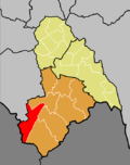
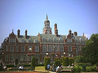
The London Borough of Croydon is a London borough in south London, part of Outer London. It covers an area of 87 km2 (33.6 sq mi). It is the southernmost borough of London. At its centre is the historic town of Croydon from which the borough takes its name; while other urban centres include Coulsdon, Purley, South Norwood, Norbury, New Addington and Thornton Heath. Croydon is mentioned in Domesday Book, and from a small market town has expanded into one of the most populous areas on the fringe of London. The borough is now one of London's leading business, financial and cultural centres, and its influence in entertainment and the arts contribute to its status as a major metropolitan centre. Its population is 386,710, making it the second largest London borough and fifteenth largest English district.

Wimbledon is a constituency represented in the House of Commons of the UK Parliament. Since 2005, the seat has been represented by Stephen Hammond of the Conservatives.
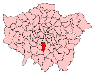
Croydon Central is a constituency created in 1974 and is represented in the House of Commons of the UK Parliament since 2017 by Labour MP Sarah Jones. The seat bucked the trend in national results in 2019, with Labour holding the seat well.

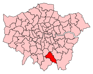
Croydon South is a constituency created in 1974 and represented in the House of Commons of the UK Parliament since 2015 by Chris Philp, a Conservative.
Streatham is a constituency represented in the House of Commons of the UK Parliament since 2019 by Bell Ribeiro-Addy of the Labour Party.
The County Borough of Croydon was a local government district in and around the town of Croydon in north east Surrey, England from 1889 to 1965. Since 1965 the district has been part of the London Borough of Croydon within Greater London.
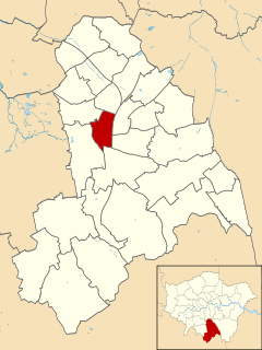
Fairfield is a ward in the London Borough of Croydon, covering most of the Croydon area of London in the United Kingdom. The ward currently forms part of the Croydon Central parliamentary constituency, except for a small area near West Croydon station which is part of the Croydon North constituency. The population of the ward at the 2011 Census was 16,569.

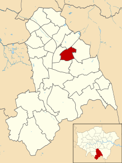
Broad Green is a ward in the London Borough of Croydon, London in the United Kingdom, covering the West Croydon area. Broad Green locality is divided between this ward and Selhurst ward.

Addiscombe West is a ward in the London Borough of Croydon, covering much of the Addiscombe and East Croydon areas of London in the United Kingdom. It extends from East Croydon railway station towards Woodside Green but does not actually cover the retail centre of Addiscombe, which was in the neighbouring Ashburton ward, the Western half of which is a key component of the new Addiscombe East (ward).
Addiscombe East is a ward in the London Borough of Croydon, in London in the United Kingdom. The ward replaced the former Ashburton Ward, which covered the Ashburton area, as well as covering the main retail area of Addiscombe, the Stroud Green, Tollgate and Longheath Garden estates, and large parts of northern Shirley. The population of the former ward at the 2011 Census was 14,721.

Bensham Manor is a ward in the London Borough of Croydon, covering part of the Thornton Heath area of London in the United Kingdom. The ward extends from Thornton Heath railway station westwards and is largely residential with a retail or industrial core. The population of the Ward at the 2011 Census was 16,201.

Old Coulsdon is a ward in the London Borough of Croydon, covering part of the Coulsdon area of London in the United Kingdom. The ward currently forms part of Chris Philp MP's Croydon South constituency. At the 2011 Census the population of the former Coulsdon East Ward was 12,244.

Coulsdon Town is a ward in the London Borough of Croydon, covering part of the Coulsdon area of London in the United Kingdom. The ward currently forms part of Chris Philp MP's Croydon South constituency, which has one of the highest majority's for the Conservative Party in London. At the 2011 Census the population of Coulsdon West ward was 13,449. The ward largely replaced the Coulsdon West ward following boundary changes for the 2018 election.
South Croydon is a ward in the London Borough of Croydon, London in the United Kingdom, covering part of the Croham Hurst and South Croydon.

New Addington North is a ward in the London Borough of Croydon, covering part of the New Addington estate in London in the United Kingdom. The ward currently forms part of the Croydon Central constituency. The population of the Fieldway ward at the 2011 Census was 11,479.
The 1964 Croydon Council election took place on 7 May 1964 to elect members of Croydon London Borough Council in London, England. The whole council was up for election and the council went into no overall control.

Addiscombe was a ward in the London Borough of Croydon, covering much of the Addiscombe and East Croydon areas of London in the United Kingdom. It extended from East Croydon railway station towards Woodside Green but did not actually cover the retail centre of Addiscombe, which was in the neighbouring Ashburton ward.

Coulsdon East was a ward in the London Borough of Croydon, covering part of the Coulsdon area of London in the United Kingdom. The ward formed part of Chris Philp MP's Croydon South constituency. At the 2011 Census the population of the Ward was 12,244.

Fieldway was a ward in the London Borough of Croydon, covering part of the New Addington estate in London in the United Kingdom. The ward formed part of the Croydon Central constituency. The population of the ward at the 2011 Census was 11,479.
Ashburton was a ward in the London Borough of Croydon, in London in the United Kingdom. The ward covered the Ashburton area, as well as covering the main retail area of Addiscombe, the Stroud Green, Tollgate and Longheath Garden estates, and large parts of northern Shirley. The population of the ward at the 2011 Census was 14,721.