
Cowichan IR No. 1
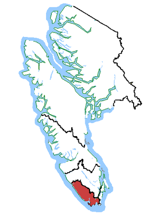
Location of Cowichan IR No. 1 in British Columbia
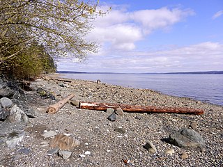
Cowichan Indian Reserve No. 1 is an Indian reserve in British Columbia, located south of the city of Duncan.
Cowichan Indian Reserve No. 1 is an Indian reserve in British Columbia, located south of the city of Duncan.
Coordinates: 48°45′14″N123°34′34″W / 48.754°N 123.576°W
| | This article about a location in British Columbia, Canada is a stub. You can help Wikipedia by expanding it. |

Duncan is a city on southern Vancouver Island in British Columbia, Canada. It is the smallest city by area in Canada. It was incorporated in 1912.

Cowichan Bay is a bay and community located on the east coast of southern Vancouver Island near Duncan, in British Columbia. The mouth of the Cowichan River is near Cowichan Bay. Mount Tzouhalem and its hiking trails and ecological reserve stands to the north. The bay is known for its fishing and scenic value. The area's main industries are fishing and tourism.
Saltair is an unincorporated community with a population of 2,325 on the east coast of Vancouver Island, British Columbia, Canada, or the Georgia Strait. It is a predominantly rural community located between the urban centers of Ladysmith and Chemainus. Saltair is within the Cowichan Valley Regional District. It is home to a number of parks: Stocking Creek Park, Diana, Princess of Wales Wilderness Park, and Saltair Centennial Park. In part, Saltair is a community of artists, scenery and farmland. It provides panoramic ocean and mountain views and a rural ambiance its residents treasure. Community news and updates can be found on Saltair websites. The area is served by the coast-spanning Island Highway and the Island Rail Corridor.
Esquimalt—Juan de Fuca is a former federal electoral district in the province of British Columbia, Canada, which was represented in the House of Commons of Canada from 1988 to 2015

The Cowichan River is a Canadian Heritage River on Vancouver Island, in British Columbia, Canada. Its headwater is Cowichan Lake. The river flows east over Skutz Falls and through Marie Canyon towards its mouth at Cowichan Bay. The river's drainage basin is 795 square kilometres (307 sq mi) in size.
Thetis Island is an island and unincorporated community off the coast of British Columbia, Canada, lying between Vancouver Island, which is to the west across Stuart Channel, and the west from the north tip of Galiano Island, from which it is separated by Trincomali Channel. With its immediate southern neighbour Penelakut Island, it is one of the Gulf Islands. Thetis island is 2,560 acres (1,036 ha) in size. It is approximately two miles wide and three miles long north to south. Two north to south land ridges define the east and west sides of the island. Burchell Hill is 503 feet above sea level, and forms the high point on the west side of Thetis island, and Moore Hill is 511 feet above sea level, and forms the high point ridge on the east side of the island

The BC Forest Discovery Centre, located in Duncan, chronicles the history of logging in British Columbia, Canada. It is a 100-acre (40 ha) site with 2.5 km of operational 3 ft narrow gauge railway.
Malahat is an unincorporated area in the Cowichan Valley, with municipal-type services delivered by the Cowichan Valley Regional District. What could be considered the hub of the community is a small collection of businesses that includes the Malahat Gas station and the Malahat Chalet and the Moon Water Lodge.

The Musqueam Indian Band is a First Nations band government in the Canadian province of British Columbia. It is the only First Nations band whose reserve community lies within the boundaries of the City of Vancouver.

Cowichan River Provincial Park is a provincial park on Vancouver Island in British Columbia, Canada. It includes the Cowichan River in a 750-hectare area stretching almost 20 kilometres, from the village of Lake Cowichan to Glenora, just south of Duncan. Its paths are part of the Trans Canada Trail
Bamberton is an industrial site located on the Saanich Inlet, just south of Mill Bay, around 45k kilometres north of Victoria on Vancouver Island.
Westholme is a community located in the Chemainus River Valley alongside the Island Highway, between Chemainus and Duncan in British Columbia, Canada. It is part of the Chemainus Land District in the District Municipality of North Cowichan. Westholme is one of the original settlements on Vancouver Island. Once a thriving mining and farming community, it is now filled with hobby farms and upscale private estates on large acreages, many of which are owned to this day by the descendants of original settlers to this area.
The Stone First Nation or Yunesitʼin First Nation is a band government of the Yunesit'in subgroup of the Tsilhqot'in people, whose territory is the Chilcotin District in the western Central Interior region of the Canadian province of British Columbia. It is a member of the Tsilhqot'in Tribal Council. The people of the Stone First Nation are known as the Yunesit'in in the Chilcotin language.
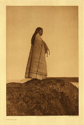
Cowichan Tribes is the band government of the Cowichan, a group of Coast Salish peoples who live in the Cowichan Valley region on Vancouver Island. With over 3,800 registered members, it is the single largest First Nations band in British Columbia.
Marie Canyon is a canyon on the Cowichan River, just below Skutz Falls, on southern Vancouver Island, British Columbia, Canada.
The Nazko First Nation is a First Nations government of the Dakelh people in the north-central Interior of British Columbia. Its reserves are located around the community of Nazko, British Columbia, which is 120 km west of Quesnel and southwest of Prince George.
Sansum Narrows is a strait or channel between Vancouver Island (W) and Saltspring Island (E) in the Southern Gulf Islands region of British Columbia, Canada. The narrows are between Maple Bay and Tl’ulpalus.
The Tseycum First Nation is a First Nations government located on Vancouver Island. In the 1850s they were signatories to the Douglas Treaties.

Cowichan was a steamship which was operated in British Columbia under the ownership of the Union Steamship Company. Cowichan sank in 1925 following a collision with another ship.
Koksilah is a community located just southeast of the City of Duncan, British Columbia, Canada. Its name is derived, via that of the Koksilah River, from that of the Hwulqwselu people, one of the Hunqinum-speaking peoples of the area today organized as the Cowichan Tribes and government.