Mount Shasta is a potentially active volcano at the southern end of the Cascade Range in Siskiyou County, California. At an elevation of 14,179 feet, it is the second-highest peak in the Cascades and the fifth-highest in the state. Mount Shasta has an estimated volume of 85 cubic miles, which makes it the most voluminous stratovolcano in the Cascade Volcanic Arc. The mountain and surrounding area are part of the Shasta–Trinity National Forest.
Landforms are categorized by characteristic physical attributes such as their creating process, shape, elevation, slope, orientation, rock exposure, and soil type.

Mount Adams, known by some Native American tribes as Pahto or Klickitat, is a potentially active stratovolcano in the Cascade Range. Although Adams has not erupted in more than 1,000 years, it is not considered extinct. It is the second-highest mountain in Washington, after Mount Rainier.

In geology and physical geography, a plateau, also called a high plain or a tableland, is an area of a highland consisting of flat terrain that is raised sharply above the surrounding area on at least one side. Often one or more sides have deep hills or escarpments. Plateaus can be formed by a number of processes, including upwelling of volcanic magma, extrusion of lava, and erosion by water and glaciers. Plateaus are classified according to their surrounding environment as intermontane, piedmont, or continental. A few plateaus may have a small flat top while others have wider ones.

A ridge is a long, narrow, elevated geomorphologic landform, structural feature, or a combination of both separated from the surrounding terrain by steep sides. The sides of a ridge slope away from a narrow top, the crest or ridgecrest, with the terrain dropping down on either side. The crest, if narrow, is also called a ridgeline. Limitations on the dimensions of a ridge are lacking. Its height above the surrounding terrain can vary from less than a meter to hundreds of meters. A ridge can be either depositional, erosional, tectonic, or a combination of these in origin and can consist of either bedrock, loose sediment, lava, or ice depending on its origin. A ridge can occur as either an isolated, independent feature or part of a larger geomorphological and/or structural feature. Frequently, a ridge can be further subdivided into smaller geomorphic or structural elements.

The Garibaldi Volcanic Belt is a northwest–southeast trending volcanic chain in the Pacific Ranges of the Coast Mountains that extends from Watts Point in the south to the Ha-Iltzuk Icefield in the north. This chain of volcanoes is located in southwestern British Columbia, Canada. It forms the northernmost segment of the Cascade Volcanic Arc, which includes Mount St. Helens and Mount Baker. Most volcanoes of the Garibaldi chain are dormant stratovolcanoes and subglacial volcanoes that have been eroded by glacial ice. Less common volcanic landforms include cinder cones, volcanic plugs, lava domes and calderas. These diverse formations were created by different styles of volcanic activity, including Peléan and Plinian eruptions.

Harter Fell is a fell in the western part of the English Lake District, located between the Eskdale and Duddon valleys. Its height is 653 metres (2,142 ft) There are several walking routes to the summit.
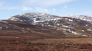
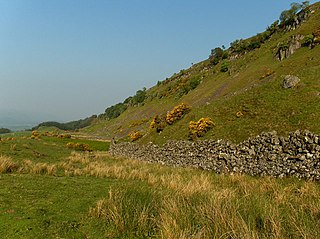
The Cheviot is an extinct volcano and the highest summit in the Cheviot Hills and in the county of Northumberland. Located in the extreme north of England, it is a 1+1⁄4-mile (2-kilometre) walk from the Scottish border and, with a height of 2,674 feet above sea-level, is located on the northernmost few miles of the Pennine Way, before the descent into Kirk Yetholm.
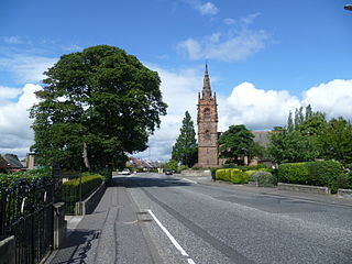
Craiglockhart is a suburb in the south west of Edinburgh, Scotland, lying between Colinton to the south, Morningside to the east Merchiston to the north east, and Longstone and Kingsknowe to the west. The Water of Leith is also to the west.
Merchiston is a residential area around Merchiston Avenue in the south-west of Edinburgh, Scotland.
Edinburgh, the capital of Scotland, is traditionally said to have been "built on Seven Hills", in an allusion to the seven hills of Rome. While there is considerable room for debate as to which hills are included and excluded from the seven, seven possibilities are listed in an old rhyme:

Hoodoo Mountain, sometimes referred to as Hoodoo Volcano, is a potentially active stratovolcano in the Northern Interior of British Columbia, Canada. It is located 25 kilometres northeast of the Alaska–British Columbia border on the north side of the Iskut River opposite of the mouth of the Craig River. With a summit elevation of 1,850 metres and a topographic prominence of 900 metres, Hoodoo Mountain is one of many prominent peaks within the Boundary Ranges of the Coast Mountains. Its flat-topped summit is covered by an ice cap more than 100 metres thick and at least 3 kilometres in diameter. Two valley glaciers surrounding the northwestern and northeastern sides of the mountain have retreated significantly over the last hundred years. They both originate from a large icefield to the north and are the sources of two meltwater streams. These streams flow along the western and eastern sides of the volcano before draining into the Iskut River.
Mount Edziza, sometimes called Edziza Mountain or Edziza Peak, is a stratovolcano in Cassiar Land District of northwestern British Columbia, Canada. It is located on the Big Raven Plateau of the Tahltan Highland which extends along the western side of the Stikine Plateau. The mountain has an elevation of 2,786 metres, making it the highest volcano of the Mount Edziza volcanic complex. However, it had an elevation of at least 3,396 metres before its original summit was likely destroyed by a violent, climactic eruption in the geologic past. Mount Edziza contains several lava domes, cinder cones and lava fields on its flanks, as well as an ice cap that is characterized by several outlet glaciers stretching out to lower altitudes. All sides of the mountain are drained by tributaries of Mess Creek and Kakiddi Creek which are situated within the Stikine River watershed.
The Edinburgh Suburban and Southside Junction Railway was a railway company that built an east-west railway on the southern margin of Edinburgh, Scotland, primarily to facilitate the operation of heavy goods and mineral traffic across the city. The line opened in 1884. Although its route was rural at the time, suburban development quickly caught up and passenger carryings on the line were buoyant; the passenger service operated on a circular basis through Edinburgh Waverley railway station.
The Gargunnock Hills are a range of hills west of the city of Stirling, Scotland. They culminate in the peak of Carleatheran, whose 485-metre (1,591 ft) summit is crowned by a trigonometrical pillar. The Gargunnock Hills are separated from the Fintry Hills to their west by the valley of the Backside Burn. To their east are the Touch Hills, whilst to the south is Carron Valley Reservoir. The hills are defined to the north by a 300-metre (980 ft) craggy escarpment overlooking the glen of the River Forth. At the foot of this scarp are the villages of Gargunnock and Kippen.

The volcanic history of the Northern Cordilleran Volcanic Province presents a record of volcanic activity in northwestern British Columbia, central Yukon and the U.S. state of easternmost Alaska. The volcanic activity lies in the northern part of the Western Cordillera of the Pacific Northwest region of North America. Extensional cracking of the North American Plate in this part of North America has existed for millions of years. Continuation of this continental rifting has fed scores of volcanoes throughout the Northern Cordilleran Volcanic Province over at least the past 20 million years and occasionally continued into geologically recent times.

The Canadian Cascade Arc, also called the Canadian Cascades, is the Canadian segment of the North American Cascade Volcanic Arc. Located entirely within the Canadian province of British Columbia, it extends from the Cascade Mountains in the south to the Coast Mountains in the north. Specifically, the southern end of the Canadian Cascades begin at the Canada–United States border. However, the specific boundaries of the northern end are not precisely known and the geology in this part of the volcanic arc is poorly understood. It is widely accepted by geologists that the Canadian Cascade Arc extends through the Pacific Ranges of the Coast Mountains. However, others have expressed concern that the volcanic arc possibly extends further north into the Kitimat Ranges, another subdivision of the Coast Mountains, and even as far north as Haida Gwaii.

The Mount Cayley volcanic field (MCVF) is a remote volcanic zone on the South Coast of British Columbia, Canada, stretching 31 km (19 mi) from the Pemberton Icefield to the Squamish River. It forms a segment of the Garibaldi Volcanic Belt, the Canadian portion of the Cascade Volcanic Arc, which extends from Northern California to southwestern British Columbia. Most of the MCVF volcanoes were formed during periods of volcanism under sheets of glacial ice throughout the last glacial period. These subglacial eruptions formed steep, flat-topped volcanoes and subglacial lava domes, most of which have been entirely exposed by deglaciation. However, at least two volcanoes predate the last glacial period and both are highly eroded. The field gets its name from Mount Cayley, a volcanic peak located at the southern end of the Powder Mountain Icefield. This icefield covers much of the central portion of the volcanic field and is one of the several glacial fields in the Pacific Ranges of the Coast Mountains.

Mount Cayley is an eroded but potentially active stratovolcano in the Pacific Ranges of southwestern British Columbia, Canada. Located 45 km (28 mi) north of Squamish and 24 km (15 mi) west of Whistler, the volcano resides on the edge of the Powder Mountain Icefield. It consists of massif that towers over the Cheakamus and Squamish river valleys. All major summits have elevations greater than 2,000 m (6,600 ft), Mount Cayley being the highest at 2,385 m (7,825 ft). The surrounding area has been inhabited by indigenous peoples for more than 7,000 years while geothermal exploration has taken place there for the last four decades.