Cranberry Lake

Last updated
Cranberry Lake (New York)
Cranberry Lake, Black Duck Hole, Wanakena, NY.jpg
Black Duck Hole, Cranberry Lake
New York Adirondack.svg
Red pog.svg
Cranberry Lake (New York)
Location within New York
Usa edcp relief location map.png
Red pog.svg
Cranberry Lake (New York)
Cranberry Lake (New York) (the United States)
Location St. Lawrence County,
New York, US
Coordinates 44°07′32″N74°53′07″W / 44.1254270°N 74.8852263°W / 44.1254270; -74.8852263 , 44°10′22″N74°49′31″W / 44.1727737°N 74.8252705°W / 44.1727737; -74.8252705 , 44°07′06″N74°53′24″W / 44.1182651°N 74.8901374°W / 44.1182651; -74.8901374
Type Reservoir
Primary inflows Oswegatchie River
(east branch)
Primary outflows Oswegatchie River
(east branch)
Basin  countries United States
Max. length8.6 mi (13.8 km)
Max. width3.8 mi (6.1 km)
Surface area6,975 acres (2,823 ha)
Average depth6 ft (1.8 m)
Max. depth38 ft (12 m)
Shore length155 mi (89 km)
Surface elevation1,480 ft (450 m)
Islands 38
Joe Indian Island, Buck Island
Settlements Cranberry Lake, Wanakena
1 Shore length is not a well-defined measure.

Cranberry Lake is on the east branch of the Oswegatchie River in the Adirondack Park in New York in the United States. It is the third largest lake in the Adirondack Park (after Lake George and the Great Sacandaga Lake). About 75 percent of the shoreline is owned by the State of New York. The 118,000-acre (480 km2) Five Ponds Wilderness Area abuts its south shore, and the Cranberry Lake Wild Forest covers much of its remaining shoreline.

Contents

Location

Most of the lake is in the eastern end of the Town of Clifton, but a small part of the east side of the lake is in the Town of Piercefield and a small part of the west side of the lake is in the Town of Fine. The lake is entirely in the south part of Saint Lawrence County, New York.

On a north arm of the lake is the community of Cranberry Lake. On a western arm of the lake in the Town of Fine, is the community of Wanakena, the location of the SUNY-ESF Ranger School.

Several islands are within the lake, the largest being Joe Indian Island and Buck Island. The Cranberry Lake Biological Station, also part of State University of New York College of Environmental Science and Forestry (SUNY-ESF), is located on Barber Point.

View from Bear Mountain lookout over Cranberry Lake Cranberrylake.jpg
View from Bear Mountain lookout over Cranberry Lake

Recreation and points of interest

A peninsula jutting into the lake from the north contains Bear Mountain and state camping facilities. One end of the Bear Mountain Trail leaves from campsite loop 3. The other end, a trail head with plenty of good parking, is located much closer to the campground entrance. The hike is fairly rigorous, but from start to the top it is only about 1-mile (1.6 km). The lookout spot near the top provides a great view to the south and south west, mainly of Joe Indian and Buck islands.

A fifty mile loop trail named the Cranberry Lake 50 is a popular destination for backpackers and traverses through both the hamlets of Cranberry Lake and Wanakena. [1]

There are several private camps on the lake's southern shore, including an island called Chair Rock Island. A large rock on Barber Point near the Biological Station bears an engraved memorial for the international fly casting champion of the late 1800s, Reuben Wood, designer of the Reub Wood fishing flies. [2]

There is a large camp setting called Wildcliffe Lodge (formerly "Hoppies" and then "Verns") that used to have an inn, bar and restaurant. The dining room was the former single room log cabin of Philo Scott, a hermit who married a local resident, Cordelia Stevens of Big Deer Pond, in 1856 and had eight children between 1858 and 1879. [3] Chair Rock Lodge was another popular dining and lodging establishment on the South Shore, but both are now closed.

The Indian Mountain Club was also on the South Shore. "Sports" from downstate New York enjoyed dining, lodging and outdoor pursuits such as hunting, fishing and shooting. A large garden provided fresh vegetables and remnants of this still exist on private property abutting the Five Ponds Wilderness.

Fishing

Fish species present in the lake are smallmouth bass, northern pike, brook trout, rock bass, yellow perch, brown bullhead, sunfish and brown trout. There is a state owned hard surface ramp on Route 3 by the outlet dam. There is also a state owned car top launch at the Cranberry Lake Campground and one more at the New York State Rangers School in Wanakena, New York. [4]

History

The lake was named for the extensive bogs that it once contained. In 1865, the state authorized the building of a dam on the east branch of the Oswegatchie that doubled the lake's surface area and killed thousands of trees, the stumps of which still remain in some areas. In 1902, the Rich Brothers Lumber Company purchased 16,000 acres (65 km2) on the southwestern shore of Cranberry Lake and constructed a lumber mill. Housing for the millworkers was built in part from lumber salvaged from the company's abandoned Pennsylvania lumber operation. There were up to 1,500 workers at the Rich Bros. mill and associated industries.

A logging railroad was constructed connecting Wanakena to the Carthage & Adirondack Railroad at Benson Mines, starting operation in 1905. The railroad allowed tourists easy access to the area. In 1913, a second railroad called the Grasse River Railroad was built by the Emporium Lumber Company, connecting Cranberry Lake to the New York Central Railroad at Childwold Station near Conifer, New York.[ citation needed ]

The Rich Bros. Lumber Co. donated 1,800 acres (7.3 km2) in the vicinity of Cranberry Lake to the New York State Ranger School in 1912. A businessman, Charles Lathrop Pack, donated 1,000 acres (4.0 km2) of what today is the Cranberry Lake Biological Station to the New York State College of Forestry in 1923. Six years later, in 1929, the International Paper Company donated 500 acres (2.0 km2) to the Ranger School. [5] By 1940, the state had purchased most of the remaining lands of the former lumber companies. [6]

Related Research Articles

<span class="mw-page-title-main">Long Lake, New York</span> Town in New York, United States

Long Lake is a town in Hamilton County, New York, United States. The population was 791 at the 2020 census.

<span class="mw-page-title-main">Clifton, New York</span> Town in New York, United States

Clifton is a town in St. Lawrence County, New York, United States. The population was 675 at the 2020 census. The town takes its name from a mining company.

<span class="mw-page-title-main">Fine, New York</span> Town in New York, United States

Fine is a town in St. Lawrence County, New York, United States. The population was 1,512 at the 2010 census. The town is named after Judge John Fine, a businessman involved in settling the town.

<span class="mw-page-title-main">State University of New York College of Environmental Science and Forestry</span> Doctoral-granting research institution in Syracuse, New York

The State University of New York College of Environmental Science and Forestry (ESF) is a public research university in Syracuse, New York focused on the environment and natural resources. It is part of the State University of New York (SUNY) system. ESF is immediately adjacent to Syracuse University, within which it was founded, and with which it maintains a special relationship. It is classified among "R2: Doctoral Universities – High research activity".

<span class="mw-page-title-main">Adirondack Park</span> Part of Forest Preserve in Northeastern U.S.

The Adirondack Park is a multi-use park in northeastern New York protecting the Adirondack Mountains. The park was established in 1892 for "the free use of all the people for their health and pleasure", and for watershed protection. At 6.1 million acres, it is the largest park in the contiguous United States.

<span class="mw-page-title-main">Oswegatchie River</span> River in northern New York state, US

The Oswegatchie River is a 137-mile-long (220 km) river in northern New York that flows from the Adirondack Mountains north to the Saint Lawrence River. The Oswegatchie River begins at Partlow Lake in Hamilton County, New York. The river continues through Cranberry Lake which was 'doubled in size' through construction of a dam in the late 1860s. The river continues from the dam to Gouverneur, to near Talcville in St. Lawrence County, where it joins the West Branch. Much of it is within Adirondack State Park. The city of Ogdensburg developed at the mouth of the river at its confluence with the St. Lawrence.

<span class="mw-page-title-main">Ninemile Creek (Onondaga Lake tributary)</span> River in New York, United States

Ninemile Creek, also known as Nine Mile Creek, is a stream in Central New York in the United States. Its source is at Otisco Lake in the town of Marcellus, from where the creek runs northward for 21.75 miles (35.00 km) through the villages of Marcellus and Camillus to Onondaga Lake in the town of Geddes. Nine Mile Creek is a scenic stream noted for trout fishing.

<span class="mw-page-title-main">Lows Lake (New York)</span> Lake in Adirondack Park, NY, USA

Lows Lake is a lake in the Adirondack Park in northeastern New York. It is in the New York State Forest Preserve Five Ponds Wilderness Area, 10 miles (16 km) southwest of Tupper Lake. The Adirondack Park Agency classifies the lake as a Primitive Area meaning that it is wilderness in character, but contains artificial structures and private lands.

<span class="mw-page-title-main">Five Ponds Wilderness Area</span>

The Five Ponds Wilderness Area, an Adirondack Park unit of New York's Forest Preserve, is located in the towns of Fine and Clifton in St. Lawrence County, the town of Webb in Herkimer County and the town of Long Lake in Hamilton County. It includes 1,064 acres (4.3 km2) of private inholdings, 99 bodies of water covering 1,964 acres (7.9 km2), 57.9 miles (93.2 km) of trails, and 14 lean-tos.

<span class="mw-page-title-main">Upper Saranac Lake</span> Lake in New York, United States

Upper Saranac Lake is one of three connected lakes, part of the Saranac River, in the towns of Santa Clara and Harrietstown, near the village of Saranac Lake in the Adirondacks in northern New York. Upper Saranac Lake is the sixth largest lake in the Adirondacks. With Middle Saranac Lake and Lower Saranac Lake, a 17-mile (27 km) paddle with only one carry is possible. There are 20 primitive campsites accessible by boat available on a first-come basis. Upper Saranac Lake is also known as Sin-ha-lo-nen-ne-pus.

<span class="mw-page-title-main">High Falls on the Oswegatchie River</span> Waterfall in New York, United States

High Falls is a small but picturesque waterfall on the upper Oswegatchie River in the Five Ponds Wilderness. It is located in the town of Fine, in a remote part of Adirondack State Park in St. Lawrence County. The falls drops about 20 feet (6.1 m). Access is by canoe or by maintained hiking trails. The closest public road, near Wanakena, is almost six miles to the north. Trail access is by a short spur from the High Falls Loop Trail. The most direct canoe access is by way of the Oswegatchie River from the Oswegatchie River Inlet on Inlet Road. The waterfall has been designated a scenic special interest area in the New York State Land Master Plan.

<span class="mw-page-title-main">Wanakena, New York</span> Hamlet in New York, United States

Wanakena is a hamlet located on the shore of Cranberry Lake in the town of Fine in St. Lawrence County, New York, United States. Tourism is a major industry in the area; a small year-round population is supplemented by an influx seasonal residents each summer. It is the location of the SUNY-ESF Ranger School.

<span class="mw-page-title-main">Cranberry Lake, New York</span> Hamlet & CDP in New York, United States

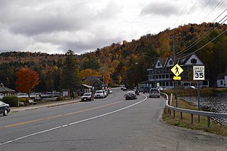
Cranberry Lake is a hamlet in the eastern part of the Town of Clifton, in St. Lawrence County, New York, United States. It lies along New York State Route 3 on the north shore of Cranberry Lake. The population was 200 at the 2010 census, which lists the community as a census-designated place.

<span class="mw-page-title-main">Indian Lake (Hamilton County, New York)</span> Reservoir in New York, United States

Indian Lake is a 12-mile (19 km) long, 4,255-acre (1,722 ha) reservoir with a southwest to northeast orientation in the towns of Indian Lake and Lake Pleasant in Hamilton County, in the Adirondack Park of New York State, in the United States. The hamlet of Indian Lake is located 2 miles (3.2 km) north of the north end of Indian Lake. New York State Route 30 runs along the west shore of the lake. Most of the shore is part of the Forest Preserve. Indian Lake is fed by the Jessup River, and drains through the Indian River into Lake Abanakee, and from there through the Indian River to the Hudson River.

<span class="mw-page-title-main">SUNY-ESF Ranger School</span>

The SUNY-ESF Ranger School, on the east branch of the Oswegatchie River near Wanakena, New York, offers A.A.S. degrees in forest and natural resources management. Established in 1912, the school is affiliated with the State University of New York College of Environmental Science and Forestry (SUNY-ESF). The Ranger School commemorated its centennial in 2012-13.

<span class="mw-page-title-main">Brantingham Lake</span> Lake

Brantingham Lake is a 327-acre (1.32 km2) lake, within the Adirondack Park, located east of Brantingham, New York in Lewis County, New York. Home to both seasonal and year-round residents, the lake and surrounding area offer boating, fishing, hunting, hiking, biking, as well as trails for all terrain vehicle, horse, and snowmobile. During the winter months, the area receives an average 150 inches of snow, making Brantingham a popular destination for winter enthusiasts.

Witchhopple Lake is a lake located by Keepawa, New York. The outlet flows into Salmon Lake and then from there into Stillwater Reservoir. Fish species present in Witchhopple Lake are brook trout, white sucker, sunfish, yellow perch, and splake. Access by trail from the north shore of Stillwater Reservoir. No motors are allowed on Witchhopple Lake. There is a trail that goes from Witchhopple Lake to Negro Lake called Bushwhack Trail.

Olmstead Pond is a lake located northeast of Wanakena, New York. The outflow creek flows into Six Mile Creek. Fish species present in the pond are brown bullhead, and brook trout. Access via trail from West Flow Bay of Cranberry Lake on the south shore. No motors are allowed on Olmstead Pond.

Pine Lake is located east of Brantingham, New York. The outlet creek flows into Middle Branch. Fish species present in the lake are brook trout, brown trout, black bullhead, white sucker, and sunfish. There is access to the lake via trail on its north and west shore. No motors are allowed on this lake.

Bear Pond is a lake located northeast of Stillwater, New York. The outflow creek flows into Middle Branch Oswegatchie River. Fish species present in the lake are brown bullhead, and brook trout. Access via trail off Raven Lake Road on the south shore. No motors are allowed on Bear Pond.

References

  1. Zohner, Troy (November 25, 2019). "The Cranberry Lake 50: A Serene 50-Mile Loop in the Western Adirondacks". The Trek. Retrieved February 25, 2024.
  2. "Reub Wood". Retrieved May 20, 2012.
  3. Scott is Nadine Gilmore's grandfather and the information is from family and public genealogy.
  4. 1 2 Sportsman's Connection (Firm) (2004-01-01), Western Adirondacks New York fishing map guide: includes lakes & streams for the following counties: Herkimer, Jefferson, Lewis, Oneida, St. Lawrence., Sportsman's Connection, ISBN   1885010672, OCLC   61449593
  5. Reznikoff, Charles, ed. (1957). Louis Marshall: Champion of Liberty. Selected Papers and Correspondence. Philadelphia: Jewish Publication Society of America. p. 1123.
  6. Smeby, Susan Thomas (2002). Cranberry Lake and Wanakena. Arcadia Publishing. ISBN   0-7385-0969-8 via Google Books.