Creoch Loch

Last updated

Creoch Loch
Creoch Loch and the Kilmarnock Dumfries railway line - geograph.org.uk - 331391.jpg
Creoch Loch and the railway from the main road
Scotland relief location map.jpg
Red pog.svg
Creoch Loch
The location of Creoch Loch, East Ayrshire
Location New Cumnock, East Ayrshire, Scotland
Coordinates Coordinates: 55°24′33.8″N4°13′5.0″W / 55.409389°N 4.218056°W / 55.409389; -4.218056
Type Freshwater loch
Primary inflows A burn from the Black Loch, Rainfall and runoff
Primary outflows To the Loch o' th' Lowes
Basin  countriesScotland
Max. length600 m (2,000 ft)
Max. width250 m (820 ft)
Islands One islet (19th century)
Settlements New Cumnock

Creoch Loch (NS 59259 15615), previously known as Little Creoch Loch, [1] is a freshwater loch in the Parish of New Cumnock in the East Ayrshire Council Area between Cumnock and New Cumnock, Scotland. It is located in a glacial kettle hole and is one of three linked lochs.

Contents

The loch

McMichael records that in wet weather the three lochs combined as one and suggests that until the trap dyke on the River Nith below Corsancone Hill wore down the Cum Loch covered the whole area as far as the watershed at Sannock Hill and had a shape and surface area similar to Loch Doon. [2]

Creoch Loch is recorded as being just over 600 metres long. [1] Robert Gordon's map of 1636-52 shows a single loch with an outflow to the River Nith. [3] Blaeu's map of 1654, based on the earlier map by Timothy Pont, also shows a single loch named Loch of the Lowis [ sic ], however a Black Loch 'section' is recorded at the northern end. [4] Two dwellings named 'Krioch' are shown on this map, an Over and a North Krioch. [4]

The Creoch Loch is said to take its name from Creoch Farm which in turn is named for the Gaelic word crioch, meaning 'boundary'. [5]

The 'Runner' is a deep and broad ditch that was dug many years back to link the three lochs of Lowes, Black, and Creoch. [6]

The Lowes Burn was canalised and diverted away from the loch.

Cartographic evidence

Blaeu's map of 1654, based on the earlier map by Timothy Pont, shows a single loch named Loch of the Lowis [ sic ], with a Black Loch 'section' recorded at the northern end. [6] Two dwellings named 'Krioch' are shown on this map, an Over and a North Krioch. [4] John Adair's map of 1685 shows a single 'L of Lon'. [7] Roy's map of 1747 shows the loch near Little Creoch. [8]

Armstrong's map of 1775, shows the loch with Lochside erroneously located on its shoreline and with no islands. [9] Thomson's 1832 map shows two additional minor inflows. [10]

The 1897 OS map shows no islets and no boathouse. A path at this point also runs from Little Creoch Farm to Lochside House with stepping stones over the loch outflow, the 'runner' that passes into the Loch o' th' Lowes. [11]

Uses

Curling matches were held on the loch in 1829 and 1861, matches being Auchinleck vs Cumnock. A boat house is shown on the 1857 OS map, near the northern end of the loch, and close to the inflow from the Black Loch. [12] Regular local curling matches were held on the loch, usually at Christmas or New Years day. [4]

The 'Runner' is a deep and broad ditch that was dug many years back to link the three lochs of Lowes, Black, and Creoch. [6]

Micro-history

Creoch Loch from near Mid Lowes Farm. Creoch Loch - detail.JPG
Creoch Loch from near Mid Lowes Farm.

The Earl of Dumfries proposed to make a 'cut' from the River Nith in New Cumnock through the Loch o' th' Lowes and Creoch Loch to the Black Loch in order to provide a supply of water to power a factory he intended to build on the Glaisnock Water. This would have resulted in part of the waters of the River Nith flowing onto the Clyde rather than the Solway, however the development was never carried to fruition. [13]

Fanciful imagination has pictured a trout swimming up the River Ayr, passing into the Lugar Water at Barskimming, entering the Black Loch via the Glaisnock Water and thence into the Black Loch. The second outflow from the loch would carry the trout into Creoch Loch, then into the Loch o' th' Lowes, the River Nith and finally into the Solway Firth after a journey of around seventy miles. [14]

The 1864 OS map shows the main line railway cutting between Black Loch and Creoch Loch, running from the east to the western shore of Creoch Loch.

See also

Related Research Articles

<span class="mw-page-title-main">River Nith</span> River in south-west Scotland

The River Nith is a river in south-west Scotland. The Nith rises in the Carsphairn hills of East Ayrshire, more precisely between Prickeny Hill and Enoch Hill, 4.4 miles (7.1 km) east of Dalmellington. For the majority of its 70 miles (110 km) course it flows in a south-easterly direction through Dumfries and Galloway and then into the Solway Firth at Airds Point.

<span class="mw-page-title-main">Carsphairn and Scaur Hills</span>

The Carsphairn and Scaur Hills are the western and eastern hills respectively of a hill range in the Southern Uplands of Scotland. Ordnance Survey maps don't have a general name for the hill area as a whole. Also, Ordnance Survey use "Scar" rather than the local spelling of "Scaur" - the word is pronounced as "Scar" however. In their Landranger Series of maps, it requires four separate sheets to cover the area.

<span class="mw-page-title-main">Littlestane Loch</span> Former lake in Irvine, Scotland

Littlestane Loch, was situated in the mid-Ayrshire clayland near Stanecastle, Irvine, North Ayrshire, Scotland. It is nowadays (2011) only visible as an area of permanent water in the Scottish Wildlife Trust Sourlie Nature Reserve. The loch was natural, sitting in a hollow created by glaciation. The loch waters outflow was via the Red Burn that flows into the River Garnock. The site of Littlestane Loch site is partly built over and much of the site is now public open space lying within the Parish of Girdle Toll.

<span class="mw-page-title-main">Hessilhead Loch</span> Body of water

Hessilhead Loch or Hazelhead Loch was situated in a low-lying area near the old Castle of Hessilhead in the Parish of Beith, North Ayrshire, Scotland. The old loch, used in the defence of the castle, was probably infilled when the castle ruins were landscaped in the 19th century.

<span class="mw-page-title-main">Blae Loch (Beith)</span> A lake in Ayrshire, Scotland

The Blae Loch is a small freshwater loch situated in a hollow in a low-lying area beneath Blaelochhead Hill in the Parish of Beith, North Ayrshire, Scotland.

<span class="mw-page-title-main">Galrigs Loch (South Ayrshire)</span> Body of water

The Galrigs Loch was a substantial freshwater loch situated in low lying area between Newfield and Dundonald in South Ayrshire, Scotland. It was drained in the early 18th century.

<span class="mw-page-title-main">Clevens Loch, Ayrshire</span> Body of water

Clevens Loch was a substantial freshwater loch situated in a low-lying area below Clevance Farm and Langholm Farm in Dundonald parish, South Ayrshire, Scotland.

<span class="mw-page-title-main">Loch of Trabboch</span> Body of water

The Loch of Trabboch or Dalrympleston Loch (NS440211) was situated in a low-lying area below the old Castle of Trabboch, once held by the Boyd family in the Parish of Stair, East Ayrshire, Scotland.

<span class="mw-page-title-main">Loch of Stair</span> Body of water

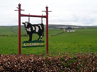
The Loch of Stair was a typical Ayrshire post-glacial 'Kettle Hole', situated in a low-lying area below the farm of Loch Hill, in the Parish of Stair, East Ayrshire, Scotland. This freshwater loch was drained in the 19th century, leaving a wetland area which still periodically floods.

<span class="mw-page-title-main">Loch Fergus</span> Body of water

Loch Fergus is a freshwater post-glacial "Kettle Hole" sometimes recorded as Fergus Loch. It is quite visible and is situated in a low-lying area close to the B742 road between the farms and dwellings of Trees, Lochfergus and Bowmanston in the Parish of Ayr, South Ayrshire, Scotland. The loch lies to the north of Martnaham Loch, four miles east-southeast of Ayr. It drains to the southwest into the Snipe Loch.

<span class="mw-page-title-main">Snipe Loch</span> Body of water

Snipe Loch (NS385173) or Loch Snipe is a freshwater loch. It is situated in a low-lying area close to the B742 road next to Clocaird Farm in the Parish of Coylton, East Ayrshire, Scotland. The loch lies to the north of Martnaham Loch, 5 miles (7 km) east of Ayr.

<span class="mw-page-title-main">Lochend Loch (Coylton)</span> Body of water

Lochend Loch, which once had nearly three acres in surface area is now only a small freshwater loch remnant. It lies in the South Ayrshire Council Area, lying on the hill above Joppa, between Gallowhill and Lochend Farm.

Plaid Loch was a freshwater loch in East Ayrshire, now a remnant due to drainage, near Sinclairston and 2 miles (3 km) south-east of Drongan, lying in a glacial kettle hole,.

<span class="mw-page-title-main">Bruntwood Loch</span> A former lake in Ayrshire, Scotland

Bruntwood Loch was a freshwater loch, now drained, lying in a glacial kettle hole in Galston, East Ayrshire, Scotland.

Loch Gate, previously known as Loch Gait, was a freshwater loch, partly in the East Ayrshire Council Area and partly in South Lanarkshire, now mainly drained, near Darvel, lying in a glacial kettle hole, Parish of Galston, Scotland.

<span class="mw-page-title-main">Black Loch (New Cumnock)</span> Body of water

Black Loch is a freshwater loch, named from its dark waters, situated in the East Ayrshire Council Area, between Cumnock and New Cumnock, lying in a glacial Kettle Hole mainly within the Parish of New Cumnock, a small portion protruding into Old Cumnock Parish. It is said to be one of only two lochs or lakes in the world that have outflows running to two separate destinations. The 'Runner' is a deep and broad ditch that was dug many years back to link the three lochs of Lowes, Black, and Creoch.

<span class="mw-page-title-main">Loch o' th' Lowes (New Cumnock)</span> Body of water

Loch o' th' Lowes, Lochside or Meikle Creoch Loch is a freshwater loch in the Parish of New Cumnock in the East Ayrshire Council Area, Scotland. One of three linked lochs, it is overlooked by the A76 road and is located in a glacial kettle hole.

<span class="mw-page-title-main">Newton Loch, South Ayrshire</span> Body of water

Newton Loch was situated in a low-lying area near Newton-on-Ayr, South Ayrshire, just south of the old South and West Sanquhar Farms. It is now (2016) only visible as remnant heath land and surface darkening in pastureland, situated mainly in the Parish of Ayr and partly in St Quivox, South Ayrshire, Scotland.

<span class="mw-page-title-main">Lands of Borland, Barony of Cumnock</span> Human settlement in Scotland

The Lands of Borland or Boreland formed a castle and land holdings within the old Barony of Cumnock, East Ayrshire, Parish of Old Cumnock, Scotland. Lying two miles south of Cumnock the property was mainly held by a cadet branch of the Hamilton family from around 1400 before passing by marriage to the Montgomeries and others. For consistency the spelling 'Borland' will be used throughout.

<span class="mw-page-title-main">Lefnoreis Castle</span>

The site of the old Lefnoreis Castle or Ward of Lochnorris lies about 100 yards north-west of the old stable block of Dumfries House in East Ayrshire, Parish of Old Cumnock, Scotland. The old castle stood on a natural rise overlooking the Lugar Water, built and held for many years by the Craufurd family. For consistency the spelling Craufurd will be used throughout and Lefnoreis for the castle.

References

Notes

  1. 1 2 Groome's Gazetteer Retrieved : 2011-12-24
  2. McMichael, Page 86
  3. Gordon's Map Retrieved : 2011-12-24
  4. 1 2 3 4 Blaeu's Map Retrieved : 2011-12-24
  5. Place-names of New Cumnock Retrieved : 2011-12-24
  6. 1 2 3 Captain Number 2 [ permanent dead link ] Retrieved : 2011-12-27
  7. Adair's Map Retrieved : 2011-12-27
  8. Roy's Map Retrieved : 2011-12-27
  9. Armstrong's Map Retrieved : 2011-12-27
  10. Thomson's Map Retrieved : 2011-12-27
  11. 6" OS Map of 1895 Retrieved : 2011-12-27
  12. 6" OS Map Retrieved : 2011-12-27
  13. Warrick, Page 11
  14. Warrick, Page 10

Sources

  • Love, Dane (2003). Ayrshire : Discovering a County. Ayr : Fort Publishing. ISBN   0-9544461-1-9.
  • McMichael, George. Notes on the Way Through Ayrshire. Ayr : Hugh Henry.
  • Warrick, John (1899). The History of Old Cumnock. Reprint. Cumnock : Carn Publishing.