Criel-sur-Mer

Last updated
Criel-sur-Mer
Crielcliff.JPG
The cliffs at Criel-sur-Mer
Blason ville fr Criel-sur-Mer (Seine-Maritime).svg
Location of Criel-sur-Mer
Criel-sur-Mer
France location map-Regions and departements-2016.svg
Red pog.svg
Criel-sur-Mer
Normandie region location map.svg
Red pog.svg
Criel-sur-Mer
Coordinates: 50°01′00″N1°19′06″E / 50.0167°N 1.3183°E / 50.0167; 1.3183
Country France
Region Normandy
Department Seine-Maritime
Arrondissement Dieppe
Canton Eu
Intercommunality CC Villes Sœurs
Government
  Mayor (20202026) Alain Trouessin [1]
Area
1
21.12 km2 (8.15 sq mi)
Population
 (Jan. 2020) [2]
2,617
  Density120/km2 (320/sq mi)
Time zone UTC+01:00 (CET)
  Summer (DST) UTC+02:00 (CEST)
INSEE/Postal code
76192 /76910
Elevation0–106 m (0–348 ft)
(avg. 15 m or 49 ft)
1 French Land Register data, which excludes lakes, ponds, glaciers > 1 km2 (0.386 sq mi or 247 acres) and river estuaries.

Criel-sur-Mer is a commune in the Seine-Maritime department in the Normandy region in northern France.

Contents

Geography

Criel-sur-Mer is a town of farming, tourism and light industry situated in the valley and at the mouth of the river Yères, some 12 miles (19 km) northeast of Dieppe. The commune is served by the D16, D940 and the D925 roads. As with much of this coastline, huge chalk cliffs look out over the English Channel. At Criel, they rise to 107m.

Victims of coastal erosion, the chalk cliffs are regularly trimmed, forcing the authorities to ban construction, or even to expropriate the residents near the cliff. The cliffs lose more than one meter per year and erosion now threatens the houses.

History

Criel had its first mention in 1059, as “Criolium”. First cited in 1326, the port was still operating in 1584, but has since closed.

In the 19th century, an amateur archeologist, Father Cochet, found traces of a Gallo-Roman site. [3]

It was the chef-lieu of a canton during the French Revolution.

Criel remained essentially a village of fishermen and farmers until the arrival of the railway in 1872. The existence of the railway station helped establish two elegant seaside resorts here, one near the mouth of the Yères and the other at the suburb of Mesnil-Val. [3] This was the golden age of the Normandy beach resort, that served as the prototype for Trouville, Cabourg and Deauville. In 1902, Criel took the name of Criel-sur-Mer.

The casino was lost in a storm in 1914 and the railway station did not survive the First World War.

Tourism really took off with the advent of paid leave in 1936. Alongside Le Tréport, Criel was the nearest beach to Paris, easily accessible in the 1950s.

Between 1950 and 1972, an industry developed exploiting the pebbles from the beach, for use either in the pharmaceutical industry or crushed for roads.

In 2005, an English residential activity company named Kingswood began using Chateau de Chantereine as a base for its study tours. Since then, hundreds of children each year visit the chateau and its surrounding towns such as Dieppe, Eu and Le Treport as part of their studies. Many local schools have formed partnerships with UK schools with the support of Kingswood.

Heraldry

Arms of Criel-sur-Mer Blason ville fr Criel-sur-Mer (Seine-Maritime).svg
Arms of Criel-sur-Mer
The arms of Criel-sur-Mer are blazoned :

Argent, 3 ducks gules 1 & 2. [4]
Someone claimed they used Normandy Gules, 2 leopards Or.


Population

Historical population
YearPop.±% p.a.
1968 1,927    
1975 2,108+1.29%
1982 2,155+0.32%
1990 2,452+1.63%
1999 2,670+0.95%
2007 2,741+0.33%
2012 2,764+0.17%
2017 2,680−0.62%
Source: INSEE [5]

Sights

The chateau de Chantereine Chantereine.jpg
The château de Chantereine

See also

Related Research Articles

<span class="mw-page-title-main">Seine-Maritime</span> Department of France

Seine-Maritime is a department of France in the Normandy region of northern France. It is situated on the northern coast of France, at the mouth of the Seine, and includes the cities of Rouen and Le Havre. Until 1955 it was named Seine-Inférieure. It had a population of 1,255,633 in 2019.

Le Tréport is a commune in the Seine-Maritime department in Normandy, France.

<span class="mw-page-title-main">Arrondissement of Dieppe</span> Arrondissement in Normandy, France

The arrondissement of Dieppe is an arrondissement of France in the Seine-Maritime department in the Normandy région. It has 343 communes. Its population is 237,203 (2016), and its area is 3,120.3 km2 (1,204.8 sq mi).

<span class="mw-page-title-main">Mers-les-Bains</span> Commune in Hauts-de-France, France

Mers-les-Bains is a commune in the Somme department in Hauts-de-France in northern France.

<span class="mw-page-title-main">Ingouville</span> Commune in Normandy, France

Ingouville, also known as Ingouville-sur-Mer, is a commune in the Seine-Maritime department in the Normandy region in northern France.

<span class="mw-page-title-main">Saint-Aubin-sur-Mer, Seine-Maritime</span> Commune in Normandy, France

Saint-Aubin-sur-Mer is a commune in the Seine-Maritime department in the Normandy region in northern France.

<span class="mw-page-title-main">Vieux-Rouen-sur-Bresle</span> Commune in Normandy, France

Vieux-Rouen-sur-Bresle is a French commune in the Seine-Maritime department in the Normandy region in northern France.

<span class="mw-page-title-main">Veules-les-Roses</span> Commune in Normandy, France

Veules-les-Roses is a commune in the Seine-Maritime department in the Normandy region in northern France.

<span class="mw-page-title-main">Hautot-sur-Mer</span> Commune in Normandy, France

Hautot-sur-Mer is a commune in the Seine-Maritime department in the Normandy region in northern France.

<span class="mw-page-title-main">Varengeville-sur-Mer</span> Commune in Normandy, France

Varengeville-sur-Mer is a commune in the Seine-Maritime department in the Normandy region in north-western France.

<span class="mw-page-title-main">Sainte-Marguerite-sur-Mer</span> Commune in Normandy, France

Sainte-Marguerite-sur-Mer is a commune in the Seine-Maritime department in the Normandy region in northern France.

<span class="mw-page-title-main">Veulettes-sur-Mer</span> Commune in Normandy, France

Veulettes-sur-Mer is a commune in the Seine-Maritime department in the Normandy region in northern France.

<span class="mw-page-title-main">Sotteville-sur-Mer</span> Commune in Normandy, France

Sotteville-sur-Mer is a commune in the Seine-Maritime department in the Normandy region in north-western France.

<span class="mw-page-title-main">Saint-Sylvain, Seine-Maritime</span> Commune in Normandy, France

Saint-Sylvain is a commune in the Seine-Maritime department in the Normandy region in northern France.

<span class="mw-page-title-main">GR 21</span>

The GR21 is a long-distance hiking trail in Normandy, France. It is part of the GR network of trails. It begins at the port city of Le Havre, a Unesco World Heritage Site, climbs through parkland to Montivilliers, then follows the chalk cliffs of the Pays de Caux for most of the route. Étretat is known for its chalk formations, painted by Claude Monet and other artists. It passes through various seaside resorts and fishing villages, including the port of Dieppe and finishes at the resort of Le Tréport, close to the historic town of Eu. The whole route is within the Seine-Maritime département.

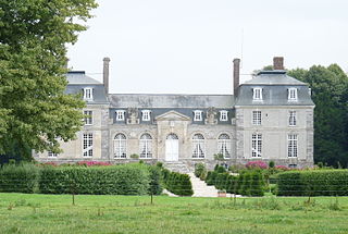
The Canton of Eu is a canton situated in the Seine-Maritime département and in the Normandy region of northern France.

<span class="mw-page-title-main">Yères</span> River in France

The Yères is a river of Normandy, France, 40 kilometres (25 mi) in length, flowing through the department of Seine-Maritime.

The Communauté de communes d'Yères et Plateaux was located in the Seine-Maritime département of the Normandy region of northern France. It was created in January 2003. It was dissolved in January 2017.

The Communauté de communes des Villes Sœurs is a Communauté de communes located in both the Seine-Maritime department and the Somme department of north-western France. On 1 January 2017 it was expanded with 7 communes, and renamed Communauté de communes des Villes Sœurs. Its seat is Eu. Its area is 214.8 km2, and its population was 36,979 in 2018, of which 6,771 in Eu and 4,723 in Le Tréport.

<span class="mw-page-title-main">Eu station</span>

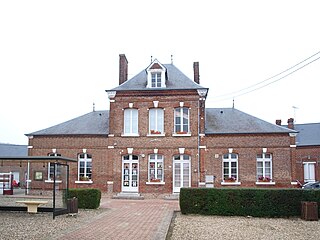
The Gare d'Eu is a railway station in the commune of Eu in the Seine-Maritime department, France, in Normandy.

References

  1. "Répertoire national des élus: les maires". data.gouv.fr, Plateforme ouverte des données publiques françaises (in French). 2 December 2020.
  2. "Populations légales 2020". The National Institute of Statistics and Economic Studies. 29 December 2022.
  3. 1 2 "Criel-Sur-Mer". Archived from the original on 2008-11-12. Retrieved 2008-10-24.
  4. "Newgaso - Toute l'actu rien que l'actu".
  5. Population en historique depuis 1968, INSEE