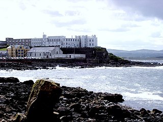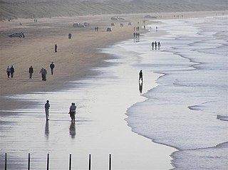
Portstewart is a small town in County Londonderry, Northern Ireland. It had a population of 8,003 people in the 2011 Census. It is a seaside resort neighbouring Portrush. Its harbour and scenic coastal paths form an Atlantic promenade leading to a two-miles beach, popular with holidaymakers in summer and surfers year-round.
Portstewart Football Club is an intermediate, Northern Irish football club from Portstewart, County Londonderry. The club was founded in 1968 and currently plays in the NIFL Premier Intermediate League. The club's main colours are sky blue and navy. Portstewart are nicknamed "The Seahawks". Portstewart Reserves play in the Coleraine and District Morning League. In 2019, Portstewart introduced an Under 20s team, to play in the Championship/PIL Development League.

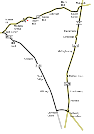
The International North West 200 is a motorcycle road race first held in 1929 on a 8.970 mi (14.436 km) street circuit known as the Triangle between the towns of Portstewart, Coleraine and Portrush in Causeway Coast and Glens, Northern Ireland, United Kingdom. It is the largest annual sporting event in Northern Ireland, with the race weekend attracting over 150,000 visitors from all over the world. The course is one of the fastest in the world, with average speeds of 120 mph (190 km/h) and top speeds in excess of 200 mph (320 km/h).

The Coleraine–Portrush line is a short branch railway line in Northern Ireland between the town of Coleraine in County Londonderry and the seaside resort of Portrush in County Antrim. The line, which is operated by Northern Ireland Railways, has two intermediate halts and connects to the main Belfast–Derry line at Coleraine.
Parkhead Stadium was a railway station in the east end of Glasgow. It was opened by the Caledonian Railway as Parkhead on 1 February 1897.
There are 22 disused railway stations in the 75 miles (121 km) between Bristol Temple Meads and Exeter St Davids, 12 of which have structures that can still be seen from passing trains. Most were closed in the 1960s but four of them, especially around Weston-super-Mare, were replaced by stations on new sites. 13 stations remain open on the line today, but there have been proposals to reopen stations at Cullompton and Wellington.

Bellahouston railway station was a railway station serving the Bellahouston area of Glasgow, Scotland. The station was originally part of the G&SWR Paisley Canal Branch.
Heads of Ayr railway station was a railway station serving the Heads of Ayr, South Ayrshire, Scotland. The station was part of the Maidens and Dunure Light Railway.

Drumree is a settled area in the civil parish of Knockmark, south County Meath, Ireland, south of Dunsany and approximately 26 kilometres (16 mi) from Dublin city centre. The next nearest settlement was the hamlet at Dunsany Cross Roads.
Ballycastle Railway was a 3 ft narrow gauge railway line which ran from Ballycastle to Ballymoney, both in County Antrim, Northern Ireland.

Capecastle or Cape Castle is a small village and townland in County Antrim, Northern Ireland, between Armoy and Ballycastle. It is part of the Causeway Coast and Glens district.
The Ballymena, Cushendall and Red Bay Railway was a 3 ft narrow gauge railway between Ballymena and Retreat, both in County Antrim, in what is now Northern Ireland. It operated from 1875 to 1940.

Scotch Dyke railway station was a railway station in Cumberland close to the Scots' Dike, the traditional border with Scotland.

Causeway Coast and Glens is a local government district covering most of the northern part of Northern Ireland. It was created on 1 April 2015 by merging the Borough of Ballymoney, the Borough of Coleraine, the Borough of Limavady and the District of Moyle. The local authority is Causeway Coast and Glens Borough Council.
St Joseph's College, Coleraine was a Roman Catholic secondary school located in Coleraine, County Londonderry, Northern Ireland. Named after St. Joseph, there was a statue of St. Joseph when entering the building.

The 3 ft narrow gauge Portstewart Tramway operated tramway services between Portstewart and Portstewart railway station at Cromore from 1882 to 1926.
Londonderry Graving Dock railway station served Derry in Northern Ireland.


