Buren is a town and municipality in the Betuwe region of the Netherlands. Buren has 27.168 inhabitants as of 1 January 2022.

Haaren is a town and former municipality in the southern Netherlands, in the province of North Brabant.

Lith is a village in the province North Brabant in the Netherlands. Before 2011, there was also a municipality; since 2011 Lith is a part of Oss.

Vught is a municipality and a town in the southern Netherlands, and lies just south of the industrial and administrative centre of 's-Hertogenbosch. Many commuters live in the municipality, and the town of Vught was once named "Best place to live" by the Dutch magazine Elsevier.

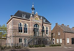
Haren is a village in the municipality of Oss in the province of North Brabant, Netherlands.

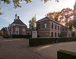
Heeswijk is a Dutch village. It is located in the province of North Brabant, in the south of the Netherlands.
Vessem is a village in the southern Netherlands. It is located in the municipality of Eersel, North Brabant. Cultural attractions include the Jacobusmolen windmill and several galleries.

Sambeek is a village in the southern Netherlands. It is located in the former municipality of Boxmeer, North Brabant. Since 2022 it has been part of the new municipality of Land van Cuijk.

Kerk-Avezaath is a village in the Dutch province of Gelderland. It is a part of the municipality of Buren, and lies about 3 km west of Tiel.

Alphen is a village in the Dutch province of Gelderland. It is a part of the municipality of West Maas en Waal, and lies about 7 km north of Oss.
Helvoirt is a village and part of the municipality of Vught, Netherlands.

Capelle is a village in the Dutch province of North Brabant. It is located about 6 km west of Waalwijk.

's Gravenmoer is a village in the Dutch province of North Brabant. It is located in the municipality of Dongen, about 3 km north of the town of Dongen. The village has a population of about 2190 inhabitants, including the farmlands to the north of the village.

Linden is a village in the Dutch province of North Brabant. It is located in the former municipality of Cuijk, about 10 km south of Nijmegen.
Lithoijen is a village in the Dutch province of North Brabant. It is located in the municipality of Oss, about 5 km northwest of the city of Oss.

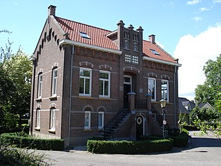
Moergestel is a village in the Dutch province of North Brabant. It is located in the municipality of Oisterwijk, about 7 km East of Tilburg.

Nieuw-Vossemeer is a village in the Dutch province of North Brabant. It is located in the municipality of Steenbergen, about 10 km northeast of Bergen op Zoom.

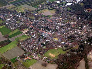
Nistelrode is a village in the Dutch province of North Brabant. It is located in the municipality of Bernheze, about 8 km south of Oss.

Udenhout is a village and a former municipality in the Dutch province of North Brabant. It is located northeast of Tilburg, north of Berkel-Enschot and south of the National Parc Loonse en Drunense Duinen.

Zweins is a village in Waadhoeke municipality in the province of Friesland, the Netherlands. It had a population of around 116 in January 2014. Before 2018, the village was part of the Franekeradeel municipality.