
Avebury is a village and civil parish in Wiltshire, England. The village is about 5.5 miles (9 km) west of Marlborough and 8 miles (13 km) northeast of Devizes. Much of the village is encircled by the prehistoric monument complex also known as Avebury. The parish also includes the small villages of Avebury Trusloe and Beckhampton, and the hamlet of West Kennett.

Great Chalfield Manor is an English country house at Great Chalfield, about 2.5 miles (4 km) northeast of the town of Bradford on Avon in the west of the county of Wiltshire.

Harrington is a hamlet and civil parish in the East Lindsey district of Lincolnshire, England. It is situated 6 miles (10 km) south-west from Alford, and 5 miles (8.0 km) north-west from Spilsby.

Clevedon Court is a manor house on Court Hill in Clevedon, North Somerset, England, dating from the early 14th century. It is owned by the National Trust and is designated as a Grade I listed building.

Dunster Castle is a former motte and bailey castle, now a country house, in the village of Dunster, Somerset, England. The castle lies on the top of a steep hill called the Tor, and has been fortified since the late Anglo-Saxon period. After the Norman Conquest of England in the 11th century, William de Mohun constructed a timber castle on the site as part of the pacification of Somerset. A stone shell keep was built on the motte by the start of the 12th century, and the castle survived a siege during the early years of the Anarchy. At the end of the 14th century the de Mohuns sold the castle to the Luttrell family, who continued to occupy the property until the late 20th century.

Dinton is a village, civil parish and former manor in Wiltshire, England, in the Nadder valley on the B3089 road about 8 miles (13 km) west of Salisbury. The parish population was 696 at the 2011 census, estimated at 733 in 2019. The civil parish includes the village of Baverstock, about 1 mile (1.6 km) east of Dinton village.

Sulgrave Manor, Sulgrave, Northamptonshire, England is a mid-16th century Tudor hall house built by Lawrence Washington, the 3rd great-grandfather of George Washington, first President of the United States. The manor passed out of the hands of the Washington family in the 17th century and by the 19th had descended to the status of a farmhouse. In 1911, Theodore Roosevelt, a former US president, suggested a memorial to commemorate 100 years of peace between the United Kingdom and the United States, and the manor was bought for this purpose in 1914. Between 1920 and 1930 the manor was restored, and a garden was created by Reginald Blomfield. Sulgrave Manor is now administered by a trust and is a Grade I listed building.

Hampton Poyle is a village in the civil parish of Hampton Gay and Poyle, in the Cherwell district, in the county of Oxfordshire, England. It is the Cherwell in valley, about 1 mile (1.6 km) northeast of Kidlington and about 5 miles (8 km) north of the centre of Oxford.
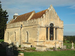
Wheatfield is a civil parish and deserted medieval village about 4 miles (6.4 km) south of Thame in Oxfordshire. Wheatfield's toponym is derived from the Old English for "white field", referring to the ripe crops that the Anglo-Saxons grew on its fertile land. Few of Wheatfield's buildings remain today except the Church of England parish church of Saint Andrew, the former rectory and the former outbuildings of the no-longer-standing manor house.

Denchworth is a village and civil parish about 2.5 miles (4 km) north of Wantage. It was part of Berkshire until the 1974 boundary changes transferred the Vale of White Horse to Oxfordshire. The 2011 Census recorded the parish's population as 171. The parish is bounded by the Land Brook in the west and the Childrey Brook in the east. The Great Western Main Line between Reading and Swindon runs through the parish just south of the village, but there is no station.

Stourton with Gasper is a civil parish in the southwest of the English county of Wiltshire. Its main settlement is the village of Stourton, along with the hamlets of Bonham and Gasper. The village is about 2+1⁄2 miles (4 km) northwest of the small town of Mere, and is part of the Stourhead estate, which includes much of the west of the parish. The estate is in the ownership of the National Trust, and the entrance to the estate's famous house and garden is through the village.

Lytes Cary is a manor house with associated chapel and gardens near Charlton Mackrell and Somerton in Somerset, England. The property, owned by the National Trust, has parts dating to the 14th century, with other sections dating to the 15th, 16th, 18th, and 20th centuries. "Yet all parts blend to perfection with one another and with the gentle sunny landscape that surrounds them," comments Nikolaus Pevsner. The House is listed as Grade I by English Heritage.

Norbury Manor is a 15th-century Elizabethan manor house and the adjoining 13th-century stone-built medieval hall house, Norbury Hall, known as The Old Manor in Norbury near Ashbourne, Derbyshire. It is a Grade I listed building.
Windlestone Hall is a mid-16th century Elizabethan country house, heavily rebuilt in 1821 to form a Greek revival stately home, situated near Rushyford, County Durham, England. The Hall sits within 400 acres of designed parkland. It is a Grade II* Listed building. As of 2022 it is back in private family ownership, with the surrounding estate maintained and conserved by a dedicated heritage charitable trust.
North Aston is a village and civil parish about 7+1⁄2 miles (12 km) south of Banbury and 10 miles (16 km) north of Oxford. The 2001 Census recorded its population as 212. The 2011 Census did not publish its population separately, but gave a combined total of 316 for the parishes of North Aston and Middle Aston. The village is on a ridge about 460 feet (140 m) above sea level. The parish measures almost 2 miles (3 km) wide east – west and about 1+1⁄2 miles (2.4 km) north – south. It is bounded to the east by the River Cherwell, and to the north by a stream that flows east to join the Cherwell. The A4260 road linking Oxford and Banbury forms part of its western boundary. Field boundaries form the southern boundary and the remainder of the western boundary. In 1983 the parish covered an area of 1,288 acres (521 ha).

Ulnaby is an abandoned village and scheduled ancient monument in the grounds of Ulnaby Hall Farm, near High Coniscliffe, County Durham, England. The toft village was occupied from the late-13th to the 16th century and temporary buildings were erected in the 19th century. Ulnaby Hall farm appears to have been built in the late-16th century, supplanting a high status medieval manorial enclosure associated with the original village. It is thought that the village shrank because of the change from labour-intensive arable farming to pasture, before being abandoned and the site was subsumed into the farm as pasture.

Horton-cum-Studley is a village and civil parish in Oxfordshire about 6+1⁄2 miles (10.5 km) northeast of the centre of Oxford and bordering Otmoor, and is one of the "Seven Towns" of Otmoor. The 2011 Census recorded the parish's population as 455. A majority of residents in the village work in the Healthcare and Educational Sectors.
Sparsholt is a village and civil parish about 3 miles (5 km) west of Wantage in the Vale of White Horse district of Oxfordshire. The parish includes the hamlet of Westcot about 1⁄2 mile (800 m) west of the village. Sparsholt was part of Berkshire until the 1974 boundary changes transferred the Vale of White Horse to Oxfordshire.

Croft and Yarpole is a civil parish in the county of Herefordshire, England, and is 17 miles (27 km) north from the city and county town of Hereford. The closest large town is the market town of Leominster, 4.5 miles (7 km) to the south. Within the parish is the National Trust property of Croft Castle and Parkland.

Ampney Park is a 16th century manor house at Ampney Crucis, Gloucestershire, England. It is a Grade II listed building.


